-
current
recommendations- Liefdefjord
New page dedicated to one of Spitsbergen's most beautiful fjords. Background information and many photos.

- New Spitsbergen guidebook
The new edition of my Spitsbergen guidebook is out and available now!
- Liefdefjord
New page dedicated to one of Spitsbergen's most beautiful fjords. Background information and many photos.
-
weather information

| Guidebook: Spitsbergen-Svalbard |
Home →
Daily Archives: 2. April 2015 − News & Stories
Lower extent of winter sea ice in the Arctic
During this winter season 2014/2015 the sea ice in the Arctic has extended much less than it usually did.
As the U.S. National Snow and Ice Data Center at the University of Colorado reports, this winter the ice likely reached its maximum extend as soon as February 25th. This is 15 days earlier than the average of the years 1981 to 2010 which serves as the reference period.
More alarming is the fact that the extent of sea ice on this date had not proceeded very far yet. Indeed, since the beginning of the satellite record the maximum extent of Arctic sea ice has never been as low as in this winter. On February 25th the ice covered an area of 14.54 million square kilometers. This is 1.1 million square kilometers less than the long term average and 130.000 square kilometers less than the former negative record of 2011. All areas were affected except for the Labrador Sea and the Davis Strait between Greenland and Canada. There was a remarkably low extent of ice on the Pacific side of the Arctic and in the Barents Sea west of Novaya Semlya and southwest of Spitsbergen.
After reaching its low maximum on February 25th the sea ice extent initially decreased significantly (with regional variations) and then increased again in the second half of March. However, a new maximum could not be reached. Currently the ice is retreating again, according to the time of the year.
It can be expected that the low extent of sea ice in winter will also lead to less ice in the summer season. This scenario is supported by the effect that open water surfaces are absorbing more solar energy and are warming up faster than ice surfaces which reflect most of the sunlight (see also Spitsbergen-Svalbard.com news: Retreat of Arctic sea ice accelerates global warming from February 2014).
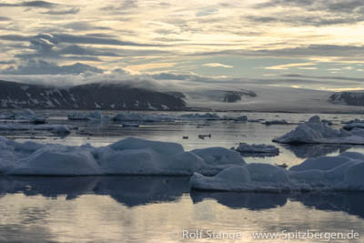
Sea ice in northern Spitsbergen.
News-Listing live generated at 2025/May/09 at 16:07:41 Uhr (GMT+1)


-
Books, Calendar, Postcards and more

-


