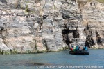
-
current
recommendations- Liefdefjord
New page dedicated to one of Spitsbergen's most beautiful fjords. Background information and many photos.

- New Spitsbergen guidebook
The new edition of my Spitsbergen guidebook is out and available now!

- Liefdefjord
New page dedicated to one of Spitsbergen's most beautiful fjords. Background information and many photos.
Page Structure
-
Spitsbergen-News
- Select Month
- April 2025
- March 2025
- February 2025
- January 2025
- December 2024
- November 2024
- October 2024
- September 2024
- August 2024
- July 2024
- June 2024
- May 2024
- April 2024
- March 2024
- February 2024
- January 2024
- December 2023
- November 2023
- October 2023
- September 2023
- August 2023
- July 2023
- June 2023
- May 2023
- April 2023
- March 2023
- February 2023
- January 2023
- December 2022
- November 2022
- October 2022
- September 2022
- August 2022
- July 2022
- June 2022
- May 2022
- April 2022
- March 2022
- February 2022
- January 2022
- December 2021
- November 2021
- October 2021
- September 2021
- August 2021
- July 2021
- June 2021
- May 2021
- April 2021
- March 2021
- February 2021
- January 2021
- December 2020
- November 2020
- October 2020
- September 2020
- August 2020
- July 2020
- June 2020
- May 2020
- April 2020
- March 2020
- February 2020
- January 2020
- December 2019
- November 2019
- October 2019
- September 2019
- August 2019
- July 2019
- June 2019
- May 2019
- April 2019
- March 2019
- February 2019
- January 2019
- December 2018
- November 2018
- October 2018
- September 2018
- August 2018
- July 2018
- June 2018
- May 2018
- April 2018
- March 2018
- February 2018
- January 2018
- December 2017
- November 2017
- October 2017
- September 2017
- August 2017
- July 2017
- June 2017
- May 2017
- April 2017
- March 2017
- February 2017
- January 2017
- December 2016
- November 2016
- October 2016
- September 2016
- August 2016
- July 2016
- June 2016
- May 2016
- April 2016
- March 2016
- February 2016
- January 2016
- December 2015
- November 2015
- October 2015
- September 2015
- August 2015
- July 2015
- June 2015
- May 2015
- April 2015
- March 2015
- February 2015
- January 2015
- December 2014
- November 2014
- October 2014
- September 2014
- August 2014
- July 2014
- June 2014
- May 2014
- April 2014
- March 2014
- February 2014
- January 2014
- December 2013
- November 2013
- October 2013
- September 2013
- August 2013
- July 2013
- June 2013
- May 2013
- April 2013
- March 2013
- February 2013
- January 2013
- December 2012
- November 2012
- October 2012
- September 2012
- August 2012
- July 2012
- June 2012
- May 2012
- April 2012
- March 2012
- February 2012
- January 2012
- December 2011
- November 2011
- October 2011
- September 2011
- August 2011
- May 2011
- April 2011
- March 2011
- February 2011
- January 2011
- December 2010
- November 2010
- September 2010
- August 2010
- July 2010
- June 2010
- May 2010
- April 2010
- March 2010
- February 2010
- November 2009
- October 2009
- August 2009
- July 2009
- June 2009
- May 2009
- April 2009
- March 2009
- February 2009
- January 2009
- December 2008
- November 2008
- October 2008
- August 2008
- July 2008
- June 2008
- May 2008
- April 2008
- March 2008
- February 2008
- April 2000
- Select Month
-
weather information
-
Newsletter

| Guidebook: Spitsbergen-Svalbard |
Home → Spitsbergen information → Islands: Spitsbergen & Co. → Spitsbergen (Northern part) → Krossfjord
Krossfjord
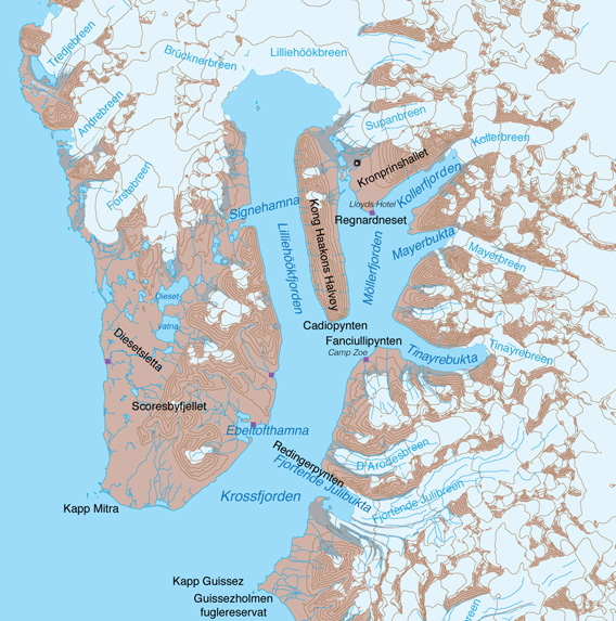
Krossfjord.
Photo galleries Krossfjord
Scroll down to the end of this page or use the links below to see photos, sorted in several galleries, from five places of interest in Krossfjord:
- Krossfjord photo gallery 1: Fjortende Julibukta
- Krossfjord photo gallery 2: Lilliehöökbreen
- Krossfjord photo gallery 3: Möllerfjord, Lloyds Hotel
- Krossfjord photo gallery 4: Signehamna
- Krossfjord photo gallery 5: Ebeltofthamna, Collinsodden
General: Krossfjord
Fjord area with beautiful and varied landscape and a long history. Krossfjord has several branches and side-bays and the largest glacier in this part of Spitsbergen. Lilliehöökfjord and Möllerfjord are the main branches in the northern part of Krossfjord. The north and east coast of Krossfjord are very mountaineous and heavily glaciated. The name is derived from a wooden cross that was erected by whalers in the entrance of the fjord system centuries ago. The cross has disappeared.
The gulf stream keeps the climate relatively mild (for regional standards at least) and the fjord open for most of the year. Krossfjord lies within the Northwest Spitsbergen National Park. The small islet near Kapp Guissez between Kongs- and Krossfjord is a Bird sanctuary, entry or approach closer than 300 metres are prohibited during the breeding season (15th May to 15th August). Ebeltoftodden on the south side of Ebeltofthamna is closed because of cultural heritage remains. For tourists, landings are permitted in Krossfjord at three locations: Signehamna, Lloyds Hotell/Regnardneset and Camp Zoe/Tinayrebukta.

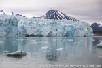
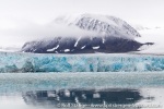
Glacierfront of Lilliehöökbreen.
Krossfjord panorama
There is a couple of sub-pages with panorama images and additional information on spitsbergen-svalbard.com so you can take a virtual tour to a number of sites in the Krossfjord area:
- Fjortende Julibukta: one of the most popular excursion sites in Krossfjord
- Lloyds Hotel: another landing site, especially popular for German cruise ships of the company Hapag-Lloyd.
- Lilliehöökbreen: the largest glacier in the area from different perspecties.
- Signehamna: remains of a German weather station from the second world war.
- Collinsodden: Tropical beaches, coastal plain and northern light research.
- Diesetsletta: the outer coast west of Krossfjord.
Geology
Varied. Mostly basement rocks, prediminantly Phyllites and mica schist, which were deformed strongly both during the Caledonian orogeny (Silurian) and the Alpidic orogeny (here lower Tertiary), when large sheets were overthrusted.

Thrust faults in Fjortende Julibukta.
Recommended book for further, well-digestable (really!) info about geology and landscape of Svalbard.
Landscape
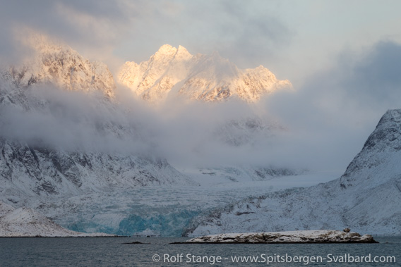
Mountain scenery on the east side of Krossfjord.
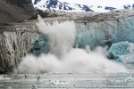
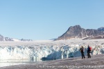
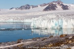
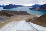
The scenery around Krossfjord is mostly mountaineous. Larger lowland areas are limited to Kapp Guissez, Kapp Mitra and the outer coast. The inland north and east of Krossfjord is strongly glaciated, and several glaciers reach the various branches and side bays. Lilliehöökbreen is the largest of the calving glaciers in Krossfjord, although it has retreated strongly since the early 20th century, with an accelerating trend in recent years. Beautiful glaciers can also be found in Tinayrebukta and Fjortende Julibukta, to name just some examples.
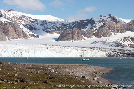
Fjortende Julibukta.
Flora and Fauna
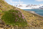
The relatively mild climate and the readily weathering schist together produce some rich vegetation. The tundra in Krossfjord is typically a colourful carpet especially rich in mosses and lichens, such as in Signehamna. The vegetation is especially rich in the vicinity of bird cliffs, such as the “hanging gardens” near Redingerpynten in Fjortende Julibukty (be careful with the fragile vegetation on the slopes and keep a good distance from breeding birds, especially geese, which are easily scared away).

Reindeer on tundra with lichens and mosses in Signehamna.
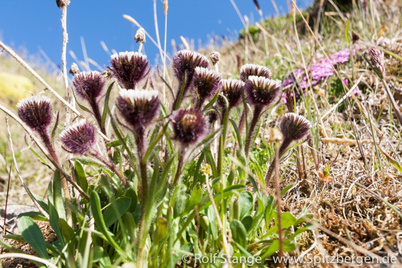
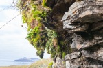
»Hanging gardens« in Fjortende Julibukta: the vegetation here includes some less common species such as Erigeron humilis.
There is a number of bird cliffs with Brünich’s guillemots and kittiwakes next to smaller numbers of puffins and glaucous gulls. Most bird cliffs are high above sea level, but there are some more accessible ones at Redingerpynten in Fjortende Julibukta and at Cadiopynten. Arctic foxes feast on everything that might fall down from these cliffs and reindeer graze on the tundra. Polar bears are not necessarily an everyday sight in Krossfjord, but they can show up anywhere and at any time, so you never know …
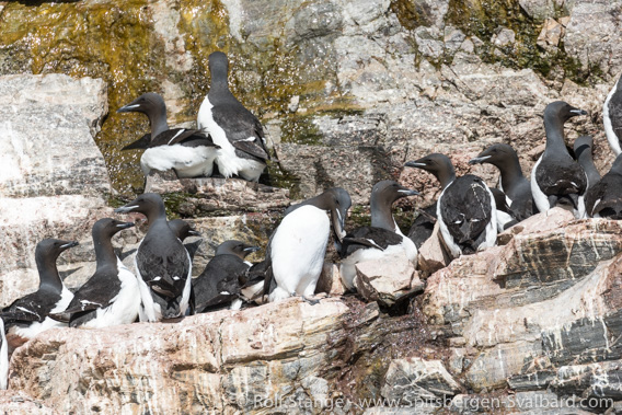
Brünich’s guillemots, Fjortende Julibukta.
History
Being of relatively easy access, the area has a long history. The 17th century whalers knew these fjords, but no remains of whaling stations are known from this area. Some of the earliest winterings of Norwegian hunters in Spitsbergen have taken place in Krossfjord in the 19th century. In 1906 and 1907 Krossfjord was investigated during oceanographical expeditions by Duke Albert I. of Monaco. The duke was himself a keen oceanographer and he took part in both expeditions. Albert II. of Monaco visited Krossfjord a century later, in 2006, to find the glaciers much smaller. Names like Fjortende Julibukta (14th July Bay, after the French national day) and other French names date back to the expeditions of Albert I.
There was a German observatory in Ebeltofthamna in the years from 1910 to 1914. It was mainly a weather station set up to investigate if the area would be suitable for polar research by airship, initiated by count Ferdinand von Zeppelin during his 1910 expedition which claimed large land areas in the Kongsfjord-Krossfjord area and further north up to Raudfjord.
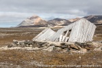
During the second world war, the German Kriegsmarine (navy) had weather stations in Signehamna in 1941-42 (code name “Knospe”) and in 1942-43 (“Nussbaum”).
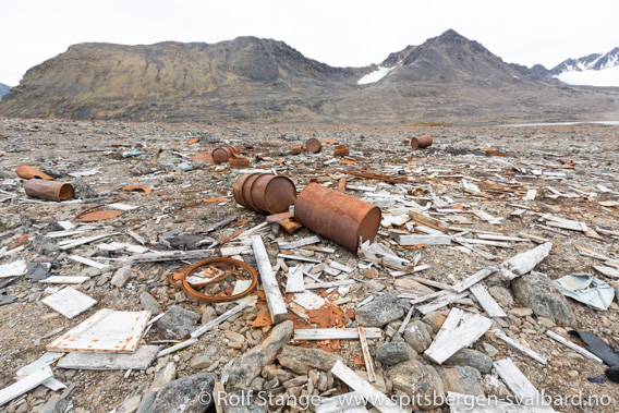
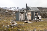
Remains after the German weather station from the second world war in Signehamna.
Krossfjord photo gallery 1: Fjortende Julibukta
Fjortende Julibukta is one of the most popular visitor sites in Krossfjord.
- gallery anchor link: #gallery_1818
Click on thumbnail to open an enlarged version of the specific photo.
Krossfjord photo gallery 2: Lilliehöökbreen
Lilliehöökbreen is the largest glacier in the area. It is strongly retreating due to climate change.
- gallery anchor link: #gallery_1820
Click on thumbnail to open an enlarged version of the specific photo.
Krossfjord photo gallery 3: Möllerfjord, Lloyds Hotel
Möllerfjord is Krossfjord’s northeastern branch. Places of interest include Lloyd’s Hotel.
- gallery anchor link: #gallery_1819
Click on thumbnail to open an enlarged version of the specific photo.
Krossfjord photo gallery 4: Signehamna
Signehamna is another frequently used landing site. During the second world war, it was the sight of two German war weather stations.
- gallery anchor link: #gallery_1821
Click on thumbnail to open an enlarged version of the specific photo.
Krossfjord photo gallery 5: Ebeltofthamna, Collinsodden
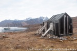
During the years from 1910 to 1914, Ebeltofthamna housed the German “geophysical observatory” initiated by count Zeppelin. At Collinsodden, some kilometres down the coast, the scientists used a trapper’s hut as a secondary observatory during one winter to observe northern lights simultaneously from two different places for altitude determination. They connected their stations in Ebeltofthamna and at Collinsodden with an improvised telephone line!
- gallery anchor link: #gallery_1822
Click on thumbnail to open an enlarged version of the specific photo.
BOOKS, CALENDAR, POSTCARDS AND MORE
This and other publishing products of the Spitsbergen publishing house in the Spitsbergen-Shop.
last modification: 2024-12-05 ·
copyright: Rolf Stange
