-
current
recommendations- Liefdefjord
New page dedicated to one of Spitsbergen's most beautiful fjords. Background information and many photos.
- New Spitsbergen guidebook
The new edition of my Spitsbergen guidebook is out and available now!
- Liefdefjord
New page dedicated to one of Spitsbergen's most beautiful fjords. Background information and many photos.
Page Structure
-
Spitsbergen-News
- Select Month
- June 2025
- May 2025
- April 2025
- March 2025
- February 2025
- January 2025
- December 2024
- November 2024
- October 2024
- September 2024
- August 2024
- July 2024
- June 2024
- May 2024
- April 2024
- March 2024
- February 2024
- January 2024
- December 2023
- November 2023
- October 2023
- September 2023
- August 2023
- July 2023
- June 2023
- May 2023
- April 2023
- March 2023
- February 2023
- January 2023
- December 2022
- November 2022
- October 2022
- September 2022
- August 2022
- July 2022
- June 2022
- May 2022
- April 2022
- March 2022
- February 2022
- January 2022
- December 2021
- November 2021
- October 2021
- September 2021
- August 2021
- July 2021
- June 2021
- May 2021
- April 2021
- March 2021
- February 2021
- January 2021
- December 2020
- November 2020
- October 2020
- September 2020
- August 2020
- July 2020
- June 2020
- May 2020
- April 2020
- March 2020
- February 2020
- January 2020
- December 2019
- November 2019
- October 2019
- September 2019
- August 2019
- July 2019
- June 2019
- May 2019
- April 2019
- March 2019
- February 2019
- January 2019
- December 2018
- November 2018
- October 2018
- September 2018
- August 2018
- July 2018
- June 2018
- May 2018
- April 2018
- March 2018
- February 2018
- January 2018
- December 2017
- November 2017
- October 2017
- September 2017
- August 2017
- July 2017
- June 2017
- May 2017
- April 2017
- March 2017
- February 2017
- January 2017
- December 2016
- November 2016
- October 2016
- September 2016
- August 2016
- July 2016
- June 2016
- May 2016
- April 2016
- March 2016
- February 2016
- January 2016
- December 2015
- November 2015
- October 2015
- September 2015
- August 2015
- July 2015
- June 2015
- May 2015
- April 2015
- March 2015
- February 2015
- January 2015
- December 2014
- November 2014
- October 2014
- September 2014
- August 2014
- July 2014
- June 2014
- May 2014
- April 2014
- March 2014
- February 2014
- January 2014
- December 2013
- November 2013
- October 2013
- September 2013
- August 2013
- July 2013
- June 2013
- May 2013
- April 2013
- March 2013
- February 2013
- January 2013
- December 2012
- November 2012
- October 2012
- September 2012
- August 2012
- July 2012
- June 2012
- May 2012
- April 2012
- March 2012
- February 2012
- January 2012
- December 2011
- November 2011
- October 2011
- September 2011
- August 2011
- May 2011
- April 2011
- March 2011
- February 2011
- January 2011
- December 2010
- November 2010
- September 2010
- August 2010
- July 2010
- June 2010
- May 2010
- April 2010
- March 2010
- February 2010
- November 2009
- October 2009
- August 2009
- July 2009
- June 2009
- May 2009
- April 2009
- March 2009
- February 2009
- January 2009
- December 2008
- November 2008
- October 2008
- August 2008
- July 2008
- June 2008
- May 2008
- April 2008
- March 2008
- February 2008
- April 2000
- Select Month
-
weather information
-
Newsletter

| Guidebook: Spitsbergen-Svalbard |
Brucebyen, William Speirs Bruce and the Scottish Spitsbergen Syndicate
Scottish mining attempts in Spitsbergen. History and photos.
Brucebyen is a small cluster of huts i Billefjord, near the large glacier Nordenskiöldbreen opposite the former Russian mining settlement of Pyramiden. Boat trips from Longyearbyen to Pyramiden usually visit Nordenskiöldbreen and pass by Brucebyen on their way there. Often, not much mention is made of it, which is a shame, because it is quite an interesting place.
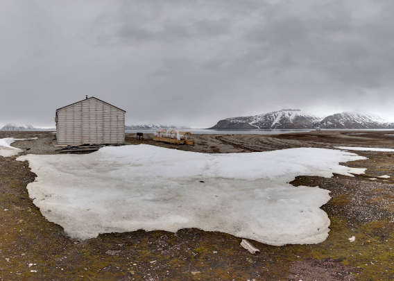
Panorama – Brucebyen
- pano anchor link: #180531c_Brucebyen_53HDR
Brucebyen: Nature and scenery
The natural surrondings are one aspect, and it would be an interesting and beautiful place well worth a visit even without the mining history. The surroundings of Brucebyen are a flat coastal plain with well-developed series of old beach ridges and small ponds where you can see red-throated divers (they are easily disturbed, keep a good distance) and arctic terns (also easily disturbed and quite aggressive, so … the same applies here). It is not uncommon to see a polar bear roaming around in the area, so keep your eyes open and be carefull as always when in the field in Spitsbergen.
Brucebyen with the rim of Nordenskiöldbreen in the background (1997).
William Speirs Bruce
But the little “settlement” has some interesting history. The famous Scottish polar explorer William Speirs Bruce was a key figure in it. Bruce’s first polar expedition was as early as 1892 with the whaling ship Balaena in the Antarctic. In 1896-97, he spent a year with Jackson and Harmsworth in Frans Josef Land where he met Fritjof Nansen and Hjalmar Johansen after their wintering, which is another story, one of the most famous ones in arctic exploration. In 1898, Bruce joined Andrew Coats on an expedition to Novaya Zemlya and Kolgujev in the Russian Arctic on the Blencathra. On the way back, he got some first glimpses of Spitsbergen, namely Kong Karls Land and Hopen, but poor weather conditions kept them from going ashore.
But he got his first chance for some closer views already later in the same summer. After returning to Tromsø, he met Duke Albert I. of Monaco, who was just about to start an expedition to Spitsbergen with his yacht Princess Alice. The Duke offered Bruce to join him and he gladly accepted the offer.
The Scottish Spitsbergen Syndicate Ltd.
Bruce joined the Duke on several further expeditions, investigating large parts of Spitsbergen’s west coast and some of the fjords on the north coast. This gave Bruce the opportunity to make himself familiar with the regional geology and he saw the potential for mining in several locations. It was mostly coal, but also other minerals such as iron ore (on Prins Karls Forland) that caught his attention. Samples taken in 1908 proved interesting and Bruce and others founded The Scottish Spitsbergen Syndicate Ltd. (SSS) in Edinburgh in July 1909. Founding members included people like Charles H. Urmston and Burn Murdoch, names that you can find on the map in Spitsbergen today, as well as those of members of the syndicate’s expeditions including Rudmose Brown and John Mathieson. Duke Albert I. was amongst the initial shareholders.
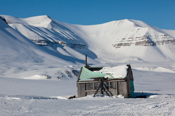
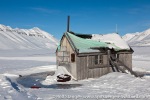
Hut in Gipsdalen, built by the Scottish Spitsbergen Syndicate
to investigate coal occurrences (photo taken in 2010).
Bruce saw mining potential in several areas, but mainly in inner Isfjord: his attention was attracted by both gypsym occurrences in Tempelfjord and coal in neighbouring Bünsow Land (between Tempelfjord and Billefjord). The syndicate organised expeditions in 1910, 1912, 1914, 1919, 1920, 1921 and 1922 to explore these occurrences as well as other parts of the Spitsbergen archipelago (the name Svalbard was hardly used before 1925).
In the end, Bruce and The Scottish Spitsbergen Syndicate had claimed the whole island of Prins Karls Forland, the whole island of Barentsøya, large parts of Edgeøya, the area between Isfjord and Storfjord and the west coast south of Bellsund!
Investigations of coal seams in Billefjord: Bruce City
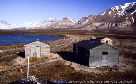
But back to the Billefjord area, where the SSS investigated coal seams in various locations from 1919. For geological reasons and because of accessibility, an area on the south side of Adolfbukta was chosen as the main location for investigations. A coal seam in the steep river flank of Carronelva looked promising, and Bruce’s geologists found it to have a thickness of about one metre. Two huts were built near the shore (two more ones followed later). This base was soon known as Bruce City. Other groups of the 1919 expedition, which had the ships Phantom and Petunia at their disposal (also names found on the map in the Billefjord area now) investigated other areas such as Tempelfjord and Storfjord including Barentsøya as well as Prins Karls Forland. Various claims were made although not much of commercial interest had been found.

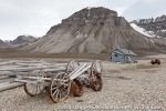
Old railway track at Brucebyen.
The amount of coal south of Adolfbukta, the area investigated from the base at Bruce City (today Brucebyen), was estimated to be in the area of 2.5 million tons based on data collected in 1919, a figure well below initial expectations, but more data were needed before any exploitation could possibly be started.
The 1920 expedition: Bruce City Coalfield, Gipsdalen and Storfjord
The expedition in 1920 had even one more ship at their disposal than in the previous year, the Autumn, the Eastonian and the Lady of Avenel, with no less than 50 expedition members led by John Mathieson. The Lady of Avenel had engine troubles on the way up and the trip took no less than 33 days for this section of the expedition. Once in Billefjord, it took great effort to transport drilling equipment and other materials across ice and snow to Brucebyen as the fjord was still frozen in that area. Finally, several drillings were made in the Carronelva area as well as other geological investigations. Further work was done on the east coast of Spitsbergen (Agardhbukta, Mohnbukta) and on Edgeøya and Barentsøya. Most of the results were rather disappointing: the coal seams were mostly of poor quality, they had a thickness of well below one metre and accessibility was difficult. But the total amount of coal on the east side of Billefjord, in an area then known as the “Bruce City Coalfield”, was now estimated at 90 million tons, something that justified further investigations.
The 1921 expedition
The expedition in 1921 was smaller, with only 10 men who focussed on the northeastern part of Billefjord. They used “Bruce City” as their main base again. Additional work was done in Gipsdalen where they found a coal seam in a distance of 16 km from the shore. All in all, the results were found to be promising.
The 1922 expedition
Another expedition was hence made in 1922, that time with 15 men, again led by John Mathieson. They used a tractor to transport material 16 km up Gipsdalen for explorative drilling. It is most likely the tractor that is still standing near the shore in Gipsvika, next an old hut that also goes back to the times of the Scottish Spitsbergen Syndicate. The tractor was weighing a ton and it was a bit of a challenge to get it ashore: a kind of raft was made with two life boats, which was towed into the river mouth of Gipsdalselva in high tide and calm weather.
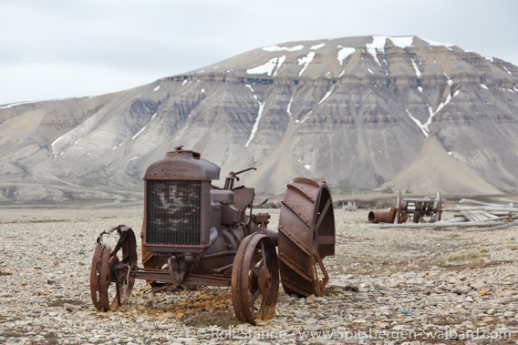
The tractor of the Scottish Spitsbergen Syndicate in Gipsvika (in 2009).
Also the iron ore occurrence on Prins Karls Forland was investigated again in 1922. Remains of the hut Kenmore at Dawespynten date back to the SSS’s activities there in those years.
Inspection trips 1923-1925
There were annual, but minor inspection trips in the years from 1923 to 1925, but without further investigations. The management of the Scottish Spitsbergen Syndicate had by then concluded that the coal occurrences in Gipsdalen and the “Bruce City Coalfield” were worth exploiting, but only in co-operation with a company that was already active with mining in Spitsbergen. Negotiations were taken up with the The Anglo Russian Grumant Co. that was mining coal in Grumantbyen. But the talks didn’t lead to any results from the Scottish perspective; instead, Russian interests took over the Grumant coal field.
The end of The Scottish Spitsbergen Syndicate Ltd.
The SSS did not have any activities in Spitsbergen after 1925. In 1950, the Scottish Spitsbergen Syndicate Ltd. was closed and the properties in Spitsbergen were sold to the Norwegian government in 1952.
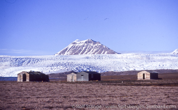
Brucebyen in 1997, with the original huts.
Brucebyen today
“Bruce City”, or in Norwegian: Brucebyen, is the most important cultural heritage today from the Scottish activities in Spitsbergen from 1908 to 1925, next to some smaller sites including two huts (one of them merely a ruin) and a tractor in Gipsdalen and some more ruins of huts on Prins Karls Forland. Unfortunately, one of the huts of Brucebyen burnt completely down in 2010 after careless handling of hot ashes by tourists. A reconstruction of the hut was made on the same place by the Sysselmannen. One of the other huts is owned and managed by the Sysselmannen for official purposes (including private use by the Sysselmannen’s employees) and another one is disposed by the Red Cross section in Longyearbyen and used, for example during crevasse rescue exercises on Nordenskiöldbreen.
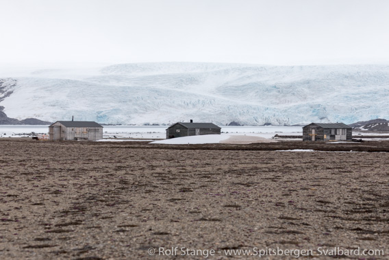
Brucebyen in 2018. The reconstructed hut is on the left hand side.
Gallery Brucebyen and Gipsdalen
To round it off, some impressions from the main working areas of The Scottish Spitsbergen Syndicate, Bruce City (= Brucebyen) and Gipsdalen.
- gallery anchor link: #gallery_1866
Click on thumbnail to open an enlarged version of the specific photo.
Source
Adolf Hoel (1967): Svalbards historie 1596-1965, Band III. There: pages 1045-1084, The Scottish Spitsbergen Syndicate.
BOOKS, CALENDAR, POSTCARDS AND MORE
This and other publishing products of the Spitsbergen publishing house in the Spitsbergen-Shop.
last modification: 2020-10-15 ·
copyright: Rolf Stange
