


-
current
recommendations- Liefdefjord
New page dedicated to one of Spitsbergen's most beautiful fjords. Background information and many photos.

- New Spitsbergen guidebook
The new edition of my Spitsbergen guidebook is out and available now!
- Liefdefjord
New page dedicated to one of Spitsbergen's most beautiful fjords. Background information and many photos.
-
weather information

| Guidebook: Spitsbergen-Svalbard |
Gruvefjellet
360°-Panoramas
Gruvefjellet 1
- pano anchor link: #Gruvefjellet_31Mar13_021
View from Gruvefjellet, directly east of Longyearbyen.
Gruvefjellet 2
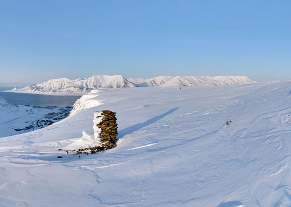
Panoramas Gruvefjellet: Gruvefjellet is a plateaux-shaped mountain east of Longyeardalen, where Longyearbyen is situated. The position of the first panorama is above Nybyen, the upper part of Longyeabyen, giving good views over the nearby glaciers, especially Larsbreen with its huge moraine. Longyearbreen is mostly hidden by the mountain ridge Sarkofagen. Further back are Trollsteinen (850 metres) and, further to the right, Nordenskiöldfjellet (1053 metres).
- pano anchor link: #Gruvefjellet_31Mar13_069
View from Gruvefjellet, directly east of Longyearbyen.
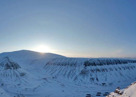
The second Gruvefjellet panorama was taken not far from the first one, but at a different time: late March (above) compared to August. Two different worlds! The exact position of the panorama below is a few hundred metres closer to Larsbreen, Longyearbyen is out of sight.
- pano anchor link: #Larsbreen_21Aug13_051
BOOKS, CALENDAR, POSTCARDS AND MORE
This and other publishing products of the Spitsbergen publishing house in the Spitsbergen-Shop.
-

Norwegens arktischer Norden (1): Spitzbergen
Photobook: Norway's arctic islands. The text in this book is German. [shop url="https://shop.spitzbergen.de/en/polar-books/70-norwegens-arktischer-norden-1-aerial-arctic-9783937903262.html"] ← BackOrder now -
Norwegens arktischer Norden (2): Aerial Arctic
Lofoten, Jan Mayen and Spitsbergen from the air - Photobook: Norway's arctic islands. The text in this book is German, but there is very little text, so I am sure that you will enjoy it regardless which languages you read (or not).Order now -
Poster “Svalbardhytter”
The poster "Svalbardhytter" (70 x 100 cm) visualizes the diversity of Spitsbergen's huts in a range of arctic landscapes.Order now -
Book “Svalbardhytter”
The companion book for the Svalbardhytter poster. The poster visualises the diversity of Spitsbergen‘s huts and their stories in a range of Arctic landscapes. The book tells the stories of the huts in three languages.Order now -
Spitsbergen – Svalbard. The complete guidebook
Comprehensive guidebook about Spitsbergen. Background (wildlife, plants, geology, history etc.), practical information including travelling seasons, how to travel, description of settlements, routes and regions.Order now -
Rocks and Ice. Landscapes of the North
A geographical traveling accompaniment to Spitsbergen and East Greenland (68-74°N). This is the English edition of the German book "Steine und Eis".Order now -
East Greenland in Winter
Join an exciting journey with dog, skis and tent through the wintery wastes of East Greenland! We were five guys and a dog when we started in Ittoqqortoormiit, the northernmost one of two settlements on Greenland’s east coast.Order now -
Postcard set Spitsbergen (Svalbard)
12 Spitsbergen postcards in a beautifully designed tray. Individually numbered limited edition!Order now -
Limited edition postcard set Antarctica
12 postcards which come in a beautifully designed tray. Beautiful images from South Georgia across Antarctica from the Antarctic Peninsula to the Ross Sea and up to Macquarie Island and Campbell Island.Order now
last modification: 2017-12-20 ·
copyright: Rolf Stange


-
Books, Calendar, Postcards and more

-


