-
current
recommendations- Liefdefjord
New page dedicated to one of Spitsbergen's most beautiful fjords. Background information and many photos.
- New Spitsbergen guidebook
The new edition of my Spitsbergen guidebook is out and available now!
- Liefdefjord
New page dedicated to one of Spitsbergen's most beautiful fjords. Background information and many photos.
Page Structure
-
Spitsbergen-News
- Select Month
- June 2025
- May 2025
- April 2025
- March 2025
- February 2025
- January 2025
- December 2024
- November 2024
- October 2024
- September 2024
- August 2024
- July 2024
- June 2024
- May 2024
- April 2024
- March 2024
- February 2024
- January 2024
- December 2023
- November 2023
- October 2023
- September 2023
- August 2023
- July 2023
- June 2023
- May 2023
- April 2023
- March 2023
- February 2023
- January 2023
- December 2022
- November 2022
- October 2022
- September 2022
- August 2022
- July 2022
- June 2022
- May 2022
- April 2022
- March 2022
- February 2022
- January 2022
- December 2021
- November 2021
- October 2021
- September 2021
- August 2021
- July 2021
- June 2021
- May 2021
- April 2021
- March 2021
- February 2021
- January 2021
- December 2020
- November 2020
- October 2020
- September 2020
- August 2020
- July 2020
- June 2020
- May 2020
- April 2020
- March 2020
- February 2020
- January 2020
- December 2019
- November 2019
- October 2019
- September 2019
- August 2019
- July 2019
- June 2019
- May 2019
- April 2019
- March 2019
- February 2019
- January 2019
- December 2018
- November 2018
- October 2018
- September 2018
- August 2018
- July 2018
- June 2018
- May 2018
- April 2018
- March 2018
- February 2018
- January 2018
- December 2017
- November 2017
- October 2017
- September 2017
- August 2017
- July 2017
- June 2017
- May 2017
- April 2017
- March 2017
- February 2017
- January 2017
- December 2016
- November 2016
- October 2016
- September 2016
- August 2016
- July 2016
- June 2016
- May 2016
- April 2016
- March 2016
- February 2016
- January 2016
- December 2015
- November 2015
- October 2015
- September 2015
- August 2015
- July 2015
- June 2015
- May 2015
- April 2015
- March 2015
- February 2015
- January 2015
- December 2014
- November 2014
- October 2014
- September 2014
- August 2014
- July 2014
- June 2014
- May 2014
- April 2014
- March 2014
- February 2014
- January 2014
- December 2013
- November 2013
- October 2013
- September 2013
- August 2013
- July 2013
- June 2013
- May 2013
- April 2013
- March 2013
- February 2013
- January 2013
- December 2012
- November 2012
- October 2012
- September 2012
- August 2012
- July 2012
- June 2012
- May 2012
- April 2012
- March 2012
- February 2012
- January 2012
- December 2011
- November 2011
- October 2011
- September 2011
- August 2011
- May 2011
- April 2011
- March 2011
- February 2011
- January 2011
- December 2010
- November 2010
- September 2010
- August 2010
- July 2010
- June 2010
- May 2010
- April 2010
- March 2010
- February 2010
- November 2009
- October 2009
- August 2009
- July 2009
- June 2009
- May 2009
- April 2009
- March 2009
- February 2009
- January 2009
- December 2008
- November 2008
- October 2008
- August 2008
- July 2008
- June 2008
- May 2008
- April 2008
- March 2008
- February 2008
- April 2000
- Select Month
-
weather information
-
Newsletter

| Guidebook: Spitsbergen-Svalbard |
Home
→ * Photos, Panoramas, Videos and Webcams
→ Spitsbergen Panoramas
→ Lovénøyane: Juttaholmen
Lovénøyane: Juttaholmen
360°-Panoramas
Kongsfjord. Lovénøyane: Juttaholmen – virtual panoramic tour
- pano anchor link: #Lovenoeyane_Juttaholmen
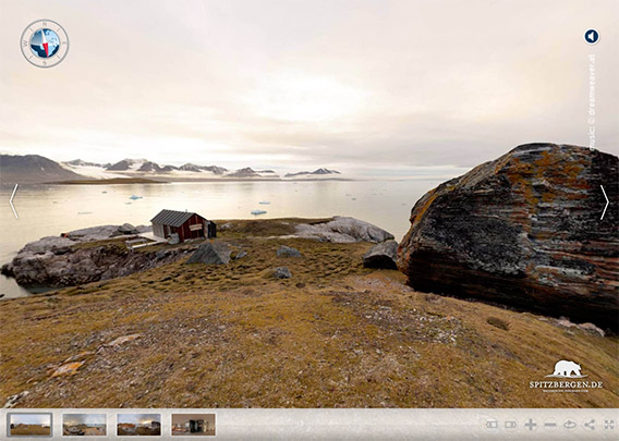
Lovénøyane: Juttaholmen 1
- pano anchor link: #Juttaholmen_23Sept15_062
There is a group of small islands in inner Kongsfjorden known as Lovénøyane, but they are known to few only. In summer, when most people are visiting Kongsfjorden who get there at all, it is not allowed to go ashore or even get within 300 m from the shore. The Lovénøyane are then home to breeding geese and eider ducks and they are protected as a bird sanctuary. Only some scientists from Ny-Ålesund visit the Lovénøyane on a regular basis to do research work on the bird populations. The birds are getting fewer and fewer, as the islands are now annually visited by polar bears who are scavenging on the nests. The tundra breeders are easy prey for predators that can reach the islands.
It is an open question if polar bears have learnt a new behaviour, if it is an adaptation to feed on birds’ nests on tundra islands rather than seals on ice of if the Barents Sea population of polar bears, which has been growing since protection in 1973 (it had been severely hunted until then) is moving back into its periphery now, as more individuals are crowding the core areas. Spitsbergen’s west coast is the periphery, seen from most polar bears’ perspective. It is only possible to speculate, we don’t know this. Maybe a bit of everything.
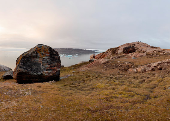
Lovénøyane: Juttaholmen 2
- pano anchor link: #Juttaholmen_23Sept15_032
As we can only visit Lovénøyane after 15th August every year, we will have autumn light. With a bit of luck, we have beautiful light of the low sun for hours above the famous mountains and glaciers surrounding Kongsfjord.
The tundra has been fertilized through thousands of years by breeding birds and one has to move around carefully in order not to damage the vegetation. Especially mosses have built up thick layers of organic matter.
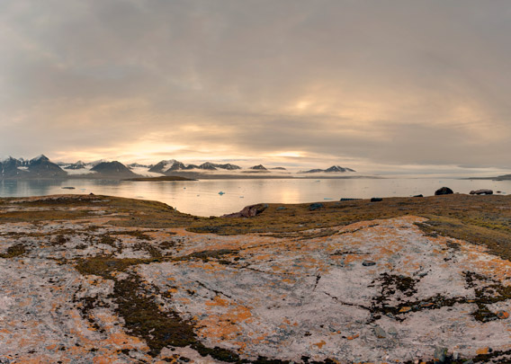
Lovénøyane: Juttaholmen 3
- pano anchor link: #Juttaholmen_23Sept15_119
The Lovénøyane comprise several small islands which have all their individual characteristics. Geologically, they are partly made up of old basement rocks (fine-crystalline carbonates or „marble“) and partly beautifully reddish Old Red sandstone. Pleistocene glaciers have left large erratic boulders on the islands.
Juttaholmen, as this island is called, was named after the housekeeper of Gunnar Isachsen, who was the leader of the expedition that mapped and named the island 1909 or 1910. That is how it worked back then. Times have changed.
It is said that Ernest Mansfield’s famous Northern Exploration Company (NEC), who had the marbly quarry “Marble Island”, now rather known as (Ny) London or Camp Mansfield on Blomstrandhalvøya, mined some breccia on Juttaholmen. A breccia is a sediment which is not of high economic value and it is hard to imagine the purpose of mining it on the small and logistically very demanding island of Juttaholmen. They can not have mined large quantities, rather a few tons if anything really at all. In contrast to many other places on Spitsbergen where the NEC was active, they did not build a hut on Juttaholmen. There are visible remains of an old camp site on top of the island, which may have served as accommodation with little comfort for the NEC workers. Lack of drinking water was only one of several problems.
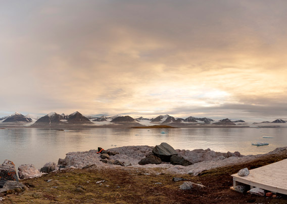
Lovénøyane: Juttaholmen 4
- pano anchor link: #Juttaholmen_23Sept15_084
The hut that is standing on Juttaholmen was built in 1954-55 by people from Ny Ålesund, so it is younger than the activities of the Northern Exploration Company. It was mainly built for free time purposes. Now the scientists from Ny-Ålesund are the only people who use this hut on a more or less regular basis.
BOOKS, CALENDAR, POSTCARDS AND MORE
This and other publishing products of the Spitsbergen publishing house in the Spitsbergen-Shop.
last modification: 2020-08-25 ·
copyright: Rolf Stange


