-
current
recommendations- Liefdefjord
New page dedicated to one of Spitsbergen's most beautiful fjords. Background information and many photos.
- New Spitsbergen guidebook
The new edition of my Spitsbergen guidebook is out and available now!
- Liefdefjord
New page dedicated to one of Spitsbergen's most beautiful fjords. Background information and many photos.
Page Structure
-
Spitsbergen-News
- Select Month
- June 2025
- May 2025
- April 2025
- March 2025
- February 2025
- January 2025
- December 2024
- November 2024
- October 2024
- September 2024
- August 2024
- July 2024
- June 2024
- May 2024
- April 2024
- March 2024
- February 2024
- January 2024
- December 2023
- November 2023
- October 2023
- September 2023
- August 2023
- July 2023
- June 2023
- May 2023
- April 2023
- March 2023
- February 2023
- January 2023
- December 2022
- November 2022
- October 2022
- September 2022
- August 2022
- July 2022
- June 2022
- May 2022
- April 2022
- March 2022
- February 2022
- January 2022
- December 2021
- November 2021
- October 2021
- September 2021
- August 2021
- July 2021
- June 2021
- May 2021
- April 2021
- March 2021
- February 2021
- January 2021
- December 2020
- November 2020
- October 2020
- September 2020
- August 2020
- July 2020
- June 2020
- May 2020
- April 2020
- March 2020
- February 2020
- January 2020
- December 2019
- November 2019
- October 2019
- September 2019
- August 2019
- July 2019
- June 2019
- May 2019
- April 2019
- March 2019
- February 2019
- January 2019
- December 2018
- November 2018
- October 2018
- September 2018
- August 2018
- July 2018
- June 2018
- May 2018
- April 2018
- March 2018
- February 2018
- January 2018
- December 2017
- November 2017
- October 2017
- September 2017
- August 2017
- July 2017
- June 2017
- May 2017
- April 2017
- March 2017
- February 2017
- January 2017
- December 2016
- November 2016
- October 2016
- September 2016
- August 2016
- July 2016
- June 2016
- May 2016
- April 2016
- March 2016
- February 2016
- January 2016
- December 2015
- November 2015
- October 2015
- September 2015
- August 2015
- July 2015
- June 2015
- May 2015
- April 2015
- March 2015
- February 2015
- January 2015
- December 2014
- November 2014
- October 2014
- September 2014
- August 2014
- July 2014
- June 2014
- May 2014
- April 2014
- March 2014
- February 2014
- January 2014
- December 2013
- November 2013
- October 2013
- September 2013
- August 2013
- July 2013
- June 2013
- May 2013
- April 2013
- March 2013
- February 2013
- January 2013
- December 2012
- November 2012
- October 2012
- September 2012
- August 2012
- July 2012
- June 2012
- May 2012
- April 2012
- March 2012
- February 2012
- January 2012
- December 2011
- November 2011
- October 2011
- September 2011
- August 2011
- May 2011
- April 2011
- March 2011
- February 2011
- January 2011
- December 2010
- November 2010
- September 2010
- August 2010
- July 2010
- June 2010
- May 2010
- April 2010
- March 2010
- February 2010
- November 2009
- October 2009
- August 2009
- July 2009
- June 2009
- May 2009
- April 2009
- March 2009
- February 2009
- January 2009
- December 2008
- November 2008
- October 2008
- August 2008
- July 2008
- June 2008
- May 2008
- April 2008
- March 2008
- February 2008
- April 2000
- Select Month
-
weather information
-
Newsletter

| Guidebook: Spitsbergen-Svalbard |
Home
→ * Photos, Panoramas, Videos and Webcams
→ Spitsbergen Panoramas
→ Lågøya: Mollbukta
Lågøya: Mollbukta
360 degree panoramas and some information and history

Lågøya is a flat island off the northwestern coast of Nordaustland. It is not frequently visited because the surrounding waters are mostly badly charted and have a lot of shallows. In addition comes a ban on all traffic on the whole west coast of the island including the waters up to 500 metres from the shore between 15 May and 15 August. This includes Purchasneset (the northern tip of the island) which used to be a popular landing site until the ban came into force in 2014. The main attractions were a walrus haulout site and polar bears that are not uncommon near walrus colonies. For birdwatchers, this was an interesting place because the rare Sabine’s gull has one of few nesting sites in Svalbard near Purchasneset.
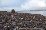
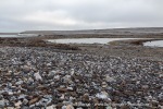
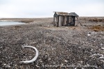
The first panorama gives a good impression of the flat landscape. The island used to be known amongst early whalers and expeditions as “Low Island”, later translated as Lavø into Norwegian, today Lågøya, the modern version of the same word. The name is obviously descriptive, the landscape appears barren and polar-desert like.
Mollbukta – Pano 1
- pano anchor link: #Mollbukta_13Aug15_152HDR
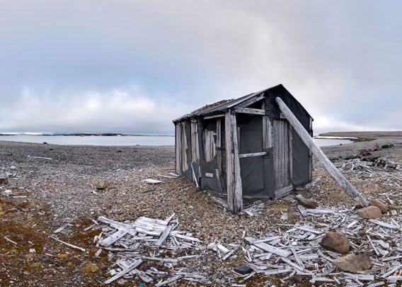
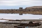
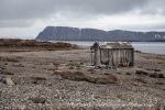
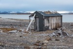
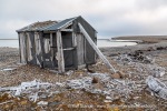
We are in Mollbukta, a shallow bay on the east coast of Lågøya. There is a hut on the north side of Mollbukta which was built in 1908 by Norwegian trappers. They caught 30 polar bears during the following winter. The hut was used again by another group of trappers in 1923-24. One of them was Meyer Olsen who wrote an interesting diary (Norwegian) which was published in 1999 (ARC – Arctic Research and Consulting DA, Oslo): Dagbok fra Nordaustlandet 1923-1924. Good reading material, especially if you happen to get to that area.
Mollbukta – Pano 2
- pano anchor link: #Mollbukta_13Aug15_133HDR
The hut has hardly been used since apart from a few visits by scientists. In July 1987, the Norwegian biologist and walrus specialist Ian Gjertz and his colleagues spent some time there, probably counting walruses. Already back then the hut was not really in good condition and the years that have passed since then have certainly not made it any better. Oskar Meyer-Olsen wrote in his above-mentioned diary about a visit to the hut where two of his comrades spent the winter. It was 13 March 1924 and the outside temperature was -33°C:
Det var et uhyggelig sted. Et tykt islag på veggene og inn over gulvet. Det var bare en kvadratmeter bart gulv i midten. En stor steinhaug i kroken ca. en meter høy. Ovnen måtte være så høyt for at rørene kunne rekke opp gennom taket. De var begge fullt påkledd i anorakk, skinnlue og vanter på og temperaturen var ca. 10 kuldegrader inne i hytten. Ovnen trakk ikke opp og røyken stod ut gjennom alle dens sammenføyninger …
(it was not a good place. A thick layer of ice on the walls and on the floor. There was only one square metre of ice-free floor in the middle. A huge pile of stones in the corner, about one metre high. The oven had to stand that high to enable to pipe to stick through the roof. Both had all their clothes on with anorak, fur cap and gloves and the temperature was minus ten degrees in the hut. The oven did not work and the smoke was coming out through all holes …)
Mollbukta – Pano 3
- pano anchor link: #Mollbukta_13Aug15_098HDR
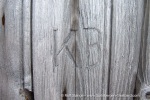
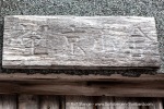
At some time the hut seems to have a mysterious visit from the far east. There is a wooden sign above the entrance, quite weathered by now, with the letters 望京小舍. I have been told that this means something like “I am missing Beijing from this hut” or “The hut that is leaning towards Beijing”. As far as I can see, the hut is still pretty vertical and not leaning anywhere, at least in 2015. I have no idea who put up the sign, when and why. Please let me know in case you happen to know more.
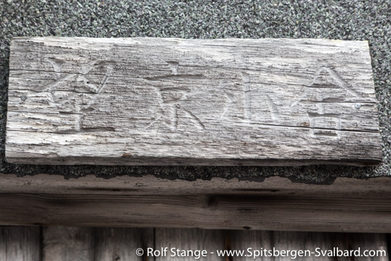
Chinese letters above the door of the hut in Mollbukta.
Photo gallery: the hut in Mollbukta on Lågøya
A photo collection taken in the years from 2004 to 2017.
- gallery anchor link: #gallery_3563
Click on thumbnail to open an enlarged version of the specific photo.
BOOKS, CALENDAR, POSTCARDS AND MORE
This and other publishing products of the Spitsbergen publishing house in the Spitsbergen-Shop.
last modification: 2025-03-20 ·
copyright: Rolf Stange

