-
current
recommendations- Liefdefjord
New page dedicated to one of Spitsbergen's most beautiful fjords. Background information and many photos.
- New Spitsbergen guidebook
The new edition of my Spitsbergen guidebook is out and available now!
- Liefdefjord
New page dedicated to one of Spitsbergen's most beautiful fjords. Background information and many photos.
Page Structure
-
Spitsbergen-News
- Select Month
- June 2025
- May 2025
- April 2025
- March 2025
- February 2025
- January 2025
- December 2024
- November 2024
- October 2024
- September 2024
- August 2024
- July 2024
- June 2024
- May 2024
- April 2024
- March 2024
- February 2024
- January 2024
- December 2023
- November 2023
- October 2023
- September 2023
- August 2023
- July 2023
- June 2023
- May 2023
- April 2023
- March 2023
- February 2023
- January 2023
- December 2022
- November 2022
- October 2022
- September 2022
- August 2022
- July 2022
- June 2022
- May 2022
- April 2022
- March 2022
- February 2022
- January 2022
- December 2021
- November 2021
- October 2021
- September 2021
- August 2021
- July 2021
- June 2021
- May 2021
- April 2021
- March 2021
- February 2021
- January 2021
- December 2020
- November 2020
- October 2020
- September 2020
- August 2020
- July 2020
- June 2020
- May 2020
- April 2020
- March 2020
- February 2020
- January 2020
- December 2019
- November 2019
- October 2019
- September 2019
- August 2019
- July 2019
- June 2019
- May 2019
- April 2019
- March 2019
- February 2019
- January 2019
- December 2018
- November 2018
- October 2018
- September 2018
- August 2018
- July 2018
- June 2018
- May 2018
- April 2018
- March 2018
- February 2018
- January 2018
- December 2017
- November 2017
- October 2017
- September 2017
- August 2017
- July 2017
- June 2017
- May 2017
- April 2017
- March 2017
- February 2017
- January 2017
- December 2016
- November 2016
- October 2016
- September 2016
- August 2016
- July 2016
- June 2016
- May 2016
- April 2016
- March 2016
- February 2016
- January 2016
- December 2015
- November 2015
- October 2015
- September 2015
- August 2015
- July 2015
- June 2015
- May 2015
- April 2015
- March 2015
- February 2015
- January 2015
- December 2014
- November 2014
- October 2014
- September 2014
- August 2014
- July 2014
- June 2014
- May 2014
- April 2014
- March 2014
- February 2014
- January 2014
- December 2013
- November 2013
- October 2013
- September 2013
- August 2013
- July 2013
- June 2013
- May 2013
- April 2013
- March 2013
- February 2013
- January 2013
- December 2012
- November 2012
- October 2012
- September 2012
- August 2012
- July 2012
- June 2012
- May 2012
- April 2012
- March 2012
- February 2012
- January 2012
- December 2011
- November 2011
- October 2011
- September 2011
- August 2011
- May 2011
- April 2011
- March 2011
- February 2011
- January 2011
- December 2010
- November 2010
- September 2010
- August 2010
- July 2010
- June 2010
- May 2010
- April 2010
- March 2010
- February 2010
- November 2009
- October 2009
- August 2009
- July 2009
- June 2009
- May 2009
- April 2009
- March 2009
- February 2009
- January 2009
- December 2008
- November 2008
- October 2008
- August 2008
- July 2008
- June 2008
- May 2008
- April 2008
- March 2008
- February 2008
- April 2000
- Select Month
-
weather information
-
Newsletter

| Guidebook: Spitsbergen-Svalbard |
Home
→ Spitsbergen information
→ Islands: Spitsbergen & Co.
→ Isfjord
→ Kapp Linne/Isfjord Radio, Festningen
Kapp Linne, Isfjord Radio, Russekeila, Festningen
Natural and human history on Spitsbergen's west coast: some background

Outer Isfjord with Kapp Linné (Isfjord Radio) and surroundings.
General
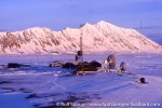
Kapp Linné is situated at the west coast just south of the entrance to Isfjord. In 1933, it became the saite of Isfjord Radio, radio and weather that provided communication with mainland Norway to all settlements in Spitsbergen and ships in the area. Since 1999, the station was run automatically and the staff was removed; soon, a fiberglass cable from Longyearbyen to the mainland made it obsolete. The buildings have been used as a hotel since the late 1990s. Definitely Spitsbergen’s most beautifully located hotel! If you are interested in staying there, then get in touch with Basecamp Spitsbergen. They can also provide transport and guided tours in the surroundings of Kapp Linné. The hotel has been renovated a couple of years ago; it lost a bit of the charme of a mid 20th century arctic station during the process but it has become more stylish and comfortable.
There is a page especially dedicated to Kapp Linné – click here.
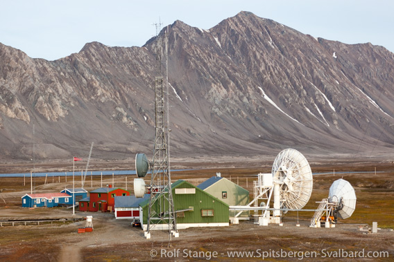
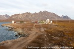
Kapp Linné: earlier Isfjord Radio, a station providing wireless communication for Spitsbergen’s settlements, today Isfjord Radio Hotel.
The Isfjord coast between Kapp Linné and Grønfjord has a lot to offer regarding geology, natural and human history and scenery, so you can easily spend a couple of rewarding days there – as always, it depends a bit on what you want, there are no calving glaciers there and if you happen to meet a polar bear there – something that is certainly possible – then this means trouble and potential danger rather than anything else.
There are several areas with dangerous shallows near the coast, so if you are out by boat or kayak, make sure you keep an eye on the chart.
Protected areas
There is a bird sanctuary directly south of the station area, which may not be entered between 15th May and 15th August. And Festningen and surroundings is a geotope, but that does not involve access restrictions; only if you want to take geological samples or anything like that, then you have to get your papers in place first, but that is the case anywhere in Spitsbergen.
For more, detailed information: the Guidebook Spitsbergen-Svalbard
Geology
The south coast of Isfjord between Kapp Linné and the Grønfjord is geologically interesting and well-known as the ‘Festningen-Section‘, so I will give it some space here. On a stretch of the coast of less than 10 km, you will find a relatively complete cross-section of the regional geology, starting with the pre-Devonian basement and reaching into the lower Tertiary, the youngest pre-Quaternary bedrock in Svalbard. This is due to the steep eastern dip of the strata: they are standing more or less vertically with a N-S trend, which is because of lower Tertiary tectonics. With a walk of a few kilometres, you can cover more than 300 million years of Earth history!
The start is at Kapp Linné with weakly to medium-metamorphosed basement rocks (phyllite, quarzite). The basement/cover-rock boundary is exposed on the north slopes of Linnéfjellet. Further east, you will reach hard Carboniferous quarzitic conglomerates (Devonian sediments are missing in this area).
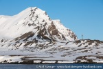
The mountain on the eastern side of Linnévatnet (Lake Linné) is very conspicuous. Its northern elongation stick out into the Isfjord, forming a prominent cape, known as Kapp Starostin. This is the type locality of the Kapp Starostin formation, a series of hard, upper Carboniferous and Permian carbonate rocks and cherts.
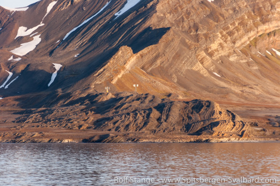
Sediment layers at Kapp Starostin.
These carbonates, mostly limestone, are rich in fossils such as brachiopods and bryoza. These rocks are common in many parts of Svalbard.
West of Kapp Starostin, in the plain between the cape and Linnéelva (Linné river), there are sink holes (karst phenomena) which are associated with the solution of carbonate rocks.
The Mesozoic succession starts with Triassic sediments east of Kapp Starostin (the proper Permian-Triassic boundary is missing in Svalbard, because there is a regional hiatus). The Mesozoic sediments consist of relatively uniform clay- and siltstones and subordinate sandstone. Some of the layers are quite fossil-rich (ammonites, shells etc.). You can find lower Cretaceous rocks at the corner to the Grønfjord. These are the youngest Mesozoic rocks in Svalbard (the upper Cretaceous, and thus unfortunately the C/T boundary, are missing due to a regional hiatus). The Festningen Sandstone is very conspicuous, a layer of hard, quarzitic sandstone within the lower Cretaceous. As the other sediments in the Festningen section, it is standing in a vertical position and, due to its hardness, stands out like a wall in the landscape. Its northern elongation forms a small island which reminds one of a fortress, hence the name ‘Festningen’ (Norwegian: fortress).
In the 1960s, footprints of dinosaurs (Iguanodons) were found here, but the rocks in question have fallen into the sea since. New tracks are supposed to come to the light of day every once in a while, but I have never found any so far – if you see some, please let me know. If you want to see dinosaur tracks in Spitsbergen, then Kvalvågen on the east coast is a better choice (but it is difficult to get there).
On the island of Festningen itself, there is a navigation beacon resembling a lighthouse; there are geese and other birds breeding there as well as on the mainland nearby, so keep your distance! For geological excursions, you should come outside the breeding season, preferably in August. East of Festningen, on the western side of the Grønfjord, lower Tertiary strata are exposed, which are essentially the same ones as in the Longyearbyen area, just tectonically deformed.
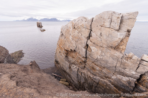
Vertical sandstone layer at Festningen.
All in all, the area offers a very nice cross section through large parts of the geology of Svalbard. If you are interested in geology and you want to see a relatively complete and easily accessible (well, more or less) section, then you should think about the Kapp Linné-Festningen area – but, as already mentioned, you should come after the breeding season. Middle or late August will be good. Additionally, the area has of course beautiful and interesting landscape as well as some wildlife and history to offer.
Recommended book for further, well-digestable (really!) info about geology and landscape of Svalbard.
Landscape
You may find the area less spectacular than other places in Spitsbergen, as there are, for example, no calving glaciers and no steep mountains near the coast, which itself is a wide, coastal plain. But still, there is a lot to see. It is one of my favourite areas in Spitsbergen – I don’t know how many times I have walked up and down the coast between Kapp Linnè and Festningen, and I will surely do it again. The coast itself is mostly a steep cliff, about five metres high, with more or less flat tundra behind. Here, you can find nice frost-patterned ground and patterns of well-preserved beach ridges.
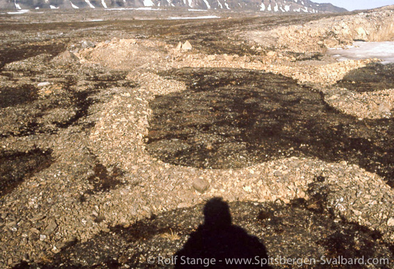
Stone rings (frost patterned ground) near Kapp Linné.
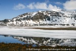
The tundra between Linnéelva and Kapp Starostin is very interesting, as there are dolines (sink holes) from underground carbonate solution, good fossil beach ridges and, if you go a bit inland, a very fine view over the lake Linnévatnet.
Festningen is a very interesting location (see above), a hard sandstone layer standing like a wall in the landscape on the corner to the Grønfjord (again, stay away from breeding geese and other birds in the season). Walking is more difficult east of Kapp Starostin than west of it, as the tundra is wetter and there are some steeply incised little valleys. The river Linnéelva is usually relatively easy to cross if you try half-way between the coast and the lake, but it may still be too high for ordinary rubber boots.
Flora and fauna
The tundra is relatively barren, especially north of Linnévatnet.
If you have come to Spitsbergen to see big arctic mammals, then Kapp Linné may not be your first place to go to. Polar bears visit the area more or less regularly, and there have been occasions when polar bears hang out around Isfjord Radio for days, something that can be a bit of a plague. It has even happened that a bear entered the entrance area of the main building! So it is certainly be important to take the usual precautionary measures. First of all: keep your eyes open and your brain switched on.
Sometimes a group of walrus can be found resting on the beach a few kilometres south of Kapp Linné.

Polar bear visiting Kapp Linné.
Arctic foxes and Spitsbergen reindeer are regular visitors. Hundreds of common eider ducks used to breed near the buildings of Isfjord Radio, even under the doors steps. Several ground breeding species are common in the area, so it is a good place for birdwatchers.
History
Remains from many different chapters of Spitsbergen’s history can be seen, although they are usually quite inconspicuous – don’t expect an exhibition worthy of the British Museum: traces of the past are often quite subtle in the Arctic, but they are nevertheless interesting.
17th century whalers used to have several stations in the Grønfjord area, including one near Festningen, but there is nothing left there to be seen these days.
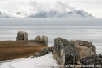
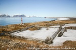
The Pomors have also used the area as hunting ground. There was a large Pomor settlement/hunting station at Russekeila at the mouth of Linnéelva. There are still remains to be seen (the inconspicuous foundations with pieces of bricks; the huts are younger). The famous Pomor patriarch Ivan Starostin used to live here, legend has it that he stayed for 32 years, mostly without returning to the mainland at all! He died there in 1826 and, appropriatly, he was buried in the area; there is a pile of stones on the ridge near Kapp Starostin (near the antenna) that could be his grave. Altogether, Russekeila is one of Spitsbergen’s most prominent Pomor locations
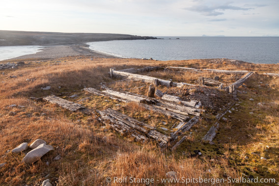
Remains of a Pomor settlement at Russekeila.
Remains from the ‘gold-rush period’, during which minerals have been investigated and claims taken into possession for the purpose of potential mining, can be seen at Kapp Mineral just east of Kapp Linné, a mine entrance is still visible where lead and zinc ore was extracted in the early 1920s.
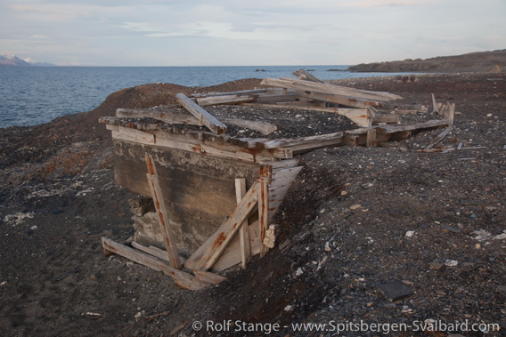
Remains of trial mining at Kapp Mineral.
At Kapp Linné, the station Isfjord Radio provided radio communication between the various settlements on Spitsbergen as well as ships in the area and mainland Norway. In later years, Isfjord Radio was connected to the settlements via beam antennas. The nearest one is standing at Kapp Starostin. The last remaining technical staff was removed from Isfjord Radio in 1999. Today, the station is technically not necessary anymore, since a glass fibre cable has been laid from Longyearbyen to the mainland, and the buildings are used as a wilderness hotel (see above).
Gallery – Kapp Linné and surroundings
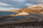
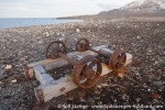
Some impressions from the Isfjord coast: Kapp Linné – Kapp Mineral – Russekeila – Kapp Starostin – Festningen.
- gallery anchor link: #gallery_1863
Click on thumbnail to open an enlarged version of the specific photo.
BOOKS, CALENDAR, POSTCARDS AND MORE
This and other publishing products of the Spitsbergen publishing house in the Spitsbergen-Shop.
last modification: 2025-02-21 ·
copyright: Rolf Stange

