-
current
recommendations- Liefdefjord
New page dedicated to one of Spitsbergen's most beautiful fjords. Background information and many photos.

- New Spitsbergen guidebook
The new edition of my Spitsbergen guidebook is out and available now!

- Liefdefjord
New page dedicated to one of Spitsbergen's most beautiful fjords. Background information and many photos.
Page Structure
-
Spitsbergen-News
- Select Month
- June 2025
- May 2025
- April 2025
- March 2025
- February 2025
- January 2025
- December 2024
- November 2024
- October 2024
- September 2024
- August 2024
- July 2024
- June 2024
- May 2024
- April 2024
- March 2024
- February 2024
- January 2024
- December 2023
- November 2023
- October 2023
- September 2023
- August 2023
- July 2023
- June 2023
- May 2023
- April 2023
- March 2023
- February 2023
- January 2023
- December 2022
- November 2022
- October 2022
- September 2022
- August 2022
- July 2022
- June 2022
- May 2022
- April 2022
- March 2022
- February 2022
- January 2022
- December 2021
- November 2021
- October 2021
- September 2021
- August 2021
- July 2021
- June 2021
- May 2021
- April 2021
- March 2021
- February 2021
- January 2021
- December 2020
- November 2020
- October 2020
- September 2020
- August 2020
- July 2020
- June 2020
- May 2020
- April 2020
- March 2020
- February 2020
- January 2020
- December 2019
- November 2019
- October 2019
- September 2019
- August 2019
- July 2019
- June 2019
- May 2019
- April 2019
- March 2019
- February 2019
- January 2019
- December 2018
- November 2018
- October 2018
- September 2018
- August 2018
- July 2018
- June 2018
- May 2018
- April 2018
- March 2018
- February 2018
- January 2018
- December 2017
- November 2017
- October 2017
- September 2017
- August 2017
- July 2017
- June 2017
- May 2017
- April 2017
- March 2017
- February 2017
- January 2017
- December 2016
- November 2016
- October 2016
- September 2016
- August 2016
- July 2016
- June 2016
- May 2016
- April 2016
- March 2016
- February 2016
- January 2016
- December 2015
- November 2015
- October 2015
- September 2015
- August 2015
- July 2015
- June 2015
- May 2015
- April 2015
- March 2015
- February 2015
- January 2015
- December 2014
- November 2014
- October 2014
- September 2014
- August 2014
- July 2014
- June 2014
- May 2014
- April 2014
- March 2014
- February 2014
- January 2014
- December 2013
- November 2013
- October 2013
- September 2013
- August 2013
- July 2013
- June 2013
- May 2013
- April 2013
- March 2013
- February 2013
- January 2013
- December 2012
- November 2012
- October 2012
- September 2012
- August 2012
- July 2012
- June 2012
- May 2012
- April 2012
- March 2012
- February 2012
- January 2012
- December 2011
- November 2011
- October 2011
- September 2011
- August 2011
- May 2011
- April 2011
- March 2011
- February 2011
- January 2011
- December 2010
- November 2010
- September 2010
- August 2010
- July 2010
- June 2010
- May 2010
- April 2010
- March 2010
- February 2010
- November 2009
- October 2009
- August 2009
- July 2009
- June 2009
- May 2009
- April 2009
- March 2009
- February 2009
- January 2009
- December 2008
- November 2008
- October 2008
- August 2008
- July 2008
- June 2008
- May 2008
- April 2008
- March 2008
- February 2008
- April 2000
- Select Month
-
weather information
-
Newsletter

| Guidebook: Spitsbergen-Svalbard |
Home
→ Spitsbergen information
→ Islands: Spitsbergen & Co.
→ Isfjord
→ Trygghamna, Alkhornet
Trygghamna and Alkhornet
Arctic nature, landscape and history on the north side of Isfjord
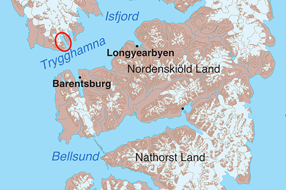
The bay of Trygghamna is located on the north side of Isfjord.
General
Trygghamna is located on the north side of the Isfjord, opposite Barentsburg. Trygghamna is the westernmost of a whole series of bays on the north side of the Isfjord. The area is a national park, but tourists are allowed to go ashore and hike everywhere.
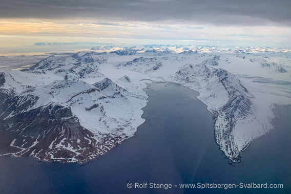
View over Trygghamna from the scheduled plane on the approach to Longyearbyen.
Alkhornet on the left side of the entrance to the bay.
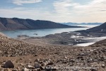
Trygghamna is surrounded by mountains, the bay is only open to the south, towards Isfjord. In easterly or westerly winds, the bay usually offers good shelter, hence the name: Trygghamna is the translation of the original English name ‘Safe Harbour’. Trygghamna is the first bay on the north side that a ship entering Isfjord reaches and is therefore a frequently used anchorage, both in the past and today. However, when the wind blows in a north-south direction, it can be stormy in the small, straight bay surrounded by mountains. And I’m not quite sure how the whalers anchored here in their day, as most of the bay is far too deep for anchoring, with depths of more than 100 metres. The innermost part of Trygghamna offers good anchorage depths for small ships, but this area did not exist in whaling times in the 17th and 18th centuries, as the glaciers still extended there at that time, which have since retreated.
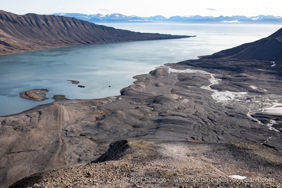
View from Knuvlen to the south-east over Trygghamna.
There is a fairly shallow area on the east side of Trygghamna, but at one point it is 4.4 metres shallow: enough to be dangerous for ships. There is also a historic shipwreck close to this shoal. It is marked on the nautical chart, anchoring and diving are prohibited there.
Trygghamna is an impressively scenic bay with rugged mountains and several glaciers. A wide, lush green tundra plain stretches around the Alkhornet, a striking mountain in the entrance area on the west side. All in all, there is a lot to discover!
Alkhornet is a popular tourist landing site and is frequently visited during the summer season.
Trygghamna panorama
The following pages are dedicated to individual places in the bay, each with more pictures, including 360-degree panoramic images, and information.
- Alkhornet with the surrounding tundra area.
- The little mountain Knuvlen in the northern part of Trygghamna, partly surrounded by glaciers.
Geology
On the western side, around the Alkhornet and a little further into the bay, you will find the old geological basement of Svalbard, which outcrops along the entire west coast. On the western shore of Trygghamna, it is composed of slate and quartzite, similar to large areas elsewhere on the west coast.
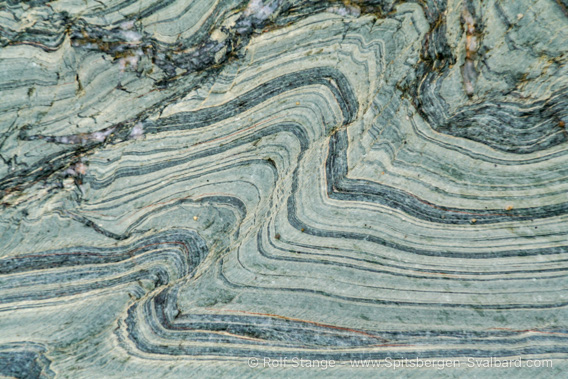
Folded slate on the shore at Alkhornet.
The striking mountain ridge Värmlandryggen on the eastern side of the bay shows that it is geologically carved from a completely different rock. The bedrock here is much younger, consisting of deposits from the upper Palaeozoic periods of Carboniferous and Permian. The Carboniferous in particular consists in part of quartzitic sandstone, which is weathered into such coarse blocks on mountain slopes by frost shatter that it can be quite strenuous to move around. This is the case in some places in the inner part of Trygghamna, for example around Knuvlen.
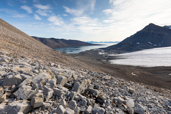
Weathered sandstone on Knuvlen.
Elsewhere, the ‘Permo-Carboniferous’ (collective term for Permian and Carboniferous) consists of hard limestone layers in which you can find beautiful fossils in places.
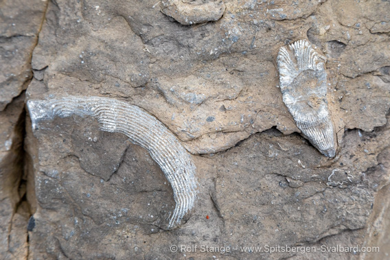
Fossilised coral stems from the upper Carboniferous/lower Permian (approx. 300 million years old) on the east side of Trygghamna.
At Värmlandryggen, tectonic movements have tilted these layers into a vertical position, giving this ridge its distinctive appearance. This is particularly striking on the shore on the east side of the entrance to Trygghamna, at Selmaneset.

Steep layers at Selmaneset and Värmlandryggen.
Landscape
Spitsbergen in a nutshell! From Alkornet westwards, the coastal plain becomes wider and wider, as is typical for large parts of the west coast of Spitsbergen. The tundra at Alkhornet with its ice wedges is an experience in itself.
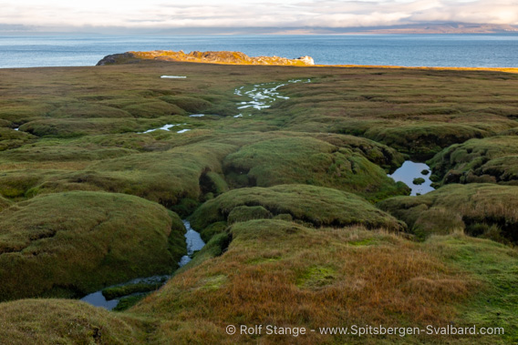
Tundra with ice wedges at Alkhornet.
In Trygghamna itself, flat land on the shore is rather limited (west side) to non-existent (mainly on the east side). Here the debris-covered slopes rise more or less from the shore up to 500-700 metres.
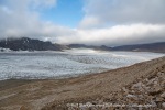
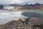
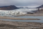
On the west and north-west side of the bay there are several smaller glaciers, Protektorbreen, Harrietbreen and Kjerulfbreen, but none of them reach the shore of the fjord. To the north, the small fjord Trygghamna continues into a small valley with several lakes.

Glacier tour on Harrietbreen.
In the geologically recent past, up until the 19th and possibly the early 20th century, the Harrietbreen and Kjerulfbreen glaciers reached the shore of the fjord and formed calving cliffs there. Here, as elsewhere, glacier retreat is pronounced, formerly as a result of the end of the Little Ice Age in the 19th century and today due to the ongoing man-made climate change.
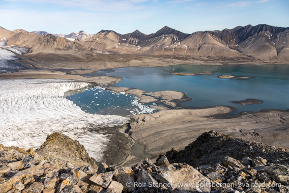
Moraine landscape on the shore in front of Harrietbreen and Kjerulfbreen.
Flora and fauna
Large parts of Trygghamna are rather inconspicuous in terms of flora and fauna: the terrain is too steep and characterised by debris-covered slopes or glaciers and moraines.
Alkhornet offers a stark contrast to this: as the name ‘Alken Horn’ suggests, numerous seabirds breed on the cliffs, even if they are mainly kittiwakes rather than guillemots (“alk”).

Alkhornet and surrounding tundra.
Fertilisation by the bird cliffs has created a tundra on the coastal plain around Alkhornet that is as green and lush as you can imagine. A paradise for reindeer and arctic foxes, and during the breeding season in early summer, the tundra is home to numerous geese.
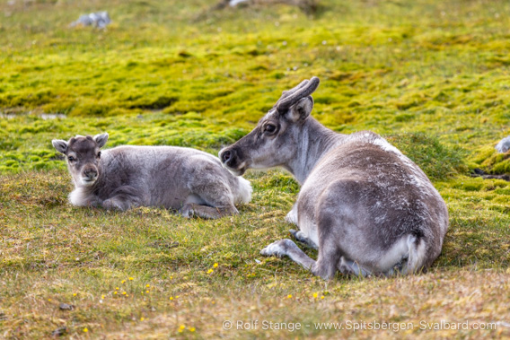
Reindeer family at Alkhornet.
History
Everyone who came to Spitsbergen needed a safe (natural) harbour, and this was and still is found in Trygghamna. Accordingly, they were all here: Whalers, Pomors and later trappers, and they all left their mark.

Graves from the whaling era (17th/18th century).
The most prominent site is probably the Pomor station on the west side of Trygghamna.

Remains of the Pomor settlement in Trygghamna.
Completely ruined, but still clearly visible, is the trapper’s hut built by Hilmar Nøis on the shore near Alkhornet in 1920. It was not the first hut on the site, and if you look closely, you can see where a hut once stood before it.

Remains of the trapper’s hut from 1920 at Alkhornet.
The photo is from 2014, since then the hut has deteriorated even further.
Just north of this trapper’s hut is a fairly modern hut from the 1970s above the shore. It is owned by the Sysselmester (governor) and there is usually field police stationed there during the summer season.
Photo gallery Trygghamna
Some impressions of Trygghamna, illustrating the variety of the landscsape from Selmaneset in the southeast to the glaciers in the northwest.
- gallery anchor link: #gallery_3474
Click on thumbnail to open an enlarged version of the specific photo.
Photo gallery Alkhornet
Some images from Alkhornet and the surrounding tundra, separate from the Trygghamna photos for better overview.
- gallery anchor link: #gallery_3477
Click on thumbnail to open an enlarged version of the specific photo.
BOOKS, CALENDAR, POSTCARDS AND MORE
This and other publishing products of the Spitsbergen publishing house in the Spitsbergen-Shop.
last modification: 2025-01-06 ·
copyright: Rolf Stange

