-
current
recommendations- Liefdefjord
New page dedicated to one of Spitsbergen's most beautiful fjords. Background information and many photos.
- New Spitsbergen guidebook
The new edition of my Spitsbergen guidebook is out and available now!
- Liefdefjord
New page dedicated to one of Spitsbergen's most beautiful fjords. Background information and many photos.
Page Structure
-
Spitsbergen-News
- Select Month
- April 2025
- March 2025
- February 2025
- January 2025
- December 2024
- November 2024
- October 2024
- September 2024
- August 2024
- July 2024
- June 2024
- May 2024
- April 2024
- March 2024
- February 2024
- January 2024
- December 2023
- November 2023
- October 2023
- September 2023
- August 2023
- July 2023
- June 2023
- May 2023
- April 2023
- March 2023
- February 2023
- January 2023
- December 2022
- November 2022
- October 2022
- September 2022
- August 2022
- July 2022
- June 2022
- May 2022
- April 2022
- March 2022
- February 2022
- January 2022
- December 2021
- November 2021
- October 2021
- September 2021
- August 2021
- July 2021
- June 2021
- May 2021
- April 2021
- March 2021
- February 2021
- January 2021
- December 2020
- November 2020
- October 2020
- September 2020
- August 2020
- July 2020
- June 2020
- May 2020
- April 2020
- March 2020
- February 2020
- January 2020
- December 2019
- November 2019
- October 2019
- September 2019
- August 2019
- July 2019
- June 2019
- May 2019
- April 2019
- March 2019
- February 2019
- January 2019
- December 2018
- November 2018
- October 2018
- September 2018
- August 2018
- July 2018
- June 2018
- May 2018
- April 2018
- March 2018
- February 2018
- January 2018
- December 2017
- November 2017
- October 2017
- September 2017
- August 2017
- July 2017
- June 2017
- May 2017
- April 2017
- March 2017
- February 2017
- January 2017
- December 2016
- November 2016
- October 2016
- September 2016
- August 2016
- July 2016
- June 2016
- May 2016
- April 2016
- March 2016
- February 2016
- January 2016
- December 2015
- November 2015
- October 2015
- September 2015
- August 2015
- July 2015
- June 2015
- May 2015
- April 2015
- March 2015
- February 2015
- January 2015
- December 2014
- November 2014
- October 2014
- September 2014
- August 2014
- July 2014
- June 2014
- May 2014
- April 2014
- March 2014
- February 2014
- January 2014
- December 2013
- November 2013
- October 2013
- September 2013
- August 2013
- July 2013
- June 2013
- May 2013
- April 2013
- March 2013
- February 2013
- January 2013
- December 2012
- November 2012
- October 2012
- September 2012
- August 2012
- July 2012
- June 2012
- May 2012
- April 2012
- March 2012
- February 2012
- January 2012
- December 2011
- November 2011
- October 2011
- September 2011
- August 2011
- May 2011
- April 2011
- March 2011
- February 2011
- January 2011
- December 2010
- November 2010
- September 2010
- August 2010
- July 2010
- June 2010
- May 2010
- April 2010
- March 2010
- February 2010
- November 2009
- October 2009
- August 2009
- July 2009
- June 2009
- May 2009
- April 2009
- March 2009
- February 2009
- January 2009
- December 2008
- November 2008
- October 2008
- August 2008
- July 2008
- June 2008
- May 2008
- April 2008
- March 2008
- February 2008
- April 2000
- Select Month
-
weather information
-
Newsletter

| Guidebook: Spitsbergen-Svalbard |
Nordaustland: Langgrunnodden
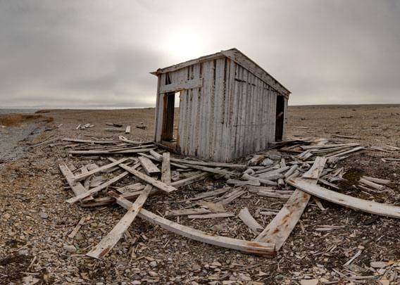
Panorama of a polar desert and an old trappers' hut
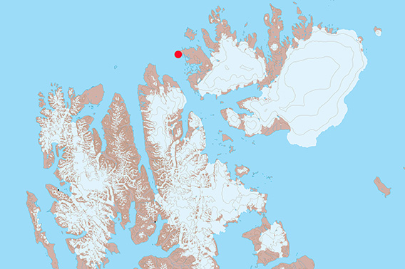
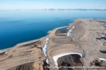
The peninsula Langgrunnodden is the northwest point of Nordaustlandet.
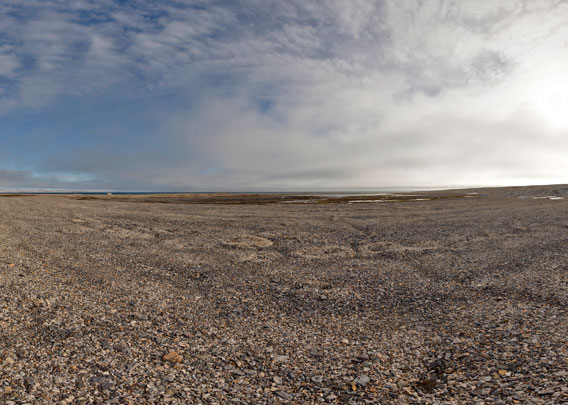
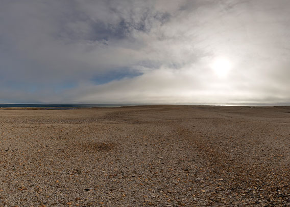
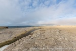
Langgrunnodden is the westernmost point of the large peninsula Storsteinhalvøya, the northwest part of Nordaustland, far north in Hinlopen Strait. This is a very barren polar desert type of landscape. The scenery is very wide-open, with low hills stretching between Murchisonfjord in the south and Franklinsund in the north. We start our little tour of Langgrunnodden on ihe north side of this low-lying peninsula.
- pano anchor link: #170806e_Langgrunnodden_20HDR
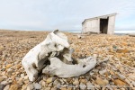
There are some lagoons, including Claravågen, one of Svalbard’s largest lagoons. The carbonate-bearing bedrock is shattered by frost into countless small, sharp rocks, often arranged in fascinating patterns by freezing-thawing-cycles over centuries and millenia.
- pano anchor link: #170806d_Detterbukta_120HDR
It is just about one kilometre across Langgrunnodden, and the terrain is largely flat and easy to walk until we have reached Detterbukta, the bay on the south side.
- pano anchor link: #170806e_Langgrunnodden_01HDR
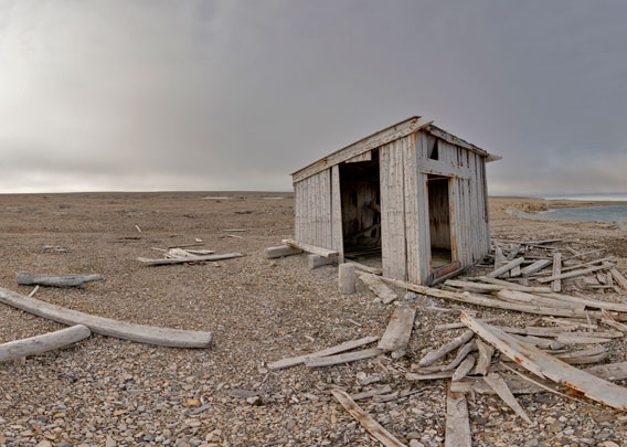
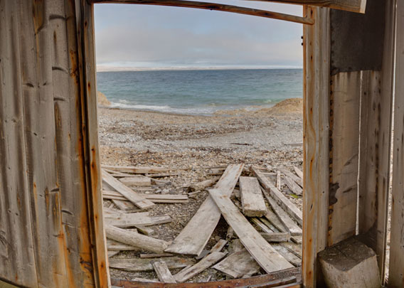
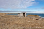
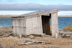
There is a ruin of a trappers’ hut in this barren landscape. The hut was built in 1908 by a group of wintering hunters led by Anders Larsen. The area was rarely used by winterers. During the few winterings in the area, the main huts were either in Murchisonfjord or in Brennevinsfjord and on Lågøya.
- pano anchor link: #170806d_Detterbukta_101HDR
In 2020, the historic monument protection authority “discovered” this hut and found it to be something special, because of a series of long, narrow wooden pins that were attached to the wall above the bunk bed in a vertical position, close and parallel to each other. You can see these pins above the remains of the bed in the following panorama (photographed in 2017):
- pano anchor link: #170806d_Detterbukta_043HDR
The use of these pins is not fully understood. It was suggested that they were meant to keep the clothes of a person in the bed from freezing to the walls in the cold winter. The walls of this hut, as of most huts built during the trapper period, were thin and hardly isolated. But it remains a matter of speculation if these pins were actually suited to serve this purpose. Because of these “freezing pins” (Norwegian: frysepinner), this hut was occasionally referred to as “frysepinnehytte”.
- pano anchor link: #170806d_Detterbukta_079HDR
Because of this “architectural peculiarity”, it was decided to make a major effort to renovate the hut at Langgrunnodden substantially, so it would survive for another long time to come. But when the official craftsmen came to do the job in the summer of 2021, they were in for a surprise: the hut was gone and away, most likely completely destroyed by a heavy winter storm that blew most of the remains out onto the drift ice where it was then lost. After more than a century, the historic monument protection authority came a couple of months too late, according to Svalbardposten.
Langgrunnodden – Photo gallery
And finally some photographic impressions of Langgrunnodden. Most of the pictures are from 2017; the hut does not exist anymore, as mentioned above.
- gallery anchor link: #gallery_2755
Click on thumbnail to open an enlarged version of the specific photo.
BOOKS, CALENDAR, POSTCARDS AND MORE
This and other publishing products of the Spitsbergen publishing house in the Spitsbergen-Shop.
last modification: 2023-07-28 ·
copyright: Rolf Stange

