-
current
recommendations- Liefdefjord
New page dedicated to one of Spitsbergen's most beautiful fjords. Background information and many photos.
- New Spitsbergen guidebook
The new edition of my Spitsbergen guidebook is out and available now!
- Liefdefjord
New page dedicated to one of Spitsbergen's most beautiful fjords. Background information and many photos.
Page Structure
-
Spitsbergen-News
- Select Month
- June 2025
- May 2025
- April 2025
- March 2025
- February 2025
- January 2025
- December 2024
- November 2024
- October 2024
- September 2024
- August 2024
- July 2024
- June 2024
- May 2024
- April 2024
- March 2024
- February 2024
- January 2024
- December 2023
- November 2023
- October 2023
- September 2023
- August 2023
- July 2023
- June 2023
- May 2023
- April 2023
- March 2023
- February 2023
- January 2023
- December 2022
- November 2022
- October 2022
- September 2022
- August 2022
- July 2022
- June 2022
- May 2022
- April 2022
- March 2022
- February 2022
- January 2022
- December 2021
- November 2021
- October 2021
- September 2021
- August 2021
- July 2021
- June 2021
- May 2021
- April 2021
- March 2021
- February 2021
- January 2021
- December 2020
- November 2020
- October 2020
- September 2020
- August 2020
- July 2020
- June 2020
- May 2020
- April 2020
- March 2020
- February 2020
- January 2020
- December 2019
- November 2019
- October 2019
- September 2019
- August 2019
- July 2019
- June 2019
- May 2019
- April 2019
- March 2019
- February 2019
- January 2019
- December 2018
- November 2018
- October 2018
- September 2018
- August 2018
- July 2018
- June 2018
- May 2018
- April 2018
- March 2018
- February 2018
- January 2018
- December 2017
- November 2017
- October 2017
- September 2017
- August 2017
- July 2017
- June 2017
- May 2017
- April 2017
- March 2017
- February 2017
- January 2017
- December 2016
- November 2016
- October 2016
- September 2016
- August 2016
- July 2016
- June 2016
- May 2016
- April 2016
- March 2016
- February 2016
- January 2016
- December 2015
- November 2015
- October 2015
- September 2015
- August 2015
- July 2015
- June 2015
- May 2015
- April 2015
- March 2015
- February 2015
- January 2015
- December 2014
- November 2014
- October 2014
- September 2014
- August 2014
- July 2014
- June 2014
- May 2014
- April 2014
- March 2014
- February 2014
- January 2014
- December 2013
- November 2013
- October 2013
- September 2013
- August 2013
- July 2013
- June 2013
- May 2013
- April 2013
- March 2013
- February 2013
- January 2013
- December 2012
- November 2012
- October 2012
- September 2012
- August 2012
- July 2012
- June 2012
- May 2012
- April 2012
- March 2012
- February 2012
- January 2012
- December 2011
- November 2011
- October 2011
- September 2011
- August 2011
- May 2011
- April 2011
- March 2011
- February 2011
- January 2011
- December 2010
- November 2010
- September 2010
- August 2010
- July 2010
- June 2010
- May 2010
- April 2010
- March 2010
- February 2010
- November 2009
- October 2009
- August 2009
- July 2009
- June 2009
- May 2009
- April 2009
- March 2009
- February 2009
- January 2009
- December 2008
- November 2008
- October 2008
- August 2008
- July 2008
- June 2008
- May 2008
- April 2008
- March 2008
- February 2008
- April 2000
- Select Month
-
weather information
-
Newsletter

| Guidebook: Spitsbergen-Svalbard |
Home
→ Spitsbergen information
→ Islands: Spitsbergen & Co.
→ Spitsbergen (Northern part)
→ Amsterdamøya-Smeerenburg
Amsterdamøya-Smeerenburg

For more, detailed information: the Guidebook Spitsbergen-Svalbard
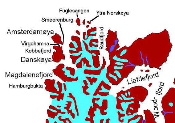
General: The little island Amsterdamøya is at the northwestern corner of Spitsbergen, directly north of Danskøya. Amsterdamøya is famous for its whaling history.

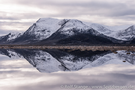
Amsterdamøya seen from southeast, with the lowland of Smeerenburg in the foreground.
Geology: Basement. Metamorphic rocks like gneiss, phyllite and mica schist are predominant. Strongly uplifted during north atlantic rifting in the upper Cretaceous and lower Tertiary. The lowland in the southeast is covered with upper pleistocene moraine.
Rocks and Ice: Recommended book for further, well-digestable (really!) information about Spitsbergen’s natural history.

Rocky, shallow shore north of Smeerenburg.
Landscape: Most of Amsterdamøya consists of a little mountain plateaux with steep rock slopes and an undulating plateaux on top with a maximum altitude of 472 metres. Only the southeastern part has some square kilometres of lowland, which is covered with muddy sand and stones. It can be quite wet and soft in the early summer. There are several lakes and lagoons near the shore and 2 glaciers.

Lagoon on Amsterdamøya. Danskøya in the background.
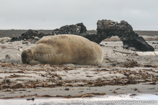
Flora and fauna: The vegetation is rather scarce and consists mostly of moss beds and lichens. Scurvy grass and Alpine sorrel are abundant on cliffs near bird colonies. Harbour seals are sometimes resting on stones near the shore exposed at low tide. Have a look for unexpected bird species on the lagoons, this seems to be a good place for vagrants. Great northern diver and Red-necked phalarope are amongst the species that have been seen here. The Spitsbergen reindeer and arctic fox are roaming over the lowland, and it is not too uncommon to see a polar bear walking somewhere. Sometimes walrusses are resting on the shore near the blubber ovens in Smeerenburg.

Walrus on the shore near a blubber oven in Smeerenburg, Amsterdamøya.
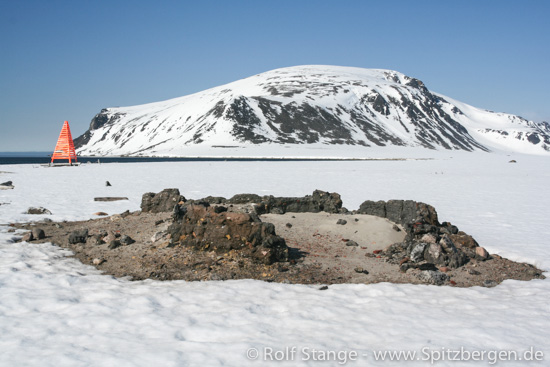
History: Amsterdamøya is famous for the whaling station Smeerenburg, which was built by Dutch whalers in the 17th century on the southeastern point of the island. 8 commerce chambers from different Dutch towns were active there and had each at least one double oven complete with 2 buildings. At times, also a Danish company was involved here. From west to east, the ovens had the following owners: Hoorn/Enkhuizen, Delft, the Danes, Veere, Vlissingen, Middelburg and Amsterdam. There were altogether 16 or 17 houses and a little fortress, probably a gun battery, in Smeerenburg, which translates as “blubber town”. In the heydays around 1620, there were up to 200 men working in Smeerenburg for some hectic summer weeks. The remains of the blubber ovens can still be seen. In the late 1620s, whaling got less profitable and the activity ceased over time, until Smeerenburg was abandoned around 1660.

Blubber oven in Smeerenburg, Amsterdamøya.
In 1633-34, a crew of 7 men wintered successfully. This was the first planned European wintering in Spitsbergen. Another attempt was made in 1634-35, but then, all 7 died. Altogether 101 graves have been found by archaeologists in the lowland not far from Smeerenburg.

Whaler’s grave on Amsterdamøya.

Almost as in the 17th century: A Dutch sailing ship, the SV Antigua, anchored at Smeerenburg. Remains of a blubber oven in the foreground.
BOOKS, CALENDAR, POSTCARDS AND MORE
This and other publishing products of the Spitsbergen publishing house in the Spitsbergen-Shop.
last modification: 2014-11-04 ·
copyright: Rolf Stange


