


-
current
recommendations- Liefdefjord
New page dedicated to one of Spitsbergen's most beautiful fjords. Background information and many photos.

- New Spitsbergen guidebook
The new edition of my Spitsbergen guidebook is out and available now!
- Liefdefjord
New page dedicated to one of Spitsbergen's most beautiful fjords. Background information and many photos.
-
weather information

| Guidebook: Spitsbergen-Svalbard |
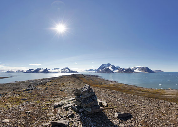
Panoramas: Hornsund
Hornsund: Treskelen
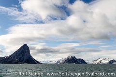
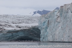
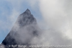
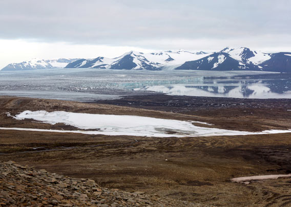
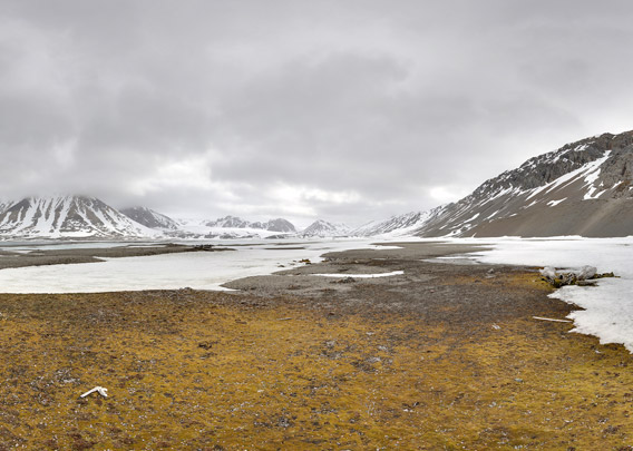
Panoramic view from the ridge of the Treskelen peninsula over almost the whole of of Hornsund. From here, you watch over Brepollen, the innermost bay of Hornsund, with its surrounding glaciers. You see the famous mountains Bautaen (“the monolith”, towering needle-sharp and 475 m high over the entrance to Brepollen) and Hornsundtind, a 1429 m high carbonate massive standing directly on the south shore of Hornsund. Hornsundtind is the highest mountain in southern Spitsbergen.
The bay Brepollen is now wide-open, but it was completely filled by the surrounding glaciers Storbreen, Hornbreen and Chomjakovbreen as recent as the early 20th century. The bay Brepollen simply didn’t exist before.
- pano anchor link: #Treskelen_13Juli13_091
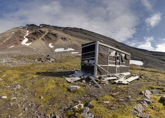
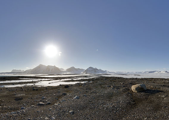
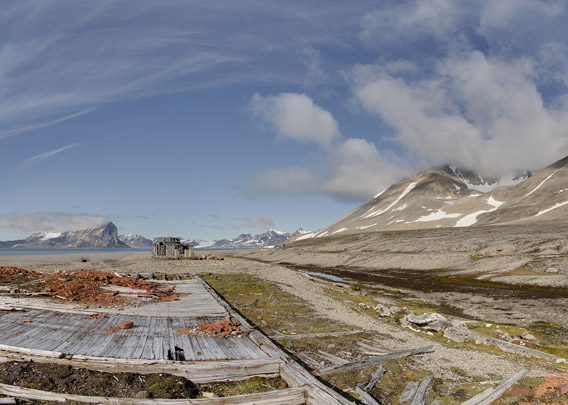
In Adriabukta, next to the peninsula Treskelen, there is another old trapper’s cabin. This was the one deepest in the fjord in the days of polar bear hunting. The hut is rather small and starting to show signs of deterioration.
- pano anchor link: #Treskelen_13Juli13_014
- pano anchor link: #Treskelen_13Juli13_035
Hornsund: Ammonitøya
Ammonitøya is a small island in Brepollen (innermost Hornsund). The name points towards fossils (ammonites) discovered here. The ammonites are found in moraine sediments covering most of the island, which was glacier-covered until the glaciers receded in the early 20th century. The rocks containing the fossils were brought by glaciers from anywhere in the catchment area of the glaciers, which includes large areas around Brepollen with sedimentary bedrock dating to the Jurassic and Cretaceous (and Tertiary, but this does not contain ammonites in Spitsbergen).
Wherever the ammonites exactly came from, they certainly enjoy brilliant views over Brepollen these days and more or less regular visits from polar bears.
- pano anchor link: #Ammonitoya_08Juni13_001
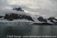
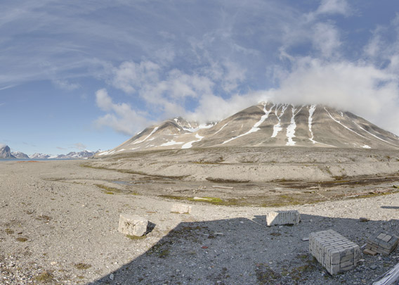
Hornsund: Brepollen
View to the east and south from Cholmaksla, a moraine-covered ridge that stretches from the mountain Mezenryggen into Brepollen (innermost Hornsund). Left and centre: Hornbreen (-glacier), in the right side background: Mendeleevbreen.
- pano anchor link: #spitsbergen_003
Hornsund: Gnålodden
Gnålodden is located centrally in Hornsund under the mountain Gnålberget. You have to keep an eye on many underwater rocks as you are approaching by boat, they have killed many zodiac outboard engine propellers.
Gnålodden is a place with a lot to see within a small area. Just the rocky shoreline is a sight in itself. The flat area is of limited size, but beautifully green with its mossy tundra, a clear indication for the presence of large numbers of Brunich’s guillemots and kittywakes that breed in the steep cliffs of Gnålberget.
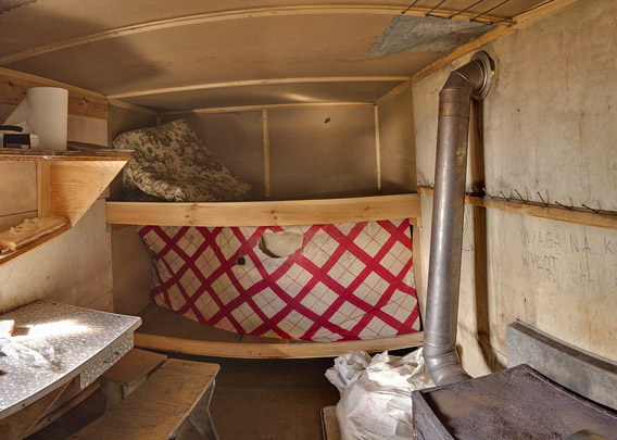
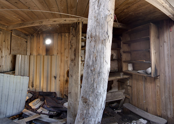
The old hut is a real eyecatcher. Until the protection of polar bears in 1973, it was part of a classical polar bear hunting area. The bears came with drift ice around the south cape, up the west coast and into Hornsund. In some years, hundreds of them migrated through the fjord and back to the east coast: rich hunting grounds for trappers, including the legendary Norwegian female hunter Wanny Woldstad, who was one of the first active lady hunters in Spitsbergen when she wintered several times in Hornsund during the 1930s.
- pano anchor link: #Gnaalodden_21Juli13_035
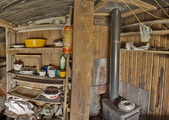
The panorama shows the main room of the hut, which is still regularly used by scientists from the near-by Polish research station and accoasionally by locals from Longyearbyen who take the long trip with snow mobiles.
Panorama: Hornsund – Gåshamna (West)
When you enter Hornsund, then you will soon have Gåshamna on your stardboard side, as it is on the southern side of the fjord. If “Goose bay”, as it translates, refers to geese that may have been present when the place got its name, a ship, the Dutch town Goes or an Austrian count Goess from the 19th century – the first time the name appeared was on an Austrian map, drawn by Sterneck and published in 1874 – is not known anymore. But what is well known is that Gåshamna provides reasonably good anchorage just under the coast and often enough protection from the strong east-westerly winds that are so frequent in Hornsund to allow landings in conditions that make other places just impossible.
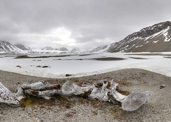
Already the whalers knew that and established their stations in the early 17th century on both sides of the bay. They hunted „Right whales“, which we know as Bowhead whales today, and left their impressive bones in large numbers bleaching for centuries under midnight sun and polar night. Exactly as you can see them today if you get there.
This panorama shows the western side of the bay Gåshamna.
- pano anchor link: #Gaashamna_09Juni13_33
- pano anchor link: #Gaashamna_09Juni13_52
Panorama: Hornsund – Gåshamna (East)
The whalers also left their traces on the east side of Gåshamna in shape of piles of mighty whalebones. These are lying a bit forgotten behind a small hill, which draws the attention at least initially because it is quite obvously a site of major activities in historical times. It is the wintering site of the Russian section of the Russian-Swedish Arc-de-meridian expedition: not very famous to the public, but certainly a major and very successful undertaking to establish the precise shape of the Earth: a perfect ball or slightly flattened on the poles? To find that out, you need to precisely measure along a meridian both on low and in high latitudes. Spitsbergen was the obvious place to get that done. Swedish and Russian scientists joint their efforts fort his huge task. Both wintered in 1899-1900. Gåshamna is the Russian site.
- pano anchor link: #Gaashamna_13Juli13_115
- pano anchor link: #Gaashamna_13Juli13_134
- pano anchor link: #Gaashamna_13Juli13_094
Burgerbukta
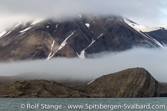
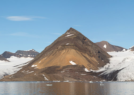
Burgerbukta is on the northern side of Hornsund, and it displays this beautiful panorama on its eastern shore. The beauty of this landscape in terms of colours and structures is deeply rooted in its geology. The colouration is due to the layers: from brownish-red Old Red at the bottom (Devonian/lower Carboniferous) through yellowish-brown upper Carboniferous/Permian to dark-brown Triassic at the top. And the deformation related to the opening of the north Atlantic is responsible for the beautiful folds and bends.
- pano anchor link: #Austre-Burgerbukta_14Juli13_065
No 360° panorama, only works with the Flash Player on mobile devices, for example, with the → Puffin-Browser.
Photo Galleries: Hornsund
Click on the yellow areas or the links below the map to view photo galleries from the individual areas.
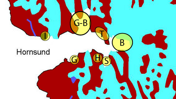
- I = Isbjørnhamna (Polish research station), Hansbreen
- G-B = Gnålodden, Burgerbukta
- T = Treskelen
- B = Brepollen
- S = Samarinvågen
- H = Hornsundtind
- G = Gåshamna
Album Hornsund
- album anchor link: #e-hornsund
Click on thumbnail to get the corresponding gallery.
BOOKS, CALENDAR, POSTCARDS AND MORE
This and other publishing products of the Spitsbergen publishing house in the Spitsbergen-Shop.
-

Norwegens arktischer Norden (1): Spitzbergen
Photobook: Norway's arctic islands. The text in this book is German. [shop url="https://shop.spitzbergen.de/en/polar-books/70-norwegens-arktischer-norden-1-aerial-arctic-9783937903262.html"] ← BackOrder now -
Norwegens arktischer Norden (2): Aerial Arctic
Lofoten, Jan Mayen and Spitsbergen from the air - Photobook: Norway's arctic islands. The text in this book is German, but there is very little text, so I am sure that you will enjoy it regardless which languages you read (or not).Order now -
Poster “Svalbardhytter”
The poster "Svalbardhytter" (70 x 100 cm) visualizes the diversity of Spitsbergen's huts in a range of arctic landscapes.Order now -
Book “Svalbardhytter”
The companion book for the Svalbardhytter poster. The poster visualises the diversity of Spitsbergen‘s huts and their stories in a range of Arctic landscapes. The book tells the stories of the huts in three languages.Order now -
Spitsbergen – Svalbard. The complete guidebook
Comprehensive guidebook about Spitsbergen. Background (wildlife, plants, geology, history etc.), practical information including travelling seasons, how to travel, description of settlements, routes and regions.Order now -
Rocks and Ice. Landscapes of the North
A geographical traveling accompaniment to Spitsbergen and East Greenland (68-74°N). This is the English edition of the German book "Steine und Eis".Order now -
East Greenland in Winter
Join an exciting journey with dog, skis and tent through the wintery wastes of East Greenland! We were five guys and a dog when we started in Ittoqqortoormiit, the northernmost one of two settlements on Greenland’s east coast.Order now -
Postcard set Spitsbergen (Svalbard)
12 Spitsbergen postcards in a beautifully designed tray. Individually numbered limited edition!Order now -
Limited edition postcard set Antarctica
12 postcards which come in a beautifully designed tray. Beautiful images from South Georgia across Antarctica from the Antarctic Peninsula to the Ross Sea and up to Macquarie Island and Campbell Island.Order now
last modification: 2017-12-18 ·
copyright: Rolf Stange


-
Books, Calendar, Postcards and more

-


