-
current
recommendations- Liefdefjord
New page dedicated to one of Spitsbergen's most beautiful fjords. Background information and many photos.
- New Spitsbergen guidebook
The new edition of my Spitsbergen guidebook is out and available now!
- Liefdefjord
New page dedicated to one of Spitsbergen's most beautiful fjords. Background information and many photos.
Page Structure
-
Spitsbergen-News
- Select Month
- April 2025
- March 2025
- February 2025
- January 2025
- December 2024
- November 2024
- October 2024
- September 2024
- August 2024
- July 2024
- June 2024
- May 2024
- April 2024
- March 2024
- February 2024
- January 2024
- December 2023
- November 2023
- October 2023
- September 2023
- August 2023
- July 2023
- June 2023
- May 2023
- April 2023
- March 2023
- February 2023
- January 2023
- December 2022
- November 2022
- October 2022
- September 2022
- August 2022
- July 2022
- June 2022
- May 2022
- April 2022
- March 2022
- February 2022
- January 2022
- December 2021
- November 2021
- October 2021
- September 2021
- August 2021
- July 2021
- June 2021
- May 2021
- April 2021
- March 2021
- February 2021
- January 2021
- December 2020
- November 2020
- October 2020
- September 2020
- August 2020
- July 2020
- June 2020
- May 2020
- April 2020
- March 2020
- February 2020
- January 2020
- December 2019
- November 2019
- October 2019
- September 2019
- August 2019
- July 2019
- June 2019
- May 2019
- April 2019
- March 2019
- February 2019
- January 2019
- December 2018
- November 2018
- October 2018
- September 2018
- August 2018
- July 2018
- June 2018
- May 2018
- April 2018
- March 2018
- February 2018
- January 2018
- December 2017
- November 2017
- October 2017
- September 2017
- August 2017
- July 2017
- June 2017
- May 2017
- April 2017
- March 2017
- February 2017
- January 2017
- December 2016
- November 2016
- October 2016
- September 2016
- August 2016
- July 2016
- June 2016
- May 2016
- April 2016
- March 2016
- February 2016
- January 2016
- December 2015
- November 2015
- October 2015
- September 2015
- August 2015
- July 2015
- June 2015
- May 2015
- April 2015
- March 2015
- February 2015
- January 2015
- December 2014
- November 2014
- October 2014
- September 2014
- August 2014
- July 2014
- June 2014
- May 2014
- April 2014
- March 2014
- February 2014
- January 2014
- December 2013
- November 2013
- October 2013
- September 2013
- August 2013
- July 2013
- June 2013
- May 2013
- April 2013
- March 2013
- February 2013
- January 2013
- December 2012
- November 2012
- October 2012
- September 2012
- August 2012
- July 2012
- June 2012
- May 2012
- April 2012
- March 2012
- February 2012
- January 2012
- December 2011
- November 2011
- October 2011
- September 2011
- August 2011
- May 2011
- April 2011
- March 2011
- February 2011
- January 2011
- December 2010
- November 2010
- September 2010
- August 2010
- July 2010
- June 2010
- May 2010
- April 2010
- March 2010
- February 2010
- November 2009
- October 2009
- August 2009
- July 2009
- June 2009
- May 2009
- April 2009
- March 2009
- February 2009
- January 2009
- December 2008
- November 2008
- October 2008
- August 2008
- July 2008
- June 2008
- May 2008
- April 2008
- March 2008
- February 2008
- April 2000
- Select Month
-
weather information
-
Newsletter

| Guidebook: Spitsbergen-Svalbard |
Home → Spitsbergen information → Islands: Spitsbergen & Co. → Spitsbergen (Northern part) → Moffen
Moffen
Moffen
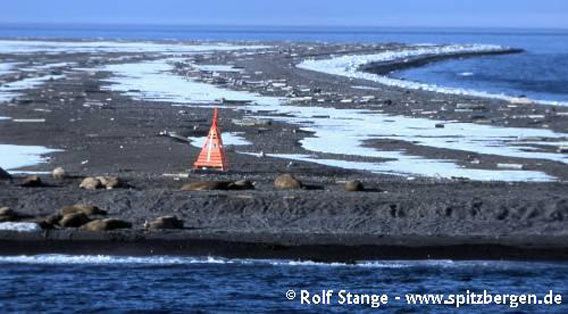
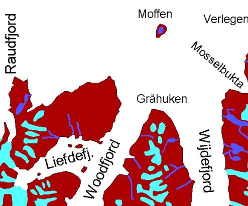
General: Moffen is a fascinating little island. After the near-exctinction of walrus in Svalbard in the middle of the 20th century, Moffen played an important rule in re-establishing the species here, a process which is still going on. Today, there are often larger numbers of walrus hauled out at the southern tip of the island, sometimes more than 100 animals. This is the reason why Moffen is protected. Approach during the summer (15th May to 15th September) is limited to a minimum distance of 500 metres. The waters around Moffen are very shallow, so most ships stay further off for nautical reasons also. Moffen is situated directly north of 80°N. This and the walrus, which you can see from the distance, makes Moffen a popular stop for ships, which keep drifting off the south end for a little while and then sail away again.
For more, detailed information: the Guidebook Spitsbergen-Svalbard
Click here to see some 360 degrees panorama images from Moffen.

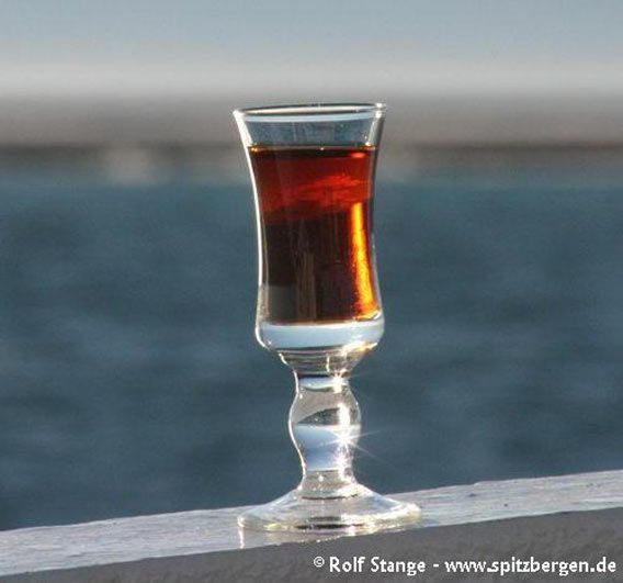
Crossing 80°N is always a good excurse for a drink.
Geology: Moffen consists entirely of several series of beach ridges, which have been thrown up from various directions on the very shallow ground, thus forming a ring-shaped island. Between the beach ridges, there is a lagoon with brackish water. There is no solid rock exposed on Moffen.
Recommended book for further, well-digestable (really!) info about geology and landscape of Svalbard.
Landscape: Totally flat island with the shape of a drop with a lagoon in the middle.

Moffen.
Flora and Fauna: Flora: Nothing other than some mosses near the southern tip, where walrus were slaughtered in numbers over several centuries, and algae in depressions near the lagoon.
Despite the small size, Moffen has some interesting wildlife, even though observation opportunities are not exactly great due to the legally required mininum distance. Arctic terns are breeding in large numbers, and there are a few pairs of the Sabine’s gull, which is extremely rare in Svalbard. It is difficult to see, though, amongst all the terns and Kittiwakes. Walrus like the shallow waters as feeding grounds and have a haul-out site (resting place) here.
History: Already the whalers knew Moffen in the 17th century, so the island became soon a slaughtering place for walrus. The name, legend has it, was a rather unfriendly nickname for German sailors on Dutch whaling ships. But I have heard several times from Dutch people, that it is more likely to be descriptive, referring to the shape of the island, which resembles a ‘Muff’, a woolen thing in which you can put your hands from both sides to protect them from cold.
BOOKS, CALENDAR, POSTCARDS AND MORE
This and other publishing products of the Spitsbergen publishing house in the Spitsbergen-Shop.
last modification: 2019-02-09 ·
copyright: Rolf Stange


