


-
current
recommendations- Liefdefjord
New page dedicated to one of Spitsbergen's most beautiful fjords. Background information and many photos.

- New Spitsbergen guidebook
The new edition of my Spitsbergen guidebook is out and available now!
- Liefdefjord
New page dedicated to one of Spitsbergen's most beautiful fjords. Background information and many photos.
-
weather information

| Guidebook: Spitsbergen-Svalbard |
Snesund
360°-Panoramas
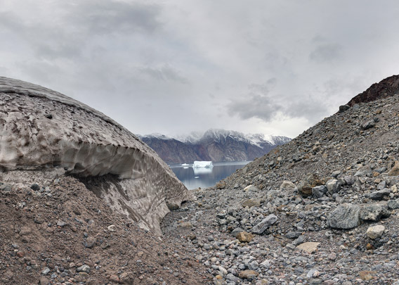
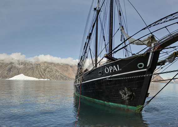
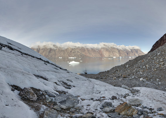
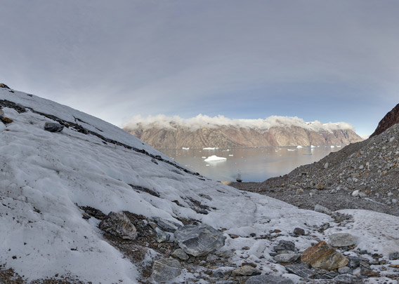
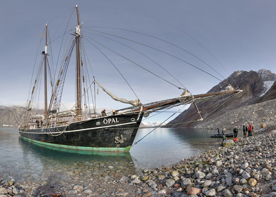
Snesund (Snow Sound) is one of many natural channels in inner Scoresbysund. It is separating the islands Sorteø (Black Island) and Storeø (Great Island) in the west from the big island Milne Land in the east, connecting Rødefjord and Øfjord. It can accordingly be used as a shortcut during a circumnavigation of Milne Land, but then you miss some scenic fjords such as Harefjord, Rypefjord and the northern part of Rødefjord. The best is of course having enough time to sail into all of them ☺ and Snesund is a very senic passage. It has the narrowest part of all the great fjords surrounding Milne Land, but even this is almost 3 kilometers wide …
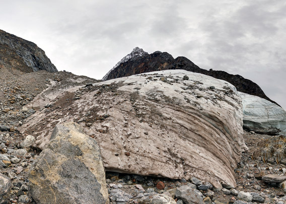
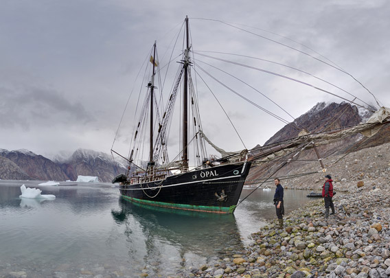
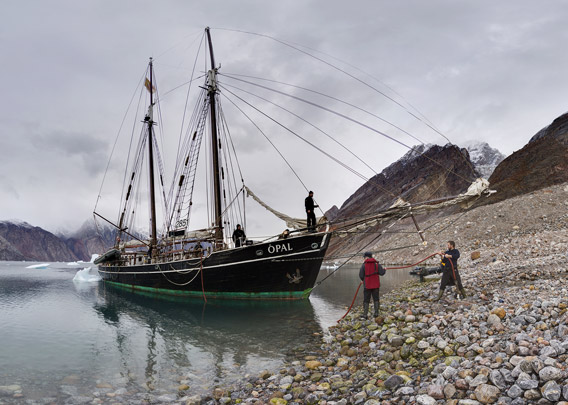
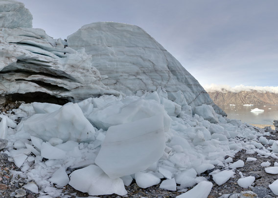
As the other fjords in the area, Snesund is very deep, even directly adjacent to its rocky, often near vertical shorelines. We took advantage of this bathymetry by parking our very robust ship Ópal directly on the shore, using a hose to stock with crystal clear glacier meltwater, filling our drinking water tanks with the best water you can imagine. Meanwhile, we took a little walk up the rocky gravel slope, visiting a smaller glacier tongue that had obviously retreated strongly in recent decades, making fascinating close contact with the glacier ice.
Panoramas
- pano anchor link: #Snesund_02Sept13_119
- pano anchor link: #Snesund_02Sept13_138
- pano anchor link: #Snesund_02Sept13_203

- pano anchor link: #Snesund_02Sept13_282
- pano anchor link: #Snesund_02Sept13_315
- pano anchor link: #Snesund_10Sept13_030
- pano anchor link: #Snesund_10Sept13_055
- pano anchor link: #Snesund_10Sept13_079
- pano anchor link: #Snesund_10Sept13_107
- pano anchor link: #Snesund_10Sept13_146
BOOKS, CALENDAR, POSTCARDS AND MORE
This and other publishing products of the Spitsbergen publishing house in the Spitsbergen-Shop.
-

Norwegens arktischer Norden (1): Spitzbergen
Photobook: Norway's arctic islands. The text in this book is German. [shop url="https://shop.spitzbergen.de/en/polar-books/70-norwegens-arktischer-norden-1-aerial-arctic-9783937903262.html"] ← BackOrder now -
Norwegens arktischer Norden (2): Aerial Arctic
Lofoten, Jan Mayen and Spitsbergen from the air - Photobook: Norway's arctic islands. The text in this book is German, but there is very little text, so I am sure that you will enjoy it regardless which languages you read (or not).Order now -
Poster “Svalbardhytter”
The poster "Svalbardhytter" (70 x 100 cm) visualizes the diversity of Spitsbergen's huts in a range of arctic landscapes.Order now -
Book “Svalbardhytter”
The companion book for the Svalbardhytter poster. The poster visualises the diversity of Spitsbergen‘s huts and their stories in a range of Arctic landscapes. The book tells the stories of the huts in three languages.Order now -
Spitsbergen – Svalbard. The complete guidebook
Comprehensive guidebook about Spitsbergen. Background (wildlife, plants, geology, history etc.), practical information including travelling seasons, how to travel, description of settlements, routes and regions.Order now -
Rocks and Ice. Landscapes of the North
A geographical traveling accompaniment to Spitsbergen and East Greenland (68-74°N). This is the English edition of the German book "Steine und Eis".Order now -
East Greenland in Winter
Join an exciting journey with dog, skis and tent through the wintery wastes of East Greenland! We were five guys and a dog when we started in Ittoqqortoormiit, the northernmost one of two settlements on Greenland’s east coast.Order now -
Postcard set Spitsbergen (Svalbard)
12 Spitsbergen postcards in a beautifully designed tray. Individually numbered limited edition!Order now -
Limited edition postcard set Antarctica
12 postcards which come in a beautifully designed tray. Beautiful images from South Georgia across Antarctica from the Antarctic Peninsula to the Ross Sea and up to Macquarie Island and Campbell Island.Order now
last modification: 2014-01-04 ·
copyright: Rolf Stange


-
Books, Calendar, Postcards and more

-


