-
current
recommendations- Liefdefjord
New page dedicated to one of Spitsbergen's most beautiful fjords. Background information and many photos.
- New Spitsbergen guidebook
The new edition of my Spitsbergen guidebook is out and available now!
- Liefdefjord
New page dedicated to one of Spitsbergen's most beautiful fjords. Background information and many photos.
Page Structure
-
Spitsbergen-News
- Select Month
- June 2025
- May 2025
- April 2025
- March 2025
- February 2025
- January 2025
- December 2024
- November 2024
- October 2024
- September 2024
- August 2024
- July 2024
- June 2024
- May 2024
- April 2024
- March 2024
- February 2024
- January 2024
- December 2023
- November 2023
- October 2023
- September 2023
- August 2023
- July 2023
- June 2023
- May 2023
- April 2023
- March 2023
- February 2023
- January 2023
- December 2022
- November 2022
- October 2022
- September 2022
- August 2022
- July 2022
- June 2022
- May 2022
- April 2022
- March 2022
- February 2022
- January 2022
- December 2021
- November 2021
- October 2021
- September 2021
- August 2021
- July 2021
- June 2021
- May 2021
- April 2021
- March 2021
- February 2021
- January 2021
- December 2020
- November 2020
- October 2020
- September 2020
- August 2020
- July 2020
- June 2020
- May 2020
- April 2020
- March 2020
- February 2020
- January 2020
- December 2019
- November 2019
- October 2019
- September 2019
- August 2019
- July 2019
- June 2019
- May 2019
- April 2019
- March 2019
- February 2019
- January 2019
- December 2018
- November 2018
- October 2018
- September 2018
- August 2018
- July 2018
- June 2018
- May 2018
- April 2018
- March 2018
- February 2018
- January 2018
- December 2017
- November 2017
- October 2017
- September 2017
- August 2017
- July 2017
- June 2017
- May 2017
- April 2017
- March 2017
- February 2017
- January 2017
- December 2016
- November 2016
- October 2016
- September 2016
- August 2016
- July 2016
- June 2016
- May 2016
- April 2016
- March 2016
- February 2016
- January 2016
- December 2015
- November 2015
- October 2015
- September 2015
- August 2015
- July 2015
- June 2015
- May 2015
- April 2015
- March 2015
- February 2015
- January 2015
- December 2014
- November 2014
- October 2014
- September 2014
- August 2014
- July 2014
- June 2014
- May 2014
- April 2014
- March 2014
- February 2014
- January 2014
- December 2013
- November 2013
- October 2013
- September 2013
- August 2013
- July 2013
- June 2013
- May 2013
- April 2013
- March 2013
- February 2013
- January 2013
- December 2012
- November 2012
- October 2012
- September 2012
- August 2012
- July 2012
- June 2012
- May 2012
- April 2012
- March 2012
- February 2012
- January 2012
- December 2011
- November 2011
- October 2011
- September 2011
- August 2011
- May 2011
- April 2011
- March 2011
- February 2011
- January 2011
- December 2010
- November 2010
- September 2010
- August 2010
- July 2010
- June 2010
- May 2010
- April 2010
- March 2010
- February 2010
- November 2009
- October 2009
- August 2009
- July 2009
- June 2009
- May 2009
- April 2009
- March 2009
- February 2009
- January 2009
- December 2008
- November 2008
- October 2008
- August 2008
- July 2008
- June 2008
- May 2008
- April 2008
- March 2008
- February 2008
- April 2000
- Select Month
-
weather information
-
Newsletter

| Guidebook: Spitsbergen-Svalbard |
Grønfjord (Green Harbour): Finneset
Some history and 360 degree panoramas
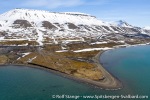
Finneset, a small headland a few kilometres south of Barentsburg on the east side of Grønfjord, is a place that receives little attention these days, but it was one of the main centres of civilisation and infrastructure for some busy years during the early 20th century. The location is strategically chosen: it is not as far away from the open sea as, for example, Longyearbyen, but it is well sheltered and a useful natural harbour, with shores on both sides that are easily accessible. The headland itself is flat and provides plenty of space for a couple of buildings and some infrastructure.

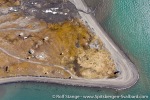
Finneset. Aerial photo from June 2019. On the southern beach (upper right), remains of the whaling station are visible, mainly the flensing platform. The radio station was further to the left, closer to the northern beach (bottom side beach).
For these reasons, Norwegian whalers called this little headland Finneset (“Fine cape”) in 1904.
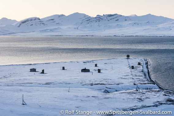
Finneset, October 2008.
The small hut to the far left was probably a Russian leisure hut.
Finneset: The whaling station (1905-1912)
The whaling company A/S Spitsbergen from Tønsberg in Norway established a shore station for whaling in Finneset in 1905. It was one two such stations in the Spitsbergen archipelago in the early 20th century. The second one was located in Kvalrossbukta on Bear Island (Bjørnøya). In those years, whaling saw another zenith based on recent technological innovations including steam-powered ships and explosive harpoons shot from powerful guns on the ships. This was all in strong contrast to the rather primitive methods of 17th century whaling, which were based on rowing boats and hand-thrown harpoons. With the new methods, whalers could go after the larger, faster baleen whales including the fin whale and blue whale.
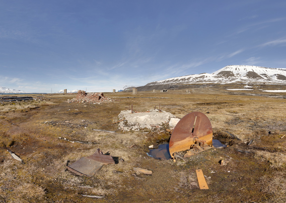
- pano anchor link: #190611a_Finneset_140HDR
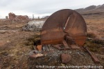
This old iron thing, which reminds of the cutter of a huge kitchen machine, was part of the technology that belonged to the flensing platform. Maybe it was part of the winch that was used to haul whales up?
Finneset: The whaling station – flensing plattform
The point with the whaling station was to cut the whale into pieces small enough to boil them to retrieve the oil, which was the main product as already in the 17th century. But now it was used not just mainly as lamp oil, but as an important raw material in the chemical industry, to produce anything from margarine through fine lubrication oil to explosives. Yes, at times whales were killed to produce bombs! Totally disgusting.
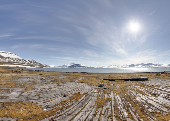
- pano anchor link: #190611a_Finneset_159HDR
Back to the remains of the whaling station at Finneset. The flensing plattform was a central part of the installations. Here, the whale was hauled up onto this wooden platform with a strong winch to be cut up (“flensed”). The platform is still basically intact after a good 100 years.
Finneset: The whaling station – buildings
There was of course a number of buildings, including simple accommodation for the workers and more up-scale housing for the manager and others, as well as storage and workshops. This old postcard indicates that Finneset almost looked like a little settlement at times!
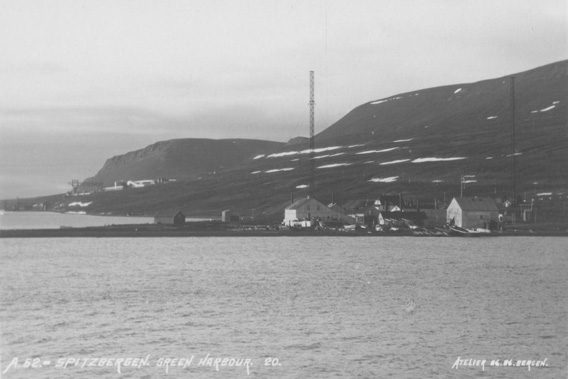
Finneset, old postcard. Barentsburg is visible in the background. The knowledgeable Leif Trønnes has suggested that this photo was taken between 1925 and 1932. Then, the whaling station was already abandoned again, but the buildings and installations were still there.
And indeed, up to several dozen men worked at the whaling station, and additionally, from 1911 there was a radio station on Finneset, just a few metres further north, on the other side.
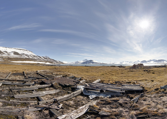
- pano anchor link: #190611a_Finneset_121HDR
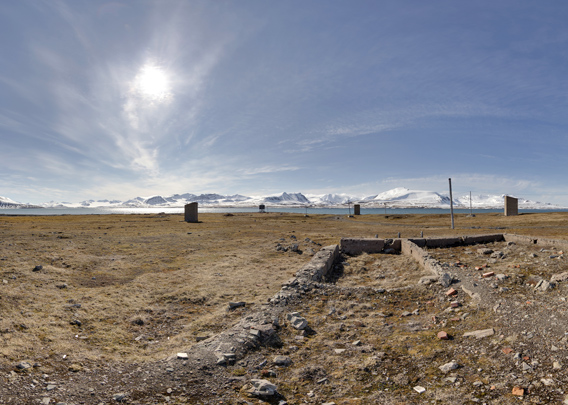
Here we have got remains of some buildings that belonged to the whaling station. Only the foundations remain. The whaling station was already in 1912. Some of the materials may have been moved to Barentsburg. Parts of the vital infrastructure were destroyed during the evacuation 1943, during the second world war, to make sure the Germans could not put them into use.
Finneset: Spitsbergen Radio – fuel storage
In 1911, Norway built a radio station called Spitsbergen Radio on the northern side of Finneset, in the immediate vicinity of the whaling station. Spitsbergen Radio made it possible, for the first time, to communicate directly from Spitsbergen to the mainland – and vice versa – without expensive, time-consuming ship traffic to relay messages. Political considerations were certainly an important part in the the Norwegian government’s motivation to build the station: Spitsbergen was still no man’s land, the Spitsbergen Treaty would not be signed before 1920, and 10 years before that, nobody could know how the sovereignty over the islands would be organised. It was just clear that someone had to take the task. In 1906, an American company had successfully established a coal mining settlement in Advent Bay (now Adventfjord) called Longyear City – now Longyearbyen – and the British Northern Exploration Company had secured rights to exploit mineral resources in large areas, such as Marble Island (now Ny London on Blomstrandhalvøya). Norway was clearly lagging behind, and they had to do something about it if they were to have a word in the negotiations regarding future sovereignty over the archipelago. Mail and telegraph were a matter of sovereignty and public interest, so there was an opportunity to be grabbed which would at the same time provide some real value to everybody who had some business in Spitsbergen. Soon the radio station became a busy place as many wished to operate their communications between their mining places and the outside world through Spitsbergen Radio on Finneset, which thus quickly became a very central place.
- pano anchor link: #190611a_Finneset_064HDR
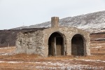
Also the radio station had a number of buildings, but also here, none is still existing. Only scarce remains such as the foundations remain to be seen. There are, however, a few exceptions. The main eyecatcher is this slightly weird building, which used to the the fuel storage, a very solid construction of concrete.
Finneset: Spitsbergen Radio – antennas
Two large antennas were needed to provide reliable radio communication with mainland Norway. The antennas are long gone – it is said that one was still lying on the ground on Finneset in the mid 1990s. It would then have been protected by law as part of Svalbard’s cultural heritage, but it is said that the remains fell victim to a Russian clean-up action.
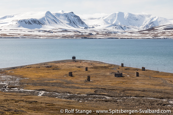
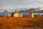
Finneset in June 2019. The Russian hut that can be seen in the photo above is gone. The fuel storage building and the foundations for the antenna anchorings can still be seen.
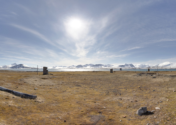
- pano anchor link: #190611a_Finneset_083HDR
Here we stand on the foundations of one of the two antennas.
Both antennas had each three solid anchorings and each of them had a large concrete foundation. Three of them can be seen all in an equal distance from our viewpoint in the above panorama.
- pano anchor link: #190611a_Finneset_102HDR
Here, we are standing in the middle of the old, small “settlement”. In this place, not far from the fuel storage, there must have been a large, solid building, but I do not know what exactly it would have been. The foundations of the antenna anchorings are also visible from here.
Spitsbergen Radio was at Finneset until 1930, when it was moved to Longyearbyen for some years and then in 1933 finally to Kapp Linné on the west coast. The new location provided a better radio connection to the south, as there were no mountains that way, and an increased distance to the new Russian neighbours in Barentsburg may also have been welcome. The Norwegian whaling station had already been abandoned years ago, in 1912.
Photo gallery Finneset
And, finally, a selection of “normal” photos from Finneset:
- gallery anchor link: #gallery_1884
Click on thumbnail to open an enlarged version of the specific photo.
BOOKS, CALENDAR, POSTCARDS AND MORE
This and other publishing products of the Spitsbergen publishing house in the Spitsbergen-Shop.
last modification: 2025-02-21 ·
copyright: Rolf Stange
