-
current
recommendations- Liefdefjord
New page dedicated to one of Spitsbergen's most beautiful fjords. Background information and many photos.
- New Spitsbergen guidebook
The new edition of my Spitsbergen guidebook is out and available now!
- Liefdefjord
New page dedicated to one of Spitsbergen's most beautiful fjords. Background information and many photos.
Page Structure
-
Spitsbergen-News
- Select Month
- June 2025
- May 2025
- April 2025
- March 2025
- February 2025
- January 2025
- December 2024
- November 2024
- October 2024
- September 2024
- August 2024
- July 2024
- June 2024
- May 2024
- April 2024
- March 2024
- February 2024
- January 2024
- December 2023
- November 2023
- October 2023
- September 2023
- August 2023
- July 2023
- June 2023
- May 2023
- April 2023
- March 2023
- February 2023
- January 2023
- December 2022
- November 2022
- October 2022
- September 2022
- August 2022
- July 2022
- June 2022
- May 2022
- April 2022
- March 2022
- February 2022
- January 2022
- December 2021
- November 2021
- October 2021
- September 2021
- August 2021
- July 2021
- June 2021
- May 2021
- April 2021
- March 2021
- February 2021
- January 2021
- December 2020
- November 2020
- October 2020
- September 2020
- August 2020
- July 2020
- June 2020
- May 2020
- April 2020
- March 2020
- February 2020
- January 2020
- December 2019
- November 2019
- October 2019
- September 2019
- August 2019
- July 2019
- June 2019
- May 2019
- April 2019
- March 2019
- February 2019
- January 2019
- December 2018
- November 2018
- October 2018
- September 2018
- August 2018
- July 2018
- June 2018
- May 2018
- April 2018
- March 2018
- February 2018
- January 2018
- December 2017
- November 2017
- October 2017
- September 2017
- August 2017
- July 2017
- June 2017
- May 2017
- April 2017
- March 2017
- February 2017
- January 2017
- December 2016
- November 2016
- October 2016
- September 2016
- August 2016
- July 2016
- June 2016
- May 2016
- April 2016
- March 2016
- February 2016
- January 2016
- December 2015
- November 2015
- October 2015
- September 2015
- August 2015
- July 2015
- June 2015
- May 2015
- April 2015
- March 2015
- February 2015
- January 2015
- December 2014
- November 2014
- October 2014
- September 2014
- August 2014
- July 2014
- June 2014
- May 2014
- April 2014
- March 2014
- February 2014
- January 2014
- December 2013
- November 2013
- October 2013
- September 2013
- August 2013
- July 2013
- June 2013
- May 2013
- April 2013
- March 2013
- February 2013
- January 2013
- December 2012
- November 2012
- October 2012
- September 2012
- August 2012
- July 2012
- June 2012
- May 2012
- April 2012
- March 2012
- February 2012
- January 2012
- December 2011
- November 2011
- October 2011
- September 2011
- August 2011
- May 2011
- April 2011
- March 2011
- February 2011
- January 2011
- December 2010
- November 2010
- September 2010
- August 2010
- July 2010
- June 2010
- May 2010
- April 2010
- March 2010
- February 2010
- November 2009
- October 2009
- August 2009
- July 2009
- June 2009
- May 2009
- April 2009
- March 2009
- February 2009
- January 2009
- December 2008
- November 2008
- October 2008
- August 2008
- July 2008
- June 2008
- May 2008
- April 2008
- March 2008
- February 2008
- April 2000
- Select Month
-
weather information
-
Newsletter

| Guidebook: Spitsbergen-Svalbard |
Home
→ * Photos, Panoramas, Videos and Webcams
→ Spitsbergen Panoramas
→ Storøya: the Ymer hut
The hut of the Ymer expedition on Storøya
Panorama of a hut of the Swedish Ymer expedition
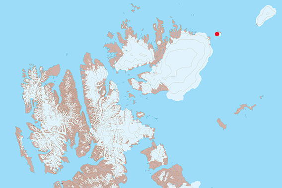
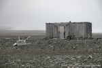
The Ymer hut (“Station Valter”) on Storøya is on the west side of the island, at Knøttodden.
There was a large Swedish scientific expedition in 1980, known as the Ymer expedition after the icebreaker that was used by the expedition. The expedition worked in the eastern and northeastern parts of Spitsbergen and in the waters north of Franz Josef Land.
Two huts were built in Svalbard, now known as the Ymer huts. Both were built and used for a few weeks for field research in the late summer of 1980. One is on Glenhalvøya on the north side of Nordaustland and the other one is the one at Knøttodden on Storøya. The latter one was called “Station Valter” by the expedition members, after Valter Schytt, an important Swedish glaciologist during the 20th century and one of the leading figures of the 1980 Ymer expedition.
It was the end of the era when people would just build a hut whenever they needed a base in the field. This is now strictly regulated and mostly not possible anymore. On the other hand, the expedition had a strong icebreaker and helicopters at their disposal. Regarding research, the glacier was their main object on Storøya. There, the ice cap Storøyjøkulen is just behind the hut.
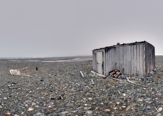
Ymer hut (“Station Valter”) – outside Panorama (1)
- pano anchor link: #230815d_Ymerhytte_016HDR
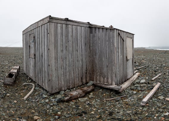
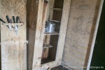
When I was there and took these photos in August 2023, the visibility was too bad to see much of the ice cap. The hut was in ok condition, starting to deteriorate and without much interiour, but structurally so far reasonably stable.
Ymer hut (“Station Valter”) – outside Panorama (2)
- pano anchor link: #230815d_Ymerhytte_046HDR
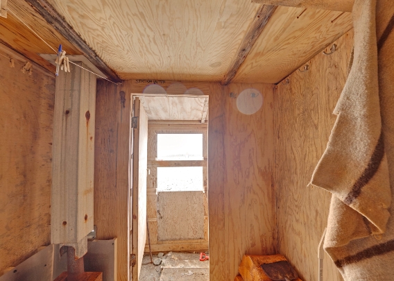
Ymer hut (“Station Valter”) – Panorama inside
A lot of the original interior of the hut had been removed, and it is not in as good and complete condition as the other hut of the Ymer-expedition on Glenhalvøya on the north coast of Nordaustland. But as of August 2023, it is at least structurally largely intact.
- pano anchor link: #230815d_Ymerhytte_067HDR
Ymer hut (“Station Valter”) – Bird pano (1)
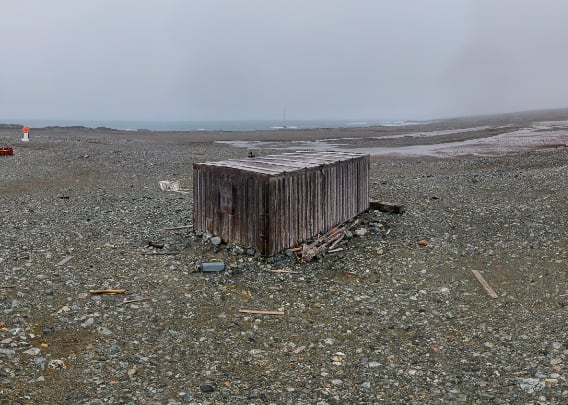
Also these panoramas taken with the flying camera (aka drone) suffered a bit from the poor visibility.
- pano anchor link: #230815d_Ymerhytte_111
Ymer hut (“Station Valter”) – Bird pano (2)
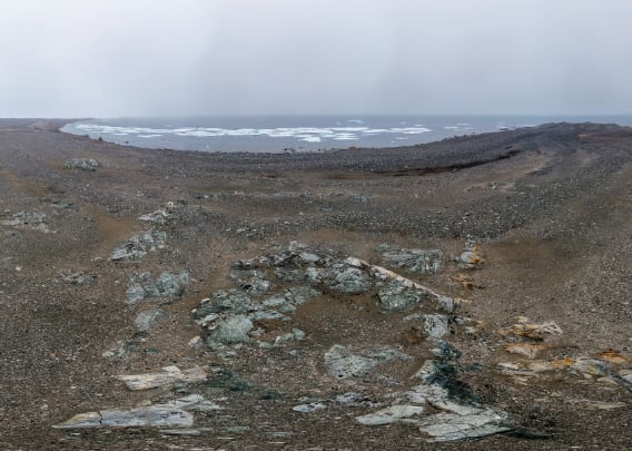
This last panorama shows the surroundings of the Ymer-hut on Storøya near the coast.
- pano anchor link: #230815d_Ymerhytte_112
Photo gallery – Storøya: Ymer hut
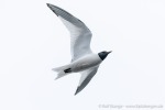
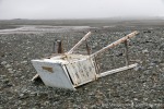
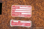
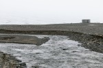
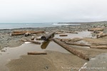
Some impressions of “Station Valter” and surroundings.
- gallery anchor link: #gallery_2788
Click on thumbnail to open an enlarged version of the specific photo.
BOOKS, CALENDAR, POSTCARDS AND MORE
This and other publishing products of the Spitsbergen publishing house in the Spitsbergen-Shop.
last modification: 2024-12-12 ·
copyright: Rolf Stange
