-
current
recommendations- Liefdefjord
New page dedicated to one of Spitsbergen's most beautiful fjords. Background information and many photos.

- New Spitsbergen guidebook
The new edition of my Spitsbergen guidebook is out and available now!

- Liefdefjord
New page dedicated to one of Spitsbergen's most beautiful fjords. Background information and many photos.
Page Structure
-
Spitsbergen-News
- Select Month
- April 2025
- March 2025
- February 2025
- January 2025
- December 2024
- November 2024
- October 2024
- September 2024
- August 2024
- July 2024
- June 2024
- May 2024
- April 2024
- March 2024
- February 2024
- January 2024
- December 2023
- November 2023
- October 2023
- September 2023
- August 2023
- July 2023
- June 2023
- May 2023
- April 2023
- March 2023
- February 2023
- January 2023
- December 2022
- November 2022
- October 2022
- September 2022
- August 2022
- July 2022
- June 2022
- May 2022
- April 2022
- March 2022
- February 2022
- January 2022
- December 2021
- November 2021
- October 2021
- September 2021
- August 2021
- July 2021
- June 2021
- May 2021
- April 2021
- March 2021
- February 2021
- January 2021
- December 2020
- November 2020
- October 2020
- September 2020
- August 2020
- July 2020
- June 2020
- May 2020
- April 2020
- March 2020
- February 2020
- January 2020
- December 2019
- November 2019
- October 2019
- September 2019
- August 2019
- July 2019
- June 2019
- May 2019
- April 2019
- March 2019
- February 2019
- January 2019
- December 2018
- November 2018
- October 2018
- September 2018
- August 2018
- July 2018
- June 2018
- May 2018
- April 2018
- March 2018
- February 2018
- January 2018
- December 2017
- November 2017
- October 2017
- September 2017
- August 2017
- July 2017
- June 2017
- May 2017
- April 2017
- March 2017
- February 2017
- January 2017
- December 2016
- November 2016
- October 2016
- September 2016
- August 2016
- July 2016
- June 2016
- May 2016
- April 2016
- March 2016
- February 2016
- January 2016
- December 2015
- November 2015
- October 2015
- September 2015
- August 2015
- July 2015
- June 2015
- May 2015
- April 2015
- March 2015
- February 2015
- January 2015
- December 2014
- November 2014
- October 2014
- September 2014
- August 2014
- July 2014
- June 2014
- May 2014
- April 2014
- March 2014
- February 2014
- January 2014
- December 2013
- November 2013
- October 2013
- September 2013
- August 2013
- July 2013
- June 2013
- May 2013
- April 2013
- March 2013
- February 2013
- January 2013
- December 2012
- November 2012
- October 2012
- September 2012
- August 2012
- July 2012
- June 2012
- May 2012
- April 2012
- March 2012
- February 2012
- January 2012
- December 2011
- November 2011
- October 2011
- September 2011
- August 2011
- May 2011
- April 2011
- March 2011
- February 2011
- January 2011
- December 2010
- November 2010
- September 2010
- August 2010
- July 2010
- June 2010
- May 2010
- April 2010
- March 2010
- February 2010
- November 2009
- October 2009
- August 2009
- July 2009
- June 2009
- May 2009
- April 2009
- March 2009
- February 2009
- January 2009
- December 2008
- November 2008
- October 2008
- August 2008
- July 2008
- June 2008
- May 2008
- April 2008
- March 2008
- February 2008
- April 2000
- Select Month
-
weather information
-
Newsletter

| Guidebook: Spitsbergen-Svalbard |
Home → Spitsbergen information → Islands: Spitsbergen & Co. → Spitsbergen (Northern part) → Kongsfjord
Krossfjord
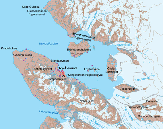
Kongsfjord.
Photo galleries Kongsfjord
There are a couple of photo galleries at the end of this page to illustrate some of the beautiful aspects – some popular visitor sites (and some less popular ones). Just scroll down or click on these links:
- Kongsfjord gallery 1: Amundsen & Co – Ny-Ålesund
- Kongsfjord gallery 2: Ny London & Co – Blomstrandhalvøya
- Kongsfjord gallery 3: Kongsvegen, Kronebreen & Co – the glaciers
- Kongsfjord gallery 4: Juttaholmen, Sigridholmen & Co – the islands (Lovénøyane)
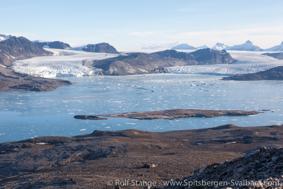
View from Blomstrandhalvøya into Kongsfjord.
General: Kongsfjord and Ny-Ålesund
Kongsfjord, in earlier days of its history known as Kings Bay, is a fjord area with beautiful and varied landscape and a long history. Today, the area is frequently visited by scientists and tourists. Especially the scientific settlement of Ny-Ålesund attracts more and more visitors each year, including large cruise ships, which is not always very convenient for the working scientists. This development has, however, changed at least to some degree when ships carrying heavy fuel were banned from Spitsbergen’s protected areas such as national parks in 2014. This keeps most of the large cruise ships away from Kongsfjord and Ny-Ålesund. The settlement itself is not located inside a national park, but there are the shipping route to Ny-Ålesund leads through at least one out of two national parks (Forlandet National Park (Prins Karls Forland) and Nordvest Spitsbergen National Park).

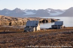
Houses in Ny Ålesund in front of the impressive mountain- and glacier-scenery of inner Kongsfjord.
The smaller islands in the Kongsfjord and Guissezholmen near Kap Guissez between Kongs- and Krossfjord are bird sanctuaries: entry and approach closer than 300 metres to the nearest shore are prohibited during the breeding season (15th May to 15th August). Ossian Sarsfjellet ist a nature reserve, camping and fire is not allowed and landings are not permitted for tourists.
Blomstrandhalvøya is another popular visitor site with varied flora, fauna, history and good hiking opportunities. There are various opportunities for more demanding hikes also in other places in Kongsfjord. The calving glaciers in inner Kongsfjord such as Kronebreen are popular for ship cruising.
Kongsfjord panoramas
Of course, I do have a number of panoramas on various pages, also including a lot of information about the individual sites. Just click on these links for a quick visit to these beautiful places:
- Ny-Ålesund: virtual walk through the settlement.
- Blomstrandhalvøya: Ny London (Marble Island) – the old marble mine.
- Blomstrandhalvøya: Bratliekollen – view over Kongsfjord (I).
- Blomstrandhalvøya: Irgensfjellet – view over Kongsfjord (II)
- Blomstrandhalvøya: coastal cave.
- Blomstrandhalvøya: more caves.
- Lovénøyane: Juttaholmen. One of the small islands of Lovénøyane.
- Lovénøyane: Sigridholmen. Another one of Lovénøyane. They are truly little perls of nature.
- Lovénøyane: Midtholmen. Yet another one of Lovénøyane. They are just lovely.
- Ossian Sarsfjellet. Nature reserve with diverse vegetation, bird cliffs and great views.
- Die Tyskehytte, not far from the glaciers, was the wintering base for a group of scientists from German Democratic Republic – East Germany! – who wintered here in 1964-65.
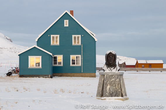
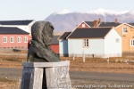
Roald Amundsen in Ny-Ålesund near the “Blaues Haus”
(the “Blue House” used to be part of the German research station).
Geology
Varied and quite complicated. On the northern side of Kongsfjord, there are weakly metamorphosed carbonates (‘marble’) of the basement, for example on Blomstrandhalvøya, where optimists once started mining (see below). In the innermost Kongsfjord, there are a lot of Devonian and Permokarboniferous sediments exposed, which have also been strongly deformed during the lower Tertiary, but not metamorphosed. This mosaic of brownish-red Devonian sandstones and conglomerates (‘Old Red’) and yellowish-brown, younger carbonates and clastics, which lie directly next to and on top of each other and the basement, is very attractive. In inner Kongsfjord, you can see rocks from the basement and well into the upper Palaeozoic, with beautiful patterns from folding and faulting. Enjoy! 🙂
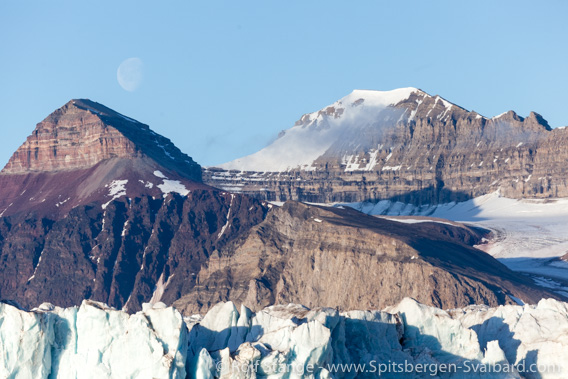
Geological mosaic east of Kongsfjord. The reddish Old Red with a steep cap of hard permo-carboniferous carbonates are prominent.
Brøggerhalvøya (Brøgger peninsula) between Kongsfjord and Engelskbukta is also a geological mosaic of basement rocks, Permocarboniferous and lower Tertiary sediments with conglomerates, sandstones and coal seams, the latter ones being the foundation of mining activities of Ny-Ålesund, which were abandoned in 1962. The coal was mostly mined below sea level. The mine area was a good kilometre southeast of the settlement, a lot of remains – rubbish more than anything else – can still be seen.
Landscape
Very varied because of the geological mosaic. Mountaineous, ice-free lowland is limited and mostly confined to Brøggerhalvøya between Kongsfjord and Engelskbukta. The interiour is strongly glaciated, and several large glacier fronts calv into Lilliehöökfjord and Kongsfjord. Well-known mountains are the Tre Kroner (Three crowns), three striking mountains east of the Kongsfjord: Svea, Dana and Nora (Sweden, Denmark, Norway).
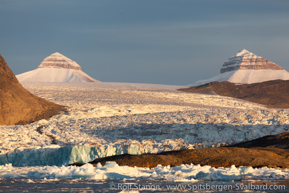
The glacier Kronebreen and two of the three famous mountains Tre Kroner in late september.
Flora and Fauna
Rich tundra vegetation in lowlands and on islands, and locally very fertile vegetation with rare plant species near bird cliffs. Because of the relatively favourable climate can flowers become comparatively large. The bird fauna is also quite rich, with a number of seabird colonies on the steep cliffs with Brünich’s guillemots, kittiwakes and glaucous gulls. An ornithological highlight is the long-tailed skua which has its only confirmed breeding sites in Svalbard here in Kongsfjord.
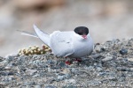
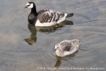
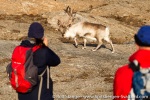
The tundra areas are important feeding sites for geese, mostly barnacle geese. The islands are home to large numbers of common eider ducks. Reindeer and arctic fox roam over the tundra. Even the settlement Ny-Ålesund has a good number of species to offer, including arctic terns which are likely to attack you (just leave them alone, never try to hit them!), possibly Arctic fox, geese, long-tailed duck and maybe even the ivory gull, if you are lucky.
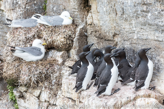
Seabird colony at Ossian Sarsfjellet with kittiwakes and Brünich’s guillemots.
History
Already the 17th century whalers knew Kongsfjord – they called it Kings Bay – and there are graves and remains of blubber ovns in Engelsbukta, south of Kongsfjord. They also knew that there was coal on the southern side of the Kongsfjord, because they found bits on the beach. But mining didn’t start in Kongsfjord until the early 20th century. It never went smooth, only with interruptions and was abandoned in 1962 after a series of accidents with casualties, the last ones even leading to a governmental crisis in Norway, as the state was and still is the owner of Kings Bay Kull Kompani. This company is now called just ‘Kings Bay’, as there is no ‘kull’ (coal) mining anymore, but Kings Bay is still running the settlement of Ny-Ålesund, which has been developed to become an international research village.
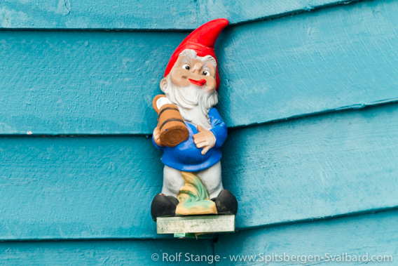
Cultural accessoire at the German “Blaues Haus”.
Very important within the history of polar exploration are the attempts of Roald Amundsen (& Co), Richard Byrd and Umberto Nobile, to fly to the pole in the 1920s.
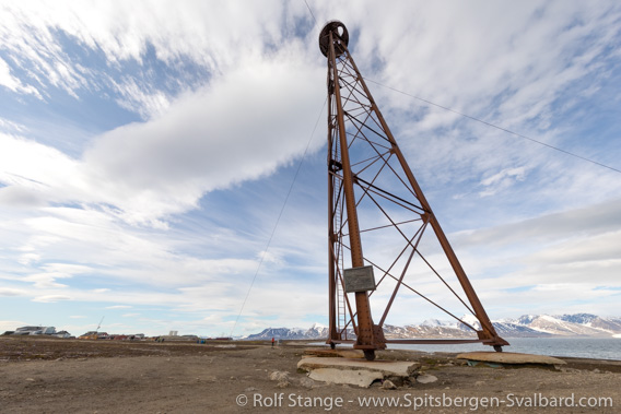
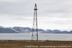
The famous airship mast where Amundsen and Nobile started their expeditions in the 1920s”.
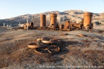
The history of Blomstrandhalvøya, then known as Marble Island, is also interesting. The British Northern Exploration Company established here a mine to extract marble, the quality of which was drastically overestimated, though. After a few years of trial mining, everything was abandoned, as first loads that had been shipped had turned out to be worthless. Remains are still visible (see the Blomstrand/Ny London/Marble Island panorama page for impressions and more information).

Houses dating back to the days of the marble trial mine on Blomstrandhalvøya: Ny London
(also known as “Marble Island” or “Camp Mansfield”).
When coal mining in Ny-Ålesund was history, scientists soon discovered the area as perfectly suited for polar research, of relatively easy access and already equipped with a lot of infrastructure. The settlement was soon developed to become a scientific village (see the Ny-Ålesund panorama pages for impressions and more information).
There was a Norwegian weather station (“geophysical station”) at Kvadehuken at the entrance to Kongsfjord from 1920 to 1924.
Kongsfjord gallery 1: Amundsen & Co – Ny-Ålesund
- gallery anchor link: #gallery_1835
Click on thumbnail to open an enlarged version of the specific photo.
Kongsfjord gallery 2: Ny London & Co – Blonstrandhalvøya
- gallery anchor link: #gallery_1834
Click on thumbnail to open an enlarged version of the specific photo.
Kongsfjord gallery 3: Kongsvegen, Kronebreen & Co – the glaciers
- gallery anchor link: #gallery_1832
Click on thumbnail to open an enlarged version of the specific photo.
Kongsfjord gallery 4: Juttaholmen, Sigridholmen & Co – the islands (Lovénøyane)
- gallery anchor link: #gallery_1833
Click on thumbnail to open an enlarged version of the specific photo.
BOOKS, CALENDAR, POSTCARDS AND MORE
This and other publishing products of the Spitsbergen publishing house in the Spitsbergen-Shop.
last modification: 2024-12-05 ·
copyright: Rolf Stange

