


-
current
recommendations- Liefdefjord
New page dedicated to one of Spitsbergen's most beautiful fjords. Background information and many photos.

- New Spitsbergen guidebook
The new edition of my Spitsbergen guidebook is out and available now!
- Liefdefjord
New page dedicated to one of Spitsbergen's most beautiful fjords. Background information and many photos.
-
weather information

| Guidebook: Spitsbergen-Svalbard |
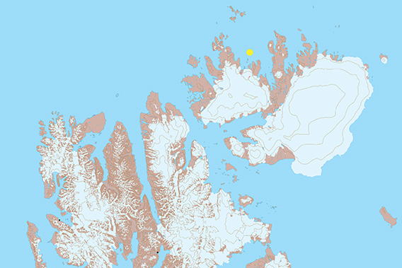
Scoresbyøya
Panorama of an arctic island in Nordenskiöldbukta
Scoresbyøya (“Scoresby Island”) is situated in Nordenskiöldbukta north of Nordaustland in northeastern Svalbard. In other words: the end of the world! There is the occasional ship coming through the area on the way to the war weather station Haudegen deep in Rijpfjord, but not a lot of traffic beyond that. And even those few people who pass through here will usually not pay much attention to Scoresbyøya, which is the largest island in Nordenskiöldbukta, with just under 6 kilometres from the southern end to the northern tip. Near the north end, there are some rocky hill, the highest one being 48 m high. The rest of the island is pretty much flat.
Some may connect the general area to the Schröder-Stranz expedition, which failed dramatically. In the late summer of 1912, expedition leader Herbert Schröder-Stranz left the expedition ship, the Herzog Ernst, close to Scoresbyøya, with 3 more men to cross Nordaustland and Spitsbergen. They failed and were never seen again.
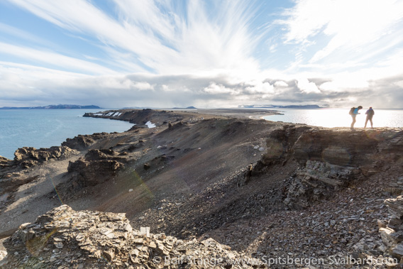
Scoresbyøya: view from the hills in the north towards the southern part of the island.
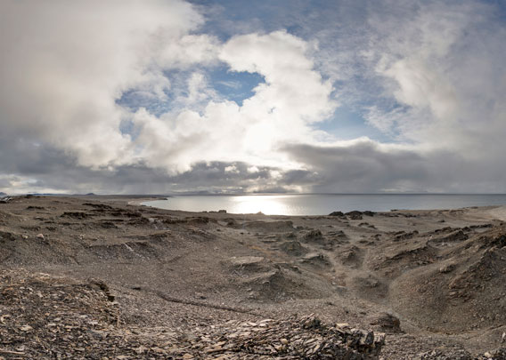
Panorama 1: Scoresbyøya (northern end)
- pano anchor link: #160811b_Scoresbyoya_104HDR
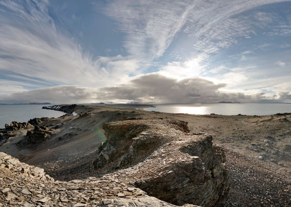
Both of the 360 degree panoramas were taken near the northern end of the island.
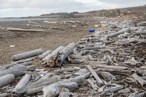
Driftwood and plastic on Scoresbyøya.
Panorama 2: Scoresbyøya (northern end)
- pano anchor link: #160811b_Scoresbyoya_128HDR
The southern part of Scoresbyøya is mostly flat, with some lagoons and shallow surrounding coastal waters. Care is needed for all navigation in the area, including small boats and especially on the west side of the island.

The southern part of Scoresbyøya: lagoons and shallow waters.
There are some more, smaller islands further west and south, including Jyplingane and Sabineøyane.
Photo gallery Scoresbyøya
And finally, as (almost) always, some impressions of Scoresbyøya, including some lovely images from a bird’s perspective.
- gallery anchor link: #gallery_2273
Click on thumbnail to open an enlarged version of the specific photo.


BOOKS, CALENDAR, POSTCARDS AND MORE
This and other publishing products of the Spitsbergen publishing house in the Spitsbergen-Shop.
-

Norwegens arktischer Norden (1): Spitzbergen
Photobook: Norway's arctic islands. The text in this book is German. [shop url="https://shop.spitzbergen.de/en/polar-books/70-norwegens-arktischer-norden-1-aerial-arctic-9783937903262.html"] ← BackOrder now -
Norwegens arktischer Norden (2): Aerial Arctic
Lofoten, Jan Mayen and Spitsbergen from the air - Photobook: Norway's arctic islands. The text in this book is German, but there is very little text, so I am sure that you will enjoy it regardless which languages you read (or not).Order now -
Poster “Svalbardhytter”
The poster "Svalbardhytter" (70 x 100 cm) visualizes the diversity of Spitsbergen's huts in a range of arctic landscapes.Order now -
Book “Svalbardhytter”
The companion book for the Svalbardhytter poster. The poster visualises the diversity of Spitsbergen‘s huts and their stories in a range of Arctic landscapes. The book tells the stories of the huts in three languages.Order now -
Spitsbergen – Svalbard. The complete guidebook
Comprehensive guidebook about Spitsbergen. Background (wildlife, plants, geology, history etc.), practical information including travelling seasons, how to travel, description of settlements, routes and regions.Order now -
Rocks and Ice. Landscapes of the North
A geographical traveling accompaniment to Spitsbergen and East Greenland (68-74°N). This is the English edition of the German book "Steine und Eis".Order now -
East Greenland in Winter
Join an exciting journey with dog, skis and tent through the wintery wastes of East Greenland! We were five guys and a dog when we started in Ittoqqortoormiit, the northernmost one of two settlements on Greenland’s east coast.Order now -
Postcard set Spitsbergen (Svalbard)
12 Spitsbergen postcards in a beautifully designed tray. Individually numbered limited edition!Order now -
Limited edition postcard set Antarctica
12 postcards which come in a beautifully designed tray. Beautiful images from South Georgia across Antarctica from the Antarctic Peninsula to the Ross Sea and up to Macquarie Island and Campbell Island.Order now
last modification: 2022-06-15 ·
copyright: Rolf Stange


-
Books, Calendar, Postcards and more

-


