


-
current
recommendations- Liefdefjord
New page dedicated to one of Spitsbergen's most beautiful fjords. Background information and many photos.

- New Spitsbergen guidebook
The new edition of my Spitsbergen guidebook is out and available now!
- Liefdefjord
New page dedicated to one of Spitsbergen's most beautiful fjords. Background information and many photos.
-
weather information

| Guidebook: Spitsbergen-Svalbard |
Upper Endalen
360°-Panoramas
Upper Endalen
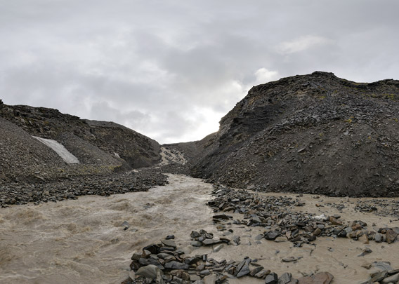
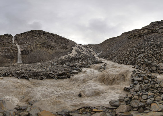
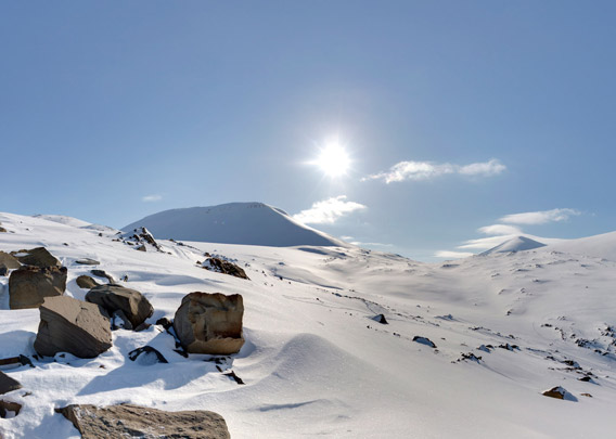
In upper Endalen, the river rushes steep slopes down that are made up of the moraine of Bogerbreen and underlying bedrock. The river is split up into several branches, one of them forming the waterfall and another one a little wildwater river, rushing down the steep moraine slope. This is quite likely the end of most summer hikes into Endalen, at least at times of high water.
- pano anchor link: #Endalen_22Aug13_196
- pano anchor link: #Endalen_22Aug13_237
Endalen 3
- pano anchor link: #Endalen_24pril14_036_HDR
A winter tour does not have to deal with the river because it does not exist in the cold season. In winter, lower Endalen is a popular cross-country skiing route. The popular part, which is sometimes even levelled and prepared for skiing, ends after a few kilometres from the road, though. From now, you have to find your own way.
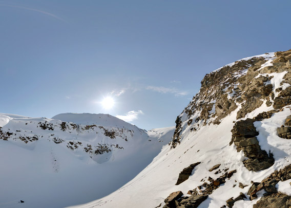
In upper Endalen, the valley is surrounded by nice lower tertiary sandstone cliffs.
Endalen 4
- pano anchor link: #Endalen_24pril14_096_HDR
A little meltwater river from Bogerbreen falls down over some sandstone cliffs. It is frozen to a column of ice in the winter. This is where the lower, flat part of Endalen ends. We can continue the tour, however, by climbing up the moraine of Bogerbreen.
Endalen 5
- pano anchor link: #Endalen_24pril14_140_HDR
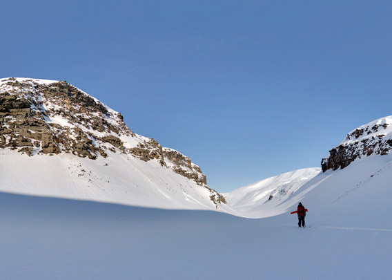
The ascent is a bit of a climb, but the view from the moraine hills of Bogerbreen is more than worth it. We are looking over the whole of Endalen towards Adventdalen in the distance.
Endalen 6
- pano anchor link: #Endalen_24pril14_184_HDR
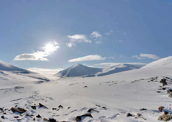
Now we have reached the transition from Endalen to Fardalen. From Fardalen, there is a steep ascent up to Longyearpass and Longyearbreen, so you don’t have to return the same way through Endalen. Together with the nice views, this makes it a very nice ski tour in March or April. It is quite a tour with 17-18 kilometres length and two significant ascents. Make sure you are not eaten by a polar bear or hit by an avalanche. Have fun!
BOOKS, CALENDAR, POSTCARDS AND MORE
This and other publishing products of the Spitsbergen publishing house in the Spitsbergen-Shop.
-

Norwegens arktischer Norden (1): Spitzbergen
Photobook: Norway's arctic islands. The text in this book is German. [shop url="https://shop.spitzbergen.de/en/polar-books/70-norwegens-arktischer-norden-1-aerial-arctic-9783937903262.html"] ← BackOrder now -
Norwegens arktischer Norden (2): Aerial Arctic
Lofoten, Jan Mayen and Spitsbergen from the air - Photobook: Norway's arctic islands. The text in this book is German, but there is very little text, so I am sure that you will enjoy it regardless which languages you read (or not).Order now -
Poster “Svalbardhytter”
The poster "Svalbardhytter" (70 x 100 cm) visualizes the diversity of Spitsbergen's huts in a range of arctic landscapes.Order now -
Book “Svalbardhytter”
The companion book for the Svalbardhytter poster. The poster visualises the diversity of Spitsbergen‘s huts and their stories in a range of Arctic landscapes. The book tells the stories of the huts in three languages.Order now -
Spitsbergen – Svalbard. The complete guidebook
Comprehensive guidebook about Spitsbergen. Background (wildlife, plants, geology, history etc.), practical information including travelling seasons, how to travel, description of settlements, routes and regions.Order now -
Rocks and Ice. Landscapes of the North
A geographical traveling accompaniment to Spitsbergen and East Greenland (68-74°N). This is the English edition of the German book "Steine und Eis".Order now -
East Greenland in Winter
Join an exciting journey with dog, skis and tent through the wintery wastes of East Greenland! We were five guys and a dog when we started in Ittoqqortoormiit, the northernmost one of two settlements on Greenland’s east coast.Order now -
Postcard set Spitsbergen (Svalbard)
12 Spitsbergen postcards in a beautifully designed tray. Individually numbered limited edition!Order now -
Limited edition postcard set Antarctica
12 postcards which come in a beautifully designed tray. Beautiful images from South Georgia across Antarctica from the Antarctic Peninsula to the Ross Sea and up to Macquarie Island and Campbell Island.Order now
last modification: 2019-04-23 ·
copyright: Rolf Stange


-
Books, Calendar, Postcards and more

-


