-
current
recommendations- Liefdefjord
New page dedicated to one of Spitsbergen's most beautiful fjords. Background information and many photos.

- New Spitsbergen guidebook
The new edition of my Spitsbergen guidebook is out and available now!

- Liefdefjord
New page dedicated to one of Spitsbergen's most beautiful fjords. Background information and many photos.
Page Structure
-
Spitsbergen-News
- Select Month
- April 2025
- March 2025
- February 2025
- January 2025
- December 2024
- November 2024
- October 2024
- September 2024
- August 2024
- July 2024
- June 2024
- May 2024
- April 2024
- March 2024
- February 2024
- January 2024
- December 2023
- November 2023
- October 2023
- September 2023
- August 2023
- July 2023
- June 2023
- May 2023
- April 2023
- March 2023
- February 2023
- January 2023
- December 2022
- November 2022
- October 2022
- September 2022
- August 2022
- July 2022
- June 2022
- May 2022
- April 2022
- March 2022
- February 2022
- January 2022
- December 2021
- November 2021
- October 2021
- September 2021
- August 2021
- July 2021
- June 2021
- May 2021
- April 2021
- March 2021
- February 2021
- January 2021
- December 2020
- November 2020
- October 2020
- September 2020
- August 2020
- July 2020
- June 2020
- May 2020
- April 2020
- March 2020
- February 2020
- January 2020
- December 2019
- November 2019
- October 2019
- September 2019
- August 2019
- July 2019
- June 2019
- May 2019
- April 2019
- March 2019
- February 2019
- January 2019
- December 2018
- November 2018
- October 2018
- September 2018
- August 2018
- July 2018
- June 2018
- May 2018
- April 2018
- March 2018
- February 2018
- January 2018
- December 2017
- November 2017
- October 2017
- September 2017
- August 2017
- July 2017
- June 2017
- May 2017
- April 2017
- March 2017
- February 2017
- January 2017
- December 2016
- November 2016
- October 2016
- September 2016
- August 2016
- July 2016
- June 2016
- May 2016
- April 2016
- March 2016
- February 2016
- January 2016
- December 2015
- November 2015
- October 2015
- September 2015
- August 2015
- July 2015
- June 2015
- May 2015
- April 2015
- March 2015
- February 2015
- January 2015
- December 2014
- November 2014
- October 2014
- September 2014
- August 2014
- July 2014
- June 2014
- May 2014
- April 2014
- March 2014
- February 2014
- January 2014
- December 2013
- November 2013
- October 2013
- September 2013
- August 2013
- July 2013
- June 2013
- May 2013
- April 2013
- March 2013
- February 2013
- January 2013
- December 2012
- November 2012
- October 2012
- September 2012
- August 2012
- July 2012
- June 2012
- May 2012
- April 2012
- March 2012
- February 2012
- January 2012
- December 2011
- November 2011
- October 2011
- September 2011
- August 2011
- May 2011
- April 2011
- March 2011
- February 2011
- January 2011
- December 2010
- November 2010
- September 2010
- August 2010
- July 2010
- June 2010
- May 2010
- April 2010
- March 2010
- February 2010
- November 2009
- October 2009
- August 2009
- July 2009
- June 2009
- May 2009
- April 2009
- March 2009
- February 2009
- January 2009
- December 2008
- November 2008
- October 2008
- August 2008
- July 2008
- June 2008
- May 2008
- April 2008
- March 2008
- February 2008
- April 2000
- Select Month
-
weather information
-
Newsletter

| Guidebook: Spitsbergen-Svalbard |
Home → Spitsbergen information → Islands: Spitsbergen & Co. → Spitsbergen (Northern part) → Raudfjord-Liefdefjord-Woodfjord
Raudfjord Liefdefjord Woodfjord
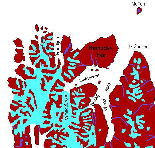
There are several new pages to replace this one which covers a very large – too large, one might say – area. The new pages have more and updated information and illustrations about the individual fjords.
For more, detailed information: the Guidebook Spitsbergen-Svalbard
General: Beautiful and varied fjord-area at Spitsbergen’s north coast. The area is usually accessible quite early in the summer, as it is still under the influence of the gulf stream, but fjord ice can block the fjords or at least the coast in places for another while. The larger part of the area (Raudfjord, Liefdefjord) is part of the Northwest Spitsbergen National Park.
Click here for panorama images from Woodfjord and Liefdefjord.
Geology: Varied. There are basement gneisses, marbles etc. in many areas around Raud- and Liefdefjord. There are also places there with remnants of the filling of the Devonian Andrée-Land-Grabens with its partly brownish-red sandstones, conglomerates etc. (‘Old Red‘).
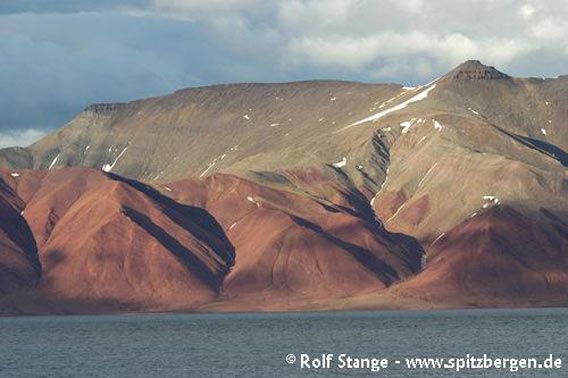
Old Red in inner Woodfjord.
These sediments have been strongly deformed by compressive tectonices probably during several stages: Svalbardian phase in the uppermost Devonian and during the Alpidic orogeny in the lower Tertiary, their total thickness exceeds 7-8 km, they are not metamorphed. The colour varies and is partly grey to black and partly beautifully red, which is due to iron oxides from weathering in a sub-tropical climate when these sediments were deposited: back then, in the Devonian, more than 350 million years ago, Spitsbergen as part of a larger plate was just south of the equator. The Raudfjord has got its name (‘Red fjord’) from an occurrence of Old Red sediments on its eastern side, although it is not as striking as the name may suggests. There are very colourful areas in the Liefdefjord/Woodfjord area: Reinsdyrflya and the islands on its southern side (Andøyane) and most of the eastern side of Woodfjord and Bockfjord. In the Bockfjord, there is another interesting geological feature: the only Quaternary volcanoes of Spitsbergen are there. Sverrefjellet is the ruin of a volcano which may have erupted a few 10 000 years ago, and there are some warm springs in the area.
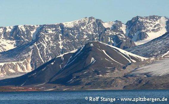
The volcanic ruin Sverrefjellet (centre).
Recommended book for further, well-digestable (really!) info about geology and landscape of Svalbard.
Landscape: Due to the geological mosaic, the landscape is very varied. In Old Red area, the mostly soft sandstones give the landscape round shapes and warm colours. Here, especially in Andrée Land east of the Woodfjord, there only few and small glaciers, as the average elevation is lower and the area is in the rain shadow of the mountains near the west coast.
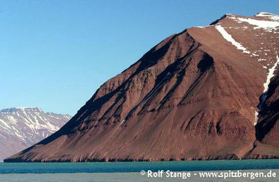
Old Red in the Bockfjord with its beautiful, red colours Farben.
Basement rocks south and west of the Liefdefjord feature a landscape with higher, jagged mountains and strong glaciation, which culminates in the large calving front of the Monacobreen.
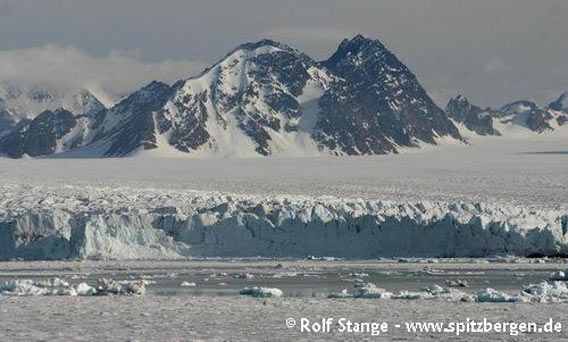
The glacier Monacobreen and surrounding landscape with alpine mountains in the inner Liefdefjord.
Flora and Fauna: Rich. Because of the influence of the gulf stream, the climate is relatively favourable and there are beautiful tundra areas, the colours of which are even enhanced by the reddish soil in the Old Red areas. These are quite productive also because weathering products of the soft sandstones can create something remotely similar to soil. Here, you can find Mountain avens, Purple saxifrage and other saxifrages such as the Spider plant, which is otherwise quite rare. Also faunistically, there is a lot to be seen in the area such as large numbers of breeding Arctic terns and Common Eider, occasionally even a King Eider. This means that early in the season, one has to be extremely careful in order not to disturb any breeding birds. There are usually huge numbers of Arctic terns and Kittywakes attracted to the front of the Monacoglacier by upwelling meltwater which seems to bring some tasty goodies to the surface.
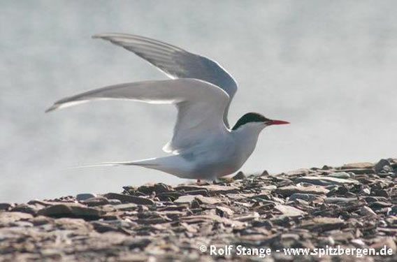
Arctic tern (Liefdefjord).
History: The area was regularly visited by whalers in the 17th century, even though no remains of land stations are known. Trappers have often used the area in the late 19th and 20th century; a tradition that has been kept alive until today on a small scale outside the national park.
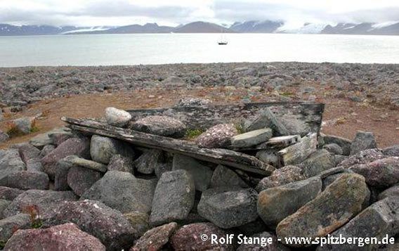
Grave at Bruceneset in Raudfjord.
In 1934-35, Christiane Ritter wintered together with her husband Hermann Ritter and the Norwegian hunter Karl Nikolaisen in the hut just south of Gråhuken (click here to see panorama images of the famous “Ritter hut” at Gråhuken). She wrote a book about this experience that became famous: “A woman in the polar night”.
The hut was actually built in 1928 by the famous trapper Hilmar Nøis.

The “Ritter-hut” at Gråhuken.
BOOKS, CALENDAR, POSTCARDS AND MORE
This and other publishing products of the Spitsbergen publishing house in the Spitsbergen-Shop.
last modification: 2023-11-23 ·
copyright: Rolf Stange


