-
current
recommendations- Liefdefjord
New page dedicated to one of Spitsbergen's most beautiful fjords. Background information and many photos.
- New Spitsbergen guidebook
The new edition of my Spitsbergen guidebook is out and available now!
- Liefdefjord
New page dedicated to one of Spitsbergen's most beautiful fjords. Background information and many photos.
Page Structure
-
Spitsbergen-News
- Select Month
- June 2025
- May 2025
- April 2025
- March 2025
- February 2025
- January 2025
- December 2024
- November 2024
- October 2024
- September 2024
- August 2024
- July 2024
- June 2024
- May 2024
- April 2024
- March 2024
- February 2024
- January 2024
- December 2023
- November 2023
- October 2023
- September 2023
- August 2023
- July 2023
- June 2023
- May 2023
- April 2023
- March 2023
- February 2023
- January 2023
- December 2022
- November 2022
- October 2022
- September 2022
- August 2022
- July 2022
- June 2022
- May 2022
- April 2022
- March 2022
- February 2022
- January 2022
- December 2021
- November 2021
- October 2021
- September 2021
- August 2021
- July 2021
- June 2021
- May 2021
- April 2021
- March 2021
- February 2021
- January 2021
- December 2020
- November 2020
- October 2020
- September 2020
- August 2020
- July 2020
- June 2020
- May 2020
- April 2020
- March 2020
- February 2020
- January 2020
- December 2019
- November 2019
- October 2019
- September 2019
- August 2019
- July 2019
- June 2019
- May 2019
- April 2019
- March 2019
- February 2019
- January 2019
- December 2018
- November 2018
- October 2018
- September 2018
- August 2018
- July 2018
- June 2018
- May 2018
- April 2018
- March 2018
- February 2018
- January 2018
- December 2017
- November 2017
- October 2017
- September 2017
- August 2017
- July 2017
- June 2017
- May 2017
- April 2017
- March 2017
- February 2017
- January 2017
- December 2016
- November 2016
- October 2016
- September 2016
- August 2016
- July 2016
- June 2016
- May 2016
- April 2016
- March 2016
- February 2016
- January 2016
- December 2015
- November 2015
- October 2015
- September 2015
- August 2015
- July 2015
- June 2015
- May 2015
- April 2015
- March 2015
- February 2015
- January 2015
- December 2014
- November 2014
- October 2014
- September 2014
- August 2014
- July 2014
- June 2014
- May 2014
- April 2014
- March 2014
- February 2014
- January 2014
- December 2013
- November 2013
- October 2013
- September 2013
- August 2013
- July 2013
- June 2013
- May 2013
- April 2013
- March 2013
- February 2013
- January 2013
- December 2012
- November 2012
- October 2012
- September 2012
- August 2012
- July 2012
- June 2012
- May 2012
- April 2012
- March 2012
- February 2012
- January 2012
- December 2011
- November 2011
- October 2011
- September 2011
- August 2011
- May 2011
- April 2011
- March 2011
- February 2011
- January 2011
- December 2010
- November 2010
- September 2010
- August 2010
- July 2010
- June 2010
- May 2010
- April 2010
- March 2010
- February 2010
- November 2009
- October 2009
- August 2009
- July 2009
- June 2009
- May 2009
- April 2009
- March 2009
- February 2009
- January 2009
- December 2008
- November 2008
- October 2008
- August 2008
- July 2008
- June 2008
- May 2008
- April 2008
- March 2008
- February 2008
- April 2000
- Select Month
-
weather information
-
Newsletter

| Guidebook: Spitsbergen-Svalbard |
Home
→ August, 2017
Monthly Archives: August 2017 − News & Stories
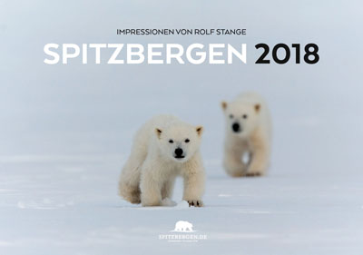
The new Spitsbergen calendar 2018 is available!
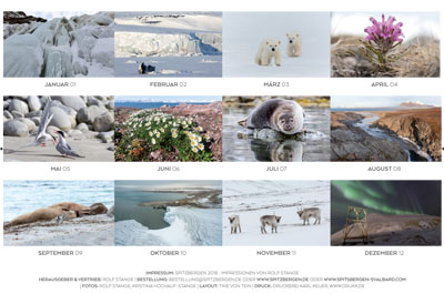
The new Spitsbergen calendar 2018 is here, fresh from the printer, and ready for ordering and shipping! Since 2012, the Spitsbergen calendar has almost become a little, annual tradition: 12 beautiful photos take you through the arctic seasons. We will enjoy polar landscapes and light, wildlife and ice. From the polar night with the stunning aurora, the northern lights, to the bright midnight sun, from a frozen water fall in the cold winter to the flowers that bring lovely colours to the tundra in the arctic summer. And of course we meet some of the big animals, as we observe a curious polar fox having a look at a bunch of lazy walrusses and we encounter two very young twin polar bears somewhere on a frozen fjord.
The new Spitsbergen-calendar 2018 is available now.
Click here for further information about the new Spitsbergen calendar 2018, including previews of all pages and the option to order. As always, the calendar is available in two sizes, A3 and A5, to suit your wishes and needs. And you can save money by ordering more than one – Christmas will come soon enough! 🙂
Overview of all pages of the new Spitsbergen-calendar 2018. Click here for more information, including larger views.
Sysselmannen takes action against drugs in Longyearbyen
Longyearbyen is not entirely free of drugs, as most places where humans live. Apart from the Scandinavian style of alcohol consumption, which may be noteworthy as seen from a central-European perspective, there are also harder drugs. It is not a secret in Longyearbyen that there is more or less regular consumption of hemp in certain circles.
Every couple of years, whenever it is considered necessary, the Sysselmannen takes action against drugs, amongst others with searching and detention of those found responsible for keeping the scene alive. In the past, this has even led to the expulsion of people from Svalbard, with an entry ban for a certain period such as two years. In modern times, banishment is certainly rather unusual in jurisdiction in western countries, but this instrument is kept available in Svalbard to protect the small and geographically isolated community. The authorities are aware of the danger of drugs for bored youngsters in the long polar winter in a small place like Longyearbyen.
The subject is currently coming up again. Last weekend, the Sysselmannen has searched places and people with help from police forces from mainland Norway, including a trained police dog from Oslo. Three persons were taken in custody. The investigation will be continued.
Typical environments where hemp has been found in Longyearbyen in the past are youngsters and students. This time, people who are in the focus of police attention belong to the tourism industry. There is mention of drugs harder than hemp, but no further information has been released so far.
Drugs in the Arctic? As if nature itself was not exciting enough!
Source: Svalbardposten
Billefjord – 14th August 2017
Mon
14 Aug
2017
On the last day of such a long, intense trip, it is allowed to be a little bit wistful. 18 days are still too short!
There was a choice in the morning, a tour through the settlement of Pyramiden or a hike on the mountain Pyramiden. Most went for the old Russian mining settlement.
Then it was time for our final landing. We went to Skansbukta, a classic for good reasons. We enjoyed it.
There was some successful fishing before we came back to Adventfjord, so we had some fresh fish to enjoy for later. Then, we were soon alongside in the harbour in Longyearbyen. Same place as 18 days ago, but still everything is different. It is a big difference if you have such a big voyage ahead of you or behind you.
Gallery – Billefjord – 14th August 2017
- gallery anchor link: #gallery_1263
Click on thumbnail to open an enlarged version of the specific photo.
We enjoyed a lot of beautiful, intense days together, mostly with a lot of weather luck, we had the wildlife, the whole lot … thanks to all of you who were there, it was great!
Barentsburg & Grønfjordfjellet – 13th August 2017
Sun
13 Aug
2017
The passage last night up to Isfjord was almost surprisingly calm. It was definitely a good idea to wait the weather out in Fridtjovhamna for a couple of hours. Which is not a bad thing anyway, considering the scenery there.
In Barentsburg, we spent the morning with some sightseeing and learning about Spitsbergen 20th century history and politics. We also got used to the usual dangers of civilisation again, car traffic and things like that. So most of us decided to spend the afternoon in the arctic nature again, doing a bit of a sportive hike up the mountains to gain a great scenic view over Grønfjord.
Gallery – Barentsburg & Grønfjordfjellet – 13th August 2017
- gallery anchor link: #gallery_1249
Click on thumbnail to open an enlarged version of the specific photo.
Sailing boat almost sunk in Spitsbergen
On Sunday (August 6) morning, a private yacht got into a dramatic situation at sea in Svalbard. It took water and was not far from sinking. Three persons were on board, all of them German. They are all well now. The incident took case near Dunderbukta, at the west coast of Spitsbergen south of Bellsund.
Shallows and exposed shorelines: the west coast of Spitsbergen can by very inhospitable.
The crew called for help via German rescue services, who alarmed the Norwegian authorities. The three, who were already on board their life raft at that time, were then taken on board the Norwegian cargo ship Norbjørn. Norbjørn also started to tow the sailing boat. The three rescued persons remained on Norbjørn for the passage to Longyearbyen, which they preferred rather than a flight on the helicopter which was soon on the scene. Their sailing boat was towed to Longyearbyen by the pilot boat from the port of Longyearbyen.
It turned out that a hose that connected a septic tank to the hull had got loose, enabling water to rush into the boat.
According to the Sysselmannen, the case will be handed over to the insurances without further police involvement.
Source: Svalbardposten
Recherchefjord – 12th August 2017
Sat
12 Aug
2017
As expected, Recherchefjord did not let us down. We got some late, but calm hours of sleep and a lovely hike.
It is still very windy all over the place, and we wait it out during the evening, hoping for the wind to calm at least a little bit down for our passage up to Isfjord.
Gallery – Recherchefjord – 12th August 2017
- gallery anchor link: #gallery_1247
Click on thumbnail to open an enlarged version of the specific photo.
Sørkapp & Raksodden – 11th August 2017
Fri
11 Aug
2017
The south cape lived up to its bad reputation, with wind force 7-8. At least it was coming from a useful direction, pushing us under sails up to a good 11 knots. Not bad for this 40 ton steel monster that they call a sailing boat.
We were all more than happy when we reached a reasonably sheltered anchorage south of Hornsund. It was great to stretch legs a little bit in the wide-open west coast tundra. The most unforgettable part of this landing was probably Heinrich’s special maneouvre when picking us up. It resulted in a wet skipper, something he and we will survive. But we do regret the loss of the engine. Well, only three more full days to go. We will make do without.
Gallery – Sørkapp & Raksodden – 11th August 2017
- gallery anchor link: #gallery_1245
Click on thumbnail to open an enlarged version of the specific photo.
All we need now is a well-sheltered anchorage and some hours of sleep. Hornsund was nothing but a wind funnel and further north, the sea was raging white. Well, we should reach a calm place in Recherchefjord just after 5 a.m. …
Negribreen & Freemansund – 10th August 2017
Thu
10 Aug
2017
Negribreen, the largest glacier of the main island of Spitsbergen, was a bit foggy, but nevertheless very impressive. But the clear highlight of the day, if not of the trip, was definitely the young polar bear that was chewing on a rather rotten walrus in Freemansund. There are no words to describe that experience. None of us will forget that, that’s for sure!
Gallery – Negribreen & Freemansund – 10th August 2017
- gallery anchor link: #gallery_1243
Click on thumbnail to open an enlarged version of the specific photo.
Easternmost Spitsbergen – 09th August 2017
Wed
9 Aug
2017
We had several polar bear sightings on the way towards Heleysund, but all of them distant in the terrain. There is a little cliff coast south of Kapp Payer, Spitsbergen’s easternmost point, which was not helpful in this case.
The currents in Heleysund turned initially out to be so strong that we decided to make a little walk in Buchholzbukta. Spitsbergen’s easternmost land (I am obviously talking about the main island here). With a ruin of an old trapper hut, 4 walruses, high arctic scenery, a little river, the whole lot.
Later, we found 2 polar bears on Barentsøya under a bird cliff. Well-fed and good in shape. This area has now been ice-free for a while. It is amazing that these polar bears that hang out near bird cliffs and don’t seem to feed on anything but vegetation and chicks and eggs that are in reach are so often in really good shape.
Gallery – Easternmost Spitsbergen – 09th August 2017
- gallery anchor link: #gallery_1241
Click on thumbnail to open an enlarged version of the specific photo.
Ormholet turned out to be a peaceful place, considering the currents, as we made another approach to those passages in the later afternoon. So it was a silent scenic pleasure to sail through it. Just as this tiny little island near Barentsøya where we made an evening walk to round the day off. Completely untouched nature, where few people have ever set their foot on. Many arctic terns, but not too agressive as their breading season is largely finished, but they are always excited and make a lot of noise which suits the otherwise silent tundra well. Coarse stones here, thick carpets of tundra there. The latter have developed through millenia of fertilization by the birds. The sun is casting a beautiful light on Spitsbergen’s glaciers in the background, a panorama that we enjoy in the late evening back on board Arctica II.
Hinlopen (2) – 08th August 2017
Tue
8 Aug
2017
The anchor fell comparatively early last night, it was indeed still yesterday and not already today, at Wahlbergøya. That was a good thing, after all those long days. So we could start the day today with a nice walk across Wahlbergøya, the famous „two peaks hike“, which nobody had done before.
And of course Wahlbergøya does not „only“ have great scenery …
Gallery – Hinlopen (2) – 08th August 2017
- gallery anchor link: #gallery_1239
Click on thumbnail to open an enlarged version of the specific photo.
Hinlopen – 07th August 2017
Mon
7 Aug
2017
Some low clouds and fog don’t keep us from hiking up a mythical mountain in Lomfjord, and as the fog clears, the reward comes in shape of amazing views of the surrounding scenery. And a lovely, long hike anyway. It is just great to spend a lot of time outside in this kind of nature!
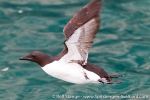
Several hundred thousand Brünich’s guillemots round the day off big style.
Gallery – Hinlopen – 07th August 2017
- gallery anchor link: #gallery_1237
Click on thumbnail to open an enlarged version of the specific photo.
Chermsideøya-Langgrunnodden – 06th August 2017
Sun
6 Aug
2017
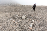
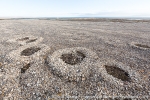
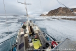
Ice and fog got denser and denser as we sailed into Rijpfjord last night, so in the end we had to turn around. One potential anchorage after the other was blocked by ice, so we just had to continue until we finally found a calm place at Chermsideøya. That is the place with the famous geoglyphs, where everybody put the name of their ship onto the ground with rocks: the Jäderin (Arc-de-Meridian expedition, 1898), the Krassin (rescued Nobile in 1928, the German submarine that brought the crew of the war weather station out to Haudegen in inner Rijpfjord in 1944.
We met some more ice with wildlife on the way to the west. No polar bears on ice, wherever they are.
Gallery – Chermsideøya-Langgrunnodden – 06th August 2017
- gallery anchor link: #gallery_1235
Click on thumbnail to open an enlarged version of the specific photo.
We managed to do another landing on Nordaustland, on Langgrunnodden. Another place where you don’t get every day now we are moving southwards in Hinlopen Strait. For the first time in this trip, we have got some noticeable wind and sea. Of course, it is headwind. Well, just for a couple of hours.
Rossøya – 05th August 2017
Sat
5 Aug
2017
The fog came down during the night, and the world was grey when we awoke today. Good that we went ashore last night, when the light was so beautiful! And now let’s see if we can still make it a bit further north.
We could. Who would have thought that we would reach Rossøya a few hours later? Svalbard’s northernmost island, or rather a rock or a skerry. From the distance, it has the shape of a turtle’s back. Just to the south of it, Vesle Taveløya is towering in the fog, like a threatening shadow. It is home to Svalbard’s northernmost seabird colony, including a surprisingly large number of puffins.
Rossøya is not more than a skerry, but it is Svalbard’s northernmost bit of land and as such certainly a significant place. It is interesting to see Rossøya, but it is much better to go ashore and have a close look – that is something different. But not exactly easy. Ice and fog were a bit marginal, but the visibility was good enough and Heinrich anchored the Arctica II so beautifully close to the island that were were well sheltered from drifting ice floes.
Timon and I checked out two routes before we found a useable ascent. Rossøya is actually pretty steep. But after a while, everybody who was happy to venture on this one had made it to the top of the island. High up on Svalbard’s northernmost bit of land! Yeah! There is some lonesome scurvy grass, a lot of lichens and three cairns. The biggest one is presukmably the northernmost one built by the Russian-Swedish Arc-de-Meridian expedition. And a pair of arctic skuas. Svalbard’s northernmost breeding birds are arctic skuas, who would have thought that?
Gallery – Rossøya – 05th August 2017
- gallery anchor link: #gallery_1233
Click on thumbnail to open an enlarged version of the specific photo.
Back on board, the fog was coming down again and the ice was drifting in. So we made our northernmost turn at 80°50’N and steamed southwards, to Nordaustland.
Franklindalen-Phippsøya – 04th August 2017
Fri
4 Aug
2017
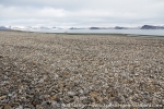
The infinite spaces, the emptyness and lonelyness of Nordaustland can be quite strong, especially if you expose yourself to it for a bit longer. A good 9 kilometres are not the world, but a good hike across the endless stone desert. Silent lakes, the sad call of the red-throated diver and gently rolling, rocky hills.
Gallery – Franklindalen-Phippsøya – 04th August 2017
- gallery anchor link: #gallery_1231
Click on thumbnail to open an enlarged version of the specific photo.
And then: let’s see how far to the north we may get. We got pretty far. The ice did try to stop us, but it had not expected the capabilities of Arctica II and Heinrich Eggenfellner to push through it. So we got as far as Phippsøya and of course we made use of the beautiful evening light by a walk across the island, one of the northernmost ones of the whole Svalbard archipelago, to a viewpoint from where we had a clear view all the way to the north pole.
Lady Franklinfjord – 03rd August 2017
Thu
3 Aug
2017
The day was very promising already from a geographical viewpoint, even if it had not been for anything else. Who has been in Lady Franklinfjord? Exactly. And we want to go to places where not everybody else is going. Lady Franklinfjord is pretty high on this hitlist.
Just have a look at the sea chart. No surprise that larger ships don’t come in here. It brings a lot of fun and a bit of adrenaline to sail through the shallow waters of Lady Franklinfjord, south of Lågøya.
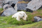
This little island in Lady Franklinfjord was not supposed to be much more than the site for a little morning walk. It turned out to be another little adrenaline kick, as suddenly we saw a polar bear walking around not too far away. We moved away without much drama and back on Arctica II, we got some nice views of the beautiful animal.
We had some stunning views of the grand scenery in inner Lady Franklinfjord from a little hill, viewing over the barren coastal landscape to the north and the majestic glaciers (Franklinbreane) to the south and east. In contrast to most of Svalbard’s glaciers, they have even advanced a little bit in recent years. Later, we had a good look at the glacier fronts and some of the many icebergs as we were cruising through that magnificient bit of scenery with Arctica II. Amazing how Heinrich maneouvres his boat in these icy waters! The scenery is indeed of Greenlandic quality, and that means something.
Gallery – Lady Franklinfjord – 03rd August 2017
- gallery anchor link: #gallery_1229
Click on thumbnail to open an enlarged version of the specific photo.
We made a nice evening walk in Jäderinfjord, a side bay of Lady Franklinfjord and another rather remote place. Fog was moving in a bit, but given we had seen the whole scenery in splendid weather during the day, we just enjoyed the atmosphere and the light.
What a day!
News-Listing live generated at 2025/June/15 at 07:06:29 Uhr (GMT+1)
