-
current
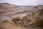
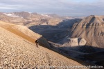
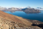
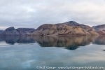
recommendations- Liefdefjord
New page dedicated to one of Spitsbergen's most beautiful fjords. Background information and many photos.

- New Spitsbergen guidebook
The new edition of my Spitsbergen guidebook is out and available now!

- Liefdefjord
New page dedicated to one of Spitsbergen's most beautiful fjords. Background information and many photos.
Page Structure
-
Spitsbergen-News
- Select Month
- April 2025
- March 2025
- February 2025
- January 2025
- December 2024
- November 2024
- October 2024
- September 2024
- August 2024
- July 2024
- June 2024
- May 2024
- April 2024
- March 2024
- February 2024
- January 2024
- December 2023
- November 2023
- October 2023
- September 2023
- August 2023
- July 2023
- June 2023
- May 2023
- April 2023
- March 2023
- February 2023
- January 2023
- December 2022
- November 2022
- October 2022
- September 2022
- August 2022
- July 2022
- June 2022
- May 2022
- April 2022
- March 2022
- February 2022
- January 2022
- December 2021
- November 2021
- October 2021
- September 2021
- August 2021
- July 2021
- June 2021
- May 2021
- April 2021
- March 2021
- February 2021
- January 2021
- December 2020
- November 2020
- October 2020
- September 2020
- August 2020
- July 2020
- June 2020
- May 2020
- April 2020
- March 2020
- February 2020
- January 2020
- December 2019
- November 2019
- October 2019
- September 2019
- August 2019
- July 2019
- June 2019
- May 2019
- April 2019
- March 2019
- February 2019
- January 2019
- December 2018
- November 2018
- October 2018
- September 2018
- August 2018
- July 2018
- June 2018
- May 2018
- April 2018
- March 2018
- February 2018
- January 2018
- December 2017
- November 2017
- October 2017
- September 2017
- August 2017
- July 2017
- June 2017
- May 2017
- April 2017
- March 2017
- February 2017
- January 2017
- December 2016
- November 2016
- October 2016
- September 2016
- August 2016
- July 2016
- June 2016
- May 2016
- April 2016
- March 2016
- February 2016
- January 2016
- December 2015
- November 2015
- October 2015
- September 2015
- August 2015
- July 2015
- June 2015
- May 2015
- April 2015
- March 2015
- February 2015
- January 2015
- December 2014
- November 2014
- October 2014
- September 2014
- August 2014
- July 2014
- June 2014
- May 2014
- April 2014
- March 2014
- February 2014
- January 2014
- December 2013
- November 2013
- October 2013
- September 2013
- August 2013
- July 2013
- June 2013
- May 2013
- April 2013
- March 2013
- February 2013
- January 2013
- December 2012
- November 2012
- October 2012
- September 2012
- August 2012
- July 2012
- June 2012
- May 2012
- April 2012
- March 2012
- February 2012
- January 2012
- December 2011
- November 2011
- October 2011
- September 2011
- August 2011
- May 2011
- April 2011
- March 2011
- February 2011
- January 2011
- December 2010
- November 2010
- September 2010
- August 2010
- July 2010
- June 2010
- May 2010
- April 2010
- March 2010
- February 2010
- November 2009
- October 2009
- August 2009
- July 2009
- June 2009
- May 2009
- April 2009
- March 2009
- February 2009
- January 2009
- December 2008
- November 2008
- October 2008
- August 2008
- July 2008
- June 2008
- May 2008
- April 2008
- March 2008
- February 2008
- April 2000
- Select Month
-
weather information
-
Newsletter

| Guidebook: Spitsbergen-Svalbard |
Home → Spitsbergen information → Islands: Spitsbergen & Co. → Isfjord → Dickson Land-Billefjord
Dickson Land-Billefjord
Nature, history and photos from one of Spitsbergen's most beautiful areas
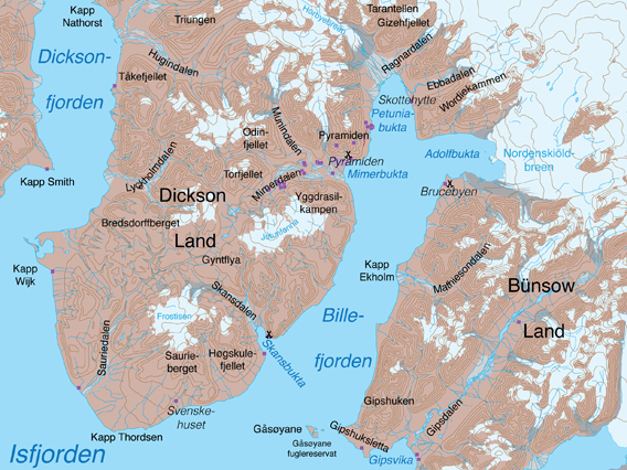
Map: Dickson Land and Billefjord.
General
Dickson Land is the name for the peninsula between Dicksonfjord and Billefjord. It is named after Oscar Dickson (1823-1897), a Swedish industrial who sponsored several polar expeditions. Billefjord is very scenic, including the large calving glacier front of Nordenskiöldbreen, and it has the former Russian mining settlement Pyramiden. Because of this and the relatively good accessibility due to the short distance to Longearbyen, it is frequently visited especially in the summer, when boats offer day trips from Longyearbyen, but also in the spring (late winter). Additionally, Dickson Land is one of the most beautiful and easily accessible hiking and trekking areas of Spitsbergen. Long trekkings following the large, ice-free valleys and high plateaux are possible as well as some mountain climbing (not technical) and glacier hikes – but this is not for everybody, it requires good physical shape and relevant knowledge and experiences with all sorts of difficulties and potential hazards that are part of the nature of an arctic environment.
For a more relaxed approach – but very rewarding! – it is possible to get accommodation and food in the hotel in Pyramiden. You will need a guide (or your own weapon etc.) for excursions, including even activities within Pyramiden, but this is locally available if needed. Recommended!
This page is about the general area of Dickson Land and Billefjord. There is a special page about Pyramiden (click here) with a lot of information.

The Russian settlement of Pyramiden in Billefjord: abandoned as a mining settlement in 1998,
still active and popular as a tourist destination.
Panoramas
There is a number special pages on this websites dedicated to various individual sites in the Billefjord area, with more information, panorama images and photos, for example:
- There is, of course, a huge collection of images and information on Pyramiden. Start here to access a page with an interactive map and use that for further online navigation.
- Panoramic view from the mountain Yggdrasilkampen south of Pyramiden.
- The glacier Hørbyebreen north of Billefjord.
- A frozen lake near Ragnarbreen north of Billefjord.
- The beautiful valley of Ebbadalen in Petuniabukta.
- The mighty glacier Nordenskiöldbreen.
- The famous Svenskehuset (“Swedish house”) at Kapp Thordsen, furthest south in Dickson Land.
- The equally famous “mining town” Brucebyen: a scottish attempt to mine coal led by William S. Bruce.
Protected areas
Southern and western Dickson Land are part of the Nordre Isfjord national park. Bünsow Land east of Billefjord is part of the Sassen-Bünsow Land national park. The little islands of Gåsøyane are a bird sanctuary (all traffic within 300 m from the shore prohibited from 15 May to 15 August).
Billefjord itself and the land areas around its northern part are not part of any specially protected area, but the general environmental regulations apply as anywhere in Spitsbsergen (see rules).
For more, detailed information: the Guidebook Spitsbergen-Svalbard
Geology
The area around the Billefjord belongs geologically to the most interesting parts of Spitsbergen, so I dedicate some space to the matter.
The pre-Devonian basement is exposed only near Nordenskiöldbreen and north of the Billefjord. On both sides of the fjord, but especially in western and northern Dickson Land, reddish sandstones and conglomerates of the Devonian Old Red give the landscape an appereance with beautiful colours.

Devonian Old Red in the mountain Lykta in Dicksonfjord. The highest part consists of hard Carboniferous limestone layers. Old Red and limestone are separate by the Svalbardian unconformity (see text below).
Fossilised tree trunks found in Devonian rocks in Hugindalen are of truly respectable age. They belong to the oldest fossilised remains of large plants on Earth.
The coal seams that were mined in Pyramiden date to the Carboniferous, meaning that they are younger than the above-mentioned plant fossils (but still much older than the coal mined in Barentsburg, Grumantbyen, Longyearbyen and Ny-Ålesund, which was all from the lower Tertiary). As the name says, the Carboniferous was a period of coal formation of global importance.
In the Carboniferous and Permian, various sediments were deposited, including evaporites such as gypsym and anhydrite. Attempts to mine these minerals were made in Skansbukta (see history section below). They can be multicoloured, giving the landscape a colourful appareance, for example the slopes of the mountains near Adolfbukta and north of Billefjord. There is, for example, a mountain called Trikolorfjellet (‘Three colour mountain’).
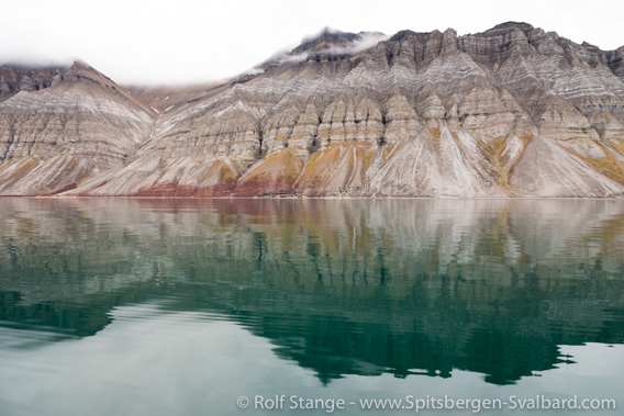
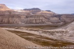
Mountains on the east side of Billefjord: colourful geology from the upper Carboniferious up into the lower Permian.
In the Permian, deposition continued mostly with carbonates, among others the hard, fossil-rich limestones of the Kapp Starostin Formation (a name that you may have heard before if you are interested in the regional geology). In Dickson Land, they often form prominent cliffs and waterfalls.
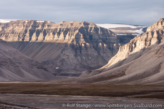
Mountain slopes exposing hard sedimentary layers (Carboniferous and Permian)
in Lyckholmdalen, central Dickson Land.
After a break of deposition in the uppermost Permian, Mesozoic ‘platform sediments’ were deposited in large parts of central and southeast Svalbard, including Dickson Land, where they are preserved in the southern part. In other words, regarding the geology and general character of the scenery, there are parts of southern Dickson Land that are more similar to Barentsøya or Edgeøya than to Dickson Land further north or Billefjord!
Phosphoritic concretions within the Triassic sediments of southern Dickson Land were tought to be economically exploitable, which lead to investigations initiated by the Swedish explorer Adolf Erik Nordenskiöld and an attempt to establish a colony and a phosphorite mine at Svenskehuset near Kapp Thordsen. In the same area, the name ‘Saurierdalen’ points to fossils of large marine reptils found in southern Dickson Land.
The lively history of regional tectonics gave rise to an interesting geological variety within a relatively small area. The rocks are partly aesthetically folded. The Billefjorden fault zone runs straight through the long Wijdefjord in the north and through Billefjord. This is one of the most important tectonic lineaments in Svalbard.
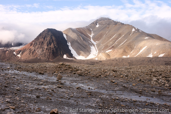
The Billefjorden fault zone at Hørbyebreen, separating older basement rocks (dark, left side) from Carboniferous limestones (right).
Another tectonic event happened in the uppermost Devonian, the so-called Svalbardian Phase, a very late, final stage of the Caledonian orogeny which is otherwise largely confined to the Silurian. The result of regional uplifting and tilting is an unconformity between the Devonian Old Red and the upperlying Carboniferous carbonates. This is well visible (at least for the trained eye), as the relatively soft Devonian sandstones and conglomerates form soft, reddish slopes topped by steep cliffs of yellowbrown carbonates (Pyramiden, Triungen, Lykta, Kinamurfjellet etc.). For an example, see photo of mount Lykta above.
Also the Quaternary geology is very interesting. All glaciers in the area have retreated strongly in the late 20th century and even more so in more recent years, leaving large, ice-cored moraines. There are beautiful series of fossil beach-ridges for example at Brucebyen. Solution of sulfates and carbonates led to the formation of karst phenomena such as sink holes in Mathiesondalen and Gipsdalen (Bünsow Land), and fallout of dissolved minerals led to quick diagenesis (hardening) of holocene sediments such as deltaic deposits and moraines in Mathiesondalen and north of the moraine of Hørbyebreen.
Recommended book for further, well-digestable (really!) info about geology and landscape of Svalbard.
Landscape
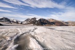
According to the varied geology, there is a variety of different landscapes to be seen. Near the coast, there are often beautiful tundra areas with very evident beach ridges. The ‘hinterland’, the area east of Billefjord and Bünsow Land, is strongly glaciated, whereas Dickson Land is relatively ice-free.
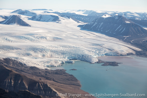
The glacier Nordenskiöldbreen is one of the main eyecatchers in Billefjord.
Around Billefjord, permocarboniferous carbonatic rocks form partly spectacular steep cliffs dissected by erosion, thus often forming regular towers and sometimes bizarre sculptures such as Tarantellen north of Billefjord. This rock tower (Tarantellen = ‘the tarantula’) is worth seeing, but it takes a long and demanding hike to reach it from the northern end of Billefjord through a steep, narrow valley. It is a double arch more than 20 metres high, which looks like a giant stone spider (see pictures in the Petuniabukta gallery at the end of this page).
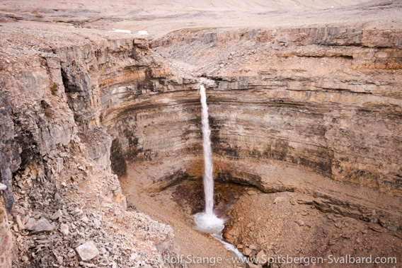
Sjursethfossen is the highest waterfall in Dickson Land.
Other cliffs are built up by the Permian Kapp Starostin Formation, for example on the northern side of Skansbukta and elsewhere. In inner parts of Dickson Land, these slopes often form steep canyons and waterfalls.
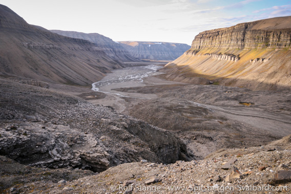
Steep slopes surrounding upper Skansdalen.
In southern Dickson Land, landscapes within the Triassic sediments remind one of places with a similar geology for example in eastern Nordenskiöld Land (east of Longyearbyen), Edgeøya etc. Here, doleritic intrusions sometimes form irregular ridges and cliffs in the slopes. Small ice caps cover parts of the high plateaus, which are dissected by steep canyons.
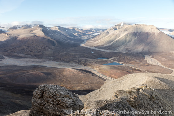
Landscape in central Dickson Land: view from Yggdrasilkampen
across Mimerdalen and into Munindalen.
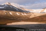
In central northern Dickson Land, the Old Red with its beautiful, reddish-brown sandstones and conglomerates dominates the appareance of the landscape; here you find several ice-free valleys with warm colours on the round lower and middle slopes (Hudindalen, Nathorstdalen). On top of these slopes, hard carbonates form steep cliffs, so it is often difficult to reach the summit.
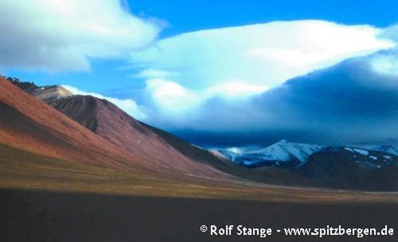
Tundra in Nathorstdalen with slopes composed of Old Red sandstone with its warm colours.
Further north, around Ålandvatnet and Mittag-Lefflerbreen, metamorphic basement and sedimentary cover rocks form a mosaic because of the tectonics related to the Billefjorden fault zone (see above). In the area of sedimentary cover rocks, there are some mountains with beautiful colours, the slopes of which are sometimes nicely dissected by erosion to form regular towers. In contrast, the harder basement rocks form steeper mountain slopes with a more irregular shape. Near Mittag Lefflerbreen, huge morains form chaotic, ever-changing landscapes around the lakes of Ålandsvatnet and Hoglandvatnet. The latter has largely disappeared.
Flora and fauna
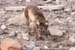
The summers are relatively warm in Billefjord, and there is quite rich tundra near the coast and in some of the large, ice-free valleys of Dickson Land. On steep cliffs, there are colonies of seabirds. Spitsbergen reindeer and arctic foxes are common.
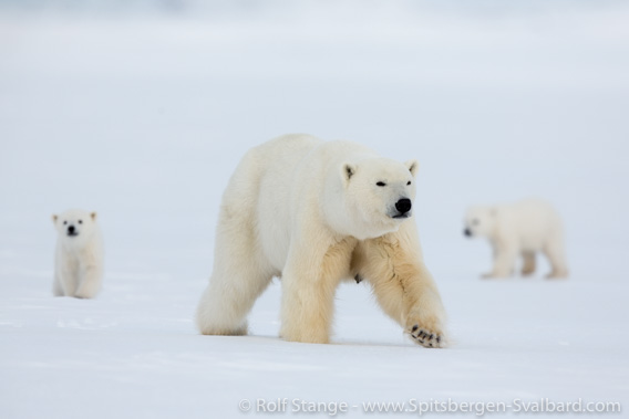
Polar bears in Billefjord.
In recent years (from 2013), polar bears were regularly seen in Billefjord, often near Nordenskiöldbreen, but also near or even in Pyramiden. At least one female, which achieved fame under the name Frost, has settled down and become quite stationary in the area, including neighbouring branches of Isfjord as far as Adventfjord (Longyearbyen!). And she is not the only polar bear in Isfjord. So be careful wherever you are, including Pyramiden itself, where the buildings keep you from having a good overview over the surroundings.
History
I do not know of any activities of 17th century whalers in the area, although Billefjord was actually named after one of them. Pomors used the area as well as Norwegian trappers. Kapp Wijk Dickson Fjord was the home of the legendary Arthur Oxaas between the wars in the 20th century. Oxaas was followed by Harald Soleim.

Old trappers’ hut on the south side of Skansbukta.
Mining was attempted at various sites in Billefjord in the 20th century. The Scottish Spitsbergen Syndicate (SSS) with William Speirs Bruce investigated Carboniferous coal east of Billefjord and built Brucebyen for this purpose.
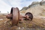
Another early attempt to explore minerals was done by the Portland Cement Fabric, which established mining facilities in Skansbukta, but here as well as in other places the occurrence turned out to be economically worthless. The entrance to the mine as well as someold machinery can still be seen.
Large-scale mining was done in Pyramiden. Founded 1910 by a Swedish company, Russians to over the area in 1926. But mining did not seriously start until 1940 and was, with interruptions, continued until 1998, when the mine was finally abandoned (access the Pyramiden page by clicking here for more information).
Gallery Skansbukta
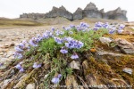
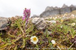
Skansbukta has some stunning scenery, interesting history and – if you get close enough at the right time of year – beautiful flowers. All this makes the place a popular excursion site. Some impressions from classic as well as more unusual perspectives:
- gallery anchor link: #gallery_1869
Click on thumbnail to open an enlarged version of the specific photo.
Gallery Billejord
Some impressions from Billejord. Various seasons, various kinds of trips, various prespectives.
- gallery anchor link: #gallery_1872
Click on thumbnail to open an enlarged version of the specific photo.
Gallery Dickson Land
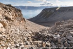
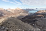
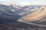
Some photos from Dickson Land, illustrating mainly the kind of impressions you might get during long summer hiking tours.
- gallery anchor link: #gallery_1875
Click on thumbnail to open an enlarged version of the specific photo.
Gallery Petuniabukta
And finally some pictures from beautiful Petuniabukta, the northernmost part of Billefjord:
- gallery anchor link: #gallery_1878
Click on thumbnail to open an enlarged version of the specific photo.
BOOKS, CALENDAR, POSTCARDS AND MORE
This and other publishing products of the Spitsbergen publishing house in the Spitsbergen-Shop.
last modification: 2020-10-15 ·
copyright: Rolf Stange

