


-
current
recommendations- Liefdefjord
New page dedicated to one of Spitsbergen's most beautiful fjords. Background information and many photos.

- New Spitsbergen guidebook
The new edition of my Spitsbergen guidebook is out and available now!
- Liefdefjord
New page dedicated to one of Spitsbergen's most beautiful fjords. Background information and many photos.
-
weather information

| Guidebook: Spitsbergen-Svalbard |
Home
→ * Photos, Panoramas, Videos and Webcams
→ Spitsbergen Panoramas
→ Straumsland & Heleysund
Straumsland and Heleysund
Panorama of tundra, coastal landscape and strong currents on Spitsbergen's east side
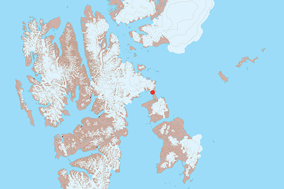
Straumsland and Heleysund are near Spitsbergen’s easternmost point.
Heleysund is a sound that separates Barentsøya at her northernmost end from the eastern part of Spitsbergen. Please refer to the info page about Heleysund and Straumsland for more geographical information and more photos.
Here we have got some panorama images to illustrate the beauty of Straumsland, on the north side of Heleysund.
Straumsland: Tundra, wetlands and hills
We start our hike with a crossing of Straumsland. The inland consists largely of wide, shallow depressions. These are mostly filled with wetlands that are not that easy to cross. It is important to find a proper place for a crossing where you can cross without much difficulty and without damaging a lot of vegetation. Wet tundra is very vulnerable!
- pano anchor link: #180813a_Straumsland_149HDR
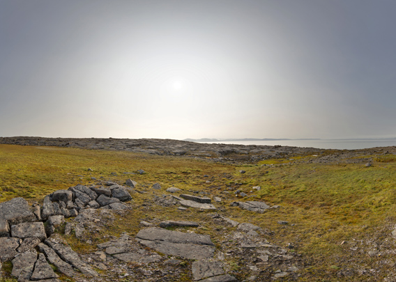
Other than that, there are some wide tundra areas in Straumsland. There are Spitsbergen reindeer and arctic foxes in these areas, and occasionally polar bears. There are many birds, like different geese and ducks and smaller tundra birds like the snow bunting. I have also seen the pretty rare Sabine’s gull here and even Whooper swans, which occur only as quite rare vagrants in Spitsbergen!
- pano anchor link: #180813a_Straumsland_059HDR

Next to the wetlands, there are low hills of dolerite, a rock similar to basalt. This is the kind of rock that makes up the bedrock in the whole area of Straumsland and Heleysund, including the northern tip of Barentsøya. On these hills, the surface is dry and the vegetation is comparatively poor. Lichens are more prominent here.
Straumsland: Newtonvika
- pano anchor link: #180813a_Straumsland_086HDR

On the east side of Straumsland, there is the little bay of Newtonvika. Unfortunately, it is very shallow, only the smallest boats could possibly anchor here.
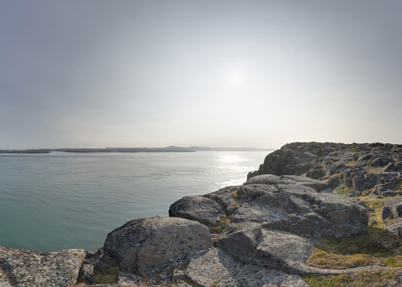
Straumsland: Heleysund
- pano anchor link: #180813a_Straumsland_178HDR

The most scenic part of Straumsland is arguably the south coast, that is forming a steep cliff towards Heleysund. From the top of the cliff, we have a view over all the neighbouring waters, from Ginevrabotnen, as the northeastern part of Storfjord is called, and to Barentsøya in the south (under the sun, it is mid-day) with her wide plateau-shaped hills and rolling tundra areas. To the north (left in the picture) of Barentsøya, there are Heleysund and Ormholet, separated by Kükenthaløya and some smaller islands.
- pano anchor link: #180813a_Straumsland_200HDR
The perspective on the landscape is changing while we are following the top of the cliff for a while.
- pano anchor link: #180813a_Straumsland_224HDR
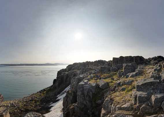
Again and again we find different, but always stunning large columns of dolerite rocks, which give the scenery a bit of a wild west character. Black guillemots are breeding in some places on the cliffs, and Glaucous gulls have their nests on top of some of the columns.
- pano anchor link: #180813a_Straumsland_245HDR

It is pure scenic pleasure to hike in this landscape for hours on a sunny days like this. Depending on the tides, the current can be very strong in Heleysund, and it can be amazing to watch that for a while, especially when there are some pieces of glacier ice drifting with the current.
BOOKS, CALENDAR, POSTCARDS AND MORE
This and other publishing products of the Spitsbergen publishing house in the Spitsbergen-Shop.
-

Norwegens arktischer Norden (1): Spitzbergen
Photobook: Norway's arctic islands. The text in this book is German. [shop url="https://shop.spitzbergen.de/en/polar-books/70-norwegens-arktischer-norden-1-aerial-arctic-9783937903262.html"] ← BackOrder now -
Norwegens arktischer Norden (2): Aerial Arctic
Lofoten, Jan Mayen and Spitsbergen from the air - Photobook: Norway's arctic islands. The text in this book is German, but there is very little text, so I am sure that you will enjoy it regardless which languages you read (or not).Order now -
Poster “Svalbardhytter”
The poster "Svalbardhytter" (70 x 100 cm) visualizes the diversity of Spitsbergen's huts in a range of arctic landscapes.Order now -
Book “Svalbardhytter”
The companion book for the Svalbardhytter poster. The poster visualises the diversity of Spitsbergen‘s huts and their stories in a range of Arctic landscapes. The book tells the stories of the huts in three languages.Order now -
Spitsbergen – Svalbard. The complete guidebook
Comprehensive guidebook about Spitsbergen. Background (wildlife, plants, geology, history etc.), practical information including travelling seasons, how to travel, description of settlements, routes and regions.Order now -
Rocks and Ice. Landscapes of the North
A geographical traveling accompaniment to Spitsbergen and East Greenland (68-74°N). This is the English edition of the German book "Steine und Eis".Order now -
East Greenland in Winter
Join an exciting journey with dog, skis and tent through the wintery wastes of East Greenland! We were five guys and a dog when we started in Ittoqqortoormiit, the northernmost one of two settlements on Greenland’s east coast.Order now -
Postcard set Spitsbergen (Svalbard)
12 Spitsbergen postcards in a beautifully designed tray. Individually numbered limited edition!Order now -
Limited edition postcard set Antarctica
12 postcards which come in a beautifully designed tray. Beautiful images from South Georgia across Antarctica from the Antarctic Peninsula to the Ross Sea and up to Macquarie Island and Campbell Island.Order now
last modification: 2024-12-12 ·
copyright: Rolf Stange


-
Books, Calendar, Postcards and more

-


