


-
current
recommendations- Liefdefjord
New page dedicated to one of Spitsbergen's most beautiful fjords. Background information and many photos.

- New Spitsbergen guidebook
The new edition of my Spitsbergen guidebook is out and available now!
- Liefdefjord
New page dedicated to one of Spitsbergen's most beautiful fjords. Background information and many photos.
-
weather information

| Guidebook: Spitsbergen-Svalbard |
Home
→ * Photos, Panoramas, Videos and Webcams
→ Spitsbergen Panoramas
→ Midterhukhamna
Midterhukhamna
Panorama of a perl of arctic nature in Bellsund
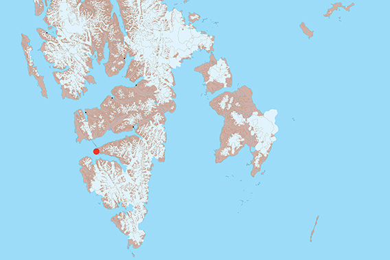
Midterhukhamna is located in the middle of Bellsund.
Midterhukhamna is a small bay on the south side of Midterhukfjellet, in the centre of Bellsund. That is the reason the mountain and the bay are called that, the word ‘midter’ refers to their position ‘in the middle’ (of the Bellsund area).
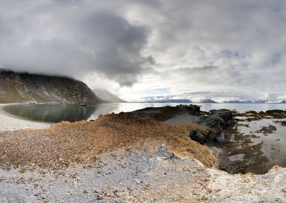
The bay is well protected from the wind and waves from the west, something that whalers, Pomors and trappers appreciated. They all left their mark on Midterhukhamna and the surrounding area.
But that’s not the subject here, that’s a topic for another page. The pictures on this page show Midterhukhamna as a small paradise of nature, starting with the coastal landscape with a view of the beach on the east side, where the whaling station (17th century) was and the trapper’s hut from 1898 still stands.
- pano anchor link: #a5v_Midterhukhamna_30Juli14_001
The next two panoramic views show the wave-cut platform on the south side of Midterhukhamna. It’s hard to imagine the force of the surf that has smashed this flat area into the solid rock, but in a storm from the west there is nothing between this shore and the open North Atlantic to slow down the force of the waves.
- pano anchor link: #a5v_Midterhukhamna_30Juli14_156
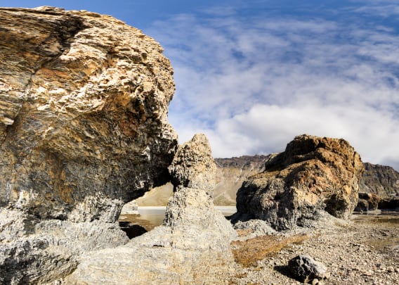
The wave-cut plastform at low tide.
- pano anchor link: #a5v_Midterhukhamna_30Juli14_200

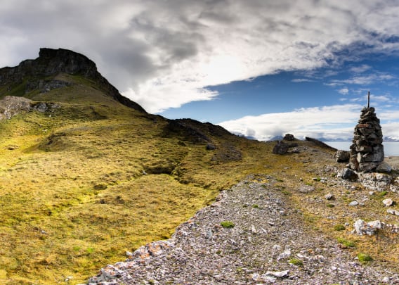
Finally, a trip to the west side of Midterhuksletta, as the plain that stretches around the mountain Midterhukfjellet is called. A long time ago, some expedition built a cairn on the ridge, a pile of stones that served as a landmark, probably as a survey point. From here you have a wonderful panoramic view over the entire Bellsund.
- pano anchor link: #a5v_Midterhukhamna_30Juli14_098
Midterhukhamna – Photo gallery
And finally, a few more impressions of Midterhukhamna. The focus is on the striking wave-cut platform and the tundra of Midterhuksletta, the ‘flat’ land to the south and west of Midterhukfjell, with the rocks, flowers, tundra …
The small hut you see several times is a trapper’s hut that was built in 2014, making it the youngest hunting hut/trapper’s hut in Svalbard. It belongs to a Norwegian hunter who uses the hunting grounds in Bellsund from the main hut Akseløya and Kapp Schollin (Fridtjovhamna).
- gallery anchor link: #gallery_3462
Click on thumbnail to open an enlarged version of the specific photo.


BOOKS, CALENDAR, POSTCARDS AND MORE
This and other publishing products of the Spitsbergen publishing house in the Spitsbergen-Shop.
-

Norwegens arktischer Norden (1): Spitzbergen
Photobook: Norway's arctic islands. The text in this book is German. [shop url="https://shop.spitzbergen.de/en/polar-books/70-norwegens-arktischer-norden-1-aerial-arctic-9783937903262.html"] ← BackOrder now -
Norwegens arktischer Norden (2): Aerial Arctic
Lofoten, Jan Mayen and Spitsbergen from the air - Photobook: Norway's arctic islands. The text in this book is German, but there is very little text, so I am sure that you will enjoy it regardless which languages you read (or not).Order now -
Poster “Svalbardhytter”
The poster "Svalbardhytter" (70 x 100 cm) visualizes the diversity of Spitsbergen's huts in a range of arctic landscapes.Order now -
Book “Svalbardhytter”
The companion book for the Svalbardhytter poster. The poster visualises the diversity of Spitsbergen‘s huts and their stories in a range of Arctic landscapes. The book tells the stories of the huts in three languages.Order now -
Spitsbergen – Svalbard. The complete guidebook
Comprehensive guidebook about Spitsbergen. Background (wildlife, plants, geology, history etc.), practical information including travelling seasons, how to travel, description of settlements, routes and regions.Order now -
Rocks and Ice. Landscapes of the North
A geographical traveling accompaniment to Spitsbergen and East Greenland (68-74°N). This is the English edition of the German book "Steine und Eis".Order now -
East Greenland in Winter
Join an exciting journey with dog, skis and tent through the wintery wastes of East Greenland! We were five guys and a dog when we started in Ittoqqortoormiit, the northernmost one of two settlements on Greenland’s east coast.Order now -
Postcard set Spitsbergen (Svalbard)
12 Spitsbergen postcards in a beautifully designed tray. Individually numbered limited edition!Order now -
Limited edition postcard set Antarctica
12 postcards which come in a beautifully designed tray. Beautiful images from South Georgia across Antarctica from the Antarctic Peninsula to the Ross Sea and up to Macquarie Island and Campbell Island.Order now
last modification: 2024-12-21 ·
copyright: Rolf Stange


-
Books, Calendar, Postcards and more

-


