-
current
recommendations- Liefdefjord
New page dedicated to one of Spitsbergen's most beautiful fjords. Background information and many photos.

- New Spitsbergen guidebook
The new edition of my Spitsbergen guidebook is out and available now!

- Liefdefjord
New page dedicated to one of Spitsbergen's most beautiful fjords. Background information and many photos.
Page Structure
-
Spitsbergen-News
- Select Month
- June 2025
- May 2025
- April 2025
- March 2025
- February 2025
- January 2025
- December 2024
- November 2024
- October 2024
- September 2024
- August 2024
- July 2024
- June 2024
- May 2024
- April 2024
- March 2024
- February 2024
- January 2024
- December 2023
- November 2023
- October 2023
- September 2023
- August 2023
- July 2023
- June 2023
- May 2023
- April 2023
- March 2023
- February 2023
- January 2023
- December 2022
- November 2022
- October 2022
- September 2022
- August 2022
- July 2022
- June 2022
- May 2022
- April 2022
- March 2022
- February 2022
- January 2022
- December 2021
- November 2021
- October 2021
- September 2021
- August 2021
- July 2021
- June 2021
- May 2021
- April 2021
- March 2021
- February 2021
- January 2021
- December 2020
- November 2020
- October 2020
- September 2020
- August 2020
- July 2020
- June 2020
- May 2020
- April 2020
- March 2020
- February 2020
- January 2020
- December 2019
- November 2019
- October 2019
- September 2019
- August 2019
- July 2019
- June 2019
- May 2019
- April 2019
- March 2019
- February 2019
- January 2019
- December 2018
- November 2018
- October 2018
- September 2018
- August 2018
- July 2018
- June 2018
- May 2018
- April 2018
- March 2018
- February 2018
- January 2018
- December 2017
- November 2017
- October 2017
- September 2017
- August 2017
- July 2017
- June 2017
- May 2017
- April 2017
- March 2017
- February 2017
- January 2017
- December 2016
- November 2016
- October 2016
- September 2016
- August 2016
- July 2016
- June 2016
- May 2016
- April 2016
- March 2016
- February 2016
- January 2016
- December 2015
- November 2015
- October 2015
- September 2015
- August 2015
- July 2015
- June 2015
- May 2015
- April 2015
- March 2015
- February 2015
- January 2015
- December 2014
- November 2014
- October 2014
- September 2014
- August 2014
- July 2014
- June 2014
- May 2014
- April 2014
- March 2014
- February 2014
- January 2014
- December 2013
- November 2013
- October 2013
- September 2013
- August 2013
- July 2013
- June 2013
- May 2013
- April 2013
- March 2013
- February 2013
- January 2013
- December 2012
- November 2012
- October 2012
- September 2012
- August 2012
- July 2012
- June 2012
- May 2012
- April 2012
- March 2012
- February 2012
- January 2012
- December 2011
- November 2011
- October 2011
- September 2011
- August 2011
- May 2011
- April 2011
- March 2011
- February 2011
- January 2011
- December 2010
- November 2010
- September 2010
- August 2010
- July 2010
- June 2010
- May 2010
- April 2010
- March 2010
- February 2010
- November 2009
- October 2009
- August 2009
- July 2009
- June 2009
- May 2009
- April 2009
- March 2009
- February 2009
- January 2009
- December 2008
- November 2008
- October 2008
- August 2008
- July 2008
- June 2008
- May 2008
- April 2008
- March 2008
- February 2008
- April 2000
- Select Month
-
weather information
-
Newsletter

| Guidebook: Spitsbergen-Svalbard |
Home
→ * Photos, Panoramas, Videos and Webcams
→ Spitsbergen Panoramas
→ Tunheim, Siloodden
Tunheim, Siloodden
Panoramas
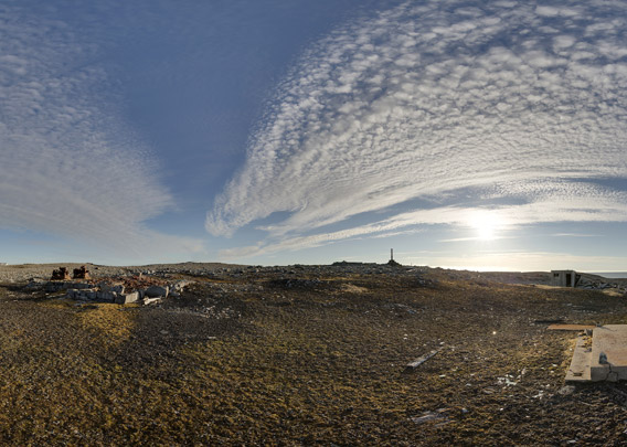
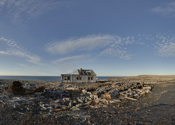
The old mining place Tunheim is situated near the northeastern coast of Bear Island (Bjørnøya). The sea is however inaccessible from the land (and vice versa), because the coast is a vertical cliff more than 10 meters high. The land around Tunheim is a vast stone desert of sharp boulders with a striking absence of vegetation. The underlying bedrock is Carboniferous and Devonian sandstone containing several coal seams, which are easily seen on the coast. The lower seams date back to the Devonian and are thus amongst the oldest on the planet: this was the time when plant life just started to conquer dry land sufficiently to enable accumulations of organic matter big enough to be turned into coal later on.
Tunheim
- pano anchor link: #Tunheim_06Juni13_178
Geological investigations seemed to indicated boundless geological treasures, and mining started accordingly in 1916. The logistical challenges such as the distance to Norway and the difficult harbour situation required investments exceeding expectations. The owners of the Norwegian company were soon facing a difficult economic situation. The Norwegian government, interested in not letting foreign interests achieve control over infrastructure and land claims in Spitsbergen in the years around the Spitsbergen Treaty (signed in 1920), stepped in with credits, payments for deliveries of coal that was yet to be mined and the acquisition of shares. Finally, further geological investigations showed in 1925 that the occurrence was much smaller than previously believed. The cessation of all activities followed immediately. Only the weather station, then located in Tunheim, was kept for another while until it was finally moved to its recent position at Herwighamna on the north coast.
Tunheim
- pano anchor link: #Tunheim_06Juni13_225
- pano anchor link: #Tunheim_06Juni13_283
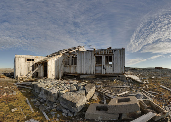
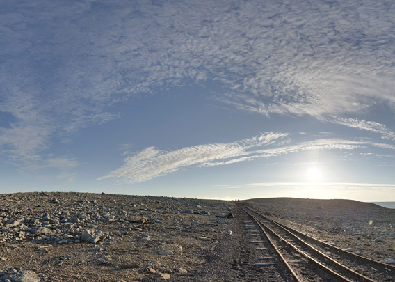
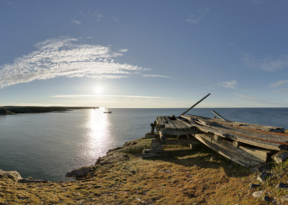
Since 1925, the buildings in Tunheim are falling apart. Many consist only of foundations or ruins, few are still standing. The small railway track that connected Tunheim to the shipping facility at Siloodden to the north is rosting away. Two old locomotivs are still standing at the southern end of the track, but in a rather sad condition. Little auks breed between the rocks around Tunheim, and polar foxes roam between the buildings.
Siloodden
- pano anchor link: #Tunheim_06Juni13_300
- pano anchor link: #Tunheim_06Juni13_318
This is the old coal shipping facility at Siloodden, directly south of the bay Austervåg, where our ship (Antigua) is anchored.
Tunheim is an interesting destination for excursions for the weather station members, the distance is just a few kilometers. Tourists visit Tunheim only rarely, as both landing conditions (only at Austervåg further north) and walking on shore are anything but comfortable. A visit is nevertheless a very interesting experience for those lucky enough to make it there. The spirit of history is unmistakable and strong. Photographers with a sense for the unusual will find a playground with endless opportunities and artistic challenges. Little auks, seabirds breeding on the cliff coast and the chance to see the Arctic fox can make a visit to Tunheim an interesting nature experience. The landscape is so barren that this is quite impressive in itself. In fog, which is frequent during the summer months, it is not a place to be for those with a tendency to moods of sadness, but it is a very typical Bear Island impression. In clear weather, Miseryfjellet provides a scenic background in the south that is as characteristic for Bear Island as anything can be.
- pano anchor link: #Tunheim_06Juni13_247
BOOKS, CALENDAR, POSTCARDS AND MORE
This and other publishing products of the Spitsbergen publishing house in the Spitsbergen-Shop.
last modification: 2018-05-16 ·
copyright: Rolf Stange
