


-
current
recommendations- Liefdefjord
New page dedicated to one of Spitsbergen's most beautiful fjords. Background information and many photos.

- New Spitsbergen guidebook
The new edition of my Spitsbergen guidebook is out and available now!
- Liefdefjord
New page dedicated to one of Spitsbergen's most beautiful fjords. Background information and many photos.
-
weather information

| Guidebook: Spitsbergen-Svalbard |
Von Otterøya
Photos and 360° panoramas of the third-largest island in Hinlopen Strait
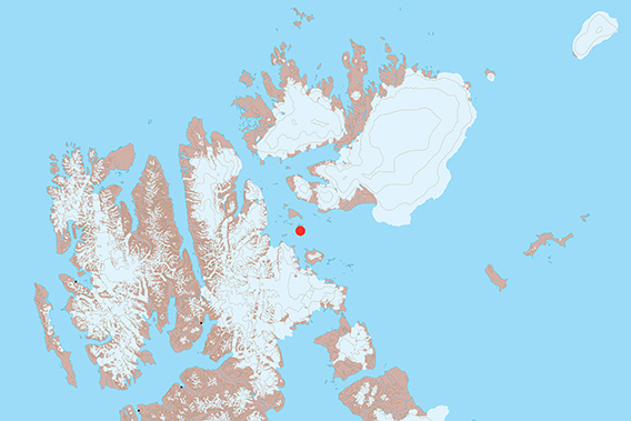
Von Otterøya in located in the centre of Hinlopen Strait.
Von Otterøya is the third-largest one out of the many islands in Hinlopen Strait. There are two which are even larger, Wilhelmøya and Wahlbergøya, which differ markedly in geology and landscape from Von Otterøya and all the smaller islands in the area. Von Otterøya and the smaller ones are almost entirely composed of dolerite, a magmatic rock type that cooled down as an intrusion well below the surface of the earth. So it was not a surface volcano. The columnar structure of the dolerite is not as perfectly well developed as that of classical basalt, a related magmatic rock-type. But it is visible also in doleritic cliffs.
- pano anchor link: #180812a_Von-Otteroya_076HDR

As the smaller islands are all composed of dolerite, they are mostly quite similar in terms of scenery and geomorphology. They are mostly quite rocky, with coarse blocks, low hills and small cliffs.
- pano anchor link: #180812a_Von-Otteroya_095HDR

There are no great heights. The highest hill on Von Otterøya does not reach beyond 76 metres above sea level. All the smaller islands are even lower. The maximum distance from coast to coast on Von Otterøya is a good 8 km, and it is actually often less than 2 km in many places and directions.
- pano anchor link: #180812a_Von-Otteroya_114HDR
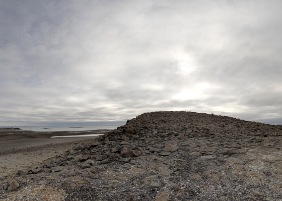
The landscape is very barren, there are only a few flowers. But the lichen flora is often impressive and gives rock surfaces a rather coloured appearance.
- pano anchor link: #180812a_Von-Otteroya_133HDR
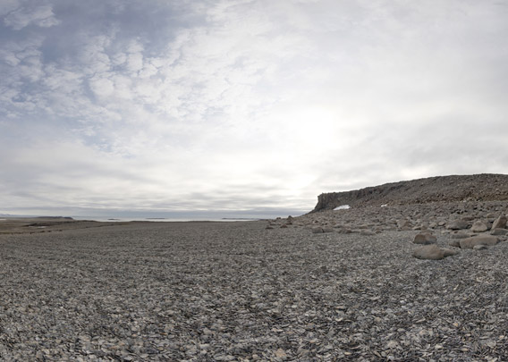
Level surfaces often have well-developed series of fossil beach ridges, and you can find remains of old whalebones in many places inland.
- pano anchor link: #180812a_Von-Otteroya_152HDR

Von Otterøya does not have much of human history beyond occasional visits by expeditions such as the Swedish section of the Arc-de-Meridian expedition (1899-1902).
- pano anchor link: #180812a_Von-Otteroya_234HDR
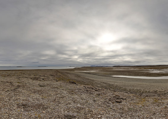
Photo gallery: Von Otterøya
Some images from the northern part of Von Otterøya. I find the many old whalebones, geomorphological witnesses of postglacial glacio-isostatic land uplift, very impressive.
- gallery anchor link: #gallery_2576
Click on thumbnail to open an enlarged version of the specific photo.


BOOKS, CALENDAR, POSTCARDS AND MORE
This and other publishing products of the Spitsbergen publishing house in the Spitsbergen-Shop.
-

Norwegens arktischer Norden (1): Spitzbergen
Photobook: Norway's arctic islands. The text in this book is German. [shop url="https://shop.spitzbergen.de/en/polar-books/70-norwegens-arktischer-norden-1-aerial-arctic-9783937903262.html"] ← BackOrder now -
Norwegens arktischer Norden (2): Aerial Arctic
Lofoten, Jan Mayen and Spitsbergen from the air - Photobook: Norway's arctic islands. The text in this book is German, but there is very little text, so I am sure that you will enjoy it regardless which languages you read (or not).Order now -
Poster “Svalbardhytter”
The poster "Svalbardhytter" (70 x 100 cm) visualizes the diversity of Spitsbergen's huts in a range of arctic landscapes.Order now -
Book “Svalbardhytter”
The companion book for the Svalbardhytter poster. The poster visualises the diversity of Spitsbergen‘s huts and their stories in a range of Arctic landscapes. The book tells the stories of the huts in three languages.Order now -
Spitsbergen – Svalbard. The complete guidebook
Comprehensive guidebook about Spitsbergen. Background (wildlife, plants, geology, history etc.), practical information including travelling seasons, how to travel, description of settlements, routes and regions.Order now -
Rocks and Ice. Landscapes of the North
A geographical traveling accompaniment to Spitsbergen and East Greenland (68-74°N). This is the English edition of the German book "Steine und Eis".Order now -
East Greenland in Winter
Join an exciting journey with dog, skis and tent through the wintery wastes of East Greenland! We were five guys and a dog when we started in Ittoqqortoormiit, the northernmost one of two settlements on Greenland’s east coast.Order now -
Postcard set Spitsbergen (Svalbard)
12 Spitsbergen postcards in a beautifully designed tray. Individually numbered limited edition!Order now -
Limited edition postcard set Antarctica
12 postcards which come in a beautifully designed tray. Beautiful images from South Georgia across Antarctica from the Antarctic Peninsula to the Ross Sea and up to Macquarie Island and Campbell Island.Order now
last modification: 2022-11-20 ·
copyright: Rolf Stange


-
Books, Calendar, Postcards and more

-


