


-
current
recommendations- Liefdefjord
New page dedicated to one of Spitsbergen's most beautiful fjords. Background information and many photos.

- New Spitsbergen guidebook
The new edition of my Spitsbergen guidebook is out and available now!
- Liefdefjord
New page dedicated to one of Spitsbergen's most beautiful fjords. Background information and many photos.
-
weather information

| Guidebook: Spitsbergen-Svalbard |
Spitsbergen 21-28 September 2008
On board S/V Noorderlicht
Noorderlicht with Rainbow

Triplog Spitsbergen 2008/09/21-28 pdf-file, size ca. 4 MB. Text, photos, layout, map: Rolf Stange. Copyright.
noorderlicht spitsbergen (gallery)
- gallery anchor link: #gallery_58
Click on thumbnail to open an enlarged version of the specific photo.


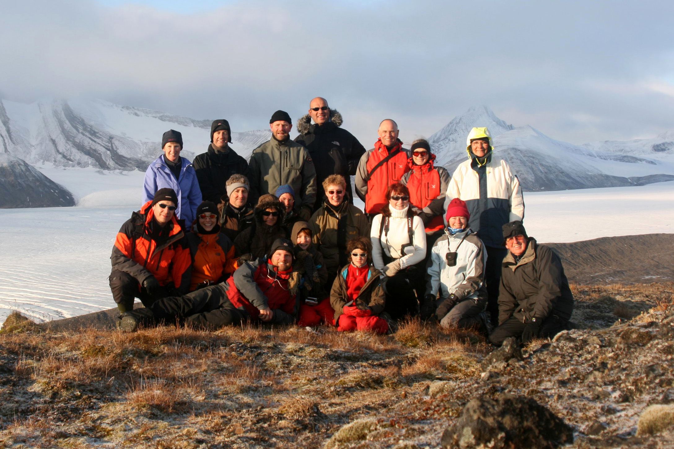
Group photo

Group photo – Fridtjovbreen, 24 September 2008 (Download large image file)

Norwegian ice chart – 19 September 2008 (© Norwegian Meteorological Institute)
Sunrise and sunset times:
| Date | Position | Latitude | Longitude | Sunrise (UTM-1 = Ortszeit) | Sunset (UTM-1 = Ortszeit) |
| 09/21 | Longyearbyen | 78°14' | 15°37' | 06.14 | 19.27 |
| 09/22 | Skansbukta | 78°31' | 16°01' | 06.19 | 19.18 |
| 09/23 | Midterhukhamna | 77°38' | 14°46' | 06.33 | 19.13 |
| 09/24 | Fridtjovhamna | 77°45' | 14°36' | 06.40 | 19.07 |
| 09/25 | Recherchefjord | 77°30' | 14°34' | 06.47 | 18.59 |
| 09/26 | Farmhamna | 78°20' | 12°50' | 07.01 | 18.59 |
| 09/27 | Barentsburg | 78°03' | 12°50' | 07.02 | 18.46 |
| 09/28 | Longyearbyen | 78°14' | 15°37' | 07.04 | 18.32 |
Map

BOOKS, CALENDAR, POSTCARDS AND MORE
This and other publishing products of the Spitsbergen publishing house in the Spitsbergen-Shop.
-

Norwegens arktischer Norden (1): Spitzbergen
Photobook: Norway's arctic islands. The text in this book is German. [shop url="https://shop.spitzbergen.de/en/polar-books/70-norwegens-arktischer-norden-1-aerial-arctic-9783937903262.html"] ← BackOrder now -
Norwegens arktischer Norden (2): Aerial Arctic
Lofoten, Jan Mayen and Spitsbergen from the air - Photobook: Norway's arctic islands. The text in this book is German, but there is very little text, so I am sure that you will enjoy it regardless which languages you read (or not).Order now -
Poster “Svalbardhytter”
The poster "Svalbardhytter" (70 x 100 cm) visualizes the diversity of Spitsbergen's huts in a range of arctic landscapes.Order now -
Book “Svalbardhytter”
The companion book for the Svalbardhytter poster. The poster visualises the diversity of Spitsbergen‘s huts and their stories in a range of Arctic landscapes. The book tells the stories of the huts in three languages.Order now -
Spitsbergen – Svalbard. The complete guidebook
Comprehensive guidebook about Spitsbergen. Background (wildlife, plants, geology, history etc.), practical information including travelling seasons, how to travel, description of settlements, routes and regions.Order now -
Rocks and Ice. Landscapes of the North
A geographical traveling accompaniment to Spitsbergen and East Greenland (68-74°N). This is the English edition of the German book "Steine und Eis".Order now -
East Greenland in Winter
Join an exciting journey with dog, skis and tent through the wintery wastes of East Greenland! We were five guys and a dog when we started in Ittoqqortoormiit, the northernmost one of two settlements on Greenland’s east coast.Order now -
Postcard set Spitsbergen (Svalbard)
12 Spitsbergen postcards in a beautifully designed tray. Individually numbered limited edition!Order now -
Limited edition postcard set Antarctica
12 postcards which come in a beautifully designed tray. Beautiful images from South Georgia across Antarctica from the Antarctic Peninsula to the Ross Sea and up to Macquarie Island and Campbell Island.Order now
last modification: 2013-10-14 ·
copyright: Rolf Stange


-
Books, Calendar, Postcards and more

-


