-
current
recommendations- Liefdefjord
New page dedicated to one of Spitsbergen's most beautiful fjords. Background information and many photos.
- New Spitsbergen guidebook
The new edition of my Spitsbergen guidebook is out and available now!
- Liefdefjord
New page dedicated to one of Spitsbergen's most beautiful fjords. Background information and many photos.
Page Structure
-
Spitsbergen-News
- Select Month
- June 2025
- May 2025
- April 2025
- March 2025
- February 2025
- January 2025
- December 2024
- November 2024
- October 2024
- September 2024
- August 2024
- July 2024
- June 2024
- May 2024
- April 2024
- March 2024
- February 2024
- January 2024
- December 2023
- November 2023
- October 2023
- September 2023
- August 2023
- July 2023
- June 2023
- May 2023
- April 2023
- March 2023
- February 2023
- January 2023
- December 2022
- November 2022
- October 2022
- September 2022
- August 2022
- July 2022
- June 2022
- May 2022
- April 2022
- March 2022
- February 2022
- January 2022
- December 2021
- November 2021
- October 2021
- September 2021
- August 2021
- July 2021
- June 2021
- May 2021
- April 2021
- March 2021
- February 2021
- January 2021
- December 2020
- November 2020
- October 2020
- September 2020
- August 2020
- July 2020
- June 2020
- May 2020
- April 2020
- March 2020
- February 2020
- January 2020
- December 2019
- November 2019
- October 2019
- September 2019
- August 2019
- July 2019
- June 2019
- May 2019
- April 2019
- March 2019
- February 2019
- January 2019
- December 2018
- November 2018
- October 2018
- September 2018
- August 2018
- July 2018
- June 2018
- May 2018
- April 2018
- March 2018
- February 2018
- January 2018
- December 2017
- November 2017
- October 2017
- September 2017
- August 2017
- July 2017
- June 2017
- May 2017
- April 2017
- March 2017
- February 2017
- January 2017
- December 2016
- November 2016
- October 2016
- September 2016
- August 2016
- July 2016
- June 2016
- May 2016
- April 2016
- March 2016
- February 2016
- January 2016
- December 2015
- November 2015
- October 2015
- September 2015
- August 2015
- July 2015
- June 2015
- May 2015
- April 2015
- March 2015
- February 2015
- January 2015
- December 2014
- November 2014
- October 2014
- September 2014
- August 2014
- July 2014
- June 2014
- May 2014
- April 2014
- March 2014
- February 2014
- January 2014
- December 2013
- November 2013
- October 2013
- September 2013
- August 2013
- July 2013
- June 2013
- May 2013
- April 2013
- March 2013
- February 2013
- January 2013
- December 2012
- November 2012
- October 2012
- September 2012
- August 2012
- July 2012
- June 2012
- May 2012
- April 2012
- March 2012
- February 2012
- January 2012
- December 2011
- November 2011
- October 2011
- September 2011
- August 2011
- May 2011
- April 2011
- March 2011
- February 2011
- January 2011
- December 2010
- November 2010
- September 2010
- August 2010
- July 2010
- June 2010
- May 2010
- April 2010
- March 2010
- February 2010
- November 2009
- October 2009
- August 2009
- July 2009
- June 2009
- May 2009
- April 2009
- March 2009
- February 2009
- January 2009
- December 2008
- November 2008
- October 2008
- August 2008
- July 2008
- June 2008
- May 2008
- April 2008
- March 2008
- February 2008
- April 2000
- Select Month
-
weather information
-
Newsletter

| Guidebook: Spitsbergen-Svalbard |
Home
→ * Photos, Panoramas, Videos and Webcams
→ Spitsbergen Panoramas
→ The Sveagruva area
→ Lunckefjellet
Lunckefjellet
360° panoramas and the story of the mine that was never worked
The Lunckefjellet-mine is part of the coal mining system of Sveagruva, the Norwegian mining settlement in Van Mijenfjord, southeast of Longyearbyen.
Map Lunckefjellet
The Lunckefjellet-mine was to be the last Norwegian coal mine in Spitsbergen. Proper investigations with the purpose of potential mining started around 2005. Outcrops were documented and drillings were done in a large number of sites to map the coal seam properly.
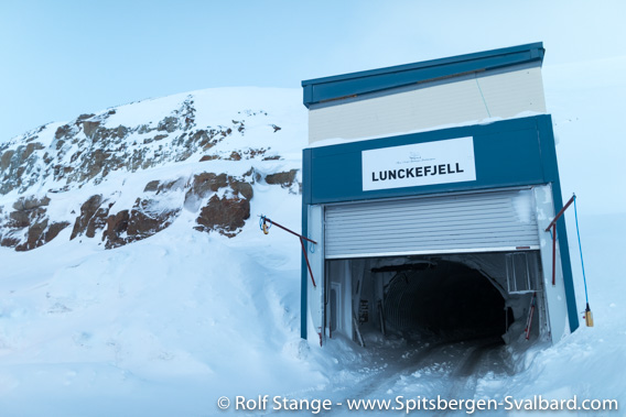
Mine entrance at Lunckefjellet.
The mine was getting ready in 2013 and in the autumn of that year it was supposed to be handed over to the miners of Store Norske Spitsbergen Kulkompani (SNSK) to start regular production of coal. But this was not to happen for economical reasons. The first miners had to be dismissed in 2013, and the coal prices on the world markets remained at a level too low to allow profitable production of coal.
Initially, the mine was set in stand-by mode to keep it ready in case of rising coal prices, but in late 2017 the Norwegian government as the owner of the SNSK made the decision to abandon the Lunckefjellet mine and Sveagruva altogether. The mines, infrastructure and the whole settlement will largely be removed as far as possible. Only those buildings and artefacts considered historically important will remain and probably a few buildings for future use within science and possible tourism.
Road over Marthabreen
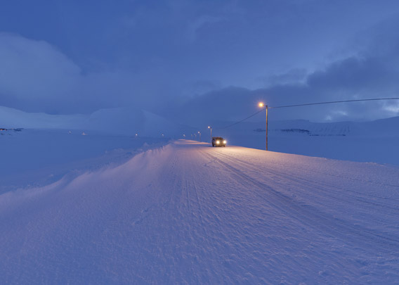
It is “only” 12 kilometres from Sveagruva to Lunckefjellet, but that is not just any 12 kilometres over proper public roads. The trip starts with 9 kilometres through the main tunnel of the older mine Svea Nord until you see the light of day again on the northern side of the mountain Gruvhjelmen (“Mine helmet”) – unless it is polar night, then it remains dark … next is a 3 kilometre road over the glacier Marthabreen – almost a real, proper, winterproof road and even with street lights! This road was the only “regular” connection between the Lunckefjellet mine and the outside world – or, at least, Sveagruva. This would have been the transport way of the coal, first by lorry and then by conveyor belt through Svea Nord.
- pano anchor link: #190206f_Marthabreen_01HDR-Pano
Day facilities Lunckefjellet
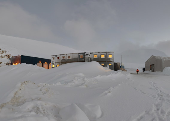
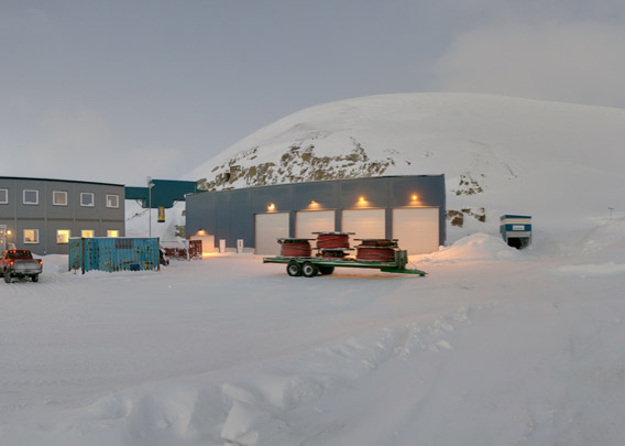
After the trip across the glacier you get to the day facilities of the Lunckefjellet mine, situated about 650 m above sea level on the south side of the mountain.
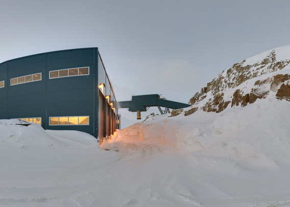
There is a large conveyor system on the mountain wall to transport coal from the mine to the lorries waiting to take it over the glacier.
- pano anchor link: #190206e_Lunckefjellet_60HDR-Pano
A lot of effort was taken to create enough space for several large storage halls and a building that houses the mine office and common rooms for the miners.
- pano anchor link: #190206e_Lunckefjellet_79HDR-Pano
Now we are about to enter the mountain. The sign with the proud inscription “Store Norske Spitsbergen Grubekompani Lunckefjellet” was removed in February 2019.
- pano anchor link: #190206e_Lunckefjellet_01HDR-Pano
The sign had its final public appearance – and probably its first one at the same time, Lunckefjellet was never a public place – in early March 2019 during the “Spitsbergen Revue”, a satirical show in Longyearbyen and part of a series of events to celebrate the return of the sun. The Spitsbergen Revue picks up issues of public interest in Spitsbergen during the year that has passed. The fate of the Lunckefjellet mine was obviously one of the things that have caught everybodies attention in Longyearbyen.
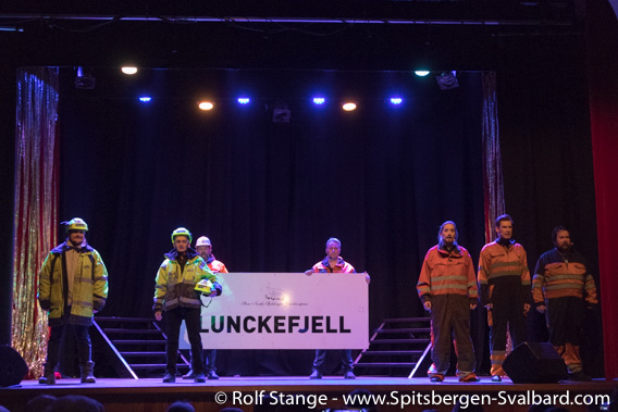
The sign from the mine entrance at Lunckefjellet during the Spitsbergen Revue on 01 March 2019 in Longyearbyen.
Entering Lunckefjellet
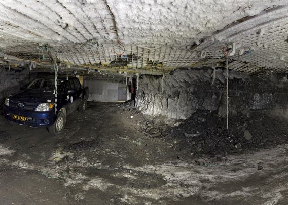
Now we are entering the actual mine with strong all terrain vehicles. The tunnels are just high enough.
Here we are at “tverrslag” (smaller cross tunnel) 4 in tunnel BT4B.
- pano anchor link: #190206g_Lunckefjellet-Loc04_068HDR-Pano
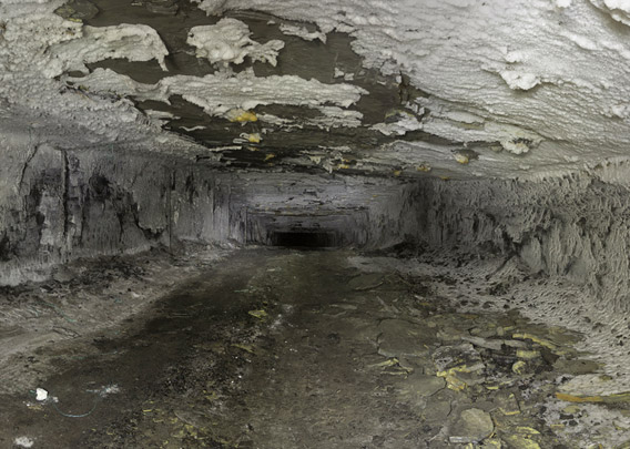
The coal seam and thus also the tunnels are more or less horizontal, with minor adjustments to the geological structure and technical requirements leading to just a little bit of up and down as you can see in the next panorama. But you are staying in one almost constant level. There is no going down over hundreds of metres as in many other mines elsewhere in the world.
- pano anchor link: #190206g_Lunckefjellet-Loc04_001HDR-Pano
Science and fossils
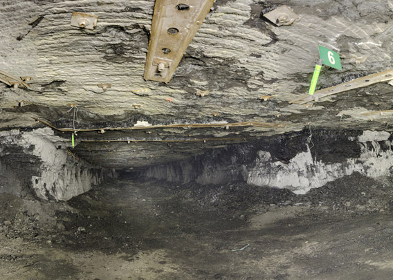
At cross tunnel (tverrslag) 6 in tunnel BT4A, we have reached the furthest part of our little tour in Lunckefjellet. The tunnel does not go much further in. Most of the Lunckefjellet mine was never built and exists just on paper.
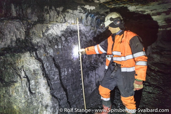
Geologist Malte Jochmann at work in the Lunckefjellet mine in February 2019, shortly before the mine was closed.
These photos and panoramas were shot during a working visit of geologists to take samples for research purposes just before the mine was closed. In this place, the geologists found a cross-section of a tree in the roof that was so well preserved that even the year rings could still be seen.
- pano anchor link: #190206d_Lunckefjellet-Loc03_14HDR-Pano
The last panorama of this collection was taken in position BT2A tverrslag 9. We found beautiful fossils of plants in the roof just a few metres from here.
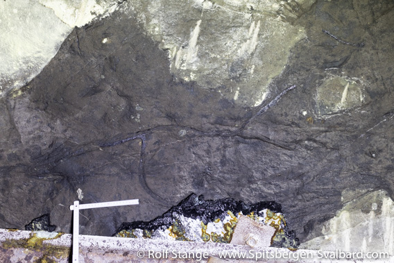
Plant fossils (roots?) in the roof. Folding rule for scale.
- pano anchor link: #190207b_Lunckefjellet-Loc05b_19HDR-Pano
The scientists took maybe 400 kg of coal samples during the two days we spent in Lunckefjellet. As the mine never entered productive operation, the production costs per ton of coal, actually spent on those few bits that ever left the mountain can well be assumed to be on a record-breaking level.

Geologists Malte Jochmann, Christopher Marshall and Maria Jensen together with photographer Rolf Stange in Lunckefjellet, February 2019.
To page: → The Sveagruva area → Sveagruva (settlement) → Svea Nord → Lunckefjellet → Kapp Amsterdam
BOOKS, CALENDAR, POSTCARDS AND MORE
This and other publishing products of the Spitsbergen publishing house in the Spitsbergen-Shop.
last modification: 2020-01-29 ·
copyright: Rolf Stange
