-
current
recommendations- Liefdefjord
New page dedicated to one of Spitsbergen's most beautiful fjords. Background information and many photos.
- New Spitsbergen guidebook
The new edition of my Spitsbergen guidebook is out and available now!
- Liefdefjord
New page dedicated to one of Spitsbergen's most beautiful fjords. Background information and many photos.
Page Structure
-
Spitsbergen-News
- Select Month
- May 2025
- April 2025
- March 2025
- February 2025
- January 2025
- December 2024
- November 2024
- October 2024
- September 2024
- August 2024
- July 2024
- June 2024
- May 2024
- April 2024
- March 2024
- February 2024
- January 2024
- December 2023
- November 2023
- October 2023
- September 2023
- August 2023
- July 2023
- June 2023
- May 2023
- April 2023
- March 2023
- February 2023
- January 2023
- December 2022
- November 2022
- October 2022
- September 2022
- August 2022
- July 2022
- June 2022
- May 2022
- April 2022
- March 2022
- February 2022
- January 2022
- December 2021
- November 2021
- October 2021
- September 2021
- August 2021
- July 2021
- June 2021
- May 2021
- April 2021
- March 2021
- February 2021
- January 2021
- December 2020
- November 2020
- October 2020
- September 2020
- August 2020
- July 2020
- June 2020
- May 2020
- April 2020
- March 2020
- February 2020
- January 2020
- December 2019
- November 2019
- October 2019
- September 2019
- August 2019
- July 2019
- June 2019
- May 2019
- April 2019
- March 2019
- February 2019
- January 2019
- December 2018
- November 2018
- October 2018
- September 2018
- August 2018
- July 2018
- June 2018
- May 2018
- April 2018
- March 2018
- February 2018
- January 2018
- December 2017
- November 2017
- October 2017
- September 2017
- August 2017
- July 2017
- June 2017
- May 2017
- April 2017
- March 2017
- February 2017
- January 2017
- December 2016
- November 2016
- October 2016
- September 2016
- August 2016
- July 2016
- June 2016
- May 2016
- April 2016
- March 2016
- February 2016
- January 2016
- December 2015
- November 2015
- October 2015
- September 2015
- August 2015
- July 2015
- June 2015
- May 2015
- April 2015
- March 2015
- February 2015
- January 2015
- December 2014
- November 2014
- October 2014
- September 2014
- August 2014
- July 2014
- June 2014
- May 2014
- April 2014
- March 2014
- February 2014
- January 2014
- December 2013
- November 2013
- October 2013
- September 2013
- August 2013
- July 2013
- June 2013
- May 2013
- April 2013
- March 2013
- February 2013
- January 2013
- December 2012
- November 2012
- October 2012
- September 2012
- August 2012
- July 2012
- June 2012
- May 2012
- April 2012
- March 2012
- February 2012
- January 2012
- December 2011
- November 2011
- October 2011
- September 2011
- August 2011
- May 2011
- April 2011
- March 2011
- February 2011
- January 2011
- December 2010
- November 2010
- September 2010
- August 2010
- July 2010
- June 2010
- May 2010
- April 2010
- March 2010
- February 2010
- November 2009
- October 2009
- August 2009
- July 2009
- June 2009
- May 2009
- April 2009
- March 2009
- February 2009
- January 2009
- December 2008
- November 2008
- October 2008
- August 2008
- July 2008
- June 2008
- May 2008
- April 2008
- March 2008
- February 2008
- April 2000
- Select Month
-
weather information
-
Newsletter

| Guidebook: Spitsbergen-Svalbard |
Home →
Daily Archives: 19. June 2017 − News & Stories
Jan Mayen – Eldste Metten – Schmelckdalen – 19th June 2017
Mon
19 Jun
2017
I spend a day watching the camp to make sure no tent is flying away as the weather has changed a bit. This is not quite unnecessary, as it turns out. There is a chance for a little walk in Kvalrossbukta while wind and rain are taking a break. Meanwhile, the others make a visit to the station, where they get a very friendly welcome.
On the next day, the Beerenberg-climbers start their long trip. Matthias, Wolfgang and Magnus will manage to climb up and back down again within 18 hours. Congratulations! Well done! Including the three of them, a good 60 people have come over the years with SY Aurora to Jan Mayen and climbed Beerenberg. Since 2010 (new laws with a ban on landing and camping near Beerenberg), three groups have managed to reach the top, the first of them in 2015. Additionally, there are more or less annual ascents by members of the Norwegian station.
Meanwhile, skipper Vidar, who took care of the boat during the windy weather yesterday, and I have a chance to say hello on the station and to make some short, but fine walks, before I venture on a second, longer trip. This time, I want to explore the area around Eldste Metten, near Beerenberg, but on the south side of Jan Mayen (the shape and orientation of the island can make these terms a bit confusing).
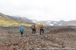
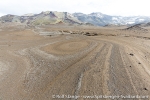
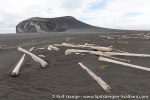
While the north side of Mid Jan and the area around the northern lagoon, just a few kilometres away from this area here, around Eggøya and Eldste Metten, are hills and plains green of mosses and lichens, here it is very barren. A lava desert, sand and rocks, like the high interiour of Iceland. Almost nothing is growing here. The soil has fascinating, roughly circular, structures and bizarre sinkholes. The latter are slightly spooky, just deep holes that can open anywhere here, probably above collapsing lava caves.
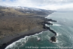
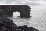
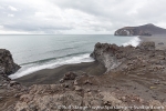
I want to have a look at the rugged coastline, where this bizarre landscape meets the sea. The heavy surf has created a wild coastline with many little bays and capes, caves and rocks. Guillemots and puffins are breeding in many places on small cliffs, and some glaucous gulls have their homes on small elevations.
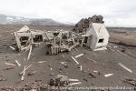
Only some scattered remains are left of „Eldste Metten“, the first weather station on Jan Mayen. The Norwegians had indeed chosen a hostile place! At least, they could get radio contact with Norway from there, and that was important. I take some time to look around. Wind and sand have carved fascinating surfaces and structures in glass and wood over almost a century.
South of Eldste Metten, there is Jamesonbukta, a wide, black sand beach, where the surf is always going high. On the way there, I happen to find a little memorial on a rock for the whaling captains William Scoresby, senior and junior. They did not only hunt whales, but they made a lot of scientific observations and discovery during their journey in the first half of the 19th century. When he was on Jan Mayen, Scoresby junior found out that Eggøya was an island, hence the name („egg island“). Today, Eggøya is firmly connected to the rest of Jan Mayen.
There are still ruins of one or two lookout posts from the war on Eggøya, and soon, there is also a lot of wind. I eat quite a bit of dust while I make my way across the sandy plain from Eggøya to Beerenberg, getting away from that exposed and inhospitable area before the wind is getting even stronger.
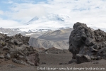
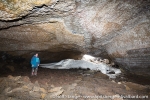
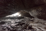
My next destination is Schmelckdalen on the foot of Beerenberg. Schmelckdalen is actually not a valley, but a lava flow that solidified when it reached the lowest slopes. It comes out of a valley higher up, but that is hard to see now in the clouds. There are some lava caves supposed to be in that area, and I am quite curious about them. Lava caves are remains of lava flows where the outer layer cooled down and became solid, while the inner part kept moving. If it all flew out, then a cave was the result. They can come in all shapes and sizes.
There are several of them in Schmelckdalen. Some are very small, you have to bend down and watch out for rocks both around your head and your feet. Others are large enough to stand in them or even bigger. There are fascinating structures left by the flowing movement of the liquid lava everywhere!
It is not easy to photograph this alien world properly. Wind and fog do not make i easie either. On top of it all comes the bizarre feeling to be inside Beerenberg! But this is not a place where I would want to spend more time then necessary. Earthquakes are rare, but they may occur. The last stronger on was this spring. An earthquake would not be a great thing while you are in a lava cave, or in any other cave, for that sake. It is a fascinating place, but I do not intend to become a caveman.
The fog is coming down to sea level now in the middle part of the island (Mid Jan), and this does not make the long way back to Kvalrossbukta more interesting. The long and boring road. It may be about 12-13 km from Schmelckdalen to Kvalrossbukta. My feet love it! It will take them a couple of years to get rid of some smaller souvenirs from all these hikes. But the impressions and memories will last much, much longer, and they are worth every single step!
Gallery – Jan Mayen – Eldste Metten – Schmelckdalen – 19th June 2017
- gallery anchor link: #gallery_1165
Click on thumbnail to open an enlarged version of the specific photo.
News-Listing live generated at 2025/May/11 at 09:52:50 Uhr (GMT+1)
