


-
current
recommendations- Liefdefjord
New page dedicated to one of Spitsbergen's most beautiful fjords. Background information and many photos.

- New Spitsbergen guidebook
The new edition of my Spitsbergen guidebook is out and available now!
- Liefdefjord
New page dedicated to one of Spitsbergen's most beautiful fjords. Background information and many photos.
-
weather information

| Guidebook: Spitsbergen-Svalbard |
Home → * News and Stories → 17 companies searching for oil in new area in the eastern Barents Sea
17 companies searching for oil in new area in the eastern Barents Sea
The exact position of the border between Russia and Norway in the Barents Sea has been determined in a treaty between the two countries as late as in 2010. Norway has recently opened a new area, as large as Switzerland, for exploration. On Tuesday, no less than 17 international companies have announced that they want to engage in exploration in the new area in 2014. These are BP, Chevron, ConocoPhillips , Eni, Royal Dutch Shell, Lukoil, Idemitsu, Repsol, Det norske, Wintershall, Suncor, VNG, PGNiG , Spike, Statoil, GDF Suez and Lundin Petroleum.
The U.S. Geological Survey estimates the potential near 90 million barrel. Exploration is scheduled to start in April 2014. The Norwegian oil ministry has already carried out some first exploration work.
It is safe to assume that environmental aspects will not keep the Norwegian authorities from giving out licenses for exploration, which includes seismic surveys with explosives, and for exploitation. (side note: it is easier to close some more areas for tourists and then pretend you have done something for the environment there).
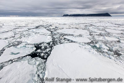
Drift ice in the Barents Sea.
Source: Financial Post
BOOKS, CALENDAR, POSTCARDS AND MORE
This and other publishing products of the Spitsbergen publishing house in the Spitsbergen-Shop.
-

Norwegens arktischer Norden (1): Spitzbergen
Photobook: Norway's arctic islands. The text in this book is German. [shop url="https://shop.spitzbergen.de/en/polar-books/70-norwegens-arktischer-norden-1-aerial-arctic-9783937903262.html"] ← BackOrder now -
Norwegens arktischer Norden (2): Aerial Arctic
Lofoten, Jan Mayen and Spitsbergen from the air - Photobook: Norway's arctic islands. The text in this book is German, but there is very little text, so I am sure that you will enjoy it regardless which languages you read (or not).Order now -
Poster “Svalbardhytter”
The poster "Svalbardhytter" (70 x 100 cm) visualizes the diversity of Spitsbergen's huts in a range of arctic landscapes.Order now -
Book “Svalbardhytter”
The companion book for the Svalbardhytter poster. The poster visualises the diversity of Spitsbergen‘s huts and their stories in a range of Arctic landscapes. The book tells the stories of the huts in three languages.Order now -
Spitsbergen – Svalbard. The complete guidebook
Comprehensive guidebook about Spitsbergen. Background (wildlife, plants, geology, history etc.), practical information including travelling seasons, how to travel, description of settlements, routes and regions.Order now -
Rocks and Ice. Landscapes of the North
A geographical traveling accompaniment to Spitsbergen and East Greenland (68-74°N). This is the English edition of the German book "Steine und Eis".Order now -
East Greenland in Winter
Join an exciting journey with dog, skis and tent through the wintery wastes of East Greenland! We were five guys and a dog when we started in Ittoqqortoormiit, the northernmost one of two settlements on Greenland’s east coast.Order now -
Postcard set Spitsbergen (Svalbard)
12 Spitsbergen postcards in a beautifully designed tray. Individually numbered limited edition!Order now -
Limited edition postcard set Antarctica
12 postcards which come in a beautifully designed tray. Beautiful images from South Georgia across Antarctica from the Antarctic Peninsula to the Ross Sea and up to Macquarie Island and Campbell Island.Order now
last modification: 2014-07-01 ·
copyright: Rolf Stange


-
Books, Calendar, Postcards and more

-


