-
current
recommendations- Liefdefjord
New page dedicated to one of Spitsbergen's most beautiful fjords. Background information and many photos.
- New Spitsbergen guidebook
The new edition of my Spitsbergen guidebook is out and available now!
- Liefdefjord
New page dedicated to one of Spitsbergen's most beautiful fjords. Background information and many photos.
Page Structure
-
Spitsbergen-News
- Select Month
- June 2025
- May 2025
- April 2025
- March 2025
- February 2025
- January 2025
- December 2024
- November 2024
- October 2024
- September 2024
- August 2024
- July 2024
- June 2024
- May 2024
- April 2024
- March 2024
- February 2024
- January 2024
- December 2023
- November 2023
- October 2023
- September 2023
- August 2023
- July 2023
- June 2023
- May 2023
- April 2023
- March 2023
- February 2023
- January 2023
- December 2022
- November 2022
- October 2022
- September 2022
- August 2022
- July 2022
- June 2022
- May 2022
- April 2022
- March 2022
- February 2022
- January 2022
- December 2021
- November 2021
- October 2021
- September 2021
- August 2021
- July 2021
- June 2021
- May 2021
- April 2021
- March 2021
- February 2021
- January 2021
- December 2020
- November 2020
- October 2020
- September 2020
- August 2020
- July 2020
- June 2020
- May 2020
- April 2020
- March 2020
- February 2020
- January 2020
- December 2019
- November 2019
- October 2019
- September 2019
- August 2019
- July 2019
- June 2019
- May 2019
- April 2019
- March 2019
- February 2019
- January 2019
- December 2018
- November 2018
- October 2018
- September 2018
- August 2018
- July 2018
- June 2018
- May 2018
- April 2018
- March 2018
- February 2018
- January 2018
- December 2017
- November 2017
- October 2017
- September 2017
- August 2017
- July 2017
- June 2017
- May 2017
- April 2017
- March 2017
- February 2017
- January 2017
- December 2016
- November 2016
- October 2016
- September 2016
- August 2016
- July 2016
- June 2016
- May 2016
- April 2016
- March 2016
- February 2016
- January 2016
- December 2015
- November 2015
- October 2015
- September 2015
- August 2015
- July 2015
- June 2015
- May 2015
- April 2015
- March 2015
- February 2015
- January 2015
- December 2014
- November 2014
- October 2014
- September 2014
- August 2014
- July 2014
- June 2014
- May 2014
- April 2014
- March 2014
- February 2014
- January 2014
- December 2013
- November 2013
- October 2013
- September 2013
- August 2013
- July 2013
- June 2013
- May 2013
- April 2013
- March 2013
- February 2013
- January 2013
- December 2012
- November 2012
- October 2012
- September 2012
- August 2012
- July 2012
- June 2012
- May 2012
- April 2012
- March 2012
- February 2012
- January 2012
- December 2011
- November 2011
- October 2011
- September 2011
- August 2011
- May 2011
- April 2011
- March 2011
- February 2011
- January 2011
- December 2010
- November 2010
- September 2010
- August 2010
- July 2010
- June 2010
- May 2010
- April 2010
- March 2010
- February 2010
- November 2009
- October 2009
- August 2009
- July 2009
- June 2009
- May 2009
- April 2009
- March 2009
- February 2009
- January 2009
- December 2008
- November 2008
- October 2008
- August 2008
- July 2008
- June 2008
- May 2008
- April 2008
- March 2008
- February 2008
- April 2000
- Select Month
-
weather information
-
Newsletter

| Guidebook: Spitsbergen-Svalbard |
Home → Arctic blog: Jan Mayen, Spitsbergen → The tour to Sør Jan – 17th-19th June 2016
The tour to Sør Jan – 17th-19th June 2016
Fri
17 Jun
2016
The sun is shining and the wind is blowing somewhere else today. So we do not waste much time but get ready for some longer hikes. Most of us aim for the north, to Beerenberg and its surroundings, the northern lagoon, Maria Muschbukta, Eggøya and so on.
I opt for a different way and take the route to the south. I know Nord Jan quite well, have seen a lot there already, while in the south, my mental map still has a lot of white gaps and my photo archive needs some serious completing. So something has to be done over there, for sure! The opportunity is good.
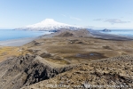
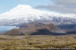
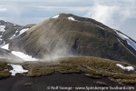
So while the majority is heading northwards – three of them will make an efficient, successful dash to the top of Beerenberg – I am going to the south. The view over the backbone of Mid Jan to Beerenberg, which is more and more getting out of the clouds, showing its amazing splendor in full sun, could not be more overwhelming. To the south, Sør Jan is stretching out with its confusing arrangement of hills and craters.
Gallery 1 – The tour to Sør Jan – 17th-19th June 2016
- gallery anchor link: #gallery_934
Click on thumbnail to open an enlarged version of the specific photo.
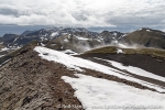
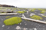
The deep, soft mosses, which are growing on large areas here, the unprecise map, the volcanic terrain which is often lacking geomorphological logic, all this contributes to the demanding expedition charakter that any longer hiking on Jan Mayen will quickly have. Another factor contributing to this is the almost constant, latent lack of water: soon after the snow melt, the few little streams are falling dry. There are only a few little lakes. So you have to rely largely on snow fields, which means: no water without a stove to melt snow. During the day, there is usually no more drink than what you carry with you. On this trip, as on previous, similar ones, I quickly greet thirst as hunger’s big, evil brother. While stumbling over dry lava fields for kilometres, I was thinking of novels that I could write about thirst. Thirst soon dominates not only my mouth, but also my brain. The idea of a lively spring is paradise, a beer worth its own weight in gold.
All this certainly far from any real danger, but there is this omnipresent, at times rather uncomfortable lack of liquid. At any time I have the next snow field in view, my planning is according to kilometres in the terrain and litres of water in my rucksack.
Yet another factor making life more difficult than necessary are the legal regulations in force since 2010. Making life difficult for those few still passionated (and stubborn) enough to travel here is the purpose of these rules, I guess. Camping in the field is forbidden as is any landing (or pickup) outside of Kvalrossbukta or the station area. Despite sea conditions being as calm as they might ever get, a quick lift or pickup by boat, technically very easy, logistically convenient and very safe, is not an option. Instead, there are all these kilometres on the long and boring road to the north or south from Kvalrossbukta, to the places we are longing for. Well, a lot has been said about the sense (or, rather, nonsense) of this legislation. Enough for now.
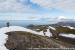
So these are the frame conditions which you have to be prepared for when hiking on Jan Mayen. Quite exactly as the trip to the top of Beerenberg, my tour amounts to a good 60 km over land and quite a lot of altitude, although the vertical metres are not concentrated on one prominent peak, but happen on many smaller hills and slopes. There are dozens of them.
The short crossing of the island from upper Trolldalen takes me to Sjuhollendarbukta. This was the site of the famous wintering of the seven Dutch whalers in 1633-34, not Kvalrossbukta, at least according to the Austrian expedition from 1882-83 (First International Polar Year). The name of the bay, which translates as Seven Dutchmen Bay, is another reference to the winterers who made it through the dark time just to die from scurvy weeks before the relief ships came.
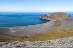
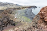
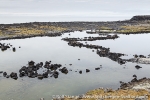
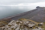
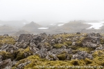
We will probably never now for sure where exactly this tragic adventure took place. Today, Sjuhollendarbukta is a lovely, beautiful bay with a wide beach of black volcanic sand, framed in by the odd-shaped rocks of wide-stretching, moss covered lava fields.
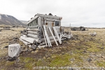
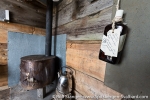
Something similar can be said about Titeltbukta, which was another important place for the Dutch whalers. Again, nothing is left of their „10 houses“ (ten tents = ti telt). All that reminds of longer-lasting human presence is a small, but charmful trappers’ hut which has withstood the wind now for more than a century.
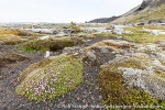
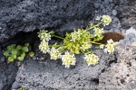
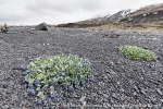
Oysterplant, rare in Spitsbergen, is colouring the black sand in many places, and the rich colours of the mosses and lichens in the lava fields are amazing.
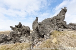
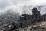
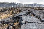
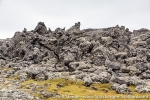
And yes, the lava fields. If Jan Mayen does not have her own legends and myths about elves and trolls, then it is just because the island has not been inhabited for more than a 1000 years such as neighbouring Iceland. Of course, there are goblins and dwarves living here, and countless other creatures that prefer the darkness above the sun! Just as the well-known giants with the strong sun allergy, which react to direct sunlight by immediately and completely turning to stone. One of these trolls just wanted to show me the way, as it hit him.
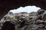
Unbelievable what else was around here: turtles, warriors, castles and towers, giant worms and knights … everything you could think of and more than that. Today, there are all silent statues of sharp-edged lava rock, secretly watching the lonely wanderer who might occasionally cross their realm.
Gallery 2 – The tour to Sør Jan – 17th-19th June 2016
- gallery anchor link: #gallery_935
Click on thumbnail to open an enlarged version of the specific photo.
But even so, I am not on my own. Myriads of Little auks are breeding in the lava fields. Numbers and densities over large areas that can certainly compete with the better-known, big colonies in Spitsbergen. Constant screaming and crazy laughter, everlasting hectic activity in the air while big swarms are heading to and fro. In more flat terrain, skuas and arctic skuas defend their territories with aggressive passion against any intruder. In Guineabukta, Common eiders are calling from a coastal lagoon. They have their nests hidden in the lava fields.
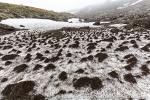
At Jan Mayen’s southwestern end, there is some lowland called Kraterflya. The name is descriptive: several nice craters and cinder cones are spread over the lowland, including Richterkrater, which is better known than many of his relatives, for reasons that are not obvious. Not that he would look any different than many other smaller kraters on Jan Mayen. Neither can it have to do with the ice wedges that decorate the steep, moss-covered slopes with geometrical patterns. Even though they are less common than, say, in Spitsbergen, this is not the only place on Jan Mayen where you can find them. Maybe it is just because it is so nicely located close to the shore, making those who pass by on a ship think: what a nice crater, I just have to visit you one day! Well, at least I have thought this more than once, and now the door has opened a bit, time and weather are on my side.
So now I am here.
Someone has called the lowland between Guineabukta and Richterkrater Helheimen, home of hell. It is not quite that bad, but not without reason, as yet another especially mean lava field is located here, giving hiking shoes and walking muscles a hard time. Be careful! No false step is allowed, a broken leg would be so much worse here than most other places in the world.
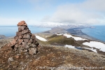
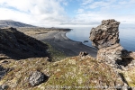
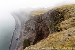
Then I am standing on the rim of Richterkrater, enjoying the views over bizarre lava flows and several craters in the surroundings and the fact that I have now come to another place that had been on my wishlist for a long time. My feet remind me that this pleasure comes at a price, but before I start returning to the north, I walk up to the steep cliffs at the southern point of Jan Mayen. Vertical, rugged cliffs, where countless Glaucous gulls and Fulmars are screaming, while keeping a watchful eye on me. Sharp rocks stick like knives out of the cliffs and the coast, former volcanic intrusions. Fog is rolling in from the east, as if to tell me: this is where you wanted to come, this is where I allowed you to come, but no further. This is it.
I agree and turn back. The way to Kvalrossbukta is still more than long enough.
Gallery 3 – The tour to Sør Jan – 17th-19th June 2016
- gallery anchor link: #gallery_936
Click on thumbnail to open an enlarged version of the specific photo.
BOOKS, CALENDAR, POSTCARDS AND MORE
This and other publishing products of the Spitsbergen publishing house in the Spitsbergen-Shop.
last modification: 2016-08-12 ·
copyright: Rolf Stange

