


-
current
recommendations- Liefdefjord
New page dedicated to one of Spitsbergen's most beautiful fjords. Background information and many photos.

- New Spitsbergen guidebook
The new edition of my Spitsbergen guidebook is out and available now!
- Liefdefjord
New page dedicated to one of Spitsbergen's most beautiful fjords. Background information and many photos.
-
weather information

| Guidebook: Spitsbergen-Svalbard |
Home
→ * Triplogs with photo galleries
→ Arctic 2013
→ Revneset, De Geerdalen, Fridtjovbreen, Colesbukt
Revneset, De Geerdalen, Fridtjovbreen, Colesbukt
April 2013
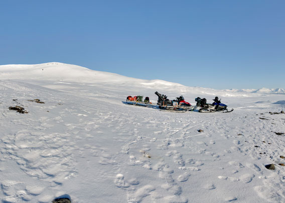
Back to the surroundings of Longyearbyen: Revneset, Advent City and De Geerdalen. Followed by a long day trip to Fridtjovbreen and Colesbukta.
Revneset, De Geerdalen (gallery)
- gallery anchor link: #gallery_354
Click on thumbnail to open an enlarged version of the specific photo.


Revneset
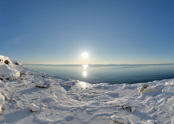
View from Revneset on the north side of Adventfjord over the whole outer and central Isfjord on a beautiful spring evening. 1/2
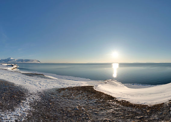
View from Revneset on the north side of Adventfjord over the whole outer and central Isfjord on a beautiful spring evening. 2/2
Advent City

In Advent City, on the north side of Adventfjord opposite the airport, an attempt was made to mine coal in the early 20th century by an American company. The attempt was not successful, and not much remains to be seen today.

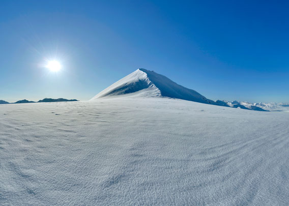
The mountain ridge Sarkofagen divides the valley Longyeardalen south of Longyearbyen in 2 branches, which are filled by the glaciers Longyearbreen and Larsbreen, respectively. From Sarkofagen, you have a great panorama view over Longyearbyen and its surroundings. 1/5

The mountain ridge Sarkofagen divides the valley Longyeardalen south of Longyearbyen in 2 branches, which are filled by the glaciers Longyearbreen and Larsbreen, respectively. From Sarkofagen, you have a great panorama view over Longyearbyen and its surroundings. 2/5

The mountain ridge Sarkofagen divides the valley Longyeardalen south of Longyearbyen in 2 branches, which are filled by the glaciers Longyearbreen and Larsbreen, respectively. From Sarkofagen, you have a great panorama view over Longyearbyen and its surroundings. 3/5
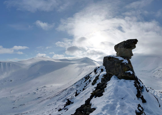
The mountain ridge Sarkofagen divides the valley Longyeardalen south of Longyearbyen in 2 branches, which are filled by the glaciers Longyearbreen and Larsbreen, respectively. From Sarkofagen, you have a great panorama view over Longyearbyen and its surroundings. 4/5

The mountain ridge Sarkofagen divides the valley Longyeardalen south of Longyearbyen in 2 branches, which are filled by the glaciers Longyearbreen and Larsbreen, respectively. From Sarkofagen, you have a great panorama view over Longyearbyen and its surroundings. 5/5
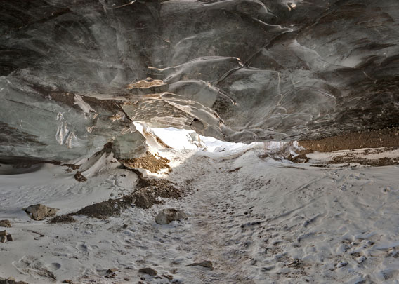
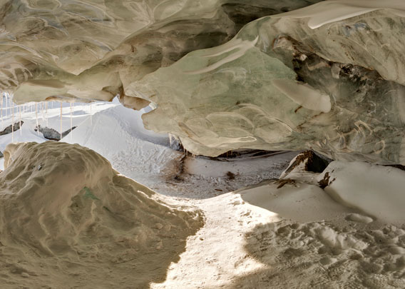
Tellbreen
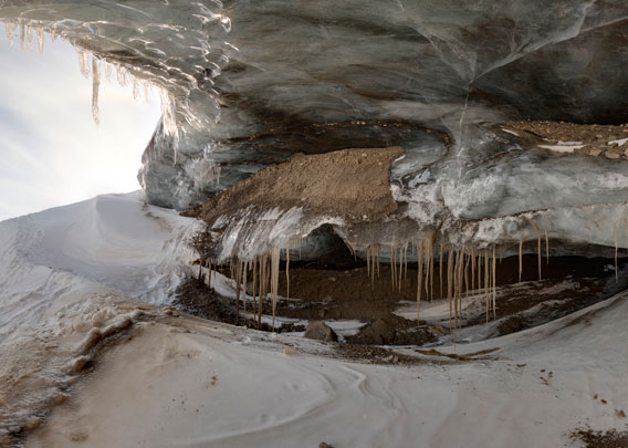
Tellbreen (-glacier) is one of many glaciers between Adventdalen and Sassenfjord. As many other glaciers, it has glacial caves: meltwater channels that fall dry during the winter. Some of them are easy to access and offer amazing insight into the interiour of a glacier. Care needs to be taken, however: these caves can obviously be extremely slippery and may suddenly drop down very steeply.

Hyperittfossen
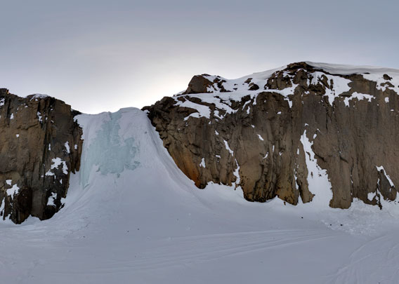
As the name suggests, Hyperittfossen is a waterfall cascading down over cliffs of basalt-like rocks. During the winter, the waterfall is frozen to a column of ice.
Colesdalen
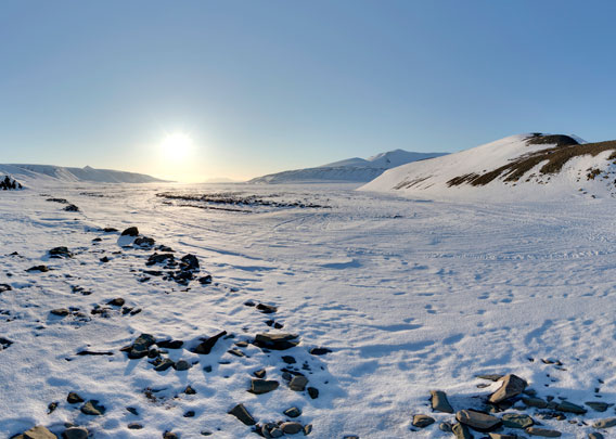
Colesdalen is an important „valley crossing“ in Nordenskiöld Land: no less than 6 valleys feed into Colesdalen. It is, for example, a regular part of the overland route between Longyearbyen and Barentsburg. In summer, it has one of the greenest and richest vegetation areas of Spitsbergen, with large tundra, wetland and swamp areas.
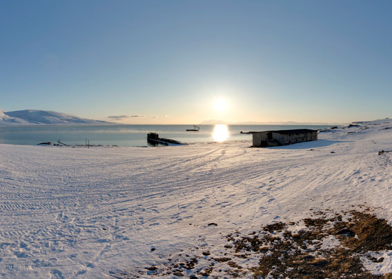
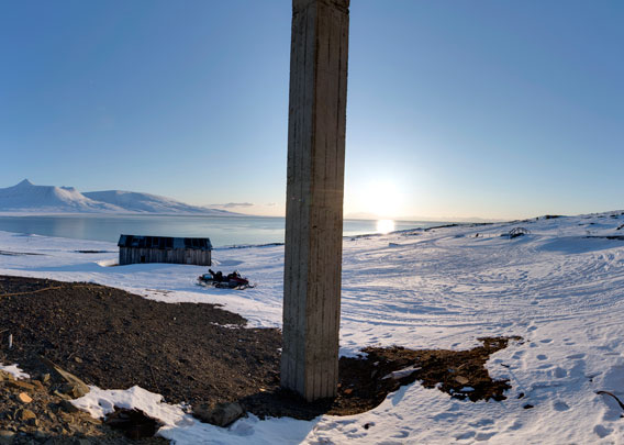
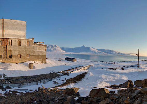
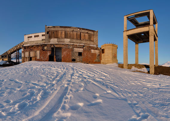
Colesbukta
Colesbukta was a small Russian settlement that was used until 1962 to ship coal that was mined in neighbouring Grumantbyen. Then, the mine was closed, for geological reasons, as they say. A few buildings and other remains can still be seen in both settlements (partly protected), the remains provide an interesting area to explore and to photograph. The area may see Russian mining activities again in the future, but a decision is not expected before 2015.


Semmeldalen

Semmeldalen is one of many ice-free valleys in central Nordenskiöld Land. South of it is the huge valley Reindalen and then Van Mijenfjord.
Tavlebreen

View from the pass south of Tavlebreen, south of Grøndalen (east of Grønfjord): typical scenery of Nordenskiöld Land with ice-free valleys, smaller glaciers and beautiful mountains.
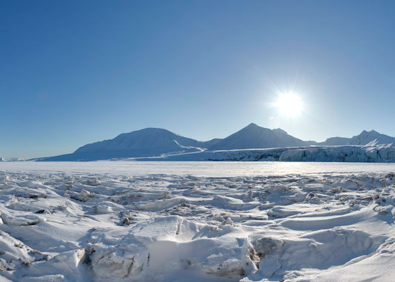
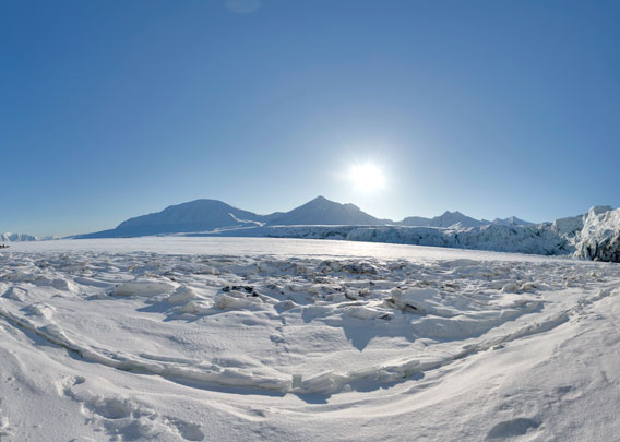
Fridtjovbreen
Upper Fridtjovbreen, not far from the pass that is leading to Austre Grønfjordbreen.
The bay Fridtjovhamna is usually frozen in winter. Fridtjovbreen is terminating here with its impressive calving cliff. The surrounding mountains are exceptionally beautiful.
BOOKS, CALENDAR, POSTCARDS AND MORE
This and other publishing products of the Spitsbergen publishing house in the Spitsbergen-Shop.
-

Norwegens arktischer Norden (1): Spitzbergen
Photobook: Norway's arctic islands. The text in this book is German. [shop url="https://shop.spitzbergen.de/en/polar-books/70-norwegens-arktischer-norden-1-aerial-arctic-9783937903262.html"] ← BackOrder now -
Norwegens arktischer Norden (2): Aerial Arctic
Lofoten, Jan Mayen and Spitsbergen from the air - Photobook: Norway's arctic islands. The text in this book is German, but there is very little text, so I am sure that you will enjoy it regardless which languages you read (or not).Order now -
Poster “Svalbardhytter”
The poster "Svalbardhytter" (70 x 100 cm) visualizes the diversity of Spitsbergen's huts in a range of arctic landscapes.Order now -
Book “Svalbardhytter”
The companion book for the Svalbardhytter poster. The poster visualises the diversity of Spitsbergen‘s huts and their stories in a range of Arctic landscapes. The book tells the stories of the huts in three languages.Order now -
Spitsbergen – Svalbard. The complete guidebook
Comprehensive guidebook about Spitsbergen. Background (wildlife, plants, geology, history etc.), practical information including travelling seasons, how to travel, description of settlements, routes and regions.Order now -
Rocks and Ice. Landscapes of the North
A geographical traveling accompaniment to Spitsbergen and East Greenland (68-74°N). This is the English edition of the German book "Steine und Eis".Order now -
East Greenland in Winter
Join an exciting journey with dog, skis and tent through the wintery wastes of East Greenland! We were five guys and a dog when we started in Ittoqqortoormiit, the northernmost one of two settlements on Greenland’s east coast.Order now -
Postcard set Spitsbergen (Svalbard)
12 Spitsbergen postcards in a beautifully designed tray. Individually numbered limited edition!Order now -
Limited edition postcard set Antarctica
12 postcards which come in a beautifully designed tray. Beautiful images from South Georgia across Antarctica from the Antarctic Peninsula to the Ross Sea and up to Macquarie Island and Campbell Island.Order now
last modification: 2013-12-27 ·
copyright: Rolf Stange


-
Books, Calendar, Postcards and more

-


