


-
current
recommendations- Liefdefjord
New page dedicated to one of Spitsbergen's most beautiful fjords. Background information and many photos.

- New Spitsbergen guidebook
The new edition of my Spitsbergen guidebook is out and available now!
- Liefdefjord
New page dedicated to one of Spitsbergen's most beautiful fjords. Background information and many photos.
-
weather information

| Guidebook: Spitsbergen-Svalbard |
Biskayarhuken: Panorama images, photos and background
Portrait of a peninsula on Spitsbergen's north coast
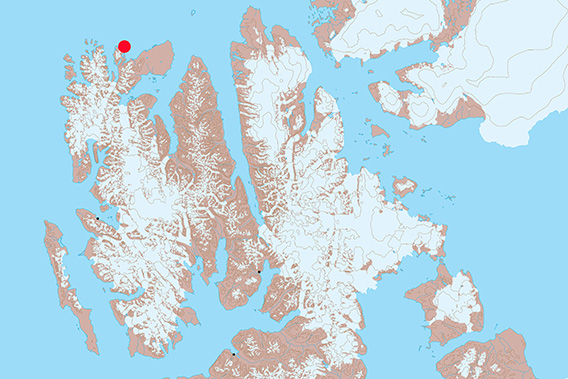
The little peninsula Biskayarhuken is located on the north coast of Spitsbergen,
east of Raudfjord.
Biskayarhuken is a point on the north coast of Spitsbergen, east of Raudfjord. The narrow peninsula is quite exposed and thus only accessible during calm weather and sea conditions.
It is, however, quite obvious that the sea isn’t always calm, especially when you consider that the bottleneck-like piece of land between the peninsula and the mainland was wide enough to cross it comfortably in the not too distant past in the 20th century. It won’t be long until ongoing coastal erosion will have made an island out of the current peninsula of Biskayarhuken.
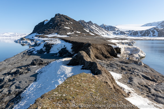
Connection between Biskayarhuken and the mainland, subject to marine erosion (2022).
As the name suggests, Biskayarhuken has got quite a bit of history. The earliest 17th century whalers had experienced Basques with them who served as whaling masters and teachers until those who came from the nations who sent the whaling ships up to Spitsbergen – mainly the Netherlands and England – had learnt the trade. There is a little graveyard and an individual grave, the latter one probably with a higher ranking individual, like a captain or a harpooner.
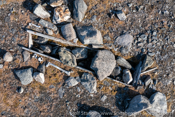
Whaler’s grave at Biskayarhuken.
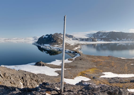
Biskayarhuken Panorama 1: Whaler’s graveyard and hut remains
- pano anchor link: #220602c_Biskayarhuken_115HDR-Pano
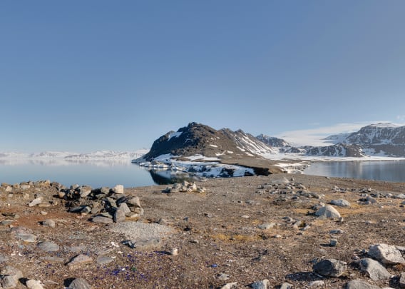
Near to the whaler’s graveyard, there are the remains of huts. There was a trapper hut, which was probably built in 1927 by Sven Olsson (“Stockholm Sven”, who also built, amongst others, the huts at Velkomstpynten in Woodfjord and Bruceneset in Raudfjord). In any case, the hut burnt down in 1959, an incident probably caused accidentally by British geologists. They built a new hut in 1961, but there is not much left but the foundations after this one either.

Cairn and view to the south.
Biskayarhuken Panorama 2: hill (south side)
- pano anchor link: #220602c_Biskayarhuken_097HDR-Pano
Close to the whalers’ graveyard, on its northeast side, there is a little hill. It is not higher than 41 metres above sea level, but the view is nevertheless stunning! Here we are on the southern end of the top of the hill …
Biskayarhuken Panorama 3: hill (north side)
- pano anchor link: #220602c_Biskayarhuken_079HDR-Pano
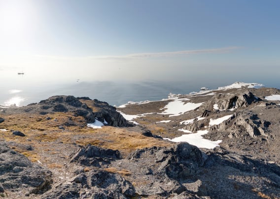
… and here we are at the northern end of the hill top, just a few metres away from position 3.
Biskayarhuken Panorama 4: northern end of the peninsula
- pano anchor link: #220602c_Biskayarhuken_061HDR-Pano
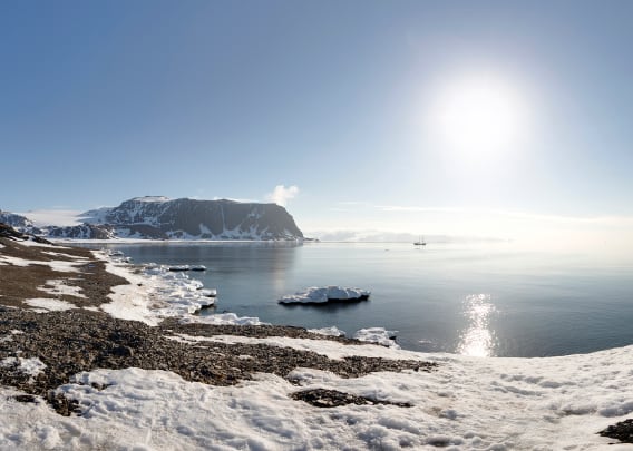
And finally, a 360 degree view from the northern end of the peninsula. It is just a good 500 metres from the whalers’ graveyard – the southern end of this little virtual tour of Biskayarhuken – to this position here at the northern end. There is a fine cairn here, one of several ones at Biskayarhuken, in the way they were typicall built by expeditions at times long past, to mark a location, as a landmark for mapping purposes or just because they had some time to bide. It is hard to tell exactly what happened here, when and who was involved.
But one thing is for sure: the view from here, to the Arctic Ocean in the north and Spitsbergen’s north coast in the south, is amazing, especially on a beautiful days like the one when I shot the panoramas!
Biskayarhuken – photo gallery
And finally, some impressions of Biskayarhuken.
- gallery anchor link: #gallery_2267
Click on thumbnail to open an enlarged version of the specific photo.


BOOKS, CALENDAR, POSTCARDS AND MORE
This and other publishing products of the Spitsbergen publishing house in the Spitsbergen-Shop.
-

Norwegens arktischer Norden (1): Spitzbergen
Photobook: Norway's arctic islands. The text in this book is German. [shop url="https://shop.spitzbergen.de/en/polar-books/70-norwegens-arktischer-norden-1-aerial-arctic-9783937903262.html"] ← BackOrder now -
Norwegens arktischer Norden (2): Aerial Arctic
Lofoten, Jan Mayen and Spitsbergen from the air - Photobook: Norway's arctic islands. The text in this book is German, but there is very little text, so I am sure that you will enjoy it regardless which languages you read (or not).Order now -
Poster “Svalbardhytter”
The poster "Svalbardhytter" (70 x 100 cm) visualizes the diversity of Spitsbergen's huts in a range of arctic landscapes.Order now -
Book “Svalbardhytter”
The companion book for the Svalbardhytter poster. The poster visualises the diversity of Spitsbergen‘s huts and their stories in a range of Arctic landscapes. The book tells the stories of the huts in three languages.Order now -
Spitsbergen – Svalbard. The complete guidebook
Comprehensive guidebook about Spitsbergen. Background (wildlife, plants, geology, history etc.), practical information including travelling seasons, how to travel, description of settlements, routes and regions.Order now -
Rocks and Ice. Landscapes of the North
A geographical traveling accompaniment to Spitsbergen and East Greenland (68-74°N). This is the English edition of the German book "Steine und Eis".Order now -
East Greenland in Winter
Join an exciting journey with dog, skis and tent through the wintery wastes of East Greenland! We were five guys and a dog when we started in Ittoqqortoormiit, the northernmost one of two settlements on Greenland’s east coast.Order now -
Postcard set Spitsbergen (Svalbard)
12 Spitsbergen postcards in a beautifully designed tray. Individually numbered limited edition!Order now -
Limited edition postcard set Antarctica
12 postcards which come in a beautifully designed tray. Beautiful images from South Georgia across Antarctica from the Antarctic Peninsula to the Ross Sea and up to Macquarie Island and Campbell Island.Order now
last modification: 2023-06-14 ·
copyright: Rolf Stange


-
Books, Calendar, Postcards and more

-


