-
current
recommendations- Liefdefjord
New page dedicated to one of Spitsbergen's most beautiful fjords. Background information and many photos.
- New Spitsbergen guidebook
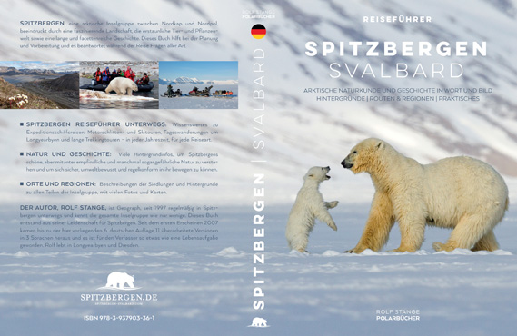
The new edition of my Spitsbergen guidebook is out and available now!
- Liefdefjord
New page dedicated to one of Spitsbergen's most beautiful fjords. Background information and many photos.
Page Structure
-
Spitsbergen-News
- Select Month
- May 2025
- April 2025
- March 2025
- February 2025
- January 2025
- December 2024
- November 2024
- October 2024
- September 2024
- August 2024
- July 2024
- June 2024
- May 2024
- April 2024
- March 2024
- February 2024
- January 2024
- December 2023
- November 2023
- October 2023
- September 2023
- August 2023
- July 2023
- June 2023
- May 2023
- April 2023
- March 2023
- February 2023
- January 2023
- December 2022
- November 2022
- October 2022
- September 2022
- August 2022
- July 2022
- June 2022
- May 2022
- April 2022
- March 2022
- February 2022
- January 2022
- December 2021
- November 2021
- October 2021
- September 2021
- August 2021
- July 2021
- June 2021
- May 2021
- April 2021
- March 2021
- February 2021
- January 2021
- December 2020
- November 2020
- October 2020
- September 2020
- August 2020
- July 2020
- June 2020
- May 2020
- April 2020
- March 2020
- February 2020
- January 2020
- December 2019
- November 2019
- October 2019
- September 2019
- August 2019
- July 2019
- June 2019
- May 2019
- April 2019
- March 2019
- February 2019
- January 2019
- December 2018
- November 2018
- October 2018
- September 2018
- August 2018
- July 2018
- June 2018
- May 2018
- April 2018
- March 2018
- February 2018
- January 2018
- December 2017
- November 2017
- October 2017
- September 2017
- August 2017
- July 2017
- June 2017
- May 2017
- April 2017
- March 2017
- February 2017
- January 2017
- December 2016
- November 2016
- October 2016
- September 2016
- August 2016
- July 2016
- June 2016
- May 2016
- April 2016
- March 2016
- February 2016
- January 2016
- December 2015
- November 2015
- October 2015
- September 2015
- August 2015
- July 2015
- June 2015
- May 2015
- April 2015
- March 2015
- February 2015
- January 2015
- December 2014
- November 2014
- October 2014
- September 2014
- August 2014
- July 2014
- June 2014
- May 2014
- April 2014
- March 2014
- February 2014
- January 2014
- December 2013
- November 2013
- October 2013
- September 2013
- August 2013
- July 2013
- June 2013
- May 2013
- April 2013
- March 2013
- February 2013
- January 2013
- December 2012
- November 2012
- October 2012
- September 2012
- August 2012
- July 2012
- June 2012
- May 2012
- April 2012
- March 2012
- February 2012
- January 2012
- December 2011
- November 2011
- October 2011
- September 2011
- August 2011
- May 2011
- April 2011
- March 2011
- February 2011
- January 2011
- December 2010
- November 2010
- September 2010
- August 2010
- July 2010
- June 2010
- May 2010
- April 2010
- March 2010
- February 2010
- November 2009
- October 2009
- August 2009
- July 2009
- June 2009
- May 2009
- April 2009
- March 2009
- February 2009
- January 2009
- December 2008
- November 2008
- October 2008
- August 2008
- July 2008
- June 2008
- May 2008
- April 2008
- March 2008
- February 2008
- April 2000
- Select Month
-
weather information
-
Newsletter

| Guidebook: Spitsbergen-Svalbard |
Home → August, 2018
Monthly Archives: August 2018 − News
Guidebook “Spitzbergen-Svalbard”: next edition soon available
The first edition of my guidebook Spitzbergen-Svalbard came out in German in 2007, followed by the first Englisch edition Spitsbergen-Svalbard in 2008 and the first Norwegian edition Svalbard – Norge nærmest Nordpolen in 2017. The German version soon became popular amongst Spitsbergen-travellers and enthusiasts, so I could develop the book through several editions. The 5th German edition came out in 2015 and it is now out of print, the new (6th) edition of the German version is currently in print and expected to be available in September 2018. I have updated the book comprehensively, both the text and the index have been improved and enlarged so the new edition will have 580 pages (the old edition has 560 pages). Maps and fonts have been improved. My knowledge and experience keep growing also after more than 20 years of learning and living the Arctic in theory and real life and all this becomes part of updated editions, and so does new relevant legislation, recent developments in Longyearbyen and so on and so forth.

The newest German edition of the guidebook Spitzbergen-Svalbard is in print and due to be released in September 2018.
Many professional guide colleagues use this book (including its English and Norwegian versions) on a daily basis in their arctic lives, referring to it as the “Svalbard bible” (or Spitsbergen bible, whatever you prefer)! A compliment that I as the author am happy to accept.
The English version Spitsbergen-Svalbard has been updated thoroughly in early 2018, and the same goes for the Norwegian version Svalbard – Norge nærmest Nordpolen which came out in 2017.
All three versions of the guidebook can be ordered on this website including the German version. If you order the German version, you will get the new, 6th edition as soon as it is available (expected in September 2018).
Bed available in ladies cabin on Antigua (11-21 September 2018)
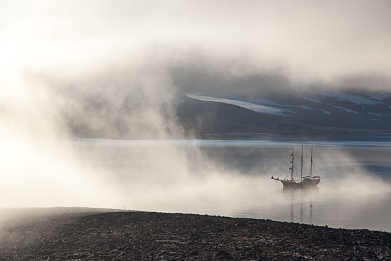
Spitsbergen under sail with SV Antigua, 11 intense days – a dream journey for friends of the Arctic at a time when sunsets have started to bring amazing colours to these high latitudes again. Now there is the opportunity to join on a short notice – there is a vacancy in a ladies cabin. Click here to read more about this trip. This trip will be German speaking, so the description is also in German.

Spitsbergen under sail with SV Antigua in September 2018: Space available in a ladies cabin.
So – go ahead and welcome on board!
Just get in touch with Rolf Stange (contact) for any questions regarding the trip, the ship, Spitsbergen … or get in touch directly with the Geographische Reisegesellschaft for reservations and booking.
Again, negative records from the arctic: ice cover low, temperatures high
It comes hardly as a surprise: once again, there are negative records of the current sea ice situations. As the Norwegian Ice Service released on Twitter, there has never been as little ice around Svalbard as currently since beginning of the recordings in 1967. As the latest ice chart shows, both Svalbard and neighbouring Frans Josef Land are completely free of sea ice:

Ice chart of 22 August 2018 (by MET Norway).
According to the Norwegian Ice Service, the sea ice cover in the Svalbard area was 123,065 square kilometres, which is 105,139 square kilometres less compared to the long-term average (1981-2010), a loss of almost 50 %!
But scientists are even more worried about the loss of ice north of Greenland, which is also visible in the ice chart above. Northernmost Greenland is an area where ice is pushed against the coast by currents, so it is – was – building up a very solid ice cover averaging 4 m in thickness and reaching more than 20 m thickness in places! This ice cover was, however, weakened by warm air incursions such as the extreme event in February. The weakened ice could be moved around by wind much more easily, and this is exactly what happened now in a large area north of Greenland. Even if the water surface freezes again soon, the damage is now done and it is hardly reversible: as the term multi-year ice suggests, it takes many years to replace a lost area of such ice, but it is hardly expected that this will happen at all given current climate developments.

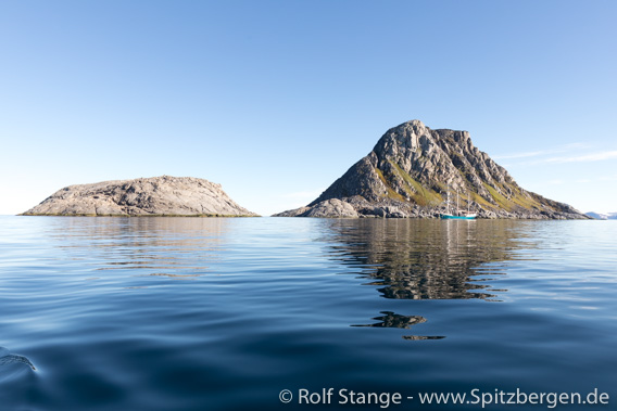
Svalbard furthest north: Rossøya (left) and Vesle Tavleøya completely ice-free, mid-July 2018.
It fits into this picture that Longyearbyen has now got an unbroken series of 90 (!) months with temperatures above the long-term average. A dramatic development, but hardly a surprise.
News-Listing live generated at 2025/May/04 at 03:33:16 Uhr (GMT+1)


