-
current
recommendations- Liefdefjord
New page dedicated to one of Spitsbergen's most beautiful fjords. Background information and many photos.
- New Spitsbergen guidebook
The new edition of my Spitsbergen guidebook is out and available now!
- Liefdefjord
New page dedicated to one of Spitsbergen's most beautiful fjords. Background information and many photos.
Page Structure
-
Spitsbergen-News
- Select Month
- June 2025
- May 2025
- April 2025
- March 2025
- February 2025
- January 2025
- December 2024
- November 2024
- October 2024
- September 2024
- August 2024
- July 2024
- June 2024
- May 2024
- April 2024
- March 2024
- February 2024
- January 2024
- December 2023
- November 2023
- October 2023
- September 2023
- August 2023
- July 2023
- June 2023
- May 2023
- April 2023
- March 2023
- February 2023
- January 2023
- December 2022
- November 2022
- October 2022
- September 2022
- August 2022
- July 2022
- June 2022
- May 2022
- April 2022
- March 2022
- February 2022
- January 2022
- December 2021
- November 2021
- October 2021
- September 2021
- August 2021
- July 2021
- June 2021
- May 2021
- April 2021
- March 2021
- February 2021
- January 2021
- December 2020
- November 2020
- October 2020
- September 2020
- August 2020
- July 2020
- June 2020
- May 2020
- April 2020
- March 2020
- February 2020
- January 2020
- December 2019
- November 2019
- October 2019
- September 2019
- August 2019
- July 2019
- June 2019
- May 2019
- April 2019
- March 2019
- February 2019
- January 2019
- December 2018
- November 2018
- October 2018
- September 2018
- August 2018
- July 2018
- June 2018
- May 2018
- April 2018
- March 2018
- February 2018
- January 2018
- December 2017
- November 2017
- October 2017
- September 2017
- August 2017
- July 2017
- June 2017
- May 2017
- April 2017
- March 2017
- February 2017
- January 2017
- December 2016
- November 2016
- October 2016
- September 2016
- August 2016
- July 2016
- June 2016
- May 2016
- April 2016
- March 2016
- February 2016
- January 2016
- December 2015
- November 2015
- October 2015
- September 2015
- August 2015
- July 2015
- June 2015
- May 2015
- April 2015
- March 2015
- February 2015
- January 2015
- December 2014
- November 2014
- October 2014
- September 2014
- August 2014
- July 2014
- June 2014
- May 2014
- April 2014
- March 2014
- February 2014
- January 2014
- December 2013
- November 2013
- October 2013
- September 2013
- August 2013
- July 2013
- June 2013
- May 2013
- April 2013
- March 2013
- February 2013
- January 2013
- December 2012
- November 2012
- October 2012
- September 2012
- August 2012
- July 2012
- June 2012
- May 2012
- April 2012
- March 2012
- February 2012
- January 2012
- December 2011
- November 2011
- October 2011
- September 2011
- August 2011
- May 2011
- April 2011
- March 2011
- February 2011
- January 2011
- December 2010
- November 2010
- September 2010
- August 2010
- July 2010
- June 2010
- May 2010
- April 2010
- March 2010
- February 2010
- November 2009
- October 2009
- August 2009
- July 2009
- June 2009
- May 2009
- April 2009
- March 2009
- February 2009
- January 2009
- December 2008
- November 2008
- October 2008
- August 2008
- July 2008
- June 2008
- May 2008
- April 2008
- March 2008
- February 2008
- April 2000
- Select Month
-
weather information
-
Newsletter

| Guidebook: Spitsbergen-Svalbard |
Home → Arctic blog: Jan Mayen, Spitsbergen → Beerenberg – 20th-21st June 2015
Beerenberg – 20th-21st June 2015
Sun
21 Jun
2015
(20th-21st June 2015) – Beerenberg – this famous, infamous mountain, towering 2277 metres above the sea in the middle of the north Atlantic, with its glacier-crowned crater summit, is a peak that one should be careful to hope for. Too much has to fit, too many factors that you just can’t control, mainly the weather, of course. How many times did I write emails to people who were thinking about this trip emphasizing they shouldn’t be focussed on Beerenberg too much. And quite right so. This would mainly increase the risk for frustration. Nevertheless, be prepared. There might suddenly be an open door.
But of course, most of us here have got this desire. And for me, it was this imagination of this peak that made me search for options some years ago, which resultet in the trips with Siggi and his boat Aurora. So, yes: I want to get up there, too.
Today might be the day. Everything is looking good, starting with the weather forecast. It is supposed to be mostly calm for several days, and the low cloud layer that is covering Jan Mayen should give way to the blue sky as soon as one has reached an altitude of some hundred metres, according to the Norwegian meteorologists. This could be our window of opportunity, our golden moment.
And everybody in this group who wants to join the climb is fit and experienced. There’s eight of us who dream of the Beerenberg summit. All of us have got similar experience from arctic or alpine environments. You should not underestimate Beerenberg. The distances, the altitude, the terrain … it is easy to think, it can’t be much of a problem, I have been to 3000 metres in the Alps. No, Beerenberg is more demanding, although 2277 metres don’t sound like much.
We have got yet another advantage: station commander Viggo, who would love to join us if duty was not calling elsewhere, offers us a very welcome ride to the north lagoon, which saves us from a hike of 13 kilometres with full luggage, saving important energy reserves that we will need later. Not a big deal for Viggo, but a huge advantage for us, that we could never have asked or hoped for – such are the rules here.
So the early afternoon sees two old jeeps on the bumpy rock and sand road to the north, along the southern lagoon (Sørlaguna) through a bleak desert of lava and volcanic sand. The low clouds add a lot to the atmosphere of total desolation. Over a low pass the track leads into Jøssingdalen, where we join forces to move a big rock that had fallen on the road to complete the drive to the northern lagoon (Nordlaguna). From here it’s walking.
Following a painful but very realistic decision, I leave two of my three lenses here, only one is allowed up on Beerenberg with me (the 16-35 mm wideangle). Weight matters greatly now. In case there is good light here when we return, I may still need the other ones, who knows. And I will certainly need the energy-rich food (meaning: chocolate and biscuits) and some drink that I also leave behind, all together in a waterproof bag and stormproof under some driftwood.
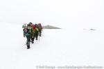
The first bit of the track up north from Nordlaguna is desolate beyond imagination in these conditions. Black sand, black lava rocks, wet snow, grey, cold fog. It would be quite hard to find the way without GPS. So we hike up across snow, stones and mosses, enjoying the occasional view when the fog lifts for a moment, the monotony broken up by attacks of Arctic and Great skuas every now and then.
Gallery – Beerenberg 2015
- gallery anchor link: #gallery_704
Click on thumbnail to open an enlarged version of the specific photo.
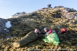
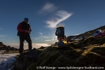
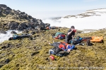
Finally we have reached the slope under Pálffykrater and thus the last suitable site for a bivouac. Time to rest for a couple of hours before we go for the summit with fresh energy. Three hours in the sleeping bags are to be enough, but there is not much real sleep anyway. It is grey and dull around us while the two gas cookers are hissing, turning snow and magic powder into something to eat.
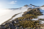
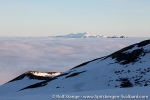
While we try to get some sleep, the fog layer is lowering and the the sky turns blue above us. Around midnight, the craters and hills of Sør Jan, the southern part of Jan Mayen, come out of the clouds in the distance. A very memorable view in the warm light of the midnight sun.
- gallery anchor link: #gallery_705
Click on thumbnail to open an enlarged version of the specific photo.
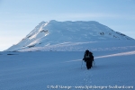
Once stomachs and water bottles are filled up again, it is time to start. The glacier is reached soon behind and above Pálffykrater. Five to six kilometres now above a gently and very evenly rising snow surface, ascending from 700 to 1500 metres, all the time the peak of Beerenberg in view, its steep slopes towering some 700 metres above the surrounding glacier. That is supposed to be another 1700 metres in altitude from here? It looks less, but it isn’t. Distances are so easily underestimated here, and the many metres, both horizontal and vertical, suck the energy out of the bones while we are moving across the snow step for step. Brody and Liz, our two American ski professionals, have brought their skies and are better off here, but carrying the equipment over many snow-free kilometres is the price to pay.
The sun is hidden behind the mountain, which is an advantage and a reason for our nightly climb, as the snow is harder now and thus easier to walk on. And Beerenberg throws a mighty shadow onto the cloud surface, decorated by a round light phenomenon that resembles a faint rainbow.
- gallery anchor link: #gallery_706
Click on thumbnail to open an enlarged version of the specific photo.
Slowly but steadily we are advancing to Nunatakken, the last bit of snow-free rock in an altitude of 1500 metres, but Nunatakken is not snow-free now. In contrast, it is completely hidden by snow. This spring brought a lot of snow to Jan Mayen, and that is another huge advantage for us, as we are now moving into crevassed glacier terrain, and the snow is providing good bridges across the crevasses. Without the snow, it would be quite difficult, if not impossible. Earlier expeditions had to turn here later in the summer when there was not enough snow.
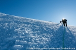
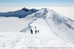
Secured with a rope, ice axe ready and our mountain boots equipped with crampons, we are now going for the steep slope. Only 1.5 kilometres to the peak as the crow flies, a good 700 metres of altitude, but every single one of those metres comes now at a price. The slope is 40 degrees steep, and that takes some energy. The crevasses require some detours.
- gallery anchor link: #gallery_707
Click on thumbnail to open an enlarged version of the specific photo.
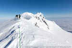
A last slope, then another last slope and then yet another last slope, it seems to be endless for a while as we are zig-zagging our way up, with hard-working legs and lungs. But finally, a slope turns out to be the last one for real, as the central crater is suddely gaping right in front of us. 1.5 kilometres wide and completely filled with ice.
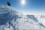
That is not it yet. The crater rim has got several peaks. The highest one is Haakon VII Toppen on the western end. So we still have got a kilometre ahead of us, following a ridge, partly snowy hummocks, partly steep, quite alpine terrain. But the snow is offering a good grip to the crampons.
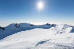
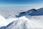
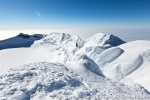
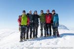
At 10 a.m. (Norwegian time, which is valid on Jan Mayen), 8.5 hard hours after leaving the bivouac at Pálffykrater, we reach the summit. 2277 metres above the sea, about 1800 metres above the clouds and anyway quite high above everything that is somewhere near in the widest sense. A dark blue sky above us, with a bright sun shining above the crater from the southeast, and the wind is currently busy somewhere else, so we can enjoy this out-of-the-world place for a good while, gazing at the panorama, sharing our excitements, taking photos. We can even set up the gas cooker to replenish our water supply, something that is very important. I don’t want do do the ascent without a steady, plentiful supply of water, and the same applies to going down.
- gallery anchor link: #gallery_708
Click on thumbnail to open an enlarged version of the specific photo.
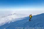
And descending is actually surprisingly hard, not only due to exhaustion – we have been without real sleep for some 30 hours now, not to mention all the walking – but also due to the sun, which is shining now surprisingly strong onto the snow, making the surface soft and wet. Once we have descended about 1000 metres and we have left the crevasses behind, we can get rid of the rope and everybody is walking his own pace from here on. May pace is slow now, as I feel like roasted both from the sun above and from the snow, I am feeling completely burnt and not far from heat stroke. On Jan Mayen! Amazing, but true. Many views back to this unique mountain, a nice rest on the first snow-free rock, and then the bivouac place is reached where we all disappear in the sleeping bags for some time.
Everybody else is soon moving on to the camp in Kvalrossbukta, another 17 km from here. I stay for another couple of hours, it is too nice here in the sun, lying in the moss. You won’t experience Jan Mayen as friendly as this too often.
- gallery anchor link: #gallery_709
Click on thumbnail to open an enlarged version of the specific photo.
Then I also start moving, there won’t be real sleep here under the free sky, and this is the next thing I need. The visibility is better now than on the way up, so I can find a better way down Alfred Øiendalen, which is almost completely filled with snow, until Tornøedalen is reached further down, which is largely snow-free. I follow the valley out of curiousity in the river bed, there is hardly any water yet. Twice I have to ascend again shorter bits, where the river will soon form waterfalls when the snowmelt is really going. Then, the northern lagoon is reached again, dense fog and a light breeze make an ice-cold combination, so I take only a short break, add the extra weight of my two lenses that I had left behind (completely useless of course now, in the fog) and pour some drink and chocolate biscuits into me. Thus strengthened, I move on. The remaining 13 kilometres on the sand road are endless … but finally, the camp in Kvalrossbukta is reached near 2 a.m.
- gallery anchor link: #gallery_710
Click on thumbnail to open an enlarged version of the specific photo.
BOOKS, CALENDAR, POSTCARDS AND MORE
This and other publishing products of the Spitsbergen publishing house in the Spitsbergen-Shop.
last modification: 2016-11-20 ·
copyright: Rolf Stange


