-
current
recommendations- Liefdefjord
New page dedicated to one of Spitsbergen's most beautiful fjords. Background information and many photos.
- New Spitsbergen guidebook
The new edition of my Spitsbergen guidebook is out and available now!
- Liefdefjord
New page dedicated to one of Spitsbergen's most beautiful fjords. Background information and many photos.
Page Structure
-
Spitsbergen-News
- Select Month
- May 2025
- April 2025
- March 2025
- February 2025
- January 2025
- December 2024
- November 2024
- October 2024
- September 2024
- August 2024
- July 2024
- June 2024
- May 2024
- April 2024
- March 2024
- February 2024
- January 2024
- December 2023
- November 2023
- October 2023
- September 2023
- August 2023
- July 2023
- June 2023
- May 2023
- April 2023
- March 2023
- February 2023
- January 2023
- December 2022
- November 2022
- October 2022
- September 2022
- August 2022
- July 2022
- June 2022
- May 2022
- April 2022
- March 2022
- February 2022
- January 2022
- December 2021
- November 2021
- October 2021
- September 2021
- August 2021
- July 2021
- June 2021
- May 2021
- April 2021
- March 2021
- February 2021
- January 2021
- December 2020
- November 2020
- October 2020
- September 2020
- August 2020
- July 2020
- June 2020
- May 2020
- April 2020
- March 2020
- February 2020
- January 2020
- December 2019
- November 2019
- October 2019
- September 2019
- August 2019
- July 2019
- June 2019
- May 2019
- April 2019
- March 2019
- February 2019
- January 2019
- December 2018
- November 2018
- October 2018
- September 2018
- August 2018
- July 2018
- June 2018
- May 2018
- April 2018
- March 2018
- February 2018
- January 2018
- December 2017
- November 2017
- October 2017
- September 2017
- August 2017
- July 2017
- June 2017
- May 2017
- April 2017
- March 2017
- February 2017
- January 2017
- December 2016
- November 2016
- October 2016
- September 2016
- August 2016
- July 2016
- June 2016
- May 2016
- April 2016
- March 2016
- February 2016
- January 2016
- December 2015
- November 2015
- October 2015
- September 2015
- August 2015
- July 2015
- June 2015
- May 2015
- April 2015
- March 2015
- February 2015
- January 2015
- December 2014
- November 2014
- October 2014
- September 2014
- August 2014
- July 2014
- June 2014
- May 2014
- April 2014
- March 2014
- February 2014
- January 2014
- December 2013
- November 2013
- October 2013
- September 2013
- August 2013
- July 2013
- June 2013
- May 2013
- April 2013
- March 2013
- February 2013
- January 2013
- December 2012
- November 2012
- October 2012
- September 2012
- August 2012
- July 2012
- June 2012
- May 2012
- April 2012
- March 2012
- February 2012
- January 2012
- December 2011
- November 2011
- October 2011
- September 2011
- August 2011
- May 2011
- April 2011
- March 2011
- February 2011
- January 2011
- December 2010
- November 2010
- September 2010
- August 2010
- July 2010
- June 2010
- May 2010
- April 2010
- March 2010
- February 2010
- November 2009
- October 2009
- August 2009
- July 2009
- June 2009
- May 2009
- April 2009
- March 2009
- February 2009
- January 2009
- December 2008
- November 2008
- October 2008
- August 2008
- July 2008
- June 2008
- May 2008
- April 2008
- March 2008
- February 2008
- April 2000
- Select Month
-
weather information
-
Newsletter

| Guidebook: Spitsbergen-Svalbard |
Home →
Yearly Archives: 2023 − News & Stories
Sørkapp & Hornsund
Wed
23 Aug
2023
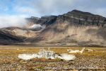
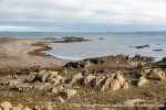
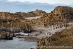
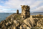
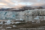
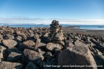
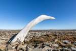
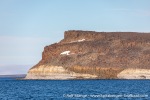
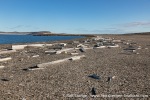
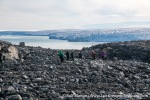
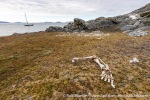
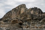
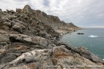
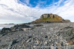
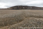
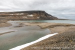
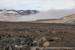
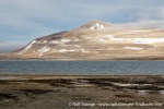
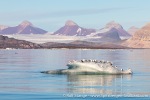
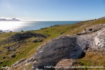
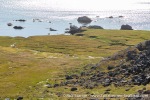
Sørkapp (Spitsbergen’s south cape) has its bad reputation for good reasons. The weather is often bad and the sea rough, and the waters are shallow. Mostly it is a tough stretch.
But on one of these rather few golden days … it can be an amazing area! Be it on the mainland coast or on the offshore islands such as Tokrossøya.
After an amazing day at these places we went into Hornsund.
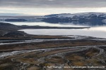
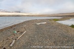
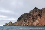
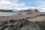
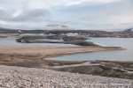
Photo gallery – Sørkapp: Keilhaufjellet & Tokrossøya and Hornsund
- gallery anchor link: #gallery_2810
Click on thumbnail to open an enlarged version of the specific photo.
In Storfjord: Kvalvågen & Haketangen
Tue
22 Aug
2023
Now it was time to get south and towards the south cape. But it was a good day in Storfjord, with two landings. One at Sporodden in Kvalvågen. Amazing geology, including dinosaur footprints. And a very good hike.
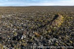
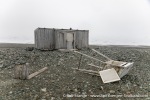
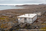
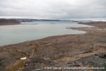
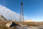
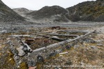
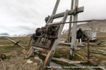
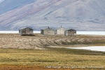
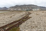
Further south at Haketangen, we found something that you would hardly expect in a remote, seemingly pristine place like this: a little runway! Of course not in use anymore, but still clearly visible in the landscape. The was one of the places where they drilled for oil and gas back then. The first drilling was done in 1976 and than again in 1987. The hole went as far down as 2,337 metres. After some more tests in 1988, the place was cleared up (at least). They found some gas, but not enough to start production.
How was it possible that they actually did these exploration works? The large national parks exist since 1973. That includes South Spitsbergen National Park, where Haketangen is situated. Today we are talking about possible bans against tourist landings in these areas, and back then they could drill, look for oil and gas and build and use a runway – under essentially the same regulations. How was that possible? One may only wonder.
Photo gallery – In Storfjord: Kvalvågen & Haketangen
- gallery anchor link: #gallery_2807
Click on thumbnail to open an enlarged version of the specific photo.
In Hinlopen Strait (II)
Mon
21 Aug
2023
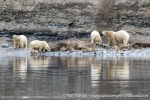
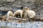
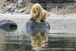
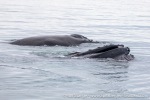
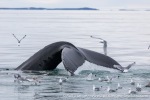
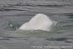
One more day in Hinlopen Strait – and what a day it was! Watching polar bears while they were having breakfast, a great hike on Wilhelmøya and to round the day off (as if anything was missing …) watching humpback whales having dinner.
Photo gallery – Hinlopen Strait (II): Polar bears, Wilhelmøya & humpback whales
- gallery anchor link: #gallery_2804
Click on thumbnail to open an enlarged version of the specific photo.
In Hinlopen Strait (I)
Sat
19 Aug
2023
Now, as we had entered Hinlopen Strait from the south, we wanted to get further into this amazing area, hoping for some good hikes, scenery and wildlife. We were not to be disappointed. From a good hike on Von Otterøya, with great panoramic views over large parts of Hinlopen, to one of many smaller islands on the area to Alkefjellet. The latter is always something special, but that night, it was just unreal. Pure magic.
Photo gallery – Hinlopen Strait: Von Otterøya, Smittøya, Alkefjellet
- gallery anchor link: #gallery_2801
Click on thumbnail to open an enlarged version of the specific photo.
Around Nordaustland: following Austfonna’s edge
Fri
18 Aug
2023
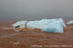
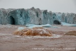
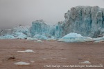
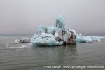
Now that we were already as far east as Storøya, we thought we might as well sail all around Nordaustland. And so we did. The day was a bit grey, but the light was actually great to highlight the amazing colour of the ice and the water, which was, in parts, heavily coloured by sediment. A part of the ice cap of Austfonna, in the area of Domen, has clearly advanced by several kilometres. The amounts of glacier ice in the water are amazing.
The pictures will tell the story. That’s the view we had for most of the day 🙂
Photo gallery – Nordaustland: Austfonna from Domen to Bråsvellbreen
- gallery anchor link: #gallery_2795
Click on thumbnail to open an enlarged version of the specific photo.
More “end of the world” islands: Raschøya & Storøya
Fri
18 Aug
2023
We started with a hike on Raschøya – in sunshine! Good thing. We may not get too much of both – hiking and sun – later today and tomorrow. The view over the surroundings, islands, bays and the huge ice cap Austfonna, from Raschøya is incredible!
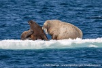
Indeed, we lost the sun (rather, it disappeared behind clouds and fog) as we reached Storøya. If anyone had not yet mentally arrived in the high Arctic, well, this was it: as barren, cold, windy and foggy as anyone could imagine. An island not for humans, but for walruses and polar bears.
We even managed to make two landings on Storøya, one near the walruses in the north and one at the hut of the Ymer-expedition in 1980.
Now we have many miles at sea ahead of us as we sail around Nordaustland.
Photo gallery – Raschøya, Storøya
- gallery anchor link: #gallery_2798
Click on thumbnail to open an enlarged version of the specific photo.
Svalbard’s remotest islands
Wed
16 Aug
2023
The world – this part of it, anyway – was ours today. Great weather, and some remote, wild arctic islands ahead of us!
Landings on such small islands are always exciting. Nordre Repøya, Karl XII-Øya, Foynøya. Amazing places! Strange that we didn’t see any polar bears (just parts of them). Where are they? All up to the ice? Hard to believe. Anyway, they were not here today. It is kind of strange to spend several days in this area without seeing a single bear. But we got all these great landings, so for us, it was not a bad thing.
Later we had the greatest arctic evening ever in in easternmost Orvin Land. At anchor in the easternmost bay before the great glacier front of Leighbreen starts, which is part of the huge ice cap Austfonna. What a light, what a view, what an evening! Unforgettable!
Photo gallery – Nordre Repøya, Karl XII-Øya, Orvin Land
- gallery anchor link: #gallery_2786
Click on thumbnail to open an enlarged version of the specific photo.
From Rijpfjord to Zorgdragerfjord and Duvefjord
Tue
15 Aug
2023
Considering the weather forecast, our expectations for this day were somewhat limited, but actually, it turned out great! Starting with a great hike from Rijpfjord to Zorgdragerfjord across the barren interiour of the country, which is hardly ever visited. Also Zorgdragerfjord does enjoy its existence in solitude, and it is great to see places like that.
Later, we went for another hike in the northwestern part of Duvefjord. We even got some sunshine there, so we went out yet one more time in the evening, to enjoy the great light.
Photo gallery – from Rijpfjord to Zorgdragerfjord and Duvefjord
- gallery anchor link: #gallery_2783
Click on thumbnail to open an enlarged version of the specific photo.
Nordenskiöldbukta and Rijpfjord
Sun
13 Aug
2023
A day in some of the remotest and most rarely visited corners of Svalbard. That is certainly true for the western part of Nordenskiöldbukta on Nordaustland: poorly charted waters with a lot of shallows, where most Captains will refuse to take their ship. But Heinrich drives his Arctica II almost like a Zodiac.
That way we got the rare opportunity for a glacier hike on Sabinebreen.
A glacier from a more classic perspective was what we got later at Rijpbreen.
We finished the day off with a visit to the Haudegen war weather station. A pretty grim part of Svalbard’s history, but interesting.
Photo gallery – Nordenskiöldbukta & Rijpfjord: Sabinebreen, Rijpbreen and Haudegen-station
- gallery anchor link: #gallery_2780
Click on thumbnail to open an enlarged version of the specific photo.
From Kapp Rubin to Ekstremfjord
Sat
12 Aug
2023
During the night we steamed to the northeast. At some stage we just have to do some miles. Big thanks to all who helped to keep the ship on course during the nightly shifts!
In the late morning, we started the day’s adventures at Kapp Rubin, a rocky headland on the north coast of Nordaustland. Looking for the traces of a tragic wintering in 1908-09 (we found some, including a grave and some small bits and pieces) and of Theodor Lerner’s expedition in 1913 (we didn’t find any). Lerner lost his ship and had to spend some time at Kapp Rubin, waiting for help.
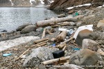
Later, we explored Ekstremfjord. Strange name, there is no explanation for it. Probably after a ship. Anyway, the name is appropriate, for example regarding the extreme amounts of plastic litter on the shores (a good bit less when we left) and extremely rocky. And extremely beautiful views over an extremely barren, beautiful landscape.
Photo gallery – Nordenskiöldbukta: From Kapp Rubin to Ekstremfjord
- gallery anchor link: #gallery_2777
Click on thumbnail to open an enlarged version of the specific photo.
From Ny-Ålesund to Virgohamna
Thu
10 Aug
2023
What a day! Within 24 hours, we had spent a night plus some quality time in Ny-Ålesund and then went as far as Virgohamna, but not without a lovely landing at Diesetsletta on the open west coast, as we had the best of conditions, so we just had to jump at that rare opportunity 🙂 we rounded the day off in Virgohamna, exploring the traces of the expeditions of Andrée and Wellman.
Photo gallery – Ny-Ålesund – Diesetsletta – Virgohamna
- gallery anchor link: #gallery_2774
Click on thumbnail to open an enlarged version of the specific photo.
In Forlandsund
Wed
9 Aug
2023
It is wonderful to wake up on a small boat at anchor in a silent bay, with beautiful landscape in the sun all around. Of course that is just asking for a good hike. And so we did. Splendid! Wonderful views over central parts of Prins Karls Forland.
After our first, “failed” 😉 attempt yesterday to see walruses in Poolepynten, we made a new attempt today further north at Sarstangen. Today, we were not disappointed! (And of course, we were not disappointed yesterday either … just kidding …).
Photo gallery – Prins Karls Forland & Sarstangen
- gallery anchor link: #gallery_2771
Click on thumbnail to open an enlarged version of the specific photo.
In Trygghamna and to Prins Karls Forland
Tue
8 Aug
2023
A silent night at anchor is one of the best things I know 🙂 and it is even better when the sun is out next morning.
The green tundra around Alkhornet is a perl of arctic nature. Many reindeer, polar foxes and mighty ice wedges. And a very busy birdcliff providing the appropriate noise.
Photo gallery – Trygghamna & Alkhornet
- gallery anchor link: #gallery_2765
Click on thumbnail to open an enlarged version of the specific photo.
Then we continued into Forlandsund, with a lot of sun and a bit of wind. The idea was to visit some walruses there, but that didn’t quite work out as planned. The place was already quite busy …
Photo gallery – Forlandsund
- gallery anchor link: #gallery_2768
Click on thumbnail to open an enlarged version of the specific photo.
With Arctica II in Billefjord
Mon
7 Aug
2023
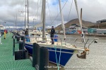
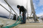
Yesterday we started in Longyearbyen with Arctica II. And now we have just about 30 hours behind us, but it feels already like 3 days.
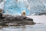
After a look at the weather forecast my expectations regarding this first had been slightly limited, but as it turned out it was a good decision to stay in Billefjord. After a visit to the mighty Nordenskiöldbreen – still an impressive glacier, despite of its dramatic retreat – we found our first polar bear just after the first breakfast on board. And what a beautiful sighting it was!
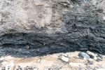
The first hike took us up a moraine and then along a river where we found coal from the Carboniferous (near 300 million years old). Much older than the stuff in Longyearbyen, Barentsburg and so on. We finished the hike in the old coal prospecting “settlement” (well, four huts) Brucebyen.
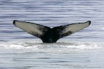
Sailing out of Billefjorden took quite some time. Too many whales 🙂
We finished this first day – as far as activities outside were concerned – at Svenskehuset. An amazing place with some rather dramatic history.
Gallery – In Billefjord
- gallery anchor link: #gallery_2762
Click on thumbnail to open an enlarged version of the specific photo.
Polar bear shot in Krossfjord
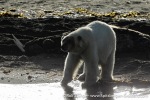
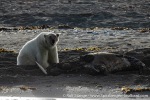
A polar bear was shot on Friday (05 August) evening in Krossfjord, while it tried to get into a hut where there were several persons insisde. It is said that the group tried to scare the polar bear away without success.
The incident is now under investigations. Further details have not yet been released at the time of writing.

Polar bear in Krossfjord (archive image).
News-Listing live generated at 2025/May/09 at 13:52:59 Uhr (GMT+1)
