-
current
recommendations- Liefdefjord
New page dedicated to one of Spitsbergen's most beautiful fjords. Background information and many photos.
- New Spitsbergen guidebook
The new edition of my Spitsbergen guidebook is out and available now!
- Liefdefjord
New page dedicated to one of Spitsbergen's most beautiful fjords. Background information and many photos.
Page Structure
-
Spitsbergen-News
- Select Month
- May 2025
- April 2025
- March 2025
- February 2025
- January 2025
- December 2024
- November 2024
- October 2024
- September 2024
- August 2024
- July 2024
- June 2024
- May 2024
- April 2024
- March 2024
- February 2024
- January 2024
- December 2023
- November 2023
- October 2023
- September 2023
- August 2023
- July 2023
- June 2023
- May 2023
- April 2023
- March 2023
- February 2023
- January 2023
- December 2022
- November 2022
- October 2022
- September 2022
- August 2022
- July 2022
- June 2022
- May 2022
- April 2022
- March 2022
- February 2022
- January 2022
- December 2021
- November 2021
- October 2021
- September 2021
- August 2021
- July 2021
- June 2021
- May 2021
- April 2021
- March 2021
- February 2021
- January 2021
- December 2020
- November 2020
- October 2020
- September 2020
- August 2020
- July 2020
- June 2020
- May 2020
- April 2020
- March 2020
- February 2020
- January 2020
- December 2019
- November 2019
- October 2019
- September 2019
- August 2019
- July 2019
- June 2019
- May 2019
- April 2019
- March 2019
- February 2019
- January 2019
- December 2018
- November 2018
- October 2018
- September 2018
- August 2018
- July 2018
- June 2018
- May 2018
- April 2018
- March 2018
- February 2018
- January 2018
- December 2017
- November 2017
- October 2017
- September 2017
- August 2017
- July 2017
- June 2017
- May 2017
- April 2017
- March 2017
- February 2017
- January 2017
- December 2016
- November 2016
- October 2016
- September 2016
- August 2016
- July 2016
- June 2016
- May 2016
- April 2016
- March 2016
- February 2016
- January 2016
- December 2015
- November 2015
- October 2015
- September 2015
- August 2015
- July 2015
- June 2015
- May 2015
- April 2015
- March 2015
- February 2015
- January 2015
- December 2014
- November 2014
- October 2014
- September 2014
- August 2014
- July 2014
- June 2014
- May 2014
- April 2014
- March 2014
- February 2014
- January 2014
- December 2013
- November 2013
- October 2013
- September 2013
- August 2013
- July 2013
- June 2013
- May 2013
- April 2013
- March 2013
- February 2013
- January 2013
- December 2012
- November 2012
- October 2012
- September 2012
- August 2012
- July 2012
- June 2012
- May 2012
- April 2012
- March 2012
- February 2012
- January 2012
- December 2011
- November 2011
- October 2011
- September 2011
- August 2011
- May 2011
- April 2011
- March 2011
- February 2011
- January 2011
- December 2010
- November 2010
- September 2010
- August 2010
- July 2010
- June 2010
- May 2010
- April 2010
- March 2010
- February 2010
- November 2009
- October 2009
- August 2009
- July 2009
- June 2009
- May 2009
- April 2009
- March 2009
- February 2009
- January 2009
- December 2008
- November 2008
- October 2008
- August 2008
- July 2008
- June 2008
- May 2008
- April 2008
- March 2008
- February 2008
- April 2000
- Select Month
-
weather information
-
Newsletter

| Guidebook: Spitsbergen-Svalbard |
Home →
Yearly Archives: 2015 − News & Stories
Tempelfjord
Sat
11 Apr
2015
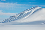
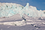
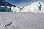
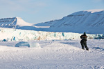
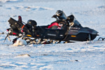
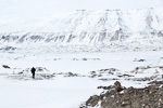
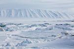
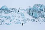
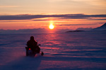
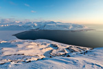
It is such a thing with Tempelfjord this year. Not too long ago, it was clear and easy: the transition from solid ground in Sassendalen to fjord ice in Tempelfjord at Fredheim was convenient and as safe as fjord ice can ever be. This had been the case until 2013. In 2014, waves were lapping against the beach at Fredheim for the whole winter! This year, it was, well, not perfect, but better. At least. It was possible to get onto the ice at Fredheim, although the ice edge was not far and the ice itself was not always as solid as one might have wished. But it worked. Of course, we did not miss the opportunity to pay the glaciers in inner Tempelfjord a visit.
- gallery anchor link: #gallery_650
Click on thumbnail to open an enlarged version of the specific photo.
Spitsbergen-Svalbard.com Easter brainteaser: the mystery solved
The Spitsbergen-Svalbard.com Easter brainteaser – what does the photo at the bottom show? – has got a lot of nice replies. A selection of answers (my own translation of those that were sent in German):
- Close-up of Humpback whale skin
- Close-up of Walrus skin in black & white
- Ice surface. It looks like something has ground it (like the surface at a curling court (Sweden become world champs yesterday!)). So that has to be my guess. Not a curling court, but a ice covered surface that been grounded in some way. Maybe from dog sledge skids?
- Ice structures
- Is it frozen water from below with trapped air bubbles?
- A warm item (e.g. a warm kettle) put on frozen water.
- An aerial photo of frozen mud flats at low tide.
- I thought frozen water at first, but I don’t think that’s right.
- Not polished concrete?
- Iced-over stromatolithes that got a glaciological haircut
- Negative imprint of a fossil fern
- think it is water over some frozen soil or something….
actually i have no clue even after staring for 30 minutes at the picture!
in any case: it is beautiful! 🙂 - A true conch in shallow water?
- Maybe a shoe sole
- A rather rare iron structure on a geode (or part of it)
- Profile of a snow mobile belt
- Close-up of ice structure
- A dog in a river bed / ice surface
A number of interesting and surprisingly varied answers! It seems to have been more difficult than I had thought, and this shows how much camera and lens may help to see things that otherwise are hidden or that we see, if at all, in a different way. All those who have seen glacier ice have had this phenomenon near them (but not necessarily seen it and paid attention to it).
This is how the picture was taken:
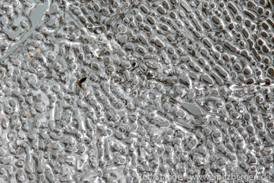
What is this? Glacier ice!
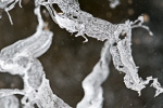
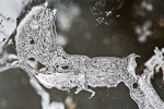
A macro photo of glacier ice in an ice cave in a glacier, with tripod and macro lens, to make smallest details visible. The brainteaser photo shows very small air bubbles in glacier ice. The individual bubbles and channels are smaller than 1 mm. The area shown on the photo is, in reality, an estimated 4×6 mm large, or rather: small. This network of air bubbles was oriented in a plain parallel to the very clear ice surface, about 2-3 cm deep in the ice, which altogether made it possible to photograph it. Please don’t ask me how exactly this pattern of air channels comes into existence, I don’t know. Please tell me if you know.
The first price for “Close-up of ice structure” goes to Stephanie in Scotland! Stephanie, the choice is yours!
The second price goes to Leipzig and the third one to Sweden. Congratulations to all winners and a big thanks to all who sent their answers! It was fun, and that was the whole purpose of it.
What is this? Very small bubbles and channels of air trapped in glacier ice
Bjørndalen
Thu
9 Apr
2015
As mentioned, we just had to return to Bjørndalen. The photos show why ☺
- gallery anchor link: #gallery_648
Click on thumbnail to open an enlarged version of the specific photo.
Mohnbukta
Wed
8 Apr
2015
The spell that the east coast has on some is strong. Magnetic. For many, coast is coast. East, west, who cares. Buth for others, the east coast is something special. A manifestation of remoteness. It may help when the first visit there took place on a trekking tour and not by snow mobile. Then, the distance has a totally different meaning. Shorter legs of the whole trip require days and not hours or just minutes. Where the landscape appears as a convenient highway in the winter, you have got endless tundra in the summer, swampy wetlands, torrential meltwater rivers, morains, glaciers, … the whole lot. Just read Martin Conway’s „First crossing of Spitsbergen“. Recommended!
And when the east coast is quite easily accessible, it does not necessarily loose that charme. Quite the opposite. It is a great pleasure not to resist the temptation as often as possible. Ice, wideness, silence …
Enough written for today. The photos will do the rest.
- gallery anchor link: #gallery_646
Click on thumbnail to open an enlarged version of the specific photo.
Adventtoppen
Tue
7 Apr
2015
Adventtoppen had been on the wishlist for quite some time already. The problem: it is on the northern side of Adventfjord. A few kilometres only from Longyearbyen, just on the other side of the fjord – on the other side of the fjord. That is exactly the problem.
But as so often in the Arctic, the winter is making life easier. Lower Adventdalen, near the fjord, is pretty much impossible to cross in the summer. The river there is huge. But in winter? A highway. Flat and dry.
A bit of apprenticeship due had to be paid on the first attempt. The upper slope of Adventtoppen is quite steep and the snow surface was hard as concrete. So the boots, nicely warm but too soft, turned out to be not good enough for this purpose. The risk of slipping and sliding down a steep 200 m slope was just too big, so it was not to happen that day.
- gallery anchor link: #gallery_644
Click on thumbnail to open an enlarged version of the specific photo.
Another attempt. Equipped with harder boots and light walking crampons, it suddenly was an easy thing. So Adventtoppen was definitely due that Tuesday. With 786 m, it is obviously not the highest mountain in Longyearbyen’s neighbourhood, but that is not the point. The point is that the top is a point. Not a plateaux, as is so often the case in this area. No, on Adventtoppen, there is one point that has got a splendid 360 degree view ☺ guess what happened there. Of course I had to capture it with 360 degree panorama technique. And as I am a bit behind with this blog, the result is already online: Click here for PanoTour.
spitsbergen-svalbard.com Easter brainteaser
Update: I haven’t got an answer so far that really hits the nail on the head. The question will remain open and entries can be filed until the answer appears as a new spitsbergen-svalbard.com news entry.
An Easter brainteaser on spitsbergen-svalbard.com? Yes, why not. I took the photo recently here in Spitsbergen. And the first one who can tell me what it shows will receive any item (your choice) of the books, postcards or calendar on this website (see right side or click here). The second and third incoming answers – being correct – have the choice within postcards or calendar. Entries by email (contact).
Not difficult, is it?
The answer has to be correct and concrete. Everything that is not wrong is correct, unless it is wrong. I (Rolf Stange) decide if it is concrete (someone has to do it). It is not enough to write that it is a bit of Spitsbergen. This would be correct, but not concrete.
To make it easier, you can download a larger file of the same photo by clicking here.
Good luck – and happy Easter!
What is this?
Easter weekend in Bjørndalen
Sun
5 Apr
2015
(4th/5th April 2015) After some calm early April days, it is time to get out again when the Easter weekend is approaching. Everybody here who has some means of transportation and possibly even access to one of the nowadays much sought-after huts is absconding from zivilisation, and I am happy to be part of that. It does not have to be far and adventurous. That is one of Longyearbyen’s nice aspects: the arctic wilderness starts as soon as you have passed the last house.
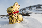
For many here, Bjørndalen is something like a city park in a wider sense. It is easy to get there by car or snow mobile, and there is a number of huts in local ownership near the Isfjord coast. This is where I spend this lovely weekend. All inclusive! Scenic views of the wide Isfjord, good food in good company, and small things are searched for by those who still believe in the Easter bunny, hidden by those who know better. At least in this case.
- gallery anchor link: #gallery_642
Click on thumbnail to open an enlarged version of the specific photo.
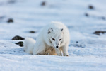
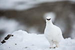
There is no Easter bunny in Bjørndalen, but Arctic fox and ptarmigan are at home there. I will have to spend some more time here, soon.
Permaculture: vegetables, fresh and tasty from the arctic
Modern life in the arctic is demanding considerable resources. Food stuffs are imported over long distances, which is costly and burns a lot of fuel. Many visitors get a bit nervous when they see the prices for food in the high north, and so-called fresh vegetables are not always as fresh as you might want.
Food waste is shredded and washed straight into the fjord together with waste water, altogether a great waste. Another solution would be highly desirable, both from an environmental and an economic perspective.
Thinking local food in the arctic, most people would probably have reindeer steaks on their mind, which is obviously not the solution. Local vegetables? Negative. Even the Russian (Sovjet, back then) settlements Barentsburg and Pyramiden were, in a way, more advanced, with considerable local production in greenhouses and stables for cows, pigs etc., most of which have been abandoned years ago.
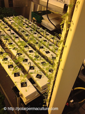
But creative people are working on solutions to grow vegetables locally, fresh and environmentally friendly. A start up project called Polar Permaculture Solutions is developing techniques in Longyearbyen for advanced greenhouses to grow vegetables in permafrost areas without high energy and water consumption. First tests are promising: according to Polar Permafrost Solutions, parsley, coriander, basil, paprika, summer squash, mini corn, onions, lettuce, tomatoes, eggplant, red chili peppers and more have already been grown successfully. Food waste is used to produce soil and fertilizer with biological techniques (sounds better than worms, but that’s what it is)
Fresh, tasty, local production and environmentally friendly – we are looking forward to see the further development!
Fresh vegetables of local production in Longyearbyen: so far an utopia, hopefully soon a reality that makes a lot of sense for the environment and economy.
Source: Polar Permaculture
Lower extent of winter sea ice in the Arctic
During this winter season 2014/2015 the sea ice in the Arctic has extended much less than it usually did.
As the U.S. National Snow and Ice Data Center at the University of Colorado reports, this winter the ice likely reached its maximum extend as soon as February 25th. This is 15 days earlier than the average of the years 1981 to 2010 which serves as the reference period.
More alarming is the fact that the extent of sea ice on this date had not proceeded very far yet. Indeed, since the beginning of the satellite record the maximum extent of Arctic sea ice has never been as low as in this winter. On February 25th the ice covered an area of 14.54 million square kilometers. This is 1.1 million square kilometers less than the long term average and 130.000 square kilometers less than the former negative record of 2011. All areas were affected except for the Labrador Sea and the Davis Strait between Greenland and Canada. There was a remarkably low extent of ice on the Pacific side of the Arctic and in the Barents Sea west of Novaya Semlya and southwest of Spitsbergen.
After reaching its low maximum on February 25th the sea ice extent initially decreased significantly (with regional variations) and then increased again in the second half of March. However, a new maximum could not be reached. Currently the ice is retreating again, according to the time of the year.
It can be expected that the low extent of sea ice in winter will also lead to less ice in the summer season. This scenario is supported by the effect that open water surfaces are absorbing more solar energy and are warming up faster than ice surfaces which reflect most of the sunlight (see also Spitsbergen-Svalbard.com news: Retreat of Arctic sea ice accelerates global warming from February 2014).
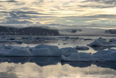
Sea ice in northern Spitsbergen.
Joyous news from the Habitat Restoration Project in South Georgia
Good news from the Habitat Restoration Project in South Georgia in the news section of the antarctic counterpart of this website (click here).
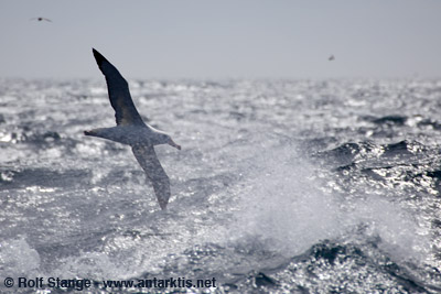
Seabirds near South Georgia: thanks to the Habitat Restoration Project, populations especially of smaller species can be expected to increase significantly in years to come.
Longyearbyen
Mon
30 Mar
2015
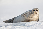
The stiff breeze from last night has evolved into a solid storm by now. The weather has been rather instable recently, fluctuating from clear, cold, calm winter days through snow storms to warm air invasions with temperatures even above zero and back, all within a week, more than once. Godt innevær, as the Norwegians say: good inside weather, good to be at home. Which is also nice. And I have to get some work done, some books need to be written (yes, I am still doing that). And when you get a visitor as lovely as this, it can’t be boring anyway 🙂
- gallery anchor link: #gallery_639
Click on thumbnail to open an enlarged version of the specific photo.
Barentsburg, Colesbukta
Sun
29 Mar
2015
The trip to Barentsburg takes about 3 hours. We make use of the fine weather by doing a bit of photo shooting.
The times, they are a changin’ … clearly and visibly also here in Barentsburg, where coal is still being mined, but the past has brought difficulties and accidents in the mines and the future may be somewhere more sunny. Many of the houses have got new fronts, ruins have been removed. There is a new brewery with a restaurant, and new, nice rooms in the hotel. A new hotel and a guesthouse have been announced. Barentsburg is attracting curious visitors in numbers already these days. Not only tourists who come with guided tours, but also locals from Longyearbyen, who appreciate the opportunity of a short holiday over the weekend. Food, rooms and service receive regular praise. The mining company Trust Arktikugol has already been called Turist Arktikugol by the local Norwegian newspaper Svalbardposten …
We are also enjoying lunch in Barentsburg. There is not too much time to look around today. We have a photographic mission together with the group we are traveling with, so we have to stick with their time schedule. Something that we usually don’t have.
But then we are done with that mission and we can spend a long evening in Colesbukta. Weird buildings of a Russian mining settlement abandoned more than half a century ago. To be precise, this was the harbour where the coal was shipped that was mined in Grumantbyen, another abandoned place at the foot of a steep cliff further east, so they could not build a harbour there. Interesting impressions in nice evening light. We stroll around, curiously investigating old buildings, marvelling at old, heavy machinery, geological samples and silent witnesses of daily life that was vibrant here until 1962. Pure photographic pleasure! Glaucous gulls are our company as we enjoy an endless sunset over Isfjord.
- gallery anchor link: #gallery_632
Click on thumbnail to open an enlarged version of the specific photo.
Meanwhile, the wind has started to pick up and it is time for the last leg of today’s trip, back to Longyearbyen. Visibility is quite poor on the pass above the glacier Longyearbreen, a good 700 m high, and although we are only following well-known and frequently travelled routes, we are quite happy to be back in town soon. On the same evening, as we hear later, a young local snow mobile driver receives serious injuries as he drives into a deep wind hole in the snow. It is so bad that, once he is found, he is immediately evacuated to the university hospital in Tromsø with the ambulance place, where the doctors have to put him into artificial coma …
Hiorthfjellet
Sat
28 Mar
2015
There are still sunsets, still are a „normal“ time, namely in the evening. The sunsets are now incredibly quickly moving towards midnight, noticeably later every day, until they join the sunrise to create the midnight sun.
There are just 2 months between polar night and midnight sun. The polar day will change life completely here, animals and people will sleep less, be more active, change their rhythm.
And of course the light will change. For a few weeks, April will still bring blue and red colours during the night, but these will give way to the sun in May, which will then be well above the horizon 24 hours a day.
- gallery anchor link: #gallery_630
Click on thumbnail to open an enlarged version of the specific photo.
And this is why we are here now, in late March, some hundred metres above Hiorthhamn, at one of the most beautiful view points, enjoying the views over Adventfjord and Longyearbyen in the light of an evening sunset. There won’t be many more until September.
Sassendalen
Sat
28 Mar
2015
Sassendalen is one of Spitsbergen’s biggest valleys: 30 km long from Rabotbreen to Tempelfjord and 5 km wide, it is making a strong impression of a very wide landscape when you stand in the middle of it, where a big meltwater river is running in the summer.
But it is especially some of the smaller tributary valleys that have scenic aspects which catch the eye of the observer and the attention of the photographer. The frozen waterfall in Eskerdalen and the canyon-like gorge in Brattlidalen, where you can touch the steep rockwalls on both sides at the same time in some places.
- gallery anchor link: #gallery_628
Click on thumbnail to open an enlarged version of the specific photo.
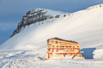
Fredheim, the famous hut of the legendary hunter Hilmar Nøis, is ready to move. The three old buildings, including the unique main building with two floors, initially built by Hilmar Nøis in 1924 and regularly used by him and his family until 1963, are threatened by coastal erosion and would not have survived the next couple of years in their present position. Now they are standing on heavy structural steel work, stabilized with wooden beams and ready to be pulled up one terrace on to safe terrain (this has been done successfully meanwhile).
De Geerdalen
Fri
27 Mar
2015
Another day in Nordenskiöld Land, a bit further east this time, again traveled few kilometres only, again spent a lot of time trying to discover something new in the landscape and photograph it. One of these photos led to the spontaneous idea of the easter brainteaser, and I thought that this showed very nicely how a material believed to be rather familiar – glacier ice – suddenly reveals something completely new as soon as you take a new, careful approach to look at it, even for someone who has spent a good part of his life near glaciers.
- gallery anchor link: #gallery_626
Click on thumbnail to open an enlarged version of the specific photo.
Photographically, a bit of a challenge. Millimetre work in freezing degrees. I don’t know if the result justifies the effort, but who cares? One thing is sure: the pleasure of doing it was reason good enough for doing it. Seeing something new and trying to figure out how to photograph it. (or not … ☺)
News-Listing live generated at 2025/May/03 at 10:30:42 Uhr (GMT+1)
