-
current
recommendations- Liefdefjord
New page dedicated to one of Spitsbergen's most beautiful fjords. Background information and many photos.
- New Spitsbergen guidebook
The new edition of my Spitsbergen guidebook is out and available now!
- Liefdefjord
New page dedicated to one of Spitsbergen's most beautiful fjords. Background information and many photos.
Page Structure
-
Spitsbergen-News
- Select Month
- June 2025
- May 2025
- April 2025
- March 2025
- February 2025
- January 2025
- December 2024
- November 2024
- October 2024
- September 2024
- August 2024
- July 2024
- June 2024
- May 2024
- April 2024
- March 2024
- February 2024
- January 2024
- December 2023
- November 2023
- October 2023
- September 2023
- August 2023
- July 2023
- June 2023
- May 2023
- April 2023
- March 2023
- February 2023
- January 2023
- December 2022
- November 2022
- October 2022
- September 2022
- August 2022
- July 2022
- June 2022
- May 2022
- April 2022
- March 2022
- February 2022
- January 2022
- December 2021
- November 2021
- October 2021
- September 2021
- August 2021
- July 2021
- June 2021
- May 2021
- April 2021
- March 2021
- February 2021
- January 2021
- December 2020
- November 2020
- October 2020
- September 2020
- August 2020
- July 2020
- June 2020
- May 2020
- April 2020
- March 2020
- February 2020
- January 2020
- December 2019
- November 2019
- October 2019
- September 2019
- August 2019
- July 2019
- June 2019
- May 2019
- April 2019
- March 2019
- February 2019
- January 2019
- December 2018
- November 2018
- October 2018
- September 2018
- August 2018
- July 2018
- June 2018
- May 2018
- April 2018
- March 2018
- February 2018
- January 2018
- December 2017
- November 2017
- October 2017
- September 2017
- August 2017
- July 2017
- June 2017
- May 2017
- April 2017
- March 2017
- February 2017
- January 2017
- December 2016
- November 2016
- October 2016
- September 2016
- August 2016
- July 2016
- June 2016
- May 2016
- April 2016
- March 2016
- February 2016
- January 2016
- December 2015
- November 2015
- October 2015
- September 2015
- August 2015
- July 2015
- June 2015
- May 2015
- April 2015
- March 2015
- February 2015
- January 2015
- December 2014
- November 2014
- October 2014
- September 2014
- August 2014
- July 2014
- June 2014
- May 2014
- April 2014
- March 2014
- February 2014
- January 2014
- December 2013
- November 2013
- October 2013
- September 2013
- August 2013
- July 2013
- June 2013
- May 2013
- April 2013
- March 2013
- February 2013
- January 2013
- December 2012
- November 2012
- October 2012
- September 2012
- August 2012
- July 2012
- June 2012
- May 2012
- April 2012
- March 2012
- February 2012
- January 2012
- December 2011
- November 2011
- October 2011
- September 2011
- August 2011
- May 2011
- April 2011
- March 2011
- February 2011
- January 2011
- December 2010
- November 2010
- September 2010
- August 2010
- July 2010
- June 2010
- May 2010
- April 2010
- March 2010
- February 2010
- November 2009
- October 2009
- August 2009
- July 2009
- June 2009
- May 2009
- April 2009
- March 2009
- February 2009
- January 2009
- December 2008
- November 2008
- October 2008
- August 2008
- July 2008
- June 2008
- May 2008
- April 2008
- March 2008
- February 2008
- April 2000
- Select Month
-
weather information
-
Newsletter

| Guidebook: Spitsbergen-Svalbard |
Home
→
Yearly Archives: 2016 − Travelblog
Bråsvellbreen, Vibebukta – 24th July 2016
Sun
24 Jul
2016
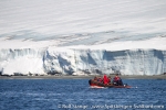
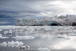
A big advantage of circumnavigating Nordaustland clockwise is that you have to sail along the long glacier front, the longest one of the northern hemisphere. This ice cliff is a phenomenon even if you just follow it for just a few miles. But for more than half a day, that is a different kind of experience, something very unique. It just doesn’t stop, it is just going on and on and on. Part of the ice cap has surged in recent years, there are still large numbers of icebergs drifting in these waters.
Gallery Bråsvellbreen, Vibebukta – 24th July 2016
- gallery anchor link: #gallery_969
Click on thumbnail to open an enlarged version of the specific photo.
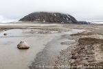
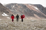
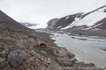
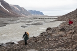
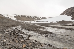
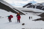
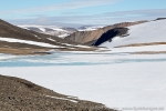
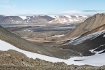
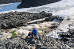
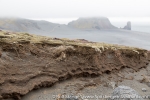
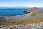
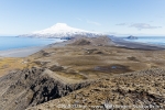
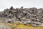
We found ideal conditions for a landing in Vibebukta, which was especially nice as we have several people on board who had been with us before, for example in 2011 when we had to cancel a landing there because of a polar bear on shore or in 2015 when the whole area was blocked by ice. Nice to get there now, for a short walk and a bit of a hike, on lower and higher hills, enjoying views over the coastal plain, the ice cap and some insight into earth history.
Storøya & Kvitøya – 23rd July 2016
Sat
23 Jul
2016
We were already far north and the weather was on our side. So we set course around Nordaustland and to Spitsbergen’s remotest areas. It turned out a day not to be forgotten. It started with calm seas, no wind and sunshine. The wide icecap of Nordaustland was glittering in the sun on starboardside, the smaller Storøya, also largely covered by an ice cap with a typical hourglass profile. North of it, some square kilometres of ice-free, barren land.
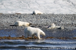
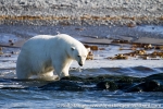
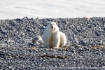
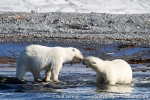
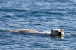
But it was not uninhabited. It did not take long until we found the first polar bear. It was not to be the last one for today. To be honest, I lost the overview in the end, we saw something like 13 or 14 polar bears on Storøya. Some were just sleeping, others walking around on the shore, some chewing on bones of a whale that must have stranded here some time ago. An amazing spectacle, which I can’t describe in all detail now, it would take a lot of time. But we spent an unforgettable morning in their near neighbourhood, watching them from the Zodiacs, how they were resting near the shore, walking around, playing with each other, occasionally curiously coming towards us, even swimming into our direction … stunning, unforgettable.
Finally, the bears went for a siesta and so did we, all those impressions needed to settle down, be processed and stored. Meanwhile, we set course on Kvitøya, Spitsbergen’s remotest island. A good 30 miles, calm hours, a chance to relax a bit.
Gallery Storøya & Kvitøya – 23rd July 2016
- gallery anchor link: #gallery_967
Click on thumbnail to open an enlarged version of the specific photo.
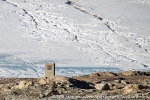
In the evening, the anchor went down near Andréeneset, where Andrée, Frænkel and Strindberg made their final landfall on 05th October 1897 after their famous balloon flight and the long journey across the ice. Stepping on solid ground was a pleasure that was not meant for us tonight, there was one polar bear just too close for that, and it even came a bit closer. So we went out into the Zodiacs to have a good look at the memorial from a little distance, a simple concrete block marking the site of the Andrée-expedition’s final camp. And of course to have a look at the polar bear that was walking around on the nearby beach not far away, looking quite meagre and chewing some seaweed. A bit further north, another polar bear scared a large herd of walruses into the water.
Sjuøyane – 22nd July 2016
Fri
22 Jul
2016
We made it up to Sjuøyane, the Seven Islands, the northernmost part of Spitsbergen! That is just around the corner from the north pole. We could almost see it from a little hill on Phippsøya, it was just hidden behind a cloud. But we could see that barren, very characteristic high arctic landscape all around us.
Gallery Sjuøyane – 22nd July 2016
- gallery anchor link: #gallery_965
Click on thumbnail to open an enlarged version of the specific photo.
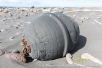
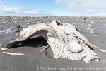
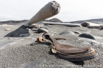
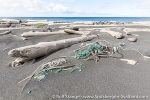
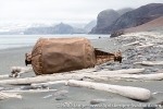
Something else that we could see was the terrible plastic waste, which is drifting into the remotest corners of the planet with sea currents. At least, there are now two cubic-metre bags less of it on Phippsøya.
Wahlenbergfjord – 22nd July 2016
Fri
22 Jul
2016
We did get wind, today in Wahlenbergfjord. This did not keep us from making a nice little landing in a hidden corner somewhere in Palanderbukta.
In the afternoon, things got interesting. Nice sailing wind to move under sails into Wahlenbergfjord, until the increasing density of icebergs and bergy bits from Bodleybreen forced us to maneouvre more and more. We did nevertheless manage to get into the innermost bay, just to find a beautiful specimen of a strong polar bear walking around in a moraine there.
Not just one, a female with a first-year cub ran up on the glacier and away from the strong one, most likely a male. Three polar bears are three good reasons for not going ashore, much to the regret of the hiking group who were ready to go ashore and start the hike across Nordaustland to Rijpfjord. It was not meant to happen today.
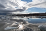
The wind delivered an impressive display of force. To begin with, it calmed completely down, giving way to beautiful reflections of the mighty glacier Bodleybreen and the icebergs on the water. But this was literally just the eye of the storm. Soon, the wind returned with increased force from the opposite direction. The anchored dragged hopelessly and had to be lifted soonest.
Gallery Wahlenbergfjord – 22nd July 2016
- gallery anchor link: #gallery_963
Click on thumbnail to open an enlarged version of the specific photo.
Maneouvring the ship out of the way while the anchor was still in the water gave Captain Joachim great fun on the bridge. Altogether it was a very impressive display of both the beauty and the powers of nature in the arctic.
Hinlopen – 21st July, 2016
Thu
21 Jul
2016
Miracles of Hinlopen Strait. Important part of today’s pleasures: the weather, in terms of no wind. Nothing you should take for granted in these waters, as we were to find out a day later. The photos will do the talking for today 🙂
- gallery anchor link: #gallery_961
Click on thumbnail to open an enlarged version of the specific photo.
Mosselhalvøya – 18th/19th July, 2016
Mon
18 Jul
2016
A tent night just under the 80th parallel, sounds like a dream, doesn’t it 🙂 and that was exactly our plan, at least for a part of the group. While landing, the thought of spending the night in a camp was a slightly mixed one, as we had a stiff breeze and the occasional little rain coming from low clouds straight into our faces.
At least these clouds were quite impressive, real storm clouds. Several steams forced most of us to change to some kind of suitable footwear for the occasion. A strong wind kept blowing out of Mosseldalen, and I sensed it wouldn’t be a good place to put up a camp, so we used the first and last nice opportunity before we got that far.
After a while, the tents were standing, reasonably well sheltered from the wind, a little stream with crystal clear water just a few metres away. Lovely place! After a simple but good dinner, the wind fell asleep and so did we, apart from the polar bear watch who stayed outside, walking around and keeping a watchful eye open for any traffic, while enjoying some beautiful light and the occasional bird or reindeer.
Next day, the weather was slowly improving. Mosseldalen turned out to be a very arctic route with scree slopes and a river plain with several channels. Very scenic and impressive.
The next excitement was the question if there was a good way over to Sorgfjord. According to the map, which isn’t exactly very detailed, this should be the case, but in reality ..? Steep rocky slopes to both sides of the valley, a nice glacier, Tåbreen, on the southern side, but that was not our way.
Behind the final bend, however, as expected and hoped for, a nice snow field and then a slope that we could negotiate rather easily. Great views over upper Mosseldalen and Tåbreen, then some low hills and snow fields and soon a little valley leading down to Sorgfjord.
An easy snow field, feeding a torrential meltwater river coming out of a snow cave at the lower end, a walk through the lower valley and then it was just a few final kilometres across the low-lying tundra to reach the shore, where good old Antigua was at anchor, waiting for us. Calm atmosphere an board, everybody had completed their various landings and we just in time for dinner 🙂
Gallery Mosselhalvøya – 18th/19th July, 2016
- gallery anchor link: #gallery_958
Click on thumbnail to open an enlarged version of the specific photo.
It is still impossible to say if this is the route used by various members of the Schröder-Stranz-expedition in 1912 and 1913, as they travelled between Sorgfjord, where their ship was trapped in ice, and Wijdefjord, trying to get through to Longyearbyen. It may as well have been a bit further north, which is also possible, as I could try a couple of years ago.
I guess it will never be possible to identify their exact route, just as their leader and 3 more comrades got lost on Nordaustland, most likely forever.
West coast – 16th and 17th July 2016
Sat
16 Jul
2016
16th and 17th July 2016 – Feels like ages ago that we were on the west coast – less than a week, actually, but it feels like a month, and indeed the time was so fully packed with endless activities and impressions that I did not manage to write anything. After the wonderful day in the southern Forlandsund, we worked our way step by step to the north.
Ny Ålesund is obviously a must, and we went to Virgohamna (who knows, maybe we get to Kvitøya on this trip, as everything is ice free up there, then having been to Virgohamna is a good start, thinking of the Andrée expedition).
Gallery West coast – 16th and 17th July 2016
- gallery anchor link: #gallery_957
Click on thumbnail to open an enlarged version of the specific photo.
Forlandsund – 15th July 2016
Fri
15 Jul
2016
Sometimes being a bit late is good thing. It is easy to keep the routine, falling asleep in Isfjord and waking up in Kongsfjord. This time, we had a couple of important things to do before we could take off from Longyearbyen.
As mentioned, there were some advantages in that. Normally, everybody is just passing by Daudmannsodden, but it is such a beautiful place. This time, we just dropped anchor there. The sea flatcalm around this exposed shore, where it can get pretty wild in westerly or southerly winds. They say this does happen here sometimes.
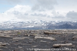
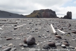
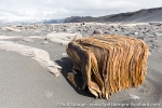
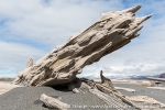
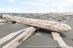
Lovely coastal landscape and wide tundra. Huge beaches, lots of driftwood, wide series of old beach ridges, little bays hidden behind coastal rocks.
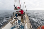
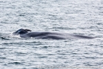
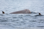
It went on like that. Instead of heading straight north, we went looking for whales in southern Forlandsund. And – we were lucky. A Blue whale was slowly swimming around, feeding. Following him carefully for a while, we happened to get closer to the southern tip of Prins Karls Forland, we we just took the opportunity and went ashore. We had sailed past it 1000 times, and admired the strongly structure coastline just as many times on the map. Now it was time to see it in reality, which turned out to be even nicer than on the map, which was no surprise.
Gallery Forlandsund – 15th July 2016
- gallery anchor link: #gallery_955
Click on thumbnail to open an enlarged version of the specific photo.
After leaving Prins Karls Forland, we saw even more whales, another Blue and one or two Humpback whales. Yet another Blue whale was seen quite close to the ship around midnight, but the long day had already taken its toll and most people did not see it anymore.
Around Jan Mayen – 22nd June 2016
Wed
22 Jun
2016
We can’t ignore it anymore, today is the day to put Basecamp down and to say goodbye to Jan Mayen. At least, we have got good weather, which makes everything much simpler and more pleasant. Weather rules everything here!
And we still have got time to sail around Jan Mayen. The mighty Beerenberg is greeting us several times by showing its white crown through holes in the clouds, then we pass Weyprechtbreen and the other glaciers which are reaching the shore on the northern side. Quite impressive, as they come kreeping down the slopes of Beerenberg, wildly crevassed, frozen rivers of broken blocks of ice.
Gallery 1 – Around Jan Mayen – 22nd June 2016
- gallery anchor link: #gallery_949
Click on thumbnail to open an enlarged version of the specific photo.
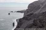
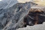
At the northern tip, we pass by the youngest part of Jan Mayen, which came into existance during a volcanic eruption in 1970. On the east coast, more glaciers reach the sea, and steep coastal cliffs allow rare views of the inside of a volcano. Then Eggøya is coming into view, and over the next couple of hours, Mid and Sør Jan are passing by, where we could make so many memorable experiences in recent days, the station, Kapp Wien …
Gallery 2 – Around Jan Mayen – 22nd June 2016
- gallery anchor link: #gallery_950
Click on thumbnail to open an enlarged version of the specific photo.
Then we are back at sea. Three days sailing back to Iceland.
Southwards to Kapp Wien – 21st June 2016
Tue
21 Jun
2016
A station visit is almost mandatory when you are on Jan Mayen, but strictly by invitation only. We have got our invitation for today 1300 Norwegian time (1100 Icelandic time = our time). So breakfast on time and we head off with discipline as scheduled. We need two hours to walk along the road, 8 km long, to the station.
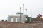
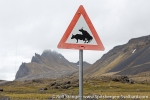
On the way, we are passing various important bits and pieces of the local infrastructure: Jan Mayen International Airport (just a simple runway), the weather station (1-2 km north of the actual station) and, of course, various specimens of the local forest of traffic signs, which are mostly reflecting the specific sense of humour on such a place rather than regulatory needs of dense traffic.
On the station, we are allowed to enjoy the hospitality with its various, typical aspects for some hours: pleasant stay in a rather zivilised venue, curious looks and photos in public areas as are made accessible to us and – the highlight – an intense shopping session in the souvenir shop. Our curious questions are also answered.
Gallery 1
- gallery anchor link: #gallery_944
Click on thumbnail to open an enlarged version of the specific photo.
As it is time to take off again, the sun is shining and the day is still long. When, if not now, do I have the chance to explore the terrain south of the station? This part of Jan Mayen does have a lot to offer: starting in Borgdalen, which I came down quite recently but without seeing anything due to the dense fog, so I saw nothing of the sharp mountain ridge Schiertzegga.
Green, wide areas, almost like meadows, are stretching in lower Blinddalen, before some hefty ascents lead up to Flykollen above Kapp Wien. There, a German weather reconnoissance plane crashed into a steep slope in July 1942. All four crew members died. The wreck is still there, as one out of two WWII aircraft wrecks on Jan Mayen. The other one, at Danielsenkrateret near the northern lagoon, is quite easily accessible, in comparison at least.
You can’t say that this one is easy to get to. For a while already, I have been climbing up a steep slope, asking myself permanently how far I was actually willing to go. Behind a little ridge, the view is opening into a steep ravine, and there it is, the plane wreck, in several parts. A wing here, the main body there. The terrain is too steep for me, I don’t want to go down here, being on my own and without any rope or other safety. I have seen enough, after a couple of photos I turn back.
Instead, I rather enjoy the grand coastal scenery at Branderpynten for a while. Jagged coastal rock stacks and caves, bird cliffs and the associated dense, colourful vegetation. All this makes this part of Jan Mayen a particularly beautiful one. I would have to spend more time here …
Gallery 2
- gallery anchor link: #gallery_945
Click on thumbnail to open an enlarged version of the specific photo.
As so often, the tour finishes with some long, tough kilometres on the road back to Kvalrossbukta, amounting to a total of 30 kilometres in the end for today. As I come back to the basecamp, I find the others gathered around a cosy camp fire. Spirits are excellent, everybody has stories about the day to tell.
Gallery 3
- gallery anchor link: #gallery_946
Click on thumbnail to open an enlarged version of the specific photo.
Haugenstranda – 20th June 2016
Mon
20 Jun
2016
The return to basecamp last night was great, everybody had stories to tell around a big casserole of Icelandic lamb stew. Anneli and Martin have reached the peak of Beerenberg together with mountain guide Magnus. Well done, congratulations!
Beyond this, everybody has explored the north extensively with most of the sites of interest over there. And as I came now stumbling back into the mess tent as the last mohican, everybody wanted to know what I had seen and experienced in the south.
After the many kilometres of the last days, my lower half demanded a calmer day. Initially I took the luxury of just being lazy for a couple of hours, before I put a little daypack together for a good beach walk. Walking along Haugenstranda to its end had been on my wishlist for a long time. It is stretching for 3 kilometres northeast from Kvalrossen, initially being very wide, getting narrower further north. It is covered with immense amounts of driftwood, something that is always interesting.
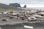
Slowly I walk between the various bits and pieces, wondering where they may have come from. As in Spitsbergen, most of the logs are cut, only a few have roots. Also the Jan Mayen driftwood has mostly made the long drift from Siberia across the Arctic Ocean. Only in a few cases, larger holes of boreworms indicate an origin in more temperate waters.
Unfortunately, the unavoidable plastic trash is to be found also here in volumes. Largely items from the fishing industry, but a lot of weird stuff as well, from hygiene articles over shoes to objects that I can not identify. A shame that tourists are not allowed anymore to make landings in places like this. They like to clean a beach, as everybody knows who has been following this blog for a while. As it is, the plastics just remain here on the arctic beaches. Well done, Oslo.
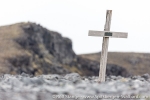
At the end of the beach, there is a lonesome grave on a little elevation. The metal plate on the wooden cross says Sivert Eide 1909. Sivert was member of the second group of Norwegian trappers who had come to Jan Mayen to overwinter and hunt polar foxes. They had mainly used the Austrian station in Maria Muschbukta, but additionally built a hut here at Haugenstranda. Sivert died here at Haugenstranda of scurvy in February 1909. The storms have not left anything of the hut, just some rusty remains of the stove and some wooden planks tell the careful observer where a wall once may have been.
Gallery 1 – Haugenstranda – 20th June 2016
- gallery anchor link: #gallery_939
Click on thumbnail to open an enlarged version of the specific photo.
The way back leads me over a ridge of low hills called Lågheia, which is separating the coasts to either side of Mid Jan. Just a few metres of elevation change the perspective greatly and allow scenic views over Haugenstranda, while saxifrages and moss campion delight the eye with colour patches on the ground. Aggressive glaucous gulls attack the wanderer fiercely. More than the birds, a light rainshower makes him set course back to Kvalrossbukta. Neumayerkrater, a volcanic crater that might have been a nice extra walk in this area, is shrouded in deep, grey clouds this time.
Various soil and vegetation structures tell a clear story about the ferocious winds Jan Mayen is so renowned for. Today, there is just a light, steady breeze blowing over the volcanic hills.
Gallery 2 – Haugenstranda – 20th June 2016
- gallery anchor link: #gallery_940
Click on thumbnail to open an enlarged version of the specific photo.
The wind, light and constant as it was up on the ridge, is falling down in strong gusts into Kvalrossbukta, quickly calming down again just to take a rest to gather strength for the next attack. During the night, we all have to get out of our sleeping bags to secure the mess tent with more stones and driftwood before it starts to take of for a flight over Jan Mayen.
The tour to Sør Jan – 17th-19th June 2016
Fri
17 Jun
2016
The sun is shining and the wind is blowing somewhere else today. So we do not waste much time but get ready for some longer hikes. Most of us aim for the north, to Beerenberg and its surroundings, the northern lagoon, Maria Muschbukta, Eggøya and so on.
I opt for a different way and take the route to the south. I know Nord Jan quite well, have seen a lot there already, while in the south, my mental map still has a lot of white gaps and my photo archive needs some serious completing. So something has to be done over there, for sure! The opportunity is good.
So while the majority is heading northwards – three of them will make an efficient, successful dash to the top of Beerenberg – I am going to the south. The view over the backbone of Mid Jan to Beerenberg, which is more and more getting out of the clouds, showing its amazing splendor in full sun, could not be more overwhelming. To the south, Sør Jan is stretching out with its confusing arrangement of hills and craters.
Gallery 1 – The tour to Sør Jan – 17th-19th June 2016
- gallery anchor link: #gallery_934
Click on thumbnail to open an enlarged version of the specific photo.
The deep, soft mosses, which are growing on large areas here, the unprecise map, the volcanic terrain which is often lacking geomorphological logic, all this contributes to the demanding expedition charakter that any longer hiking on Jan Mayen will quickly have. Another factor contributing to this is the almost constant, latent lack of water: soon after the snow melt, the few little streams are falling dry. There are only a few little lakes. So you have to rely largely on snow fields, which means: no water without a stove to melt snow. During the day, there is usually no more drink than what you carry with you. On this trip, as on previous, similar ones, I quickly greet thirst as hunger’s big, evil brother. While stumbling over dry lava fields for kilometres, I was thinking of novels that I could write about thirst. Thirst soon dominates not only my mouth, but also my brain. The idea of a lively spring is paradise, a beer worth its own weight in gold.
All this certainly far from any real danger, but there is this omnipresent, at times rather uncomfortable lack of liquid. At any time I have the next snow field in view, my planning is according to kilometres in the terrain and litres of water in my rucksack.
Yet another factor making life more difficult than necessary are the legal regulations in force since 2010. Making life difficult for those few still passionated (and stubborn) enough to travel here is the purpose of these rules, I guess. Camping in the field is forbidden as is any landing (or pickup) outside of Kvalrossbukta or the station area. Despite sea conditions being as calm as they might ever get, a quick lift or pickup by boat, technically very easy, logistically convenient and very safe, is not an option. Instead, there are all these kilometres on the long and boring road to the north or south from Kvalrossbukta, to the places we are longing for. Well, a lot has been said about the sense (or, rather, nonsense) of this legislation. Enough for now.
So these are the frame conditions which you have to be prepared for when hiking on Jan Mayen. Quite exactly as the trip to the top of Beerenberg, my tour amounts to a good 60 km over land and quite a lot of altitude, although the vertical metres are not concentrated on one prominent peak, but happen on many smaller hills and slopes. There are dozens of them.
The short crossing of the island from upper Trolldalen takes me to Sjuhollendarbukta. This was the site of the famous wintering of the seven Dutch whalers in 1633-34, not Kvalrossbukta, at least according to the Austrian expedition from 1882-83 (First International Polar Year). The name of the bay, which translates as Seven Dutchmen Bay, is another reference to the winterers who made it through the dark time just to die from scurvy weeks before the relief ships came.
We will probably never now for sure where exactly this tragic adventure took place. Today, Sjuhollendarbukta is a lovely, beautiful bay with a wide beach of black volcanic sand, framed in by the odd-shaped rocks of wide-stretching, moss covered lava fields.
Something similar can be said about Titeltbukta, which was another important place for the Dutch whalers. Again, nothing is left of their „10 houses“ (ten tents = ti telt). All that reminds of longer-lasting human presence is a small, but charmful trappers’ hut which has withstood the wind now for more than a century.
Oysterplant, rare in Spitsbergen, is colouring the black sand in many places, and the rich colours of the mosses and lichens in the lava fields are amazing.
And yes, the lava fields. If Jan Mayen does not have her own legends and myths about elves and trolls, then it is just because the island has not been inhabited for more than a 1000 years such as neighbouring Iceland. Of course, there are goblins and dwarves living here, and countless other creatures that prefer the darkness above the sun! Just as the well-known giants with the strong sun allergy, which react to direct sunlight by immediately and completely turning to stone. One of these trolls just wanted to show me the way, as it hit him.
Unbelievable what else was around here: turtles, warriors, castles and towers, giant worms and knights … everything you could think of and more than that. Today, there are all silent statues of sharp-edged lava rock, secretly watching the lonely wanderer who might occasionally cross their realm.
Gallery 2 – The tour to Sør Jan – 17th-19th June 2016
- gallery anchor link: #gallery_935
Click on thumbnail to open an enlarged version of the specific photo.
But even so, I am not on my own. Myriads of Little auks are breeding in the lava fields. Numbers and densities over large areas that can certainly compete with the better-known, big colonies in Spitsbergen. Constant screaming and crazy laughter, everlasting hectic activity in the air while big swarms are heading to and fro. In more flat terrain, skuas and arctic skuas defend their territories with aggressive passion against any intruder. In Guineabukta, Common eiders are calling from a coastal lagoon. They have their nests hidden in the lava fields.
At Jan Mayen’s southwestern end, there is some lowland called Kraterflya. The name is descriptive: several nice craters and cinder cones are spread over the lowland, including Richterkrater, which is better known than many of his relatives, for reasons that are not obvious. Not that he would look any different than many other smaller kraters on Jan Mayen. Neither can it have to do with the ice wedges that decorate the steep, moss-covered slopes with geometrical patterns. Even though they are less common than, say, in Spitsbergen, this is not the only place on Jan Mayen where you can find them. Maybe it is just because it is so nicely located close to the shore, making those who pass by on a ship think: what a nice crater, I just have to visit you one day! Well, at least I have thought this more than once, and now the door has opened a bit, time and weather are on my side.
So now I am here.
Someone has called the lowland between Guineabukta and Richterkrater Helheimen, home of hell. It is not quite that bad, but not without reason, as yet another especially mean lava field is located here, giving hiking shoes and walking muscles a hard time. Be careful! No false step is allowed, a broken leg would be so much worse here than most other places in the world.
Then I am standing on the rim of Richterkrater, enjoying the views over bizarre lava flows and several craters in the surroundings and the fact that I have now come to another place that had been on my wishlist for a long time. My feet remind me that this pleasure comes at a price, but before I start returning to the north, I walk up to the steep cliffs at the southern point of Jan Mayen. Vertical, rugged cliffs, where countless Glaucous gulls and Fulmars are screaming, while keeping a watchful eye on me. Sharp rocks stick like knives out of the cliffs and the coast, former volcanic intrusions. Fog is rolling in from the east, as if to tell me: this is where you wanted to come, this is where I allowed you to come, but no further. This is it.
I agree and turn back. The way to Kvalrossbukta is still more than long enough.
Gallery 3 – The tour to Sør Jan – 17th-19th June 2016
- gallery anchor link: #gallery_936
Click on thumbnail to open an enlarged version of the specific photo.
Crossing to Jan Mayen – 14th-16th June 2016
Tue
14 Jun
2016
The crossing is amazingly calm and life is relaxed, even for confirmed land rats on a small sailing boat like this. I can even do my little presentation of Jan Mayen outside, where there is less noise from the engine. Other than that, the crossing is only interrupted by the sighting of a rare Blue whale and some occasional Beaked whales.
Gallery Crossing to Jan Mayen – 14th-16th June 2016
- gallery anchor link: #gallery_930
Click on thumbnail to open an enlarged version of the specific photo.
Jan Mayen is coming up on the horizon on the third day of our crossing. We follow the southern north coast for some hours until we reach Kvalrossbukta. The anchor goes down after 440 nautical miles, and soon, we have established our base camp on shore.
Island – 13th June 2016
Mon
13 Jun
2016
Let’s not talk too much about yesterday. A hasty goodbye to Antigua and her good people, re-organization of luggage and equipment late at night, then a day spent being tired in airports and on flights. Longyearbyen, Oslo, Keflavik, Reykjavik. Who wants that? I don’t, but there is no way around it. There is no train and no bus to Jan Mayen.
24 hours after leaving Antigua in Longyearbyen I am already in a simple guest house in Reykjavik, slowly recovering from the voyage.
I continue early next morning with a small, but powerful propeller-driven aircraft to Ísafjörður, the metropolis of Iceland’s remote northwest fjords.
Don’t expect too much from this metropolis. You have seen most of it after an hour or two. But Ísafjörður is not only our gateway to Jan Mayen, it is also extremely friendly today: the sun is burning from a cloudless sky. There is still time for a little excursion. A rental bike is quickly found, and after a little ride I start ascending the mountain Kubbi. Just a bike and hiking boots. Nothing that flies or burns fuel. Wonderful! That is fun, that is how it should be. Getting a bit out of breath, fresh, unfiltered air in the lungs, sitting on arctic heather tundra a few metres high with bare feet, enjoying stunning views on mountains, waterfalls and fjords – a lot of my ideas of good life are in this. More, please! Well, there may be a lot of it in a few days’ time on Jan Mayen.
Soon some final shopping is done, the last preparation before departure involves a big plate of local fried cod. Then, a little group of 11 gathers around the table on Sigurdur’s Aurora. Next to the skipper himself, mate Vidar and mountain guide Magnus, all from Iceland, and me, there are Anneli from Estonia, who is attracted by remote places that are difficult to get to („you can’t get there? Great, let’s go there!“), Dominique from England, a friend of remote islands, Erling from Norway, who had felt a desire to go to Jan Mayen already in childhood days, Fred from America, who has recently made an impressive expedition to Heard Island, Karl, who had been with Siggi to Greenland, Marcus, who is fascinated by polar history, and Martin, who has a strong passion for the volcanoes of the world.
Gallery Island – 13th June 2016
- gallery anchor link: #gallery_928
Click on thumbnail to open an enlarged version of the specific photo.
Next to Aurora, Sigurdur’s new ship is alongside, the old Bør, now bearing her new name Arktika. That would be a good ship for Greenland … well, now we are on Aurora, heading for Jan Mayen. The adventure begins.
We have a lovely start in the nicest evening light. Sometimes the fjord lies calm and clear around us, sometimes a breeze from the table mountains further north pushes small waves up. The ship is stomping into a strong wind as we surround the last capes, but it should not last too long, the forecast is fine and we should have a reasonably calm crossing.
Isfjord – 11th June 2016
Sat
11 Jun
2016
As unpleasant as the weather had been yesterday afternoon near Magdalenefjord, there was only one thing to do: put the foot down and leave the area, steaming south and towards new places, far away from the dark, low clouds. Nice scenery under a blue sky, that would be good now, for the last day of this voyage. A presentation, a film and Captain’s dinner make the afternoon go past quickly.
So we awoke today deep in Isjord. It had worked well, the impressive mountains around Billefjorden are enlightened by bright sunshine. We take a walk under the fortress-like cliffs of mount Skansen, having a look at the remains of an old gypsym mine and at the remains of lagoons from the days when Spitsbergen was still part of a large landmass near the equator. A little group of reindeer is roaming the tundra close to us. We enjoy the impressions and the surroundings in arctic silence.
Gallery Isfjord – 11th June 2016
- gallery anchor link: #gallery_926
Click on thumbnail to open an enlarged version of the specific photo.
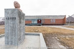
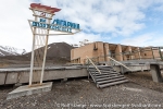
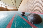
Pyramiden is also largely a silent place, but otherwise so completely different from the other places we had seen so far. A strong visual contrast to everything the arctic had given us so far, a last place that rounds our Spitsbergen experience off to make it as complete as can be.
News-Listing live generated at 2025/June/16 at 09:14:10 Uhr (GMT+1)
