-
current
recommendations- Liefdefjord
New page dedicated to one of Spitsbergen's most beautiful fjords. Background information and many photos.
- New Spitsbergen guidebook
The new edition of my Spitsbergen guidebook is out and available now!
- Liefdefjord
New page dedicated to one of Spitsbergen's most beautiful fjords. Background information and many photos.
Page Structure
-
Spitsbergen-News
- Select Month
- April 2025
- March 2025
- February 2025
- January 2025
- December 2024
- November 2024
- October 2024
- September 2024
- August 2024
- July 2024
- June 2024
- May 2024
- April 2024
- March 2024
- February 2024
- January 2024
- December 2023
- November 2023
- October 2023
- September 2023
- August 2023
- July 2023
- June 2023
- May 2023
- April 2023
- March 2023
- February 2023
- January 2023
- December 2022
- November 2022
- October 2022
- September 2022
- August 2022
- July 2022
- June 2022
- May 2022
- April 2022
- March 2022
- February 2022
- January 2022
- December 2021
- November 2021
- October 2021
- September 2021
- August 2021
- July 2021
- June 2021
- May 2021
- April 2021
- March 2021
- February 2021
- January 2021
- December 2020
- November 2020
- October 2020
- September 2020
- August 2020
- July 2020
- June 2020
- May 2020
- April 2020
- March 2020
- February 2020
- January 2020
- December 2019
- November 2019
- October 2019
- September 2019
- August 2019
- July 2019
- June 2019
- May 2019
- April 2019
- March 2019
- February 2019
- January 2019
- December 2018
- November 2018
- October 2018
- September 2018
- August 2018
- July 2018
- June 2018
- May 2018
- April 2018
- March 2018
- February 2018
- January 2018
- December 2017
- November 2017
- October 2017
- September 2017
- August 2017
- July 2017
- June 2017
- May 2017
- April 2017
- March 2017
- February 2017
- January 2017
- December 2016
- November 2016
- October 2016
- September 2016
- August 2016
- July 2016
- June 2016
- May 2016
- April 2016
- March 2016
- February 2016
- January 2016
- December 2015
- November 2015
- October 2015
- September 2015
- August 2015
- July 2015
- June 2015
- May 2015
- April 2015
- March 2015
- February 2015
- January 2015
- December 2014
- November 2014
- October 2014
- September 2014
- August 2014
- July 2014
- June 2014
- May 2014
- April 2014
- March 2014
- February 2014
- January 2014
- December 2013
- November 2013
- October 2013
- September 2013
- August 2013
- July 2013
- June 2013
- May 2013
- April 2013
- March 2013
- February 2013
- January 2013
- December 2012
- November 2012
- October 2012
- September 2012
- August 2012
- July 2012
- June 2012
- May 2012
- April 2012
- March 2012
- February 2012
- January 2012
- December 2011
- November 2011
- October 2011
- September 2011
- August 2011
- May 2011
- April 2011
- March 2011
- February 2011
- January 2011
- December 2010
- November 2010
- September 2010
- August 2010
- July 2010
- June 2010
- May 2010
- April 2010
- March 2010
- February 2010
- November 2009
- October 2009
- August 2009
- July 2009
- June 2009
- May 2009
- April 2009
- March 2009
- February 2009
- January 2009
- December 2008
- November 2008
- October 2008
- August 2008
- July 2008
- June 2008
- May 2008
- April 2008
- March 2008
- February 2008
- April 2000
- Select Month
-
weather information

| Guidebook: Spitsbergen-Svalbard |
Home →
Yearly Archives: 2015 − News & Stories
Ittoqqortoormiit – 08th September 2015
Tue
8 Sep
2015
Iceland’s first autumn storm has sent a bit of rushed air up to Scoresbysund. As we are south of Jameson Land, an easterly wind is picking up, and the sails are going up – good stuff, and there may be one or the other on board who discovers his or her love for sailing. So we forget about the idea of going to Kap Hope – not a bad exchange, after all, for us.
Ittoqqortoormiit, or Scoresbysund village, whatever you want to call it, comes accordingly a bit grey and windy. An arctic late summer day. Memories from my longer stay there in 2006 come to mind again (my God, 10 years ago!), the bay frozen over, dog sleds going over the ice where Ópal is drifting now, in the position where I got the Greenland shark … old stories, fond memories. The village has lost some inhabitants, both humans (a few) and dogs (quite a lot) since then.
Gallery Ittoqqortoormiit – 08th September 2015
- gallery anchor link: #gallery_738
Click on thumbnail to open an enlarged version of the specific photo.
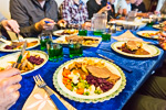
A nice farewell to Greenland, with a dinner at a private home in good atmosphere.
Bjørne Øerne & Charcot Havn – 07th September 2015
Mon
7 Sep
2015
Jyttes Havn in Bjørne Øerne (Bear Islands) is one of the most beautiful natural harbours in Scoresbysund. Grundtvigskirke and other mountains around eastern Øfjord, almost 2000 metres high, have perfect mirror images on the calm water in the morning sun. The hike up the rocky hills is a bit demanding, but easy for strong hikers and the views are extremely rewarding.
Further south, Charcot Havn is the only useful bay on the eastern side of Milne Land. In contrast to the very old crystalline bedrock that makes up most of inner Scoresbysund, there is some sediment rock on the southern side of the bay, a western outlier of the Jameson Land Basin, and some fossils would be interesting for a change. The slope does not look too promising, the lower part covered with moraine remnants, all crystalline basement rock, where no Mesozoic frutti di mare would have got lost. Further up, there are coarse sandstone blocks. And they have got it all: bivalves, brachiopods, coral fragments, belemnites, the whole lot. Jurassic wadden sea, preserved in the rocks for more than 150 million years, brought to daylight by glaciers and frost action.
Gallery Bjørne Øerne & Charcot Havn – 07th September 2015
- gallery anchor link: #gallery_736
Click on thumbnail to open an enlarged version of the specific photo.
Huge icebergs are drifting every here and there in the late evening light, while Ópal is sailing through Hall Bredning, the wide-open middle part of the Scoresbysund. The water is flat calm, a beautiful evening.
Northern light – 06th September 2015
Sun
6 Sep
2015
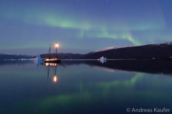
The late night brought another highlight: a northern light. The sky was glowing with green colours above the southwestern mountains when a beautiful aurora started to shine, coming and going a couple of times. That was definitely another wish that all of us here on board had.
Photo Northern light – 06th September 2015
Tundra land & Island fjord – 06th September 2015
Sun
6 Sep
2015
The country in inner Scoresbysund is mostly steep and rather alpine, and it is not easy to find a place for a longer hike. No question that we had to go out once for a good walk to get lost in the arctic nature with body and soul. Today was the day, both the terrain and the weather were perfect for it.
Photo C. Hofmann Halvo – 06th September 2015 – 1/2

The tundra is glowing in all autumn colours: the Arctic willow in green and yellow, the Dwarf birch in red and brown and the Crowberry with a red so intense as if they had an lightbulb inbuilt. The hike is taking us from one hill crowned with a huge erratic boulder to the next one, every single one inviting for shorter or longer breaks to let the eye wander over the wide tundra and the colourful mountains. A first class arctic experience, faultless polar pleasure. A snowy hare and some muskoxen are the icing on the cake.
Photo C. Hofmann Halvo – 06th September 2015 – 2/2
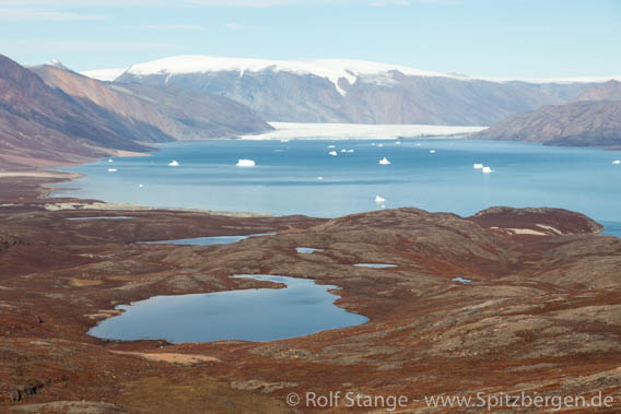
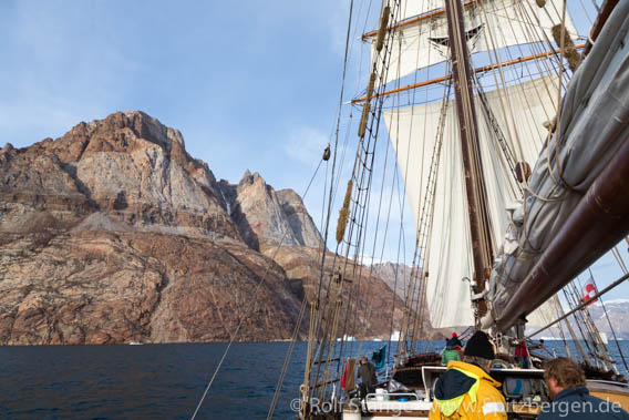
The passage through Øfjord makes the round trip through the inner fjords of Scoresbysund complete. 40 nautical miles through this mighty sound, where near-vertical rockwalls drop a kilometre below sea level and rise similarly high above. A feast for those interested in geology and in aesthetical structures in rocks, and those who want to be impressed by the dimensions of a huge landscape, will find their heaven here anyway.
Photo Ofjord – 06th September 2015
Fjord of colours II – 05th September 2015
Sat
5 Sep
2015
The display of colours at Røde Ø was impressive, but even more impressive was the bigger display of the same colours in one of the canyons further north. Normally, nature experience is not a matter of getting the same thing bigger, better or faster, but in this case, referring to the colours, this was the impression. We just went into one of these canyons without knowing how far we would get. We got amazingly far. Hundreds of metres of near vertical rockwalls to all sides, screaming dark red, crowned by a deep blue sky. An explosion of two colours, an amazing intensity.
Photo Rodefjord Canyon – 05th September 2015

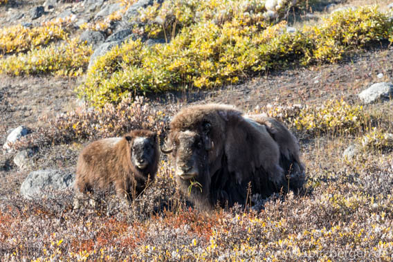
Further north, muskoxen are grazing not far from the shore, then we reach a smaller outlet glacier that comes down from the inland ice. After a little climb, we get nice views down onto a crevassed glacier. On the way, an unexpected, happy meeting with a small muskoxen family. Surprise on both sides, cameras here, some moments of thinking there, then they move away. Amazing how fast these arctic, ice-age-style goats can climb up the steep slopes.
Photo Harefjord – 05th September 2015
A little evening walk into the colours of the sunset – again colours, that is just how Greenland is on a nice late summer day. Ópal is already anchored in a little bay as we arrive.
Fjord of wind – fjord of colours – 04rd September 2015
Fri
4 Sep
2015
Fønfjord has got its name for a reason, and it lived up to its reputation. Of course the katabatic wind blows down and away from the inland ice, straight on the nose for us, that is. It is safe to bet the house on it. Pretty strong today, the wind.
But who says you can’t go ashore in Fønfjord?
Photo Fjord of wind – fjord of colours – 04rd September 2015
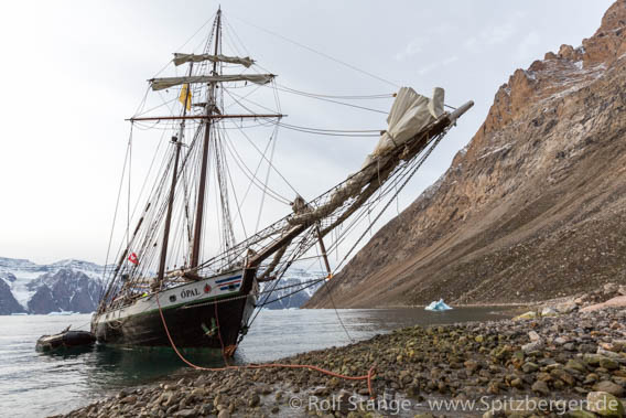
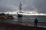
There is a nice little bay on the shore of Milne Land, where Ópal celebrated her lovely water ceremony. Meaning that we filled up our water supplies there. The captain put the bow straight on to the beach, and down into a little clear stream with the pump. Small ship pleasures!
Photo Røde Ø – 04rd September 2015 – 1/2

Rødefjord also has got its name for a reason. Deeply red sandstone. Near Red Island, nature has created an amazing wall of basalt columns like a pile of firewood. Vertical rock faces, just like Marlboro Country.
Photo Røde Ø – 04rd September 2015 – 2/2
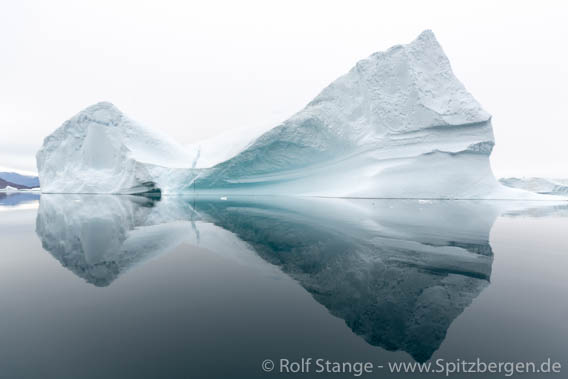
But the icebergs are of course the best part. The famous iceberg graveyard north of Røde Ø, iceberg alley, iceberg city, whatever you want to call it. An incredible gathering of huge icebergs, mighty giants, grounded and surrounded with water calm like a mirror, scary dimensions and amazing numbers. Deep green colours indicate massive volumes of ice under water. After the zodiac tour, captain Hörður asked me if I liked it. What a question. If you don’t like that, then Greenland is not a place to go for you. The sheer beauty would make everyone speachless, I guess.
Basalt heaven in Vikingebugten – 03rd September 2015
Thu
3 Sep
2015
The night has brought a fresh, white cover of snow to the ship and to the land. But it is thawing already, getting grey and wet, and it will not last for long.
The crew has to fight some neargoing ice floes off with long poles during the night.
Photo Basalt heaven in Vikingebugten – 03rd September 2015
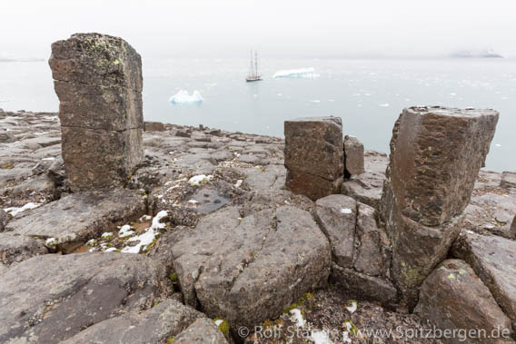
The whole country south of Scoresbysund consists of basalt. The blood of the Earth, shed when a crack started to split a huge continent from south to north. The crack kept growing and today we know it as the Atlantic ocean. The Earth’s blood that was spilled during early stages of that process, that is the basalt. A huge basalt plateau that later broke into two parts. The Færøer Islands are part of the eastern bit.
Photo Taenderne – 03rd September 2015

East Greenland south of Scoresbysund is the western bit. This is why we find so many of nature’s architectural masterpieces, the basalt columns, in this area, in all shapes and sizes. The snow makes the structures very appearent in many places.
Photo Hecla Havn – 03rd September 2015

It is clearing up in the afternoon. The rocky hills of Danmark Ø invite for some good hiking. Colourful rocks provide insight in billions of years of Earth history next to amazing views over a very fine bit of Greenland.
From Reykjavik to Scoresbysund
Wed
2 Sep
2015
It could have been a lovely calm night of desperately needed good sleep if that film team had not picked the little street just outside my guesthouse room to start filming at 5 a.m. I hope it will be a successful film, at least.
At 8 a.m., our small group of Greenland explorers met at the little domestic airport. Crossing the Denmark Strait in 27000 feet altitude is much faster and more comfortable than riding the waves for days.
Photo Blosseville Kyst – 02nd September 2015
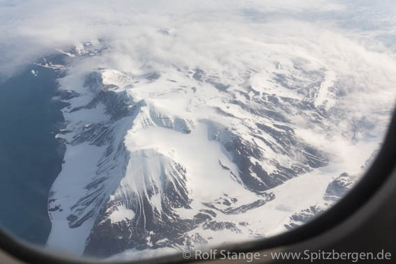
The first part of Greenland that we saw was the Blosseville Kyst around Rømer Ø, south of Scoresbysund.
Photo Constable Point – 02nd September 2015

In Hurry Inlet, Ópal was waiting for us next to her sister vessel Donna Wood, a new member of the North Sailing fleet.
The first icebergs never fail to attract attention, and so do the mountains south of Scoresbysund. This wild coast is called Volquart Boons Kyst, a very inhospitable shore, with rugged mountains rising steeply more than 1000 metres high from the fjord, separated by some crevassed glaciers. A view as forbidding as attractive.
Photo Hall Bredning – 02nd September 2015
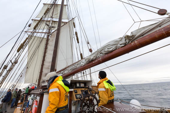
We want to get to the inner branches of the fjord, so we spend the afternoon sailing until we reach Vikingebugten. The anchor goes to the bottom and we go to bed.
Spitsbergen calendar 2016 available
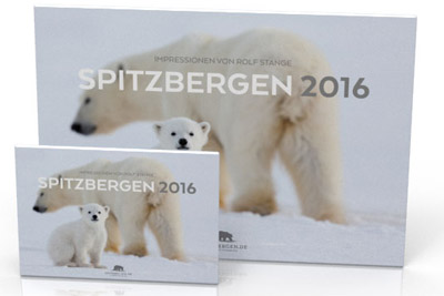
The Spitsbergen calendar 2016 is available from now on in two sizes (A3 and A5). Twelve beautiful photos bring Spitsbergen’s scenery and wildlife throughout the arctic seasons onto your wall. Click here for further information about the new Spitsbergen calendar 2016.
Der Spitzbergen-Kalender 2016 ist ab sofort wie gewohnt in den Formaten A3 und A5 erhältlich. Zwölf schöne Fotos bringen Spitzbergens Landschaften und Tiere durch die Jahreszeiten auf die Wand. Der Spitzbergen-Kalender 2016 ist hier bestellbar.
The new Spitsbergen calendar 2016.
Mild summer in Spitsbergen
According to weather data of the Norwegian Meteorological Institute, the current summer month August is the warmest of its kind since the beginning of measurements in the 1970s at the airport near Longyearbyen. The normal average temperature in August is 4.8°C. The corresponding value for 2015 will be between 6.6 and 6.8°C (the final value is not yet available).
Longyearbyen has not had summer temperatures on this average level at least since the 1970s. And indeed, parts of August were real summer in Longyearbyen, with temperatures up to around 16°C in cases. People were enjoying the outside tables of the cafés and restaurants and their own homes.
Sometimes, the warm temperatures were more of a local character: while it was more than 16°C in Longyearbyen, it was pleasantly cool (4-5°C) at Kapp Lee on Edgeøya. Altogether, however, weather data from other stations (Ny Ålesund, Isfjord Radio, Barentsburg) indicate a very mild summer also elsewhere in the region.
Locals are more worried about warmer winters than warmer summers. The winter cold is important for the fjord ice. Also shrinking glaciers already make for very obvious changes in the landscape.
Summer weather in Isfjord.
Source: NRK
Smoldering fire at cultural heritage in Colesbukta
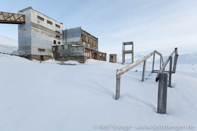
Almost two weeks ago a team of the Sysselmannen started extinguishing a subterranean fire in Colesbukta caused by a camp fire. The fire was ignited at the foundation of a historical building which is protected as a listed monument. In Colesbukta several buildings from the time between 1913 and 1962 are preserved. They served as a harbor where coal from the nearby Russian mining settlement Grumantbyen was loaded. Both settlements are cultural heritages.
On Tuesday 13th of August the Sysselmannen was informed by tourists about the fire in Colesbukta and a team was sent by helicopter. The original camp fire was already extinguished but it had initiated a smoldering fire under the ground which was about to spread. First the Sysselmannen´s team prevented the fire from spreading by digging a trench and the cultural heritage could be saved.
As now, almost two weeks later on Tuesday 25th of August the Sysselmannen and the fire department examined the place again, they noticed that the fire was still smoldering. The fire fighters tried to extinguish it with foam and now they think about using a several meters long hose for pumping water from the coast to the fire area.
As it is prohibited in Svalbard to make a fire close to cultural heritages, the Sysselmannen is investigating in this case. So far it is not known who made the camp fire. The Sysselmannen asks for information, preferably from the responsible persons themselves.
The old mining/harbour settlement Colesbukta in winter.
Source: Svalbardposten
Nordaustland circumnavigated by sea kayakers
The main island of Spitsbergen has been circumnavigated by sea kayakers already in 1990. But the second-largest island, Nordaustland, has so far withstood all attempts. Not that there have been a lot, but there were a few, which never really took off due to heavy ice conditions.
Next to difficult ice and weather conditions, it is the long ice cliff of the ice cap Austfonna on the east and south coast of Nordaustland, which makes any attempt to kayak this coast a very demanding venture. The calving glacier front is about 160 kilometres long and does not afford any opportunity to land for a rest or to sit out bad weather.
This summer, two groups have been successful with their attempts to circumnavigate Nordaustland. The Norwegian group “Nordaustland” reached Kinnvika on August 14, where they had started their kayaking expedition. A cruise ship provided safe and comfortable transportation from Longyearbyen to Kinnvika and back, the goal of the expedition was kayaking around Nordaustland and this has been achieved. Congratulations!
But “Nordaustland 2015” were not the first group. Just about one day before, a group of three kayakers, two from New Zealand and one from Norway, had completed their kayak-circumnavigation of Nordaustland successfully. Congratulations also to this group! But they have not yet completed their expedition, as it is their ambitious plan to circumnavigate the whole archipelago, from Longyearbyen to Longyearbyen. But they have done the largest step, Nordaustland, with impressive success.
Both groups met on the way, kept good contact and supported each other with information. “Nordaustland 2015” wrote in their blog “If we reckon that Nordaustlandet is 800 million years old, 24 hours difference is insignificant.” Only a quibbler would challenge this 🙂
Both groups have made an amazing achievement with years of preparation and training. The New Zealand-Norwegian group completed the 160 kilometer ice cliff coast within 40 hours without any major rests. Camping on Isisøyane (earlier called Isispynten) was not possible because of the presence of a number of polar bears. Vibebukta was the next place where putting up a tent was an option. Drift ice and fog slowed the trip down. Fridtjof Nansen, who in 1895 and 1896 made an incredible kajak adventure north of and within Franz Josef Land together with Hjalmar Johansen during his Fram Expedition, would be impressed.
Glacier front on the south coast of Nordaustland behind dense drift ice, July 2015.
Sources: Nordaustland 2015 (Facebook), Ice bears and Islands
Sysselmannen removes garbage from Svalbard´s beaches
This year an amount of 101 cubic meters of garbage was collected on the Sysselmannen´s annual cleanup cruise to remote beaches in Svalbard. The Sysselmannen´s ship ‘Polarsyssel’ was operating for eight days, approaching three places at the west- and the north coast of the main island Spitsbergen and two places in the northwest of the island Nordaustlandet. 24 volunteers supported the Sysselmannen´s crew in cleaning the single coastlines from garbage that was washed ashore.
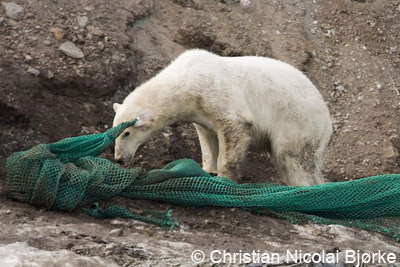
It is most of all plastic garbage of different kind and size from all over the world which floats on the ocean´s surface, sometimes for years, and finally finds its way to the coast. And the bigger part derives from the fishing industry: fishnets, fishnet floats, ropes and so on. For animals the garbage can turn into a lethal trap, in the water as well as ashore. Seabirds for example swallow small pieces of plastic which they are not able to digest. They finally die by the accumulation of plastic pieces in their stomachs. Birds and other animals get entangled in ropes and fishnets. On this year´s campaign the Sysselmannen´s crew found a reindeer skeleton completely wrapped in a fishnet and in 2014 a polar bear was trailing a huge fishnet with its ear. The net got stuck at an earmark placed by scientists (see also Spitsbergen-Svalbard.com news Again polar bear caught in fishing net from August 2014).
With 101 cubic meters there was more garbage collected than last year (88 cubic meters). Yet, the Sysselmannen´s cleanup cruise was not as successful as expected. In the beginning the work was two times disturbed by polar bears showing up and later bad weather prevented the approach to highly polluted beaches. Special thanks go to the local population with its willingness to support the campaign. More than 200 locals volunteered for the cleanup and finally 24 were chosen to accompany the Sysselmannen´s crew.
Generally, the Sysselmannen can only cover a very small part of Svalbard´s coasts with this annual campaign, as for example this year there were only five beaches cleaned. Therefore smaller private expedition cruise ships are a significant help in this case, as most of them constantly arrange similar cleanups with their passengers (see also Spitsbergen-Svalbard.com news The Ocean Cleanup: solution for the global plastic pollution problem from June 2014).
Fishnet washed ashore
© Christian Nicolai Bjørke
Source: Sysselmannen, Svalbardposten
Four polar bears, one walrus – 11th August 2015
Tue
11 Aug
2015
New trip, new luck. Old polar friends with their friends and relatives, a very familiar setting right from the beginning. Very pleasant.
A little bit of swell in the Isfjord entrance. Christmas-tree Willi finds out that the sea is something different than a forest. The shaking of a boat is less pleasant than the shaking of the trees.
Mirror images on the water in Forlandsund. Mountains and glaciers seem to rise both upwards into the sky and downwards on the water.
Photo Kongsfjord – 11th August 2015 – 1/2
Ny Ålesund is a good start, a gentle transition from zivilisation to the arctic wilderness. And meeting Marten Loonen, the head of the Dutch arctic station, is always a very pleasant affair, where you will always learn a lot. Geese and foxes change in having good and bad years, roughly similarly to lemmings. The cycles don’t have three years, but seven or eight. The grass, the reindeer, rain or snow, it is all part of the system. It is complex.
Photo Kongsfjord – 11th August 2015 – 2/2
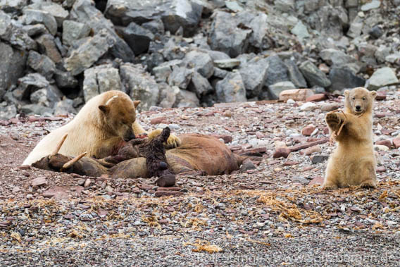
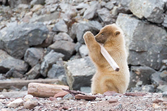
A dead walrus on the shore as attracted two polar bear families. Two mothers, each with one cub of the year. One family is staying a bit away while the other one is feeding. The mother is paying full attention to the walrus carcass, while the cub is busy with a piece of driftwood. The small boat with the visitors off the beach is, however, completely irrelevant to them. A reach meal, a feast for bears and tourists. A wild bit of arctic nature. A great experience. Unless you are the walrus.
Erdmannflya – 05th August 2015
Wed
5 Aug
2015
A calm night, a calm passage northwards to Isfjord, interrupted only by a short stop when cod appeared on the depth sounder – dinner was secured. Time to show some photos, for the very first time, from our Beerenberg ascent on Jan Mayen in July.
Then we reach Borebukta, one of those bays in the rather civilised Isfjord area where there is not too much traffic. Once again, we venture into the arctic wilderness, without seeing anyone. Once again into the silent tundra, flat coastal plains, which seem boring from the distance but are actually full of details. An old, small sealing ship on the shore looks as if it was left behind by its crew with the intention to continue the voyage soon, but they never returned. What happened? No idea. (Amendment: the boat was left there by a well-known inhabitant of Longyearbyen usually known as „Hamarøyen“ – he came from the island Hamarøy – to serve as accommodation. The nearby lake has always been popular for fishing amongst the locals).
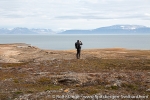
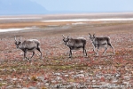
Beaches, interrupted by small capes and cliff coasts, incised rivers. Rock landscapes with fox dens, and very appropriately, two young polar foxes, one of them reasonably curious. A little herd of six reindeer making a curious semi-circle around us. A nice farewell from Spitsbergen’s tundra.
The surf had picked up and did not leave all boots dry. Good we had been able to avoid that during the trips so far.
Gallery Erdmannflya – 05th August 2015
- gallery anchor link: #gallery_732
Click on thumbnail to open an enlarged version of the specific photo.
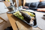
A last, calm night at anchor in Colesbukta, then some final miles to Longyearbyen. Then the voyage is over. My very own party is based on fresh arctic char from the north coast, a present from Pål. It is enough for me for two days.
News-Listing live generated at 2025/April/04 at 23:41:24 Uhr (GMT+1)
